3 miles (4.9 km) with 67m of total ascent
 |
| The bridleway between points 8 & 9 |
This is the shorter of two walks that start and finish in Bunkers Park, south of Hemel Hempstead. The route passes through two excellent nature reserves. Unlike most of our routes this walk doesn't pass close to a pub or cafe, so you might want to take some refreshments.
Getting there
For those travelling by car there is a car park at Bunkers Park (location -
https://w3w.co/pardon.gender.mess) which was free-of-charge when we visited, but please check before leaving your car in case this has changed.
There are bus stops close to point 2 in the walk (location -
https://w3w.co/groom.thigh.knots) which are served by the number 20 and 320 buses. You can check bus times at the
Intalink site.
Although this is a short walk in terms of distance, it does have 67m of total elevation, which means you will climb the equivalent of 22 flights of stairs along the way.
One public right of way crosses two livestock fields between points 10 & 12. I have created a detour for those who are nervous if cattle are present (see map of detour in the directions below).
The section between points 3 & 4 can be muddy after rain, so waterproof hiking boots and a hiking pole are recommended.
There is a particularly lovely section of bridleway between points 8 & 9 which was fine when we walked it but looks as though it could be muddy after rain.
The longer route from Bunkers Park is
Walk 260: Bedmond North-West Loop which is 5.8 miles (9.4 km) with 144m of total ascent.
Both walks are adapted from a much longer route shared by local walker Susie Jackson, a member of the
Hertfordshire Walker Facebook group, who recommended we explore this area and add a walk or two to the collection. Thanks Susie.
Fly through preview of walk
If you want to check what sort of landscape you will be crossing before you set off on this walk you can view a short 3D video of the route below. It's created using the free version of
Relive.
Directions
 |
Map for Walk 262: Bunkers Park South Loop
Click on the map above for a larger version
Created on Map Hub by Hertfordshire Walker
Elements © Thunderforest © OpenStreetMap contributors
There is an interactive map below these directions |
Those with GPS devices can download
GPX or
KML files for this walk. We've added
What3Words location references for those who use that system. If you print these walks you might want to use the green
PrintFriendly icon at the bottom of these directions to delete elements such as photographs.
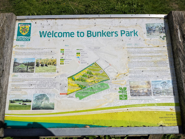 |
An information board at Bunkers Park
Click on the image above for a larger version |
Park in the car park at Bunkers Park (location -
https://w3w.co/pardon.gender.mess) which was free-of-charge when we visited, but please check before leaving your car in case this has changed.
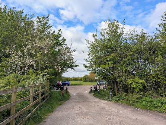 |
| The car park at Bunkers Park |
1: Exit the car park from the middle path (location -
https://w3w.co/dices.mime.dirt), see image below.
 |
| Head WSW across Bunkers Park |
Head WSW across Bunkers Park keeping to the right of the line of trees (see orange arrow on the image above). Continue for 215m until you reach a junction (location -
https://w3w.co/down.beats.fuel), see image below.
 |
| Continue heading WSW at the junction |
2: Head straight and WSW at the junction along a stretch that can be muddy after rain. Continue for 165m until you reach a clearing (location -
https://w3w.co/scuba.upper.match), see image below.
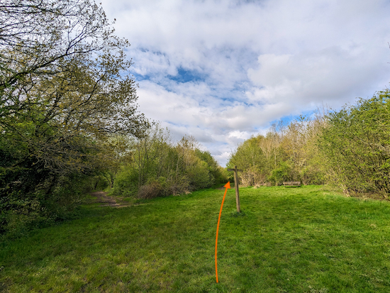 |
| Continue heading straight across the clearing |
3: Continue heading straight across the clearing. When we walked the route in April 2024 there was a bench on the right.
 |
| The bench in the clearing at point 3 |
Head WSW for 205m along another stretch that can be muddy after rain. Continue until you reach another clearing and a junction (location -
https://w3w.co/giant.king.dates), see image below.
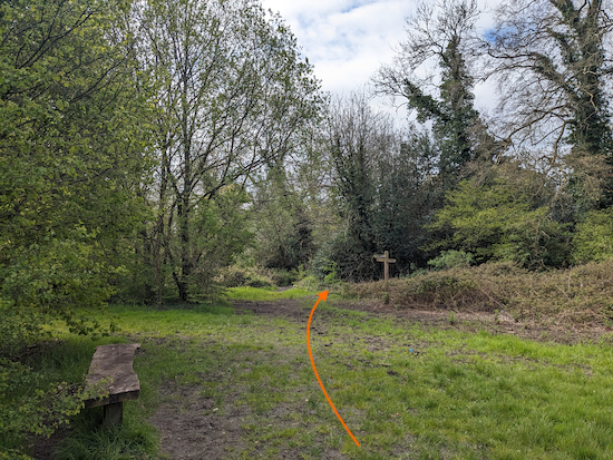 |
| Pass a bench on the left and a wooden signpost on the right |
4: Keep heading WSW until you pass a bench on the left and a wooden signpost on the right (see image above).
 |
| Take the first path immediately after the signpost |
Take the first path immediately after the signpost (location -
https://w3w.co/strong.merit.miss), then follow the path through the trees for 55m until you reach a field (location -
https://w3w.co/shells.unrealistic.punchy).
There should be a bench-with-a-view about 20m to the left this point (location -
https://w3w.co/when.noisy.drum).
.jpeg) |
| The view from the bench |
When you reach the field continue heading WSW and downhill. See the direction of the orange arrow on the image below.
 |
| Head WSW and downhill across the field |
This stretch was carpeted with cowslip when we walked in April 2024.
.jpeg) |
| Cowslip carpet in Bunkers Park |
Continue across the field heading WSW and downhill for 210m until the path bends left at the hedgerow (location -
https://w3w.co/drag.humble.player), then heads S for 85m to a gate and the exit from Bunkers Park (location -
https://w3w.co/jolly.note.teams), see image below.
 |
| The SW exit at Bunkers Park |
5: Cross Bunkers Lane then enter the
Long Deans Nature Reserve (location -
https://w3w.co/misty.calls.nests), see image below.
 |
| Cross Bunkers Lane then enter the Long Deans Nature Reserve |
On the left you will find one of two information boards, see image below.
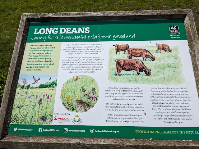 |
The information board as you enter Long Deans
Click on the image for a larger version |
Once across Bunkers Lane turn right then head in a south-westerly direction.
 |
| Continue heading SW through Long Deans |
Continue heading SW through Long Deans for 855m until the path bends to the right (location -
https://w3w.co/back.pencil.asking), see image below.
 |
| Follow the path to the right and up to an exit gate |
Follow the path to the right and up to an exit gate leading to Bunkers Lane (location -
https://w3w.co/ants.fool.bucks), see image below.
 |
| Go through the gate then turn left on Bunkers Lane |
Go through the gate then turn left on Bunkers Lane. You might want to read the information board before you leave the reserve, see image below.
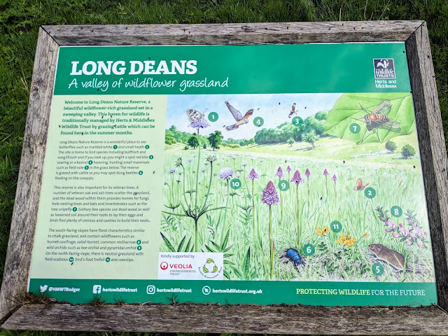 |
The information board as you exit Long Deans
Click on the image for a larger version |
6: Turn left on Bunkers Lane then head SSW for 45m until you reach High Woodhall Lane on the left (location -
https://w3w.co/vote.unwanted.single), see image below.
 |
| Turn left on High Woodhall Lane |
Turn left on High Woodhall Lane then head SE for 255m until you reach a junction (location -
https://w3w.co/jumped.wire.comb), see image below.
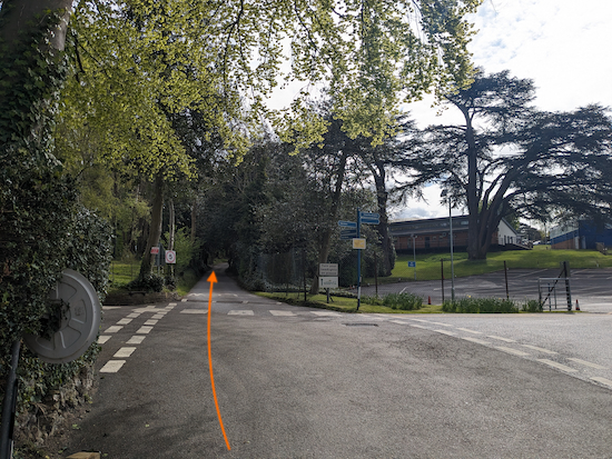 |
| Continue, now heading E, until you reach Langley Tennis Club |
Cross the junction then continue, now heading E, for 125m until you reach a turn off on the right for Langley Tennis Club and a track heading straight on (location -
https://w3w.co/drain.detail.sizes), see image below.
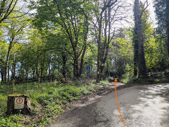 |
| Continue heading SE, now on Nash Mills BOAT 3 |
7: Continue heading SE, now on Nash Mills BOAT 3 (
byway open to all traffic). Continue on Nash Mills BOAT 3 for 180m until you reach a
bridleway on the left (location -
https://w3w.co/preoccupied.span.cases), see image below.
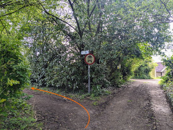 |
| Turn left on Abbots Langley bridleway 76 |
8: Turn left on Abbots Langley bridleway 76 then head NE for 1.3 km. This is a lovely stretch of bridleway which was firm underfoot when we tested this route in April 2024, however it looks like it could be quite muddy after rain.
Continue until you reach Highwoodhall Lane (location -
https://w3w.co/fluid.dish.nearly), see image below.
 |
| Abbots Langley bridleway 76 joining Highwoodhall Lane |
9: Continue along Highwoodhall Lane for 290m until you reach a footpath on the left (location -
https://w3w.co/lunch.fancy.arrow).
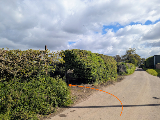 |
| Turn left on Abbots Langley footpath 5 |
* When we tested this walk in April 2024 cattle were grazing in the two fields crossed by the next footpath. If you are nervous about walking through fields occupied by livestock I have created a 920m detour (which adds 430m to the total walk) between points 9 & 11 that avoids the fields by using two lanes and a road (with a pedestrian pavement), see detour map below.
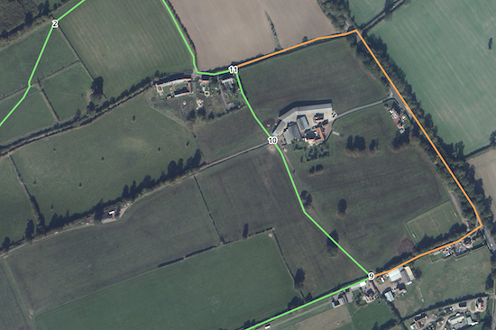 |
| The detour between points 9 & 11 marked in orange |
10: If you don't take the detour, turn left on Abbots Langley
footpath 5 then head NNW for 325m until you reach a farm track (location -
https://w3w.co/humble.mess.reap), see image below.
 |
| Cross the farm track then take the footpath opposite |
11: Cross the farm track then take the footpath opposite and continue on Abbots Langley footpath 5 across another livestock field and still heading NNW for 80m until you reach a gate (location -
https://w3w.co/dined.lush.assist), see image below.
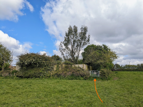 |
| Go through the gate then continue on Abbots Langley footpath 5 |
Go through the gate then continue on Abbots Langley footpath 5 for 70m until you reach Bunkers Lane (location -
https://w3w.co/mass.flap.larger).
12: Turn left on Bunkers Lane then head W for 75m until you reach a byway on the right (location -
https://w3w.co/visits.stored.sing), see image below.
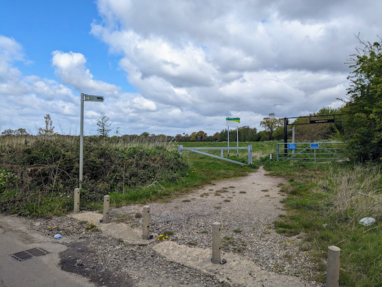 |
| Turn right on Nash Mills BOAT 4 |
13: Turn right on Nash Mills BOAT 4 then head NNW for 270m back to the car park at the start of the walk (location -
https://w3w.co/fully.axed.loft) see image below.
Interactive map


.jpeg)

.jpeg)


Lovely walk. Thank you for sharing. The description is so helpful, especially with the photos. We did the walk this week (June 2024) and would recommend people take the diversion described at points 9 to 10 - even if fine with the cattle - because the last bit of footpath before rejoining the road is covered in chest-high nettles. Thank you again.
ReplyDeleteThanks for the feedback and for the tip. Glad you enjoyed the walk. David
Delete