5.7 miles (9.1 km) with 149m of total ascent
 |
| The path through Long Deans near the end of the walk |
This is a wonderful walk which crosses rolling countryside on well-marked footpaths and bridleways. It winds through two beauty spots
Bunkers Park and
Long Deans and passes Blackwater Wood which was carpeted in bluebells when we tested the walk in April 2024.
Getting there
For those travelling by car there is a car park at Bunkers Park (location -
https://w3w.co/pardon.gender.mess) which was free-of-charge when we visited, but please check before leaving your car in case this has changed.
There are bus stops close to point 2 in the walk (location -
https://w3w.co/groom.thigh.knots) which are served by the number 20 and 320 buses. You can check bus times at the
Intalink site.
This is an area that we have previously not explored because we were concerned about the proximity of the M1 and the M25, but we needn't have worried because, apart from the distant sound of traffic along the eastern part of the route, there are plenty of sections where you can enjoy uninterrupted birdsong.
This walk has been adapted from a much longer route shared by local walker Susie Jackson, a member of our
Hertfordshire Walker Facebook group, who recommended we explore this area. Thanks Susie, great suggestion.
Although this walk is called Bedmond North-West Loop it actually starts at Bunkers Park south of Hemel Hempstead; this is because of the parking options which were free-of-charge when we tested the walk.
You will pass through two livestock fields between points 2 & 3 where dog owners are asked to keep their pets on a lead.
We had a chat with a friendly and helpful farmer when we tested this walk. He explained that the first field contained steers (young male cattle) and the second field contained heifers (young female cattle).
We didn't have a problem with the young and curious cattle, and the farmer said they are no danger to the public. If they get too close, he said, "just shoo them away".
However, if you want to do this walk and are worried about meeting young cattle I have created a detour between points 2 & 5 which involves walking along lanes and a road (with a pedestrian pavement) so that you can avoid the section, see image below.
This detour might also be useful in the nettle season if the footpath after point 2 is blocked with nettles.
The green line is the official route through the livestock fields, the orange line is the detour avoiding cattle and linking points 2 & 5.
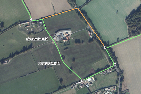 |
| The detour (in orange) to avoid the livestock fields |
Fly through preview of walk
If you want to check what sort of landscape you will be crossing before you set off on this walk you can view a short 3D video of the route below. It's created using the free version of
Relive.
Directions
 |
Walk 260: Bedmond North-West Loop
Click on the map above for a larger version
Created on Map Hub by Hertfordshire Walker
Elements © Thunderforest © OpenStreet Map contributors
There is an interactive map below these directions |
Those with GPS devices can download
GPX or
KML files for this walk. We've added
What3Words location references for those who use that system. If you print these walks you might want to use the green
PrintFriendly icon at the bottom of these directions to delete elements such as photographs.
 |
| Turn right on Nash Mills BOAT 4 |
1: With your back to the car park, turn right on Nash Mills BOAT 4 (
byway open to all traffic), then head SE for 265m until you reach Bunkers Lane (location -
https://w3w.co/forget.dozen.crash), see image below.
 |
| Turn left on Bunkers Lane |
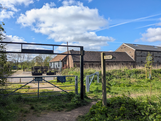
2: Turn left on Bunkers Lane then head in an easterly direction for 75m until you reach a
footpath on the right (location -
https://w3w.co/melt.mock.salt), see image below.
.jpeg) |
| Turn right on Abbots Langley footpath 5 |
Turn right on Abbots Langley footpath 5 then head SSE for 75m until you reach a gate leading to a livestock field (location -
https://w3w.co/dined.lush.assist), see image below.
* If you are worried about walking through a livestock field when cattle are present please see the detour I have suggested earlier in these directions.
 |
| Continue across the livestock field |
Continue across the livestock field, still on Abbots Langley footpath 5 and still heading SSE, for another 75m until you reach a gate leading to a farm track (location -
https://w3w.co/lobby.eggs.chart) and, beyond that, another gate, see image below.
 |
| Cross the farm track then go through the gate |
Cross the farm track, go through a gate, then continue heading SSE through another livestock field. Continue, still on Abbots Langley footpath 5, for 330m until you reach a gate leading to Highwoodhall Lane (location -
https://w3w.co/wiping.chat.fears), see image below.
 |
| Turn left on Highwoodhall Lane |
3: Turn left on Highwoodhall Lane then head ENE for 235m until you reach Bedmond Road (location -
https://w3w.co/talent.look.goad), see image below.
 |
| Turn left on Bedmond Road |
4: Cross Bedmond Road then turn left on the pedestrian pavement. Head NNW for 125m until you reach a footpath on the right (location -
https://w3w.co/middle.means.trend), see image below. This is the point where the detour, mentioned above, rejoins the route.
 |
| Turn right on St Michael's Rural footpath 18 |
5: Turn right on St Michael's Rural footpath 18 then head ENE for 180m until you reach Blackwater Wood on the left (location -
https://w3w.co/radar.send.asks), see image below.
 |
| Blackwater Wood to the left of St Michael's Rural footpath 18 |
Blackwater Wood is managed by Hertfordshire's
Countryside Management Service and members of the public are welcome to explore the ancient woodland as long as they keep to the paths - especially at bluebell time. Click on the image of the Blackwater Wood information board below for a larger version if you want to read the detail.
 |
| A footpath through Blackwater Wood |
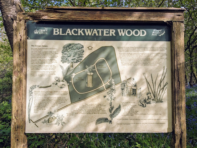 |
The information board in Blackwater Wood
Click on the image for a larger version |
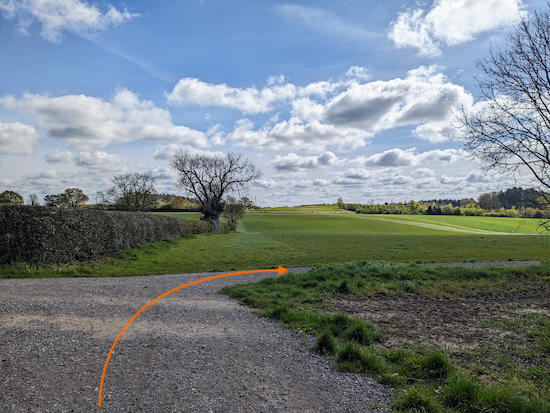
Continue, with Blackwater Wood on the left, for 215m until you pass the woodland then continue for 165m to a junction (location -
https://w3w.co/rests.export.icon), see image below.
 |
| Turn right on St Michael's Rural footpath 14 |
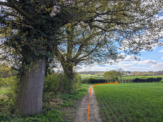
6: Turn right on St Michael's Rural footpath 14 then head in a south-easterly direction following the path as it zig-zags for 715m until it reaches a bend (location -
https://w3w.co/crowds.movies.wash), see image below.
 |
| Turn right at the junction then head WSW |
7: Turn right at the junction then head WSW for 25m before St Michael's Rural footpath 14 turns left through the hedgerow (location -
https://w3w.co/kick.powder.ended), see image below.
 |
| Go through the hedgerow then continue across an arable field |
Go through the hedgerow then continue heading SSE across an arable field, and still on St Michael's Rural footpath 14, and keeping to the right of a line of trees, see image below.
 |
Keep the line of trees on the left
|
Continue for 270m until you cross the parish boundary where the footpath you are on becomes St Stephen footpath 55 (location -
https://w3w.co/bugs.double.nobody).
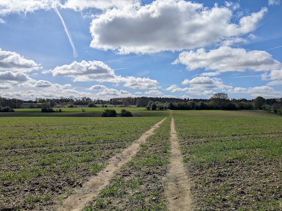
8: Keep heading SSE, now on St Stephen footpath 55, for 100m until you cross another arable field (location -
https://w3w.co/puppy.blaze.topped), see image below.
 |
| Continue across the arable field on St Stephen footpath 55 |
Continue across the arable field, still on St Stephen footpath 55, for 335m until you reach a right-hand bend (location -
https://w3w.co/hops.wishes.shorts)
9: Turn right at the bend then head WSW for 105m until St Stephen footpath 55 bends left (location -
https://w3w.co/digits.short.froze), see image below.
 |
| Follow the footpath SSE until you reach St Albans Lane |
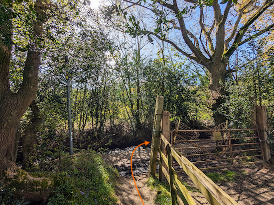
10: Follow the footpath SSE for 405m until you reach St Albans Lane (location -
https://w3w.co/models.clocks.grow), see image below.
 |
| Turn right on St Albans Lane |
11: Turn right on St Albans Lane then head SW for 125m until you merge with Serge Hill Lane (location -
https://w3w.co/zealous.lanes.handy), see image below.
 |
| Continue heading SW until you reach Church Hill |
Continue heading SW for 135m until you reach Church Hill (location -
https://w3w.co/boats.return.cling).
* If you need refreshments you could turn left at this point then head S for 65m where you will find Bedmond Premier Store on the right (location - https://w3w.co/best.codes.edgy), or continue for 270m to The Bell (location - https://w3w.co/theme.trucks.resist).
 |
| Cross Church Hill then take Abbots Langley footpath 18 |
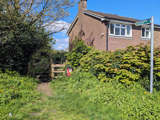
12: Cross Church Hill then take Abbots Langley footpath 18 (location -
https://w3w.co/smart.bring.chain). Head W for 145m until you reach a junction (location -
https://w3w.co/gifts.basket.cooks), see image below.
 |
| Continue heading W across an arable field |
13: Continue heading W across an arable field, still on Abbots Langley footpath 18, for 295m until you reach woodland on the left (location -
https://w3w.co/skinny.ages.teeth), see image below.
 |
| Keep heading straight and W, now on Abbots Langley footpath 17 |
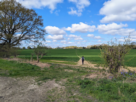
14: Keep heading straight but now slightly WNW, now on Abbots Langley footpath 17, for 125m to an arable field (location -
https://w3w.co/refers.earth.create), see image below.
 |
| Head NW across the arable field, still on Abbots Langley footpath 17 |
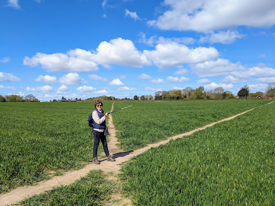
15: Head NW across the arable field, still on Abbots Langley footpath 17 for 195m until you reach a junction in the middle of the field (location -
https://w3w.co/homes.slurs.going), see image below.
 |
| Turn right on Abbots Langley footpath 16 |
16: Turn right then head NNW on Abbots Langley footpath 16 for 185m until you reach Harthall Lane (location -
https://w3w.co/bits.little.rooms), see image below.
 |
| Turn left on Harthall Lane then head WSW for 10m |
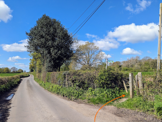
17: Turn left on Harthall Lane then head WSW for 10m until you reach a footpath on the right (location -
https://w3w.co/summer.dads.sparks), see image below.
 |
| Turn right on Abbots Langley footpath 13 |
Turn right on Abbots Langley footpath 13 then continue heading NW for 155m until you reach Hyde Lane (location -
https://w3w.co/piano.host.admits), see image below.
 |
| Turn left on Hyde Lane |
18: Turn left on Hyde Lane then head SW for 75m looking for a footpath on the right (location -
https://w3w.co/stir.crisp.sticks), see image below.
 |
| Turn right on Abbots Langley footpath 11 |
Turn right on Abbots Langley footpath 11 then head NNW for 150m until you reach a field where we spotted the sign below when we walked the route (location -
https://w3w.co/poker.level.rating).
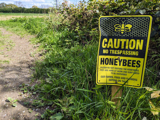 |
| Caution, no trespassing, honeybees at work |
Continue heading NNW for 170m with the hedgerow on the left until you come to a junction (location -
https://w3w.co/hopes.shops.shrimp), see image below.
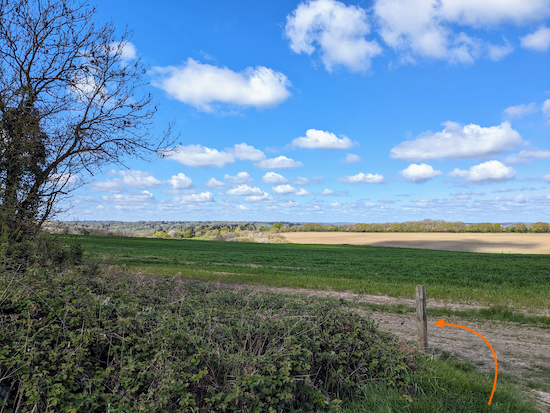 |
| Turn left on Abbots Langley footpath 9 |
19: Turn left on Abbots Langley footpath 9 then head SW for 420m until you reach a footpath on the right just after some farm buildings (location -
https://w3w.co/kick.meant.sheet), see image below. It looks as thought the beginning of this section could be muddy after rain; it was dry when we tested this route.
 |
| Turn right on Abbots Langley footpath 8 |
20: Turn right on Abbots Langley footpath 8 then head NW for 230m where the footpath enters woodland (location -
https://w3w.co/alert.decay.cheer), see image below.
 |
| Continue through the woodland, still on Abbots Langley footpath 8 |
21: Continue heading NW, now through the woodland and still on Abbots Langley footpath 8. This is a lovely stretch of woodland, and if you have one of the free bird identification apps (we have
Merlin) it's worth stopping here because the birdsong is wonderful. The list of usual suspects below serenaded us as we paused for a water break.
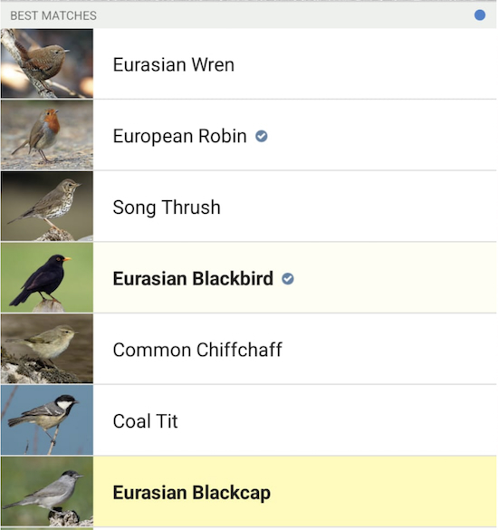 |
| The list of birds identified with the free Merlin app |
Follow Abbots Langley footpath 8 downhill and NW for 210m to a junction (location -
https://w3w.co/ending.swaps.kinds), see image below.
 |
| Cross the junction then continue on Abbots Langley footpath 8 |
22: Cross the junction then continue on Abbots Langley footpath 8 still heading NNW for 335m to a junction (location -
https://w3w.co/kinds.report.hunt), see image below.
 |
| Bear left at the junction on Nash Mills BOAT 3 |
23: Bear left at the junction then head NW, now on Nash Mills BOAT 3, for 300m then continue along Highwoodhall Lane for 390m until you reach Bunkers Lane (location -
https://w3w.co/vote.unwanted.single).
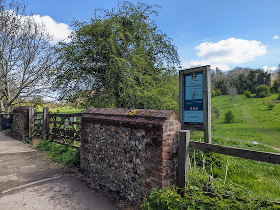
24: Turn right on Bunkers Lane then head NE for 38m looking out for a footpath on the right which leads to
Long Deans Nature Reserve (location -
https://w3w.co/handle.dose.trips), see image below.
 |
| Turn right into Long Deans Nature Reserve |
Turn right into Long Deans Nature Reserve, turn left, then follow the central footpath NE and parallel to Bunkers Lane (which will be on your left). Check the information board soon after entering the reserve, see image below. Click on the image for a larger version if you want to read the detail.
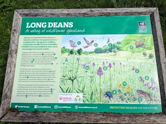 |
The information board at Long Deans
Click on the image for a larger version |
Head NE through the reserve for 770m until you reach a lovely bench-with-a-view slightly uphill to the left of the path (location -
https://w3w.co/snail.fades.smoke), see image below.
.jpeg) |
| A bench-with-a-view in Long Deans Nature Reserve |
Continue heading NE for 115m until the path leaves Long Deans Nature Reserve at a gate then crosses Bunkers Lane (location -
https://w3w.co/life.face.loans), see image below.
 |
| The gate leaving Long Deans Nature Reserve |
Just before you leave Long Deans take a look at the information board on the right just before you go through the gate, see image below. Click on the image for a larger version if you want to read the detail.
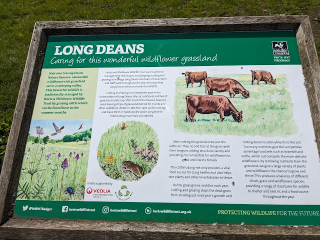 |
The second information board at Long Deans
Click on the image for a larger version |
25: Cross Bunkers Lane then take the footpath on the other side (location -
https://w3w.co/jolly.note.teams), see image below.
 |
| Go through the gate then enter Bunkers Park |
Go through the gate, enter Bunkers Park, then take the right fork just before the information board (location -
https://w3w.co/shop.stale.blues), see images below. Click on the image of the information board for a larger version if you want to read the detail.
 |
| Take the right fork at the information board |
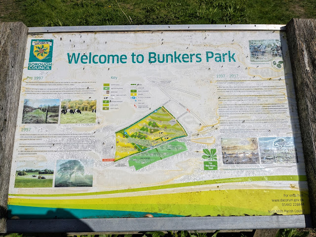 |
The information board at Bunkers Park
Click on the image above for a larger version |
Follow the path ENE for 265m until it heads between woodland on the left and a hedgerow and Bunkers Lane on the right (location -
https://w3w.co/report.headed.report), see image below.
 |
| Follow the path ENE until you reach a set of stairs |
* At this point, if you need a rest and a nice bench-with-a-view (location - https://w3w.co/carbon.books.dive), turn left at the woodland and climb uphill for 100m and take a break, see image below.
.jpeg) |
| The view from the bench |
26: If you don't take the detour to the bench, continue heading ENE for175m to a set of stairs (location -
https://w3w.co/lots.order.closet), see orange arrow on the image below.
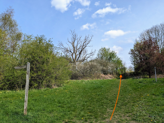 |
| The path approaching the stairs |
27: Climb the stairs then go through the gate on your left (location -
https://w3w.co/clown.vocal.groom), see image below.
 |
| Once through the gate head diagonally across a field |
Once through the gate head diagonally across a field (see orange arrow on the image above) heading NE for 165m to another gate which is the one on the left of two gates (location -
https://w3w.co/employ.copy.arts), see image below.
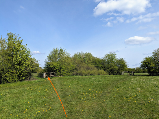 |
| Go through the gate on the left |
28: Go through the gate on the left then continue heading diagonally NE across the next field to another gate (location -
https://w3w.co/gained.movies.tender), see image below.
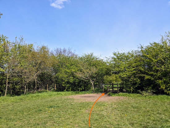 |
| Go through the gate then follow the path back to the car park |
29: Go through this final gate then follow the path ENE for 170m back to the car park (location -
https://w3w.co/hunt.fish.cult).
Interactive map


.jpeg)


.jpeg)


.jpeg)


Did this new walk on Sunday 21 April. Very easy to follow, nice open walk, only a couple of muddy areas that you could get round without too much dufficulty. Bluebells in the woods were lovely. There's a nice 'bench with a not bad view' just before the steps near the end of the walk as well as the one David mentioned. There was no livestock in fields when we did this walk but evidence they had been there recently. Christine Johnson
ReplyDeleteThanks for the update, Christine. Glad you found another nice bench along the way. The bluebells were lovely when we tested the walk. David
DeleteThe bullocks are now very large, and we paused and considered for once whether to divert. Though they "blocked" us twice, they moved when talked to sternly. I would be wary of walking through with a dog - but I am not a dog owner. The instructions are spot on very useful. Thankyou.
ReplyDeleteThanks for the comment about the bullocks. I have built in a detour so that field can be avoided. We found them curious but friendly. But we don't have a dog either.
DeleteUpdate from HCC: Today I had an email from HCC about the 2 fallen tree trees on this walk that I reported on 18/Feb/25. As usual their response is auto-generated, but they claim to have visited the site and have closed my ticket stating that it will be resolved BUT my concerns are that they keep mentioning "roadworks" and a phrase that made me laugh was "Thanks for helping us to keep Hertfordshire roads in the best condition we can". I reported a footpath and not a road of course - I wonder if they did visit the site! Anyway the ticket is closed now so if anyone does this walk in future please mention if the trees are still blocking the path at W3W habit.friend.pulled.
ReplyDelete