4.2 miles (6.8 km) with 69m of total ascent
 |
| The view leading up to Hammonds Lane |
This is the seventh walk in the collection that features the village of Sandridge north of St Albans and close to Heartwood Forest. This route explores the countryside to the east of the village over towards Symondshyde Great Wood. The return leg offers excellent views west towards Heartwood Forest.
Getting there
There are bus stops in the village of Sandridge (location -
https://w3w.co/beats.loans.bucket), which are served by the numbers 304. 305, 357 and the 612 buses. You can check bus times at
Intalink. There is parking in Heartwood Forest (location -
https://w3w.co/probe.ruby.item).
Fly through preview of walk
If you want to check what sort of landscape you will be crossing before you set off on this walk you can view a short 3D video of the route below. It's created using the free version of
Relive.
Directions
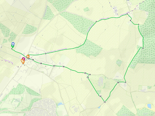 |
Map for Walk 256: Sandridge East Loop
Click on the map for a larger version
Created on Map Hub by Hertfordshire Walker
Elements © Thunderforest © OpenStreetMap contributors
There is an interactive map below the directions |
Those with GPS devices can download
GPX or
KML files for this walk. We've added
What3Words location references for those who use that system. If you print these walks you might want to use the green
PrintFriendly icon at the bottom of these directions to delete elements such as photographs.
Park in the
Heartwood Forest car park (free at the time we tested this walk). Please be sure to check when the car park closes. There will be a notice as you drive in advising on when the gates close.
1: From the car park head S towards a gate in the hedgerow (location -
https://w3w.co/other.plan.plan), see map below.
 |
| Leave the car park at the southern exit |
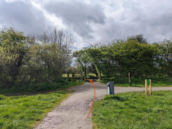
Go through the gate to leave Heartwood Forest, see image below.
 |
| Leave the car park then turn left on Sandridge bridleway 8 |
After going through the gate turn left on Sandridge
bridleway 8 then head ESE for 300m until you reach High Street, Sandridge (location -
https://w3w.co/kicked.skins.expose), see image below.
 |
| Turn left on High Street |
2: Turn left on High Street then head NE for 55m until you reach a footpath on the right (location -
https://w3w.co/dame.words.flap), see image below.
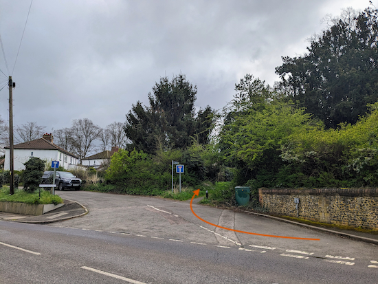 |
| Turn right on Sandridge footpath 18 |
Turn right on Sandridge footpath 18 then head E for 320m until you reach Langley Grove (location -
https://w3w.co/tunes.ledge.blend), see image below.
 |
| Cross Langley Grove then continue on Sandridge footpath 18 |
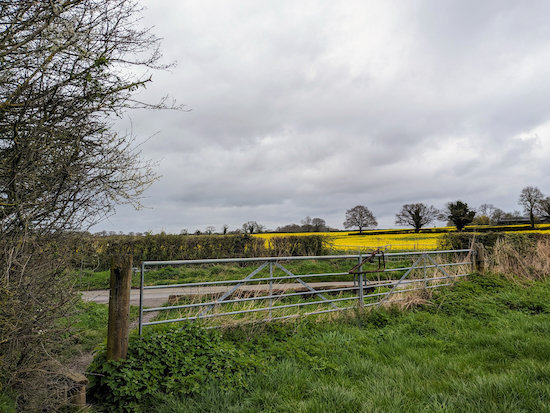
3: Cross Langley Grove then continue, still on Sandridge footpath 18, heading ENE for 650m then NE for 540m to reach Hammonds Lane (location -
https://w3w.co/torch.glare.grain), see image below.
 |
| Turn right on Hammonds Lane |
4: Turn right on Hammonds Lane.
* Hammonds Lane is a narrow lane without a pedestrian pavement and you will be walking along it for 580m. If you are uncomfortable with this, there is an unofficial and well-used path that runs parallel to Hammonds Lane inside the field on the right immediately before the gate leaving the field. The route is clearly well-used by walkers, but, as far as I know it is not a permissive path. The photo below taken at (location - https://w3w.co/sculpture.fumes.result) shows Hammonds Lane on the left and the unofficial route on the right. None of our routes include unofficial paths.
 |
| Hammonds Lane on the left and the unofficial path on the right |
After turning right on Hammonds Lane head ENE for 580m until you reach a driveway and the entrance to a footpath and a
restricted byway on the right (location -
https://w3w.co/only.across.gates), see image below.
 |
| Turn right on Sandridge restricted byway 1 |
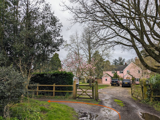
5: Turn right on Sandridge restricted byway 1 then head SE then SW for 160m before reaching a junction just before a large house (location -
https://w3w.co/fell.throw.goad), see image below.
 |
| Turn left, still on Sandridge restricted byway 1 |
6: Turn left, still on Sandridge restricted byway 1, then head SE for 170m until the byway bends sharp right (location -
https://w3w.co/given.middle.pots) then heads SSE for 230m to a junction (location -
https://w3w.co/puzzle.cope.quit), see image below.
 |
| Keep straight at the junction, still on Sandridge restricted byway 1 |
7: Keep straight at the junction, still on Sandridge restricted byway 1, then follow it S for 225m until the path bends right (location -
https://w3w.co/bravo.jokes.ships), see image below.
 |
| Keep right, still on Sandridge restricted byway 1 |
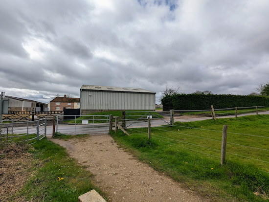
8: Keep right, still on Sandridge restricted byway 1, then head W for 50m before the byway bends left then heads SSW for 620m to a junction (location -
https://w3w.co/charge.pots.parts) where Sandridge restricted byway 1 bends to the left then heads SSE for 100m to a gate leading to a lane called Woodcock Hill (location -
https://w3w.co/bridge.lived.forgot), see image below.
 |
| Turn right on Woodcock Hill then head W |
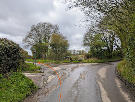
9: Turn right on Woodcock Hill then head W for 145m until you reach a road junction (location -
https://w3w.co/gown.singer.tester), see image below.
 |
| Turn left on Nashes Farm Lane |
10: Turn left on Nashes Farm Lane then head SW for 425m until you reach a footpath on the right (location -
https://w3w.co/adopt.learns.linked), see image below.
 |
| Turn right on Sandridge footpath 20 |
11: Turn right on Sandridge footpath 20 then head NW for 130m until you reach a gate leading to a house (location -
https://w3w.co/marked.elbow.race), see image below.
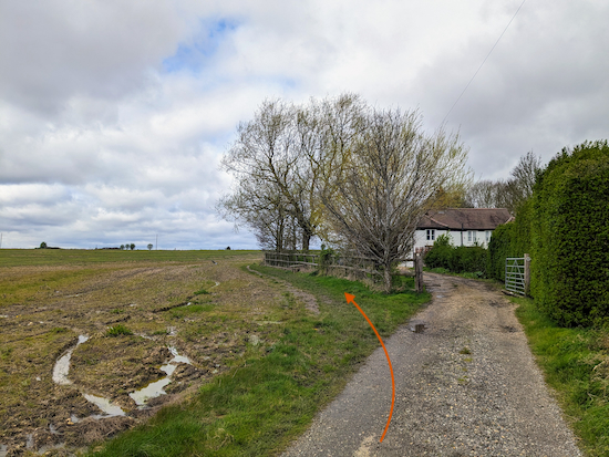 |
| The route of Sandridge footpath 20 marked in orange |
12: The yellow Hertfordshire County Council right of way marker shows the footpath going through the gate and along the drive to the house, but we found that lead to a dead end with no onward signage. Instead, we retraced our steps to the gate then took a track to the left of the gate (see orange arrow on the image above) in order to continue on Sandridge footpath 20. We have written to Hertfordshire County Council asking to clarify this right of way and will update these directions when we hear back.
Continue heading NW on Sandridge footpath 20 for 205m until you reach a junction (location -
https://w3w.co/format.axed.ages), see image below.
 |
| Ignore the footpath on the left and continue heading NW |
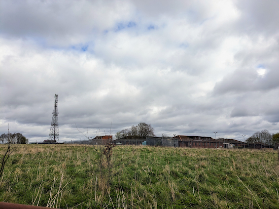
Ignore the footpath on the left and continue heading NW. At this point you will notice a large complex on the right. This is the
Home Office Scientific Branch wireless station (location -
https://w3w.co/codes.editor.marble), see image below.
 |
| The Home Office Scientific Branch wireless station |
Continue heading NW on Sandridge footpath 20 for 225m until the footpath bends right (location -
https://w3w.co/remote.rotate.doll), see image below.
 |
| Follow Sandridge footpath 20 as it bends right |
13: Follow Sandridge footpath 20 as it bends right then heads NE for 65m to Woodcock Hill (location -
https://w3w.co/keeps.passes.plant).
14: Turn left on Woodcock Hill then head WNW for 70m until you reach a footpath sign on the left (location -
https://w3w.co/yoga.urgent.tricky), see image below.
 |
| Leave Woodcock Hill then follow Sandridge footpath 31 |
15: Leave Woodcock Hill then follow Sandridge footpath 31, which runs parallel to the lane, as it heads WNW for 450m before rejoining Woodcock Hill (location -
https://w3w.co/sweat.bunk.mash).
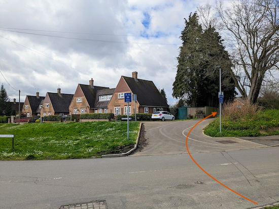
16: Turn left on Woodcock Hill then head W for 175m until you reach Langley Grove (location -
https://w3w.co/cried.path.garden), see image below.
 |
| Cross Langley Grove then take Sandridge footpath 22 |
17: Cross Langley Grove then take Sandridge footpath 22 (location -
https://w3w.co/chin.shades.keys) on the other side (see the orange arrow on the image above). Follow Sandridge footpath 22 WNW for 230m until you reach a play area on the left (location -
https://w3w.co/smug.shark.needed)
18: Continue heading WNW on Sandridge footpath 22 for 165m until you reach Church End (location -
https://w3w.co/lion.poppy.third), and beyond that the gate (location -
https://w3w.co/robe.wheels.flat) leading to the churchyard of the church of
St Leonard 's, a Grade II* listed building (location -
https://w3w.co/spin.youth.took), see image below.
.jpeg) |
| Head W through the churchyard on Sandridge footpath 36 |
19: Head W through the churchyard on Sandridge footpath 36 keeping the church on your right. Continue for 75m until you exit the churchyard and emerge on Church End (location -
https://w3w.co/transit.rally.shin) close to The Queen's Head (location -
https://w3w.co/gains.rides.lobby), see image below.
 |
| The Queen's Head, Sandridge |
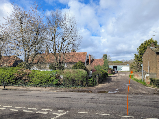
Continue heading W along Church End for 50m until you reach High Street (location -
https://w3w.co/forced.knots.soda), see image below.
* If you require refreshments you have several options at this stage. There is The Queen's Head which you have just passed as well as The Green Man (location - https://w3w.co/having.statue.gravel), The Rose and Crown (location - https://w3w.co/closes.buddy.whites), and the Heartwood Tearooms (location - https://w3w.co/half.cheat.finely), all within 100m SW of this point along High Street.
 |
| Cross High Street then follow Sandridge bridleway 8 |
20: If you don't take the detour for refreshments cross High Street then follow Sandridge bridleway 8 as it heads WNW for 300m to a gate on the right (location -
https://w3w.co/other.plan.plan), which leads back to the car park at the start of the walk, see image below.
.jpeg) |
| The gate off Sandridge bridleway 8 leading to the car park |
If you have any comments about this walk please add them to the comment box at the foot of these directions. You are also welcome to join our friendly
Hertfordshire Walker Facebook group where fellow-walkers are sharing updates and photographs from their rambles in the Hertfordshire countryside.
Interactive Map


.jpeg)


.jpeg)


Another lovely walk David . Easy to follow and very little up and down . Did it this morning. Very little mud apart from through the woods between 7 & 8 and even there you had plenty of alternative places to get by . All the best ….Mick
ReplyDeleteHi Mick, glad you enjoyed our latest walk. I've wanted to create one exploring the countryside east of Sandridge for a long time. Thanks for the feedback.
DeleteCouple of extra points about this walk A) thanks for telling us what the wireless station was. We were just wondering what it was when your instructions told us & B) deffinately recommend coming off the lane ( following the instructions) at Point 15 & walking parallel to the lane in the field as the lane was very narrow but very busy - about 8 or 10 cars in the five mk s or so we walked along side it.
ReplyDeleteHi, thanks for the feedback. And I am glad the instructions helped you avoid the traffic. It's a handy detour. If you haven't already done so please consider joining our friendly Hertfordshire Walker Facebook group where fellow-walkers are sharing their walking experiences and photos. The more the merrier. :-) David
Deletehttps://www.facebook.com/groups/hertfordshirewalker