4.1 miles (6.6 km) with 96m of total ascent
 |
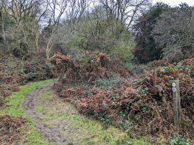
| Northchurch footpath 31 approaching point 3 in the walk |
This is a lovely walk through ancient woodland and across common land. It follows one of the
Ashridge Estate's boundary paths for part of the route before branching off across arable land. The walk starts and finishes in the Northchurch Common car park.
When we tested the walk in December 2023 there were some muddy sections but we managed to navigate them wearing walking boots.
The '
The Walk In Cafe' (closed during winter months) is close to the start/finish point, more details below. And there are several pubs a short drive from the start/finish point including
The Greyhound Inn (location -
https://w3w.co/civil.tadpole.rewrites) and
The Valiant Trooper (location -
https://w3w.co/thudding.cabs.employer) in Aldbury,
The Bridgewater Arms (location -
https://w3w.co/unlocking.radiating.pulps) in Little Gaddesden, and
The Alford Arms (location -
https://w3w.co/backs.slope.laptop) at Frithsden.
Fly through preview of walk
If you want to check what sort of landscape you will be crossing before you set off on this walk you can view a short 3D video of the route below. It's created using the free version of
Relive.
Directions
 |
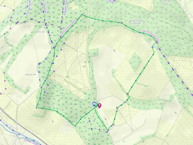
Map for Walk 250: Northchurch Common Loop
Click on the map above for a larger version
Created on Map Hub by Hertfordshire Walker
Elements © Thunderforest © OpenStreetMap contributors
There is an interactive map below these directions |
Those with GPS devices can download
GPX or
KML files for this walk. We've added
What3Words location references for those who use that system. If you print these walks you might want to use the green
PrintFriendly icon at the bottom of these directions to delete elements such as photographs.
 |
| The entrance to Northchurch Common car park |
Park in Northchurch Common car park (location -
https://w3w.co/tight.clarifies.webcams) off the B4506. When we tested this walk in December 2023 the car park was free-of-charge.
The 'The Walk In Cafe" at Hill Farm Barn (location - https://w3w.co/annotated.letters.mimes) is opposite the entrance to the car park if you want refreshments before or after the walk. The cafe website states it's closed for the winter reopening in March. Please check opening hours.
1: After parking your car, exit the car park the way you drove in then take the first track on your right (location -
https://w3w.co/readers.talkers.theory), see image below.
 |
| Turn right on the first track on the right as you leave the car park |
Head SW and downhill along the track for 450m until you reach a
footpath on the right just before a gate (location -
https://w3w.co/confetti.hurtles.lifters), see image below.
 |
| Turn right on Northchurch footpath 31 |
2: Turn right on Northchurch footpath 31 then head NW along the
Ashridge Boundary Trail for 745m until the path bends to the right (location -
https://w3w.co/messing.tinted.foot), see image below.
 |
| Follow Northchurch footpath 31 as it climbs NNE |
3: Follow Northchurch footpath 31 as it climbs NNE for 145m to a fork (location -
https://w3w.co/forgiving.broccoli.cluttered), see image below.
 |
| Take the left fork then continue on Northchurch footpath 31 |
Take the left fork then continue, still on Northchurch footpath 31 and now heading N, for 200m until you reach a small car park (location -
https://w3w.co/nicknames.wisely.lizard).
 |
| Turn right then head NNE on Northchurch bridleway 32 |
4: Enter the car park then turn right heading NNE on Northchurch
bridleway 32 for 190m until you reach a junction (location -
https://w3w.co/squirted.logo.chopper), see image below.
 |
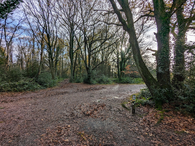
| Keep left at the junction, still on Northchurch bridleway 32 |
5: Keep left at the junction, still on Northchurch bridleway 32, then follow the path NE for 10m before it bends to the right (location -
https://w3w.co/heightens.head.proves), see image below.
 |
| Continue on Northchurch bridleway 32, now heading NNE |
Continue on Northchurch bridleway 32, now heading NNE for 370m to a fork (location -
https://w3w.co/save.contrived.ballooned), see image below.
 |
| Take the left fork then follow Northchurch bridleway 32 into the woodland |
Take the left fork then follow Northchurch bridleway 32 into the woodland then head N for 225m to a junction (location -
https://w3w.co/unless.albums.liberated), see image below.
 |
| Turn right on Northchurch bridleway 33 |
6: Turn right on Northchurch bridleway 33 then head NE for 700m until you reach a road (location -
https://w3w.co/butlers.beam.baths).
7: Turn right on the road then head ESE for 105m to a T-junction (location -
https://w3w.co/september.supply.bats). Cross the junction then continue heading ESE, still on Northchurch bridleway 33, for 675m to a junction (location -
https://w3w.co/redefined.tools.ledge), see image below.
 |
| Keep to the right at the fork then head SE |
8: Keep to the right at the fork then head SE until you reach a track (location -
https://w3w.co/intrigued.neck.runner). Follow the track ESE for 320m until you reach a junction (location -
https://w3w.co/snow.stated.bins), see image below.
 |
| Turn right on Northchurch footpath 64 |
9: Turn right on Northchurch footpath 64 then head SSW through the farmyard of Little Coldharbour Farm (location -
https://w3w.co/baroness.escorting.restore), see image below.
 |
| Northchurch footpath 64 heads through the farmyard |
Once through the farmyard, Northchurch footpath 64 bends to the left then heads SSE for 115m before bending right (location -
https://w3w.co/recapture.tidying.snows) then heading SSW along track for 820m with hedgerow on the left and a field on the right. Continue to a bend (location -
https://w3w.co/rarely.broccoli.litigate).
10: Follow Northchurch footpath 64 as it bends left then heads SSE and downhill for 60m before bending right (location -
https://w3w.co/commented.icon.neckline) then heading SW and uphill for 125m to a junction (location -
https://w3w.co/distorts.occurs.contracts), see image below.
 |
| Northchurch footpath 64 continues heading SW through a gate |
11: Northchurch footpath 64 heads left and SW through a gate (see image above) then continues for 155m to a left-hand bend (location -
https://w3w.co/wimp.stray.insert).
12: Turn left (location -
https://w3w.co/insurance.fats.drama) then immediately right (location -
https://w3w.co/culling.dent.flinches), see image below.
 |
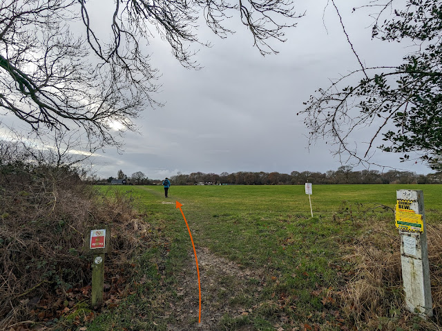
| Northchurch footpath 64 now heads S and diagonally across a field |
Northchurch footpath 64 now heads S and diagonally across a field for 275m before reaching a farmyard (location -
https://w3w.co/crafted.work.insisting), see image below.
 |
| Follow Northchurch footpath 64 diagonally across a field |
13: After crossing the field walk through the farmyard of Northchurch Farm, still on Northchurch footpath 64, for 110m to a gate (location -
https://w3w.co/truffles.excusing.rankings), see image below.
 |
| Go through the gate then continue heading SW on Northchurch footpath 64 |
Go through the gate and ignore the first track on the right. Continue heading SW, still on Northchurch footpath 64, for 25m until you reach a Northchurch BOAT 39 (
byway open to all traffic), (location -
https://w3w.co/redefined.bypasses.irritated), see image below.
 |
| Turn right on Northchurch BOAT 39 |
14: Turn right on Northchurch BOAT 39 then follow it NNW for 395m until you reach the B4506 (location -
https://w3w.co/alongside.victory.smelter). Cross the road then turn right and head N for 40m back to the car park and the start/finish point (location -
https://w3w.co/audio.betrayal.prospered).
Interactive map


This walk can be muddy in wet weather. We tested it in December. It was fine in good waterproof boots. But it might be worth taking a walking pole for the slippy sections.
ReplyDeleteDid this walk last Saturday and it was the muddiest walk we have ever been on! Had wellies but even with those some of the puddles were so deep it was hard to wade through. Tiring walking 4 miles through treacle like mud but it was a lovely sunny day and there was lots of bird song. Would definitely try this walk again when it hasnt been raining for weeks:) Thanks again for all these free walks that you publish.
ReplyDeleteYes, it was sticky when we did it. I don't like walking in the mud because I spend all my time trying not to slip over rather than enjoying the scenery. But you are right. Well worth trying in the nicer weather.
DeleteA lovely leisurely walk today, easily managed and thoroughly enjoyed by my 9 & 11 year old. Excellent gpx routing kept us on track even when the signs were missing and the choices of path many. A great first walk with Hertfordshire Walker but definitely not the last. Thanks
ReplyDeleteHi Mark, great to hear you enjoyed your first of our 250 walks - and that your children enjoyed it too. If you are on Facebook please consider joining our friendly Hertfordshire Walker Facebook group where fellow walkers are sharing their walking experiences and photographs taken along the way. David
Deletehttps://www.facebook.com/groups/hertfordshirewalker
Absolutely stunning walk, thank you so much, would never have known it was there!
ReplyDelete