3.5 miles (5.7km) with 80m of total ascent
 |
| Datchworth bridleway 13 between points 11 & 12 |
This is a lovely walk over the rolling countryside south-west and south of Datchworth Green. It mainly follows footpaths, bridleways and byways, but there are some short stretches along quiet lanes. There are four pubs along the way, two at the start and finish where there is also a cafe. There is one stretch where a footpath crosses a livestock field and dog owners are asked to keep their pets on a short lead.
The starting point for this walk is 1.8 miles west from Watton-at-Stone Station by road.
Fly through preview of walk
If you want to check what sort of landscape you will be crossing before you set off on this walk you can view a short 3D video of the route below. It's created using the free version of
Relive.
Directions
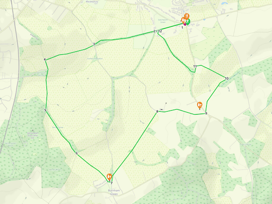 |
Map for Walk 243: Datchworth South West Loop
Click on the map above for a larger version
Created on Map Hub by Hertfordshire Walker
Elements © Thunderforest © OpenStreetMap contributors
There is an interactive map below these directions |
Those with GPS devices can download
GPX or
KML files for this walk. We've added
What3Words location references for those who use that system. If you print these walks you might want to use the green
PrintFriendly icon at the bottom of these directions to delete elements such as photographs.
You start the walk in the village of Datchworth Green which has two pubs,
The Plough and
The Tilbury, a cafe called
Datchworth Coffee, and a village store which sells refreshments.
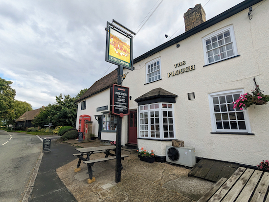 |
| The Plough and Datchworth Coffee at the start of the walk |
1: From Datchworth Green, with your back to The Plough pub (location -
https://w3w.co/attend.face.oiled), turn left then head WSW, with the green and the cricket pitch on your right. Continue for 260m until you reach the clubhouse on your right (location -
https://w3w.co/parade.gums.daily), see image below.
 |
| Take the path to the left of the cricket clubhouse |
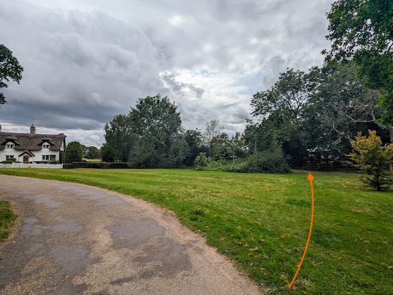 |
| Head WSW along Datchworth restricted byway 11 |
2: With the cricket clubhouse on your right continue heading WSW along Datchworth
restricted byway 11 for 400m until the track you are on crosses the parish boundary and becomes Woolmer Green
bridleway 9 (location -
https://w3w.co/fetch.hers.behind), see image below.
 |
| Continue heading WSW on Woolmer Green bridleway 9 |
Continue heading WSW on Woolmer Green bridleway 9 for 210m until you reached White Horse Lane (location -
https://w3w.co/exams.seat.agreed), see image below.
 |
| Head WSW along Robbery Bottom Lane |
3: Cross White Horse Lane then continue heading WSW along Robbery Bottom Lane for 510m until the lane bends left (location -
https://w3w.co/shaky.buzz.caked), see image below.
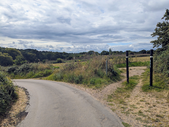 |
| Keep left then follow Robbery Bottom Lane SSE |
4: Keep left then follow Robbery Bottom Lane SSE for 85m until you reach a right-hand bend and a bridleway on your left (location -
https://w3w.co/junior.nuns.judges), see image below.
 |
| Follow Woolmer Green bridleway 24 S |
Take the bridleway, Woolmer Green bridleway 24, then head S for 415m until you reach a junction in the tracks (location -
https://w3w.co/grades.shaky.blitz), see image below.
 |
| Take the left fork, Woolmer Green footpath 25 |
5: Take the left fork at the junction then follow Woolmer Green footpath 25 SE for 540m until you reach a footpath crossing where the track you are on crosses the parish boundary and becomes Datchworth footpath 16 (location -
https://w3w.co/cloak.draw.festivity).
6: Continue heading SE on Datchworth footpath 16 for 420m until you reach Burnham Green (location -
https://w3w.co/remove.dance.mess).
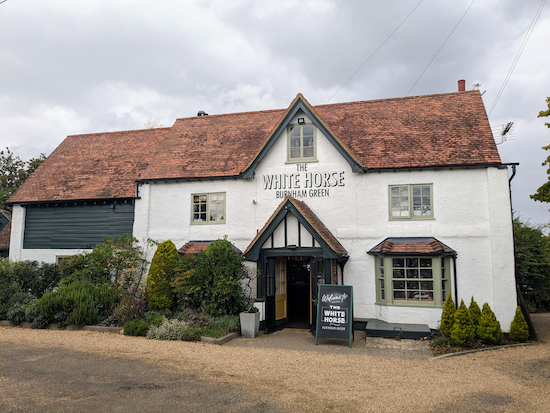 |
| Walk past the White Horse on your left |
7: Turn left at Burnham Green then head E for 40m, walking past
The White Horse on your left, before turning left on White Horse Lane. Head N on White Horse Lane for 65m looking for a footpath on the right (location -
https://w3w.co/scenes.input.broken), see image below.
 |
| Turn right on Datchworth footpath 17 |
Turn right on Datchworth footpath 17 then head NE for 795m until you reach Coltsfoot Lane (location -
https://w3w.co/steps.bolt.cherry), see image below.
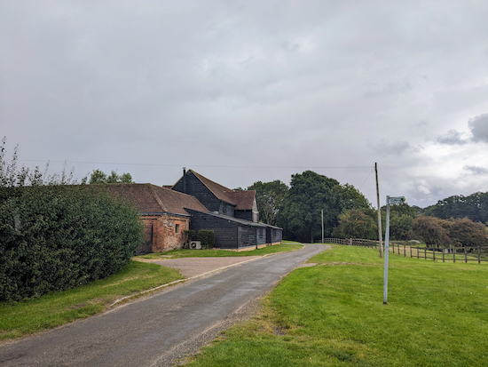 |
| Turn right on Coltsfoot Lane |
8: Turn right on Coltsfoot Lane then head E for 500m until you reach Bramfield Road in Bulls Green (location -
https://w3w.co/invite.rings.taken). You will see
The Horns pub/restaurant on the left (location -
https://w3w.co/mugs.labels.factories), see image below.
 |
| Walk past The Horns then turn left on Bramfield Road |
9: Walk past The Horns then turn left on Bramfield Road and head NW for 10m looking for a footpath on the right (location -
https://w3w.co/arrive.scars.penny), see image below.
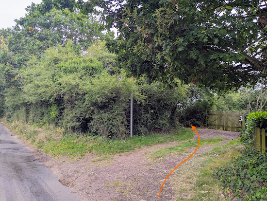 |
| Turn right on Datchworth footpath 18 |
Turn right on Datchworth footpath 18 which crosses two livestock fields. There is a sign at the first gate asking dog owners to keep their pets on a lead, see image below.
 |
| Head NE on Datchworth footpath 18 |
Head NE on Datchworth footpath 18 for 160m at which point the footpath crosses a parish boundary and becomes Watton-at-Stone footpath 27. Continue heading NE for 240m on Watton-at-Stone footpath 27 until you reach a footpath on the left which crosses and arable field (location -
https://w3w.co/beam.minds.nuns), see image below.
 |
| Turn left on Watton-at-Stone footpath 28 |
10: Turn left on Watton-at-Stone footpath 28. When we tested this walk on Sunday 27 August 2023 the field the footpath crossed had recently been ploughed, see image below for the direction you need to take.
 |
| Follow Watton-at-Stone footpath 28 NW |
Follow Watton-at-Stone footpath 28 NW for 290m until you reach the corner of the field and a wire fence on the right (location -
https://w3w.co/steps.hurls.fully) where the footpath meets a private drive, see image below.
 |
| Continue along the drive on Datchworth footpath 14 |
Continue along the private drive, which is also Datchworth footpath 14, then head W for 70m until you reach Bramfield Road (location -
https://w3w.co/accent.burns.orders).
11: Turn left on Bramfield Road then head S for 65m looking for a bridleway on your right (location -
https://w3w.co/print.snack.branded), see image below.
 |
| Turn right on Datchworth bridleway 13 |
Turn right on Datchworth bridleway 13 then head NW for 570m until you reach the junction you passed at point 2 in the walk (location -
https://w3w.co/picked.preoccupied.undulation), see image below.
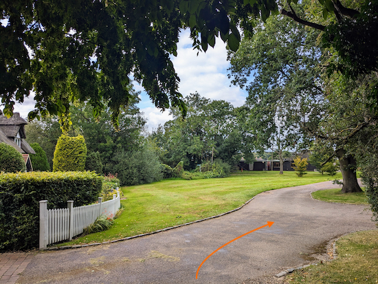 |
| Turn right at the junction then head back to the starting point |
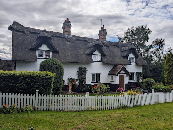
12: Turn right then pass a cottage on your left.
 |
| After passing the cottage keep right |
After passing the cottage keep right then head ENE for 270m back to the starting point along the track you walked earlier between points 1 & 2.
Interactive map


I went today to go on this walk but the start was very muddy so I abandoned it and went to the coffee shop where I was told the route does get very muddy
ReplyDeleteHi Michael, yes, mud is a problem on many Hertfordshire footpaths and bridleway this time of the year. Pity you gave up. It's a nice walk. Perhaps try it again in the summer? We have a friendly Facebook group where members are posting comments and photos of their walks. You are welcome to join.
Deletehttps://www.facebook.com/groups/hertfordshirewalker
Very well signposted. Puddles at the very start of the walk, but otherwise fine. June 15 2024
ReplyDeleteGreat, thanks for the feedback. David
Delete