6.2 miles (10 km) with 143m total ascent
 |
| Pirton footpath 7 between points 4 & 5 |
Another excellent walk over the rolling hills in the north of Hertfordshire and west of Hitchin. This is a lovely route offering some wonderful wide open views along the way. It starts and finishes at Pirton then heads SW before looping back across the
Pegsdon Hills along a section of
The Icknield Way. Soon after the start you will cross an area of land that was once a mediaeval village.
There are several signs along the way requesting dog owners to keep their pets on a lead.
Getting there
There are bus stops close to the start of the walk (location -
https://w3w.co/escapades.soak.decreased) and (location -
https://w3w.co/scarecrow.universally.whizzed) which are served by the number 89 bus. You can check bus times at
Intalink.
Fly through preview of walk
If you want to check what sort of landscape you will be crossing before you set off on this walk you can view a short 3D video of the route below. It's created using the free version of Relive.
Directions
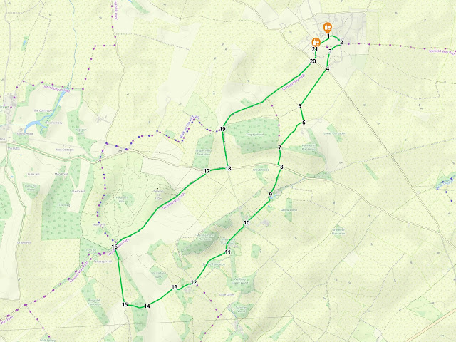 |
Map for Walk 241: Pirton South-West Loop
Click on the map above for a larger version
Map created on MapHub
- copyright details here
Elements © Thunderforest © OpenStreetMap contributors
There is an interactive map embedded at the end of these directions |
Those with GPS devices can download
GPX or
KML files for this walk. We've added
What3Words location references for those who use that system. If you print these walks you might want to use the green
PrintFriendly icon at the bottom of these directions to delete elements such as photographs.
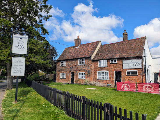 |
| The Fox on High Street, Pirton |
1: With your back to
The Fox pub/restaurant (location -
https://w3w.co/revision.otherwise.beside) on High Street, Pirton, turn left then head E then SE along High Street for 200m passing Blacksmith's Pond on the right (location -
https://w3w.co/yesterday.rainbow.seagulls).
According to an information board at the site, Blacksmith's Pond
"... has been part of Pirton for hundreds of years. Cattle and sheep could use it to drink from as they were herded by and horses and ponies would wade into it as part of the shoeing process, carried on from Blacksmith's Cottage across the road".
If you want to know more about Pirton, the village has
an excellent local history site.
 |
| The information board at Blacksmith's Pond |
Continue past Blacksmith's Pond until you reach the junction with Walnut Tree Road (location -
https://w3w.co/acting.corrupted.covenants).
2: Turn right on Walnut Tree Road then head S for 40m until you reach a
footpath on the right (location -
https://w3w.co/combos.holidays.rivals), see image below.
 |
| Turn right on Pirton footpath 18 |
Turn right on Pirton footpath 18, then head SW to a gate leading to
The Bury and Toot Hill.
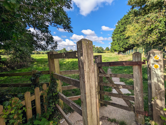 |
| The gate on Pirton footpath 18 leading to The Bury |
This site is recognised by
Historic England as a '
Scheduled Monument'. According to Historic England:
"The monument consists of the earthworks of the castle motte Toot Hill, and the surrounding earthworks of the castle bailey. The site also includes the remains of a medieval village known as The Bury which lies to the south of the bailey."
 |
| Go through the gate then head WSW |
Go through the gate then head WSW then SW across The Bury (see orange arrow on the image above). Continue for 160m until you reach a footpath junction (location -
https://w3w.co/spending.push.rollover), see image below.
 |
| Take the left fork at the junction |
3: Take the left fork at the junction (see orange arrow on the image above) then head SSW for 220m until you reach a gate leading to Walnut Tree Road (location -
https://w3w.co/charging.direct.factually), see image below.
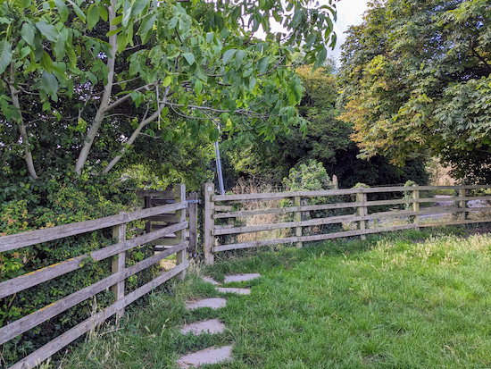 |
| Go through the gate then turn right on Walnut Tree Road |
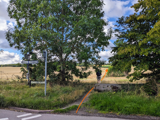
4: Go through the gate then turn right on Walnut Tree Road. Head SW for 30m until you reach the junction with Hitchin Road (location -
https://w3w.co/prelude.nation.encourage), see image below.
 |
| Cross Hitchin Road then head SW on Pirton footpath 7 |
Cross Hitchin Road then head SW on Pirton footpath 7 for 570m to a junction (location -
https://w3w.co/worlds.sweetened.squeaks), see image below.
The photograph taken at the top of these directions was taken along this stretch.
 |
| Turn left at the junction then head S, still on Pirton footpath 7 |
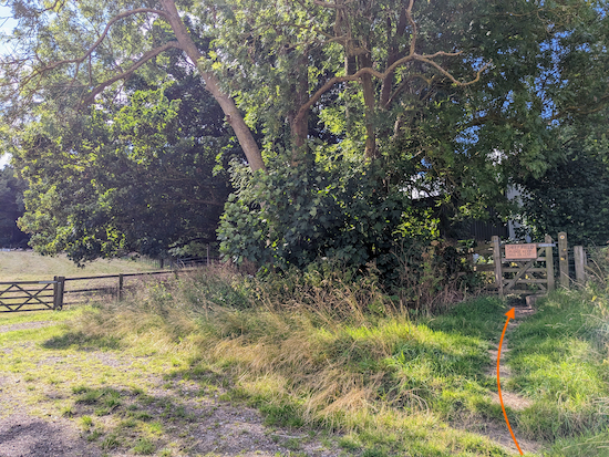
5: Turn left at the junction then head S, still on Pirton footpath 7, for 215m until you reach a bend and a gate on the right (location -
https://w3w.co/added.basic.everybody), see image below.
 |
| Turn right at the bend then head SW, still on Pirton footpath 7 |
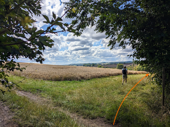
6: Turn right at the bend, go through the gate, then head SW, still on Pirton footpath 7. Continue across a livestock field for 465m until the path cuts through the hedgerow to reach a track (location -
https://w3w.co/reservoir.press.obstruction), see image below.
 |
| Cross the track then head S, still on Pirton footpath 7 |
7: Cross the track then head S, still on Pirton footpath 7, with the hedgerow on the right and field on the left. Continue for 280m until the footpath reaches the corner of the field then cuts through the hedgerow then turns left in the hedgerow then runs parallel to the B655 before turning right to meet the road (location -
https://w3w.co/beam.reckons.workflow), see image below.
 |
| Cross the B655 then head SSW on Offley footpath 37 |
8: Cross the B655 then head SSW on Offley footpath 37. This is a lovely track which climbs steeply along a path which, when we tested this walk in early August, was edged by fields of wildflowers. After 220m you will reach a footpath crossing (location -
https://w3w.co/quicksand.fades.bluffing), see image below.
 |
| Continue heading SSW, still on Offley footpath 37 |
Continue heading SSW, still on Offley footpath 37, for 165m until you reach a gate in the corner of the field (location -
https://w3w.co/reclaim.excavated.outreach), see image below.
 |
| Go through the gate then continue heading SSW |
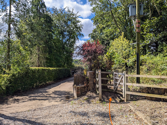
9: Go through the gate then continue heading SSW, still on Offley footpath 37, for 505m until you pass through a farmyard and reach a gate (location -
https://w3w.co/wanting.gilding.token), see image below.
 |
| Go through the gate then head SW for 45m until you reach a junction |
10: Go through the gate then head SW for 45m until you reach a junction (location -
https://w3w.co/frizz.shunning.shower). Turn left at the junction on Offley
bridleway 34 then head S for 25m until Offley bridleway 34 swings right (location -
https://w3w.co/soon.scar.sunflower), see image below.
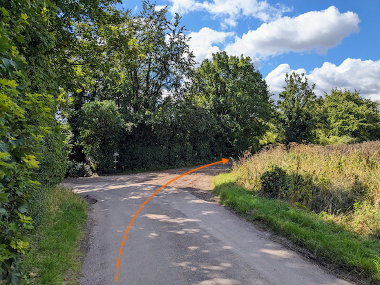 |
| Turn right on Offley bridleway 34 |
Turn right on Offley bridleway 34 then head SW then S for 410m until you reach a bridleway on the right (location -
https://w3w.co/slacker.softest.remaking), see image below.
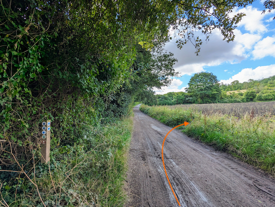 |
| Turn right on Offley 36 |
11: Turn right on Offley bridleway 36 then head WSW for 320m crossing an arable field, see image below.
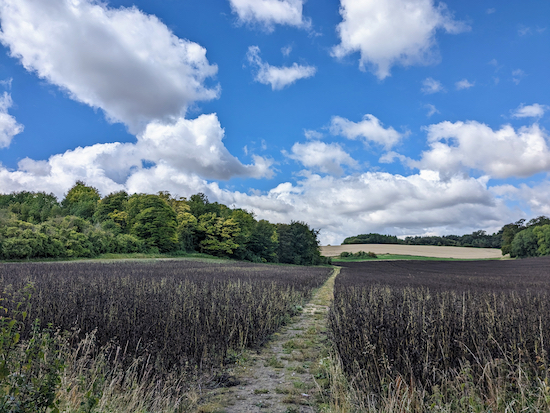 |
| Offley bridleway 36 crossing an arable field |
Continue, now heading SW and uphill, still on Offley bridleway 36, for 325m until you reach a farmyard (location -
https://w3w.co/misted.blissful.sundial), see image below.
 |
| Continue through the farmyard, still on Offley bridleway 36 |
12: Continue through the farmyard, still on Offley bridleway 36 (see the route marked with an orange arrow on the image above) for 285m until you reach a junction (location -
https://w3w.co/expired.request.finishers), see image below.
 |
| Keep left at the junction then head SW, still on Offley bridleway 36 |
13: Keep left at the junction then head SW, still on Offley bridleway 36, for 430m until you reach woodland (location -
https://w3w.co/gourmet.perfect.tadpole) where the bridleway you are on crosses the parish boundary and becomes Lilley bridleway 18, see image below.
 |
| Continue through the woodland on Lilley bridleway 18 |
14: Continue through the woodland on Lilley bridleway 18 for 290m until you leave the woodland (location -
https://w3w.co/storyline.danger.animals), cross a field, and reach a junction (location -
https://w3w.co/explains.stretcher.parked), see image below.
 |
| Turn right on Lilley bridleway 9 |
15: Turn right on Lilley bridleway 9 then head N for 75m to a fork (location -
https://w3w.co/built.ferrets.menu), see image below.
 |
| Take the right-hand fork, then head N on Lilley bridleway 19 |
Take the right-hand fork then head N for 180m on Lilley bridleway 19 until you reach another fork (location -
https://w3w.co/homes.skimmers.desktop), see image below.
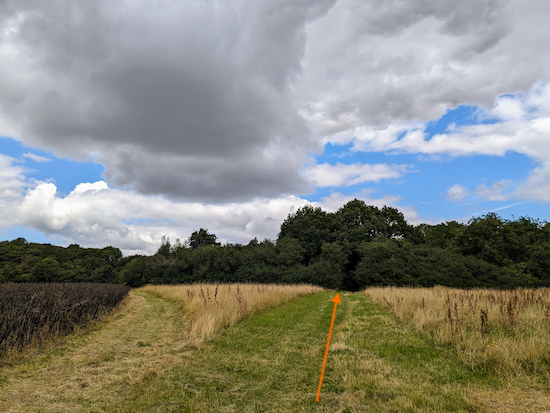 |
| Keep straight, still heading N, now on Lilley bridleway 20 |
Keep straight, still heading N for 195m, now on Lilley bridleway 20, to a junction (location -
https://w3w.co/magazine.flask.honeybees), see image below.
 |
| Turn right at the junction on Offley BOAT 53 |
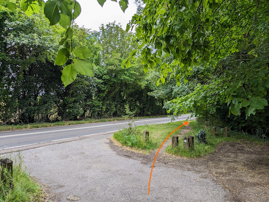
16: Turn right at the junction on Offley BOAT 53 (
byway open to all traffic) then follow it NE for 1.5km, with Pegsdon Hills and Deacon Hill on your left, until you reach the B655 (location -
https://w3w.co/torch.pushes.playback), see image below.
 |
| Turn right on a track running along the south side of the B655 |
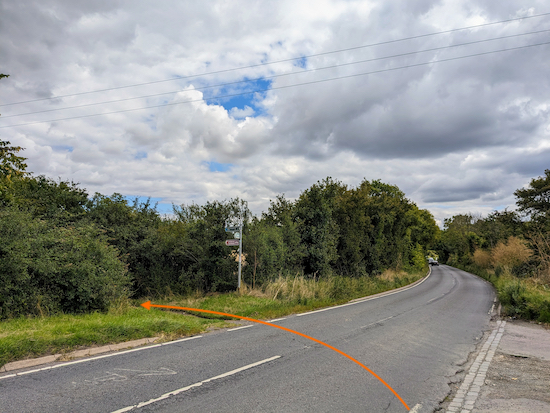
17: Turn right on a track running along the south side of the B655 then head ENE for 255m until you reach a bridleway on the left (location -
https://w3w.co/rental.timer.fallen), see image below.
 |
| Turn left on Pirton bridleway 8 |
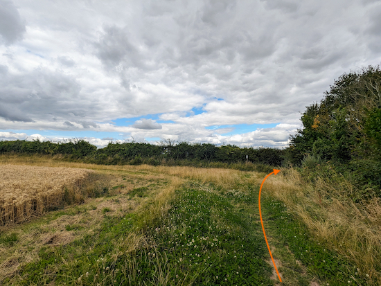
18: Turn left on Pirton bridleway 8 then head N for 515m until you reach a right-hand bend (location -
https://w3w.co/upward.strutted.rents), see image below.
 |
| Continue on Pirton bridleway 8 as it now heads NE |
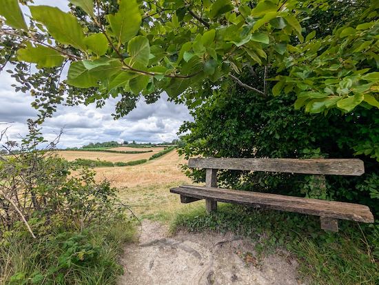
19: Continue on Pirton bridleway 8 as it now heads NE. After 655m look out for a lovely bench-with-a-view on your right (location -
https://w3w.co/with.width.relaxing), see image below.
 |
| The bench-with-a-view along the Icknield Way |
Continue on Pirton bridleway 8 for 785m until you reach Priors Hill (location -
https://w3w.co/slumped.pinging.guard), see image below.
 |
| Cross Priors Hill then head NE on Great Green |
20: Cross Priors Hill then head NE then N on Great Green for 165m until you reach the
Motte & Bailey pub/restaurant on the right (location -
https://w3w.co/objective.overheard.shed), see image below.
 |
| Turn right after the Motte & Bailey |
21: Turn right after the Motte & Bailey then head NE on Crab Tree Lane for 250m back to the starting point.
Interactive map


Hi, this morning I did the route 241 from Pirton - SW loop. A very pleasant 6.25 miles with very little near any roads. Mostly tracks and fields with a bit of undulation here and there. For the first 5.5 miles I saw no one 😊 then having found a bench to have my coffee with very little distance left; - a couple of dog walkers, a single guy, a whole ‘pack’ of ramblers, 2 more dog walkers and 2 very speedy mountain bikers passed by! A good walk on a dry day with views to the distance in several places 👍
ReplyDeleteHi Angela, great write-up. So glad you enjoyed it. We really liked that walk
DeleteYou saw a lot more people than us Angela - a solitary walker right at the beginning and a lone cyclist right at the end
DeleteHi David, the Hertfordshire CMS walking group did this yesterday on a magnificent October day. Stunning walk, covering some territory I had covered from Great Offley, but slightly better pubs in Pirton. Just fitted our definition very well of around 6 miles or so with a pub start/finish loop, though we started at The Motte & bailey as it opens at lunchtime on most days. Minimal road, lovely well defined paths and so quiet. About 50% of our monthly walks use HW routes so do keep going. Thank you so much.
ReplyDeleteIan
Hi Ian, so glad you enjoyed the walk. Ellie and I really liked that one, too. And great to hear that the Herts CMS walking group is using the routes. Thanks for the feedback. Please encourage your members to join our Hertfordshire Walker Facebook group where fellow walkers are sharing updates and photos from their walks. It's a lovely community. David
Deletehttps://www.facebook.com/groups/hertfordshirewalker