6.6 miles (10.7km) with 138m of total ascent
 |
| Barton Hills Nature Reserve from the bridleway at point 12 |
This is a lovely walk in late July when the hedgerows are ablaze with wildflowers, and butterflies flutter around as you walk. The majority of the route is like walking through a natural garden, particularly between points 4-6, 9-10, and 12-14.
This is our second walk from the village of Hexton, and, as with the other walk,
Walk 237: Hexton South-East Loop, it involves a fair amount of up and down.
The walk starts from
The Raven pub in Hexton then heads south before turning west and crossing the border into Bedfordshire. It then turns north to explore the Barton Hills then looping back via Barton-le-Clay. A little more than half the walk is in Bedfordshire.
The starting point for this walk is 6.5 miles west from Hitchin Station by road.
There are three short sections where you will be walking along roads without pedestrian pavements. Please be prepared to step on the verge in the case of oncoming traffic.
Fly through preview of walk
If you want to check what sort of landscape you will be crossing before you set off on this walk you can view a short 3D video of the route below. It's created using the free version of
Relive.
Directions
 |
Map for Walk 240: Hexton South-West Loop
Click on the map above for a larger version
Created on Map Hub by Hertfordshire Walker
Elements © Thunderforest © OpenStreetMap contributors
There is an interactive map below these directions |
Those with GPS devices can download
GPX or
KML files for this walk. We've added
What3Words location references for those who use that system. If you print these walks you might want to use the green
PrintFriendly icon at the bottom of these directions to delete elements such as photographs.
 |
| The Raven pub/restaurant at the start and finish of the walk |
1: With your back to The Raven pub/restaurant (location -
https://w3w.co/panther.incoming.escalates), turn right then head S for 460m until you reach a junction (location -
https://w3w.co/wolves.sang.lentil) see image below.
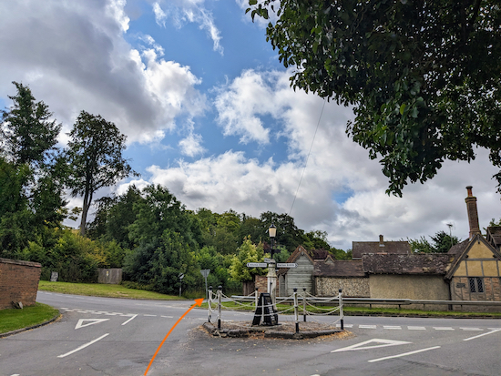 |
| Cross Barton Road then continue heading S, now on Hexton Road |
2: Cross Barton Road then continue heading S, now on Hexton Road.
There isn't a pedestrian pavement along this stretch so be prepared to step on the verge if traffic approaches. Continue for 170m until you reach a
footpath on the right (location -
https://w3w.co/shoelaces.tolls.legal), see image below.
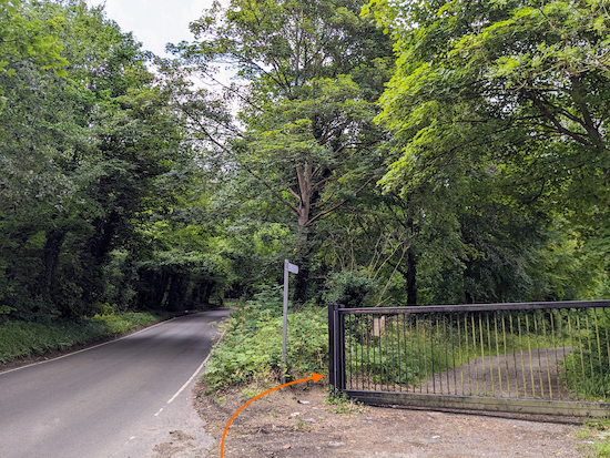 |
| Turn right on Hexton footpath 2 |
3: Turn right on Hexton footpath 2 then head SSW for 390m until the track you are on bends right and Hexton footpath 2 bends left (location -
https://w3w.co/stow.candle.crowds), see image below.
 |
| Turn left, still on Hexton footpath 2 |
4: Turn left, still on Hexton footpath 2, then climb uphill heading SSE, with woodland on either side, for 450m until you leave the woodland (location -
https://w3w.co/banana.fortunate.butter), see image below.
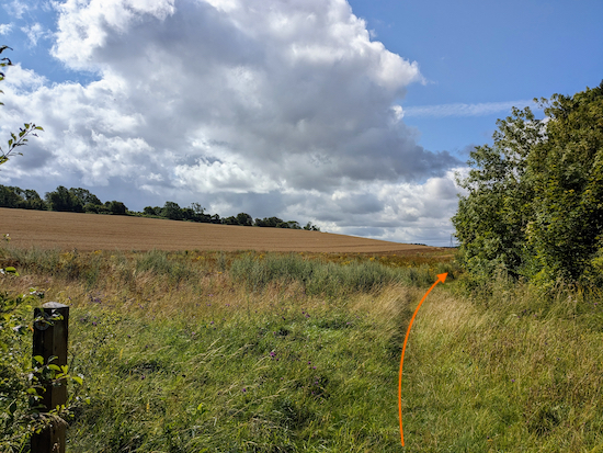 |
| Continue on Hexton footpath 2 with the hedgerow on the right |
5: Continue on Hexton footpath 2, now heading SSW, with the hedgerow on the right and field on the left for 455m until the footpath cuts through the hedgerow (location -
https://w3w.co/valley.slower.vines).
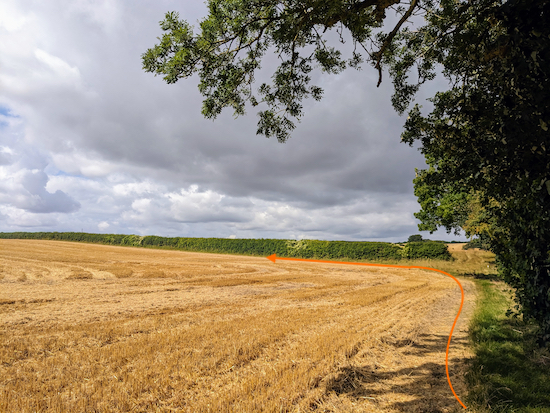 |
| Follow the path as it turns right then left |
6: After cutting through the hedgerow follow the path as it turns right then head W for 65m, with the woodland on the right and field on the left, until you reach the corner of the field (location -
https://w3w.co/mount.reply.cube), where you turn left, still on Hexton footpath 2, then head SSW for 535m, with the hedgerow on the right and field on the left, until you reach a road (location -
https://w3w.co/opera.jumpy.vase), see image below.
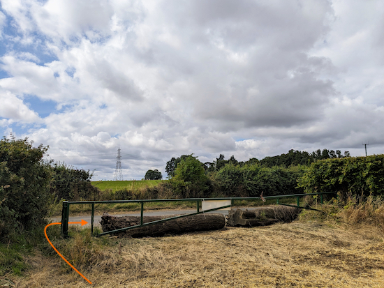 |
| Turn right on the road then head W |
7: Turn right on the road.
There isn't a pedestrian pavement along this stretch, so be prepared to step on the verge if traffic approaches. Head W for 175m until you reach a
bridleway on the left (location -
https://w3w.co/sides.breath.edit), see image below.
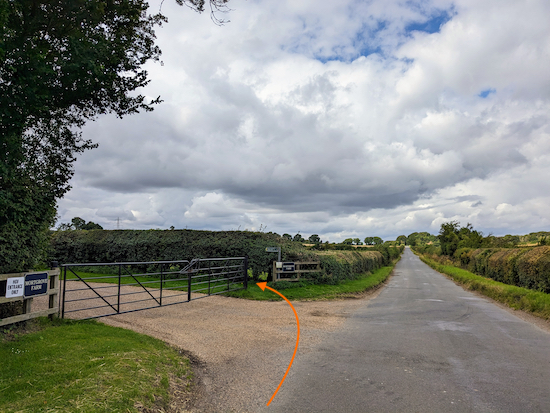 |
| Turn left on Hexton bridleway 1 |
Turn left on Hexton bridleway 1 then head SSW for 250m until you reach a junction immediately after passing Mortgrove Farm on your left (location -
https://w3w.co/dates.basket.hooks), see image below.
 |
| Continue heading SSW, still on Hexton bridleway 1 |
8: Continue heading SSW, still on Hexton bridleway 1, for 370m until you reach a junction (location -
https://w3w.co/others.feeds.rate), see image below.
 |
| Turn right on Hexton BOAT 8 |
9: Turn right on Hexton BOAT 8 (
byway open to all traffic), which is also Lilley BOAT 23, then head SW. This stretch is also
The Icknield Way and
The John Bunyan Trail. Continue for 675m until you reach a junction (location -
https://w3w.co/fast.poetic.lists), see image below.
 |
| Turn right at the junction on Streatley bridleway 41 |
10: When you reach the junction you are now in Bedfordshire. Turn right at the junction on Streatley bridleway 41 then head NNW and N for 1.1km until you reach a road (location -
https://w3w.co/humble.hops.fantastic), see image below.
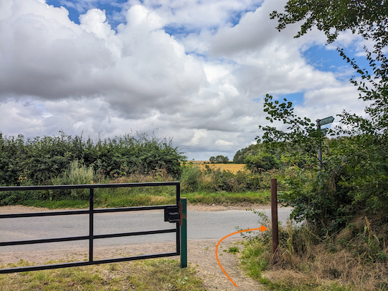 |
| Turn right then head E along the road |
11: Turn right then head E.
There isn't a pedestrian pavement along this stretch, so be prepared to step on the verge if traffic approaches. Continue for 150m until you come to a footpath on the left just before you reach Barton Hill Farm (location -
https://w3w.co/boil.like.deflection), see image below.
 |
| Turn left on Barton-le-Clay footpath 16 |
Turn left on Barton-le-Clay footpath 16 then head N for 1.1km until you reach a junction (location -
https://w3w.co/album.frock.invest), see image below.
 |
| Keep straight at the junction on Barton-le-Clay bridleway 16 |
12: Keep straight at the junction, now heading NNW on Barton-le-Clay bridleway 16. Soon after the junction you will see a gate on the left leading to the
Barton Hills Nature Reserve (location -
https://w3w.co/fried.above.drive), see image below.
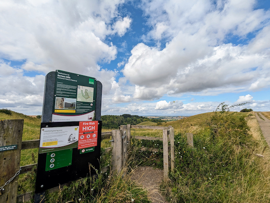 |
| The gate leading to the Barton Hills Nature Reserve |
Pass the gate and continue on Barton-le-Clay bridleway 16 for 230m until you reach a junction (location -
https://w3w.co/burn.gangs.crowd), see image below.
 |
| Continue straight, now on Barton-le-Clay bridleway 26 |
13: The route continues straight, now on Barton-le-Clay bridleway 26, but, if you prefer, you could take a detour on your left at this point to walk through the reserve. If you want to take that route, the map below shows how you can leave the main route and rejoin it later.
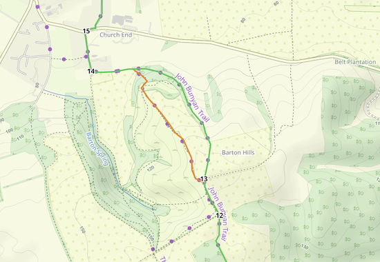 |
| The detour through the nature reserve shown in orange |
We chose to stay on the bridleway and continued on Barton-le-Clay bridleway 26 for 880m as it heads NNE, then NNW, then W. There are some lovely views to the north and east from this bridleway and we saw masses of wildflowers and butterflies along this stretch.
 |
| The view from Barton-le-Clay bridleway 26 |
Continue on Barton-le-Clay bridleway until you reach a fork (location -
https://w3w.co/relishing.parts.remote) where the detour footpath through the nature reserve rejoins the main route.
 |
| Head W with the hedgerow on the right until you reach Church Road |
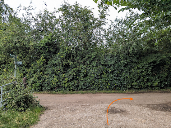
Keep right at the fork then head W for 250m with the hedgerow on the right until you reach Church Road (location -
https://w3w.co/crisps.rocky.divisible), see image below.
 |
| Turn right on Church Road |
14: Turn right on Church Road then head N for 240m to reach Hexton Road (location -
https://w3w.co/specifies.worked.craftsman), see image below.
* At this point, if you need refreshments, you could turn left on Hexton Road then right on Bedford Road. There are two pubs on Bedford Road in Barton-le-Clay. Both are a short detour from the route. They are The Royal Oak (location - https://w3w.co/nags.craft.hatch) and The Waggon & Horses (location - https://w3w.co/sake.postings.goodnight). There are also cafes, restaurants, and shops along the same road.
 |
| Turn right on Hexton Road |
15: If you don't take the detour for refreshments, turn right on Hexton Road then head E for 55m until you reach Manor Road on your left
(location -
https://w3w.co/croaking.vocally.paint), see image below.
 |
| Then turn left on Manor Road |
Turn left on Manor Road then head N for 490m until you reach a footpath sign on the right just beyond a school on your right (location -
https://w3w.co/juggles.remotest.surely), see image below.
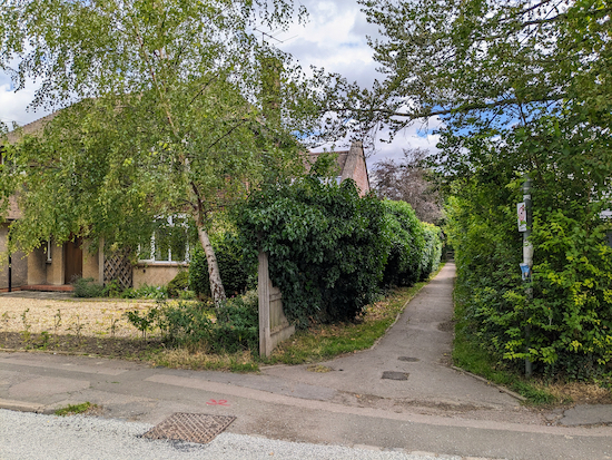 |
| Turn right on Barton-le-Clay footpath 2 |
16: Turn right on Barton-le-Clay footpath 2 then follow the path as it heads E for 80m, NNE for 80m, and E for 45m before reaching a junction
(location -
https://w3w.co/respects.collision.propelled).
Keep heading straight at the junction, now on Barton-le-Clay footpath 23, then head eastwards for 1.3km until you reach a junction (location -
https://w3w.co/singing.vitals.elections), see image below.
 |
| Continue heading E on Barton-le-Clay footpath 23 |
Continue heading E on Barton-le-Clay footpath 23, with the hedgerow on the right, for 335m until you reach a footbridge where you leave Bedfordshire and enter Hertfordshire (location -
https://w3w.co/noticing.replayed.drill), see image below.
 |
| Cross the footbridge then head diagonally SE across a field |
17: Cross the footbridge then head diagonally right and SE across an arable field on Hexton footpath 5 for 315m until you reach a lane (location -
https://w3w.co/warping.maternal.geese), see image below.
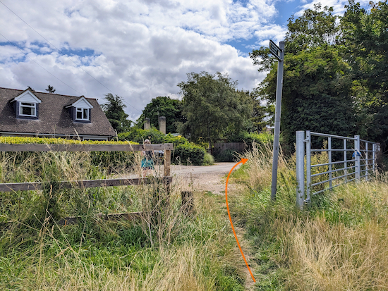 |
| Turn right on the lane |
18: Turn right on the lane then follow it SSE then E for 154m to a junction (location -
https://w3w.co/airbase.disengage.boom). Turn right at the junction then head S for 50m back to the starting point.
Interactive map


We did this walk yesterday and really loved it! Would recommend a short detour through the first gate into Barton Hills nature reserve (point 12) for amazing views and a couple of benches that provided a very welcome, and ideal, picnic spot.
ReplyDeleteMany thanks, as always, to David and Ellie!
Janet & Nick
Hi Janet and Nick, thanks for mentioning the short detour at point 12. We agree, it's worth exploring. Glad you enjoyed the walk.
DeleteThis route looks great and one I'm eager to try. How was the traffic on the road sections?
ReplyDeleteHi, I can only say for the day when we tested the walk. There are two short sections of the same road where you have to walk. One is 170m after point 7 and the other is 155m after point 11. We met two cars and we able to step to one side. Are you a member of our Facebook group? Because you could ask the question there. We have 3.5k members and there might be one or two who could share their experiences walking that stretch. David
Deletehttps://www.facebook.com/groups/hertfordshirewalker