3.5 miles (5.6km) with 27m of total ascent
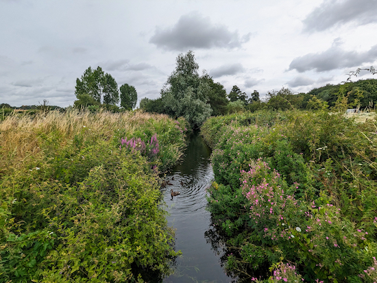 |
The River Colne at Willows Lakes
|
This walk starts in Colney Heath then circles Willows Lakes, a series of former quarries which are now part of a private fishery. It's a great walk for anyone interested in wild flowers, butterflies, and bird spotting. The route follows public rights of way around the site and keeps away from the private footpaths which are accessible to anglers only.
Willows Lakes were renamed Albans Lakes in 2018. The starting point for this walk is 2.6 miles WNW from Welham Green Station by road.
Fly through preview of walk
If you want to check what sort of landscape you will be crossing before you set off on this walk you can view a short 3D video of the route below. It's created using the free version of
Relive.
Directions
 |
Map for Walk 239: Willows Lakes West Loop
Click on the map above for a larger version
Created on Map Hub by Hertfordshire Walker
Elements © Thunderforest © OpenStreetMap contributors
There is an interactive map below these directions |
Those with GPS devices can download
GPX or
KML files for this walk. We've added
What3Words location references for those who use that system. If you print these walks you might want to use the green
PrintFriendly icon at the bottom of these directions to delete elements such as photographs.
Please note that Hertfordshire County Council's Rights of Way (ROW) team is in the process of renaming some of the public footpaths and public bridleways along this route. As a result, the names and numbers of the signs you will see along the way may not match those plotted on the council's online maps which are being updated. I have included the plan for the revised names and numbers at the foot of this walk.
1: With your back to St Mark's Church Centre, (location -
https://w3w.co/flips.sheep.crass), turn right then head SSE along Church Lane. This section of the walk is also
The Watling Chase Timberland Trail.
After 225m you will reach a road bridge over the River Colne, (location -
https://w3w.co/acting.dozed.slave), see image below.
 |
| Cross the bridge then continue following Church Lane |
2: Cross the road bridge then continue following Church Lane as it heads SSE for 80m then bends right to head SW for 75m until it reaches a track (location -
https://w3w.co/theme.pumps.expand), see image below.
 |
| Ridge bridleway 2 heading WSW towards Willows Lakes |
3: This track is also Ridge bridleway 2 which you follow heading WSW for 145m, passing a miniature railway on the left (location -
https://w3w.co/ready.dates.dish), operated by
The North London Society of Model Engineers, see image below.
 |
| The NLSME miniature railways at Colney Heath |
Continue until you reach a bridleway junction (location -
https://w3w.co/busy.clever.casual), see image below.
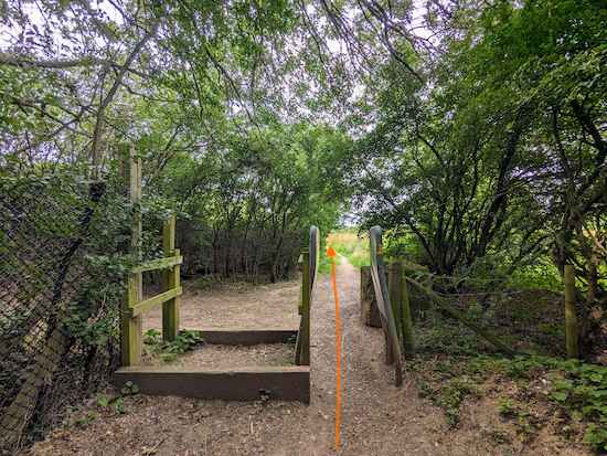 |
| Continue on Ridge bridleway 2 |
4: Continue on Ridge bridleway 2, now heading SW, for 400m until the footpath crosses a track used by quarry traffic (location -
https://w3w.co/gent.adults.sums), see images below.
 |
| Ridge bridleway 2 approaching the track |
 |
| Ridge bridleway 2 crossing the track |
5: Cross the track with care (it is still used by trucks) then continue heading SW, still on Ridge bridleway 2, for 70m until it reaches a footbridge over the quarry conveyor belt (location -
https://w3w.co/lease.keeps.stud), see image below.
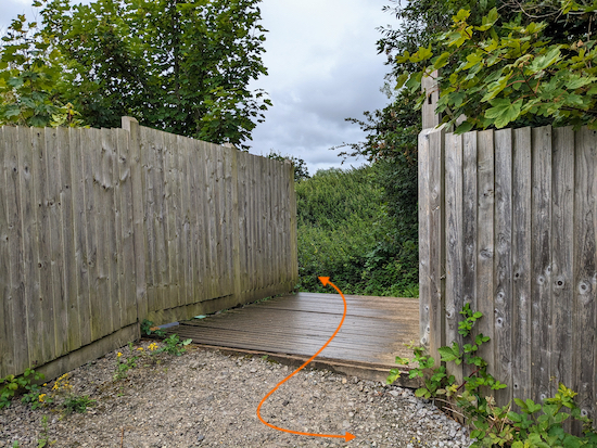 |
| Cross the footbridge then continue on Ridge bridleway 2 |
6: Cross the footbridge then follow the path round to a junction (location -
https://w3w.co/shack.truly.tooth), see image below.
 |
| Keep left at the junction then head S on Ridge bridleway 6 |
Keep left at the junction then head S on Ridge bridleway 6 for 350m until you reach a fork (location -
https://w3w.co/locked.sudden.spice), see image below.
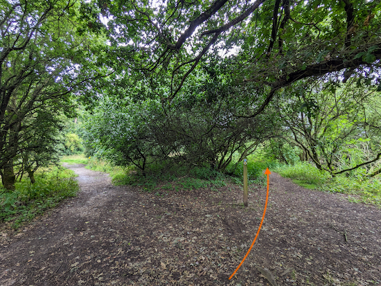 |
| Keep right at the fork then follow Ridge footpath 52 |
7: Keep right at the fork then follow Ridge footpath 52 as it heads S, with the river on your right and fields on your left. This is a lovely stretch where we saw many wildflowers when we walked the route in July 2023. A few of the species we saw are included at the foot of these directions.
Continue for 925m until you reach a junction (location -
https://w3w.co/raves.wing.rats), see image below.
 |
| Continue straight at the junction ignoring a footpath on the left |
8: Continue straight at the junction ignoring a footpath on the left. You are now about to walk alongside the
Willows Activity Farm. After 15m turn right, still on Ridge footpath 52, then head WNW crossing a footbridge over the River Colne (location -
https://w3w.co/split.skill.super), see image below.
 |
| Cross the bridge then turn left after the gate |
Cross the bridge then turn left after the gate. Head SW for 165m to a gate leading to a junction (location -
https://w3w.co/bless.duck.liability), see image below.
 |
| Go through the gate then turn right on Ridge footpath 3 |
9: Go through the gate then turn right on Ridge footpath 3. Head NW for 65m to a junction (location -
https://w3w.co/second.apron.attend), see image below.
 |
| Continue heading NW, now on London Colney footpath 38 |
10: Continue heading NW, now on London Colney footpath 38. The footpath follows a paved track uphill for 360m until it reaches fork (location -
https://w3w.co/lowest.buyers.type), see image below.
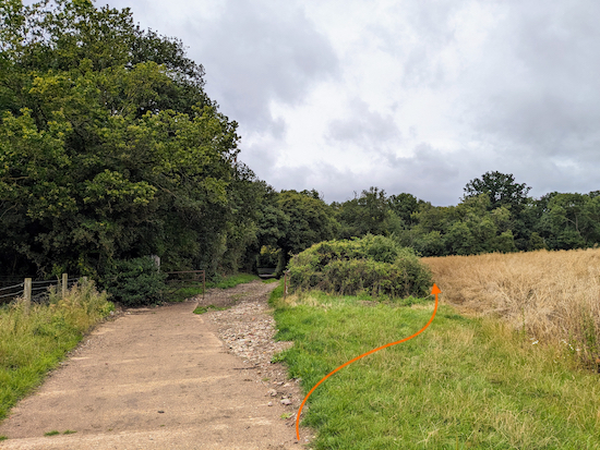 |
| Keep right at the fork then head NW |
11: Keep right at the fork then follow Ridge footpath 38 as it heads NW, with the hedgerow on the left and the field on the right, for 80m until it reaches a right-hand bend and a junction (location -
https://w3w.co/hurt.retain.panels), see image below.
 |
| Keep right at the bend then follow Ridge footpath 33 |
12: Keep right at the bend then follow Ridge footpath 33, with the woodland on the left and field on the right, for 1.2km as it heads NE, NNE, then E before the footpath cuts across a field (location -
https://w3w.co/idea.excuse.lived), see image below.
 |
| Head E across the field for 50m |
13: Head E across the field, still on Ridge footpath 33, for 50m until you reach a track (location -
https://w3w.co/shell.loving.zone), see image below.
 |
| Cross the track then continue heading E to a junction |
Cross the track then continue heading E for 45m until you reach a junction (location -
https://w3w.co/fresh.skin.shirts), see image below.
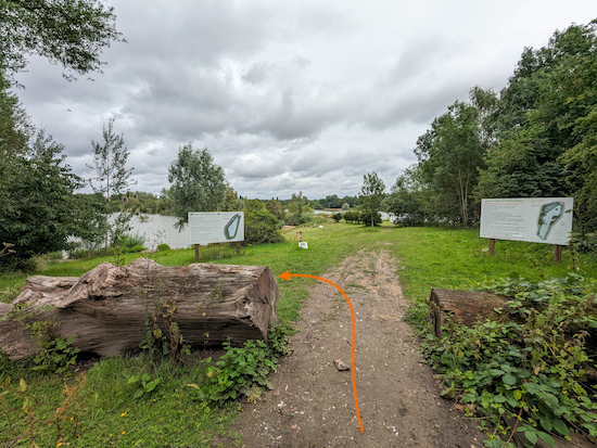 |
| Turn left on Ridge footpath 1 |
14: Turn left on Ridge footpath 1 then head N for 175m until you reach a track (location -
https://w3w.co/trip.divisions.matter), see image below.
 |
| Turn right on the track, which is still Ridge footpath 1 |
15: Turn right on the track, which is still Ridge footpath 1, then head ENE for 320m until you reach the Albans Lakes fishery buildings on the right (location -
https://w3w.co/opens.hits.shower). Just beyond the fishery buildings you will see a signpost in front of a fenced track (location -
https://w3w.co/woes.remote.create), see image below.
 |
| Turn right on the track between the fences then head SSE |
16: Turn right on the track between the fences then head SSE for 30m until the path bends left then heads ENE for 25m crossing a bridge over the River Colne (location -
https://w3w.co/wants.lame.gross), see image below.
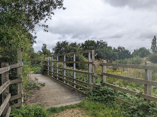 |
| Cross the bridge then head SE for 20m to reach a junction |
Cross the bridge then head SE for 20m to reach a junction. This is the junction you passed earlier in the walk, see image below.
 |
| Turn left at the junction then head NE |
Turn left at the junction. You are now on the path you walked at the start of the walk. Follow the path NE for 1.1k back to the starting point retracing the route you took earlier between point 6 and point 1.
* If you want refreshments after your walk you could turn right on a footpath just after you cross the River Colne at point 2 (location - https://w3w.co/onion.oddly.swept) then head ENE on Colney Heath footpath 21 for 95m then keep heading ENE along Park Lane for 185m until you reach High Street where you turn right then head ESE for 85m to visit The Crooked Billet (location - https://w3w.co/pens.bunch.sends), see map for detour below.
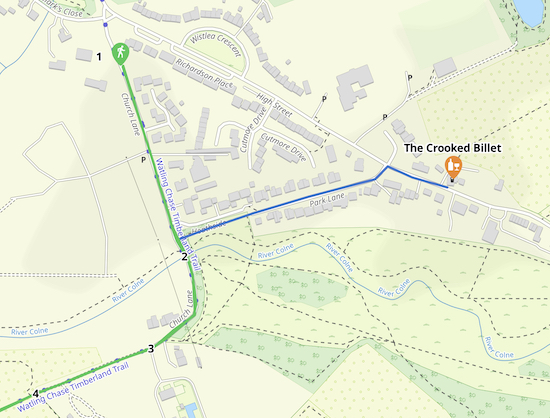 |
| Map for the detour (in blue) to The Crooked Billet |
Images of some of the flowers seen along this route, identified using the free
Flora Incognito app.
 |
| Flora identified with the free Flora Incognito app |
 |
| Flora identified with the free Flora Incognito app |
 |
| Flora identified with the free Flora Incognito app |
 |
| Flora identified with the free Flora Incognito app |
 |
| The revised version of the public rights of way on this walk |
Interactive map


Another lovely short walk - the directions were excellent and kept us on the right paths but still able to appreciate the lakes. Great to walk through part of Willows Farm!
ReplyDeleteYes, a lovely walk, one we keep returning to because we live close by. Glad you enjoyed it.
DeleteDid this walk on 28th March, my birthday. Got caught in Storm Nelson which made it interesting to say the least. A lovely walk.
ReplyDeleteOh no! What a way to spend a birthday - getting washed out in a storm. I hope it didn't ruin your day. By the way, if you haven't already done so please consider joining our friendly Hertfordshire Walker Facebook group where fellow walkers are sharing their walking experiences and photos. David
Deletehttps://www.facebook.com/groups/hertfordshirewalker
Hi David, already joined the Facebook group when you first started it up 👍
Delete