2.7 miles (4.3km) with 47m of total ascent
 |
| Hertford Heath bridleway 4 between points 16 & 17 |
This short loop follows both public rights of way and other trails across Hertford Heath, Golding's Wood, and Much Wood. Those with children might enjoy exploring 'Hertford Heath Fairy Trail' between points 5 & 6 on the walk. The walk starts and finishes at The Goat pub/restaurant and passes close to The College Arms.
For those interested in local history, the start of this walk was once called Little Amwell, which forms the northern part of the modern village of Hertford Heath. The civil parish of Little Amwell was abolished in 1990, merging with parts of the neighbouring parishes of Great Amwell, Stanstead St Margarets, and Ware to form the new parish of Hertford Heath. Little Amwell remains the name of the ecclesiastical parish which covers Hertford Heath.
More on Wikipedia.
Getting there
The nearest bus stop to the start of the walk is on London Road close to Woodland Road in Hertford Heath (location -
https://w3w.co/poem.blunt.case), which is 260m SE of the start/finish point. The stop is served by the 341 and 641 buses from Hertford or from Broxbourne. You can check bus times by visiting the free
Intalink online timetable.
Fly through preview of walk
If you want to check what sort of landscape you will be crossing before you set off on this walk you can view a short 3D video of the route below. It's created using the free version of
Relive.
Directions
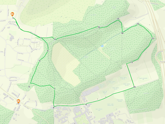 |
Map for Walk 238: Hertford Heath South-East Loop
Click on the map above for a larger version
Created on Map Hub by Hertfordshire Walker
Elements © Thunderforest © OpenStreetMap contributors
There is an interactive map below these directions |
Those with GPS devices can download
GPX or
KML files for this walk. We've added
What3Words location references for those who use that system. If you print these walks you might want to use the green
PrintFriendly icon at the bottom of these directions to delete elements such as photographs.
 |
| The Goat, Hertford Heath |
1: With your back to
The Goat pub/restaurant on Vicarage Causeway, Hertford Heath (location -
https://w3w.co/edit.rounds.goal), take the road that heads SE with the village green on your right (location -
https://w3w.co/bared.grit.catch). Continue for 100m along Mount Pleasant until you reach a junction (location -
https://w3w.co/pipes.elite.edit).
2: Head straight and SE on Mount Pleasant for 230m until the road becomes a track at a fork (location -
https://w3w.co/precautions.pint.landed), see image below.
 |
| Turn right at the fork on Hertford Heath bridleway 5 |
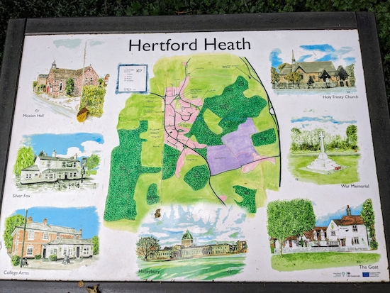 |
| The information board at the start of the bridleway |
3: Turn right at the fork then head SE on Hertford Heath
bridleway 5, which is metalled along this stretch. Continue for 140m until you reach a junction (location -
https://w3w.co/shave.gravy.talent), see image below.
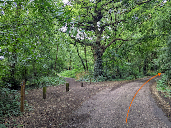 |
| Keep right at the junction, still on Hertford Heath bridleway 5 |
4: Keep right at the junction, still on Hertford Heath bridleway 5, then head SW for 120m until Hertford Heath bridleway 5 becomes a track (location -
https://w3w.co/curry.shine.intro) see image below.
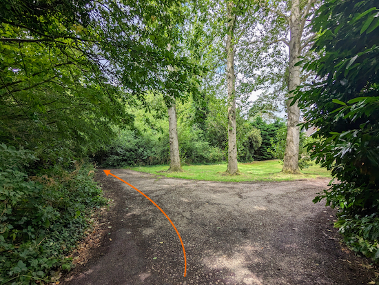 |
| Continue along Hertford Heath bridleway 5 |
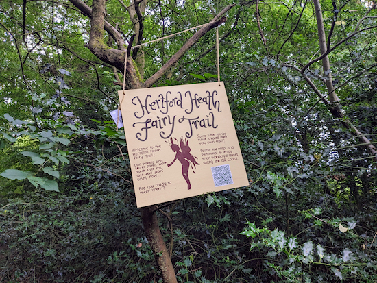
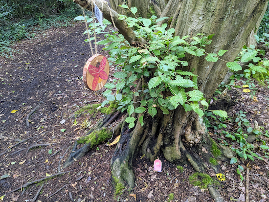
5: Continue along Hertford Heath bridleway 5, now heading SSW. Along this stretch you might notice a sign on your right for 'Hertford Heath Fairy Trail' which has small painted pieces of wood along the way with QR codes revealing stories about each stage of the trail, see images below.
 |
| Hertford Heath Fairy Trail |
 |
| One of the stages along the fairy trail |
 |
| The QR codes when scanned with a smartphone reveal a story |
Continue heading SSW on Hertford Heath bridleway 5 for 255m until you reach a junction (location -
https://w3w.co/entire.upon.actor), see image below.
 |
| Turn left at the junction |
* If you need refreshments you could take a short detour at this point to head 165m to visit The College Arms (location - https://w3w.co/fans.ending.complains), be sure to check opening times.
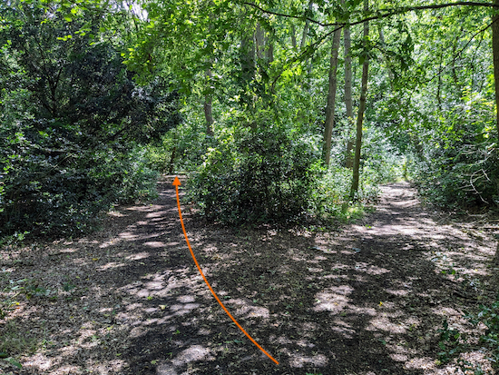
6: Turn left at the junction then follow the path ENE for 45m to a junction (location -
https://w3w.co/limbs.over.crowned), see image below.
 |
| Take the left fork at the junction |
Take the left fork at the junction then head E for 80m until you reach a pond on the left (location -
https://w3w.co/final.trails.spoil), see image below.
 |
| Pass the pond on the left |
Immediately after the pond the path forks. You take the left fork (location -
https://w3w.co/patch.insect.most), see image below.
 |
| Take the left fork immediately after the pond |
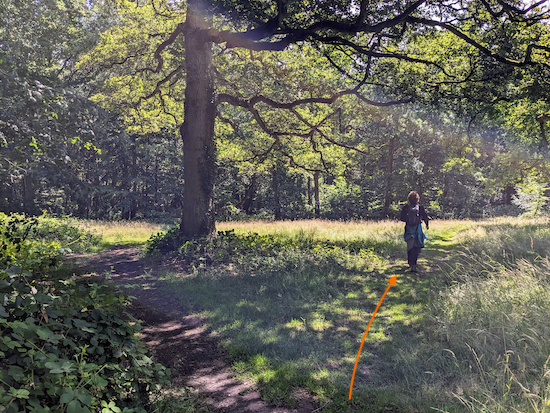
Continue for 50m until the path forks right (location -
https://w3w.co/valid.crass.atoms), see image below.
 |
| Take the right fork then continue to a junction |
Continue for 60m until you reach a junction (location -
https://w3w.co/extend.grant.learns).
7: Turn right then Head S, now on Hertford Heath bridleway 17, for 120m until the path forks, see image below.
 |
| Fork left, still on Hertford Heath bridleway 17 |
Take the left fork then continue heading S, still on Hertford Heath bridleway 17, for 40m until you reach a junction (location -
https://w3w.co/trials.stages.pitch), see image below.
 |
| Turn left then follow a paved path |
8: Turn left then follow a paved path as it heads E for 300m before reaching a car park then sports fields (location -
https://w3w.co/cats.brains.asleep), see image below.
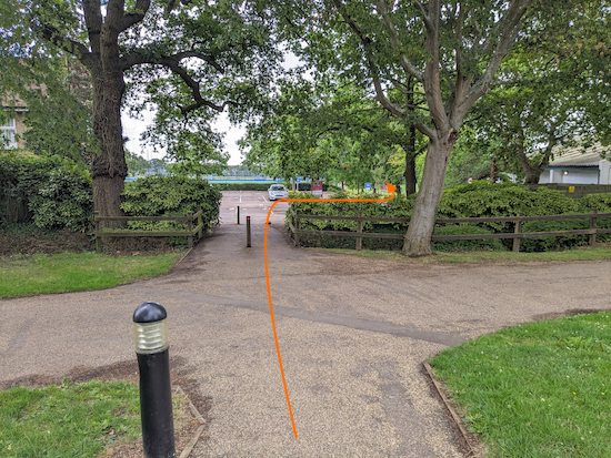 |
| Keep heading E, with sports fields on the left and right |
9: Keep heading E, with sports fields on the left and right, for 480m until you reach a junction (location -
https://w3w.co/river.lift.bike), see image below.
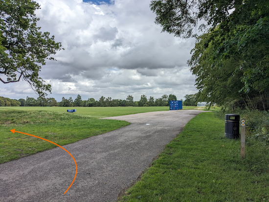 |
| Turn left on Hertford Heath footpath 18 |
10: Turn left on Hertford Heath
footpath 18 then head NNW for 225m, with the trees on the right and the field on the left, until the path bends right (location -
https://w3w.co/remain.lock.remote), see image below.
 |
| Turn right when you reach the woodland |
Turn right when you reach the woodland then head ENE for 45m before turning left into the woodland (location -
https://w3w.co/fingernails.towers.posed), see image below.
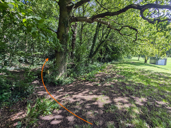 |
| Turn left into the woodland then turn right |
11: Turn left into the woodland then turn right and follow the path NE inside the edge of the woodland for 300m until the path bends left (location -
https://w3w.co/belts.deeper.label).
12: Keep left then follow the path NW inside the edge of the woodland for 190m until you reach a left-hand bend (location -
https://w3w.co/intervals.healers.aims), see image below.
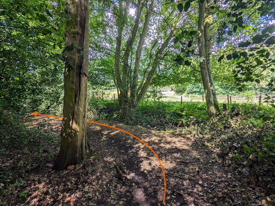 |
| Keep left then head SW |
13: Keep left at the bend then head SW for 175m until you reach a bridge (location -
https://w3w.co/hurray.visa.gravy), see image below.
 |
| Turn right then cross the bridge |
14: Turn right, cross the bridge, then head NNW for 125m until you reach a left-hand bend (location -
https://w3w.co/bumpy.fine.oldest), see image below.
 |
| Turn left then head WSW |
15: Turn left then head WSW for 185m until you reach a junction (location -
https://w3w.co/crisis.slower.piper), see image below.
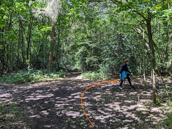 |
| Turn right at the junction |
Turn right at the junction then head NW for 10m to another junction, see image below.
 |
| Turn left then head WSW on Hertford Heath bridleway 4 |
16: Turn left at the junction then head WSW on Hertford Heath bridleway 4 for 435m until you reach a junction (location -
https://w3w.co/detect.chase.movie), see image below.
 |
| Turn right at the junction, still on Hertford Heath bridleway 4 |
 |
| Continue on Hertford Heath bridleway 4 |
17: Turn right at the junction, still on Hertford Heath bridleway 4, then head NW for 50m until you reach Mount Pleasant (location -
https://w3w.co/school.third.bike).
18: Turn left on Mount Pleasant then head westerly for 430m back to The Goat and the starting point.
Interactive map


Sorry but I am a bit confused why this called "Little Amwell"? It's about 3 miles from Little Amwell which I believe is part of Great Amwell.
ReplyDeleteYou are right, I probably should rename it but it would involve changing so many related links and anyone who bookmarked the walk with the old title would end up with a blank page. The reason I gave it this title is explained on Wikipedia: "Little Amwell was a village and civil parish in Hertfordshire, England, lying 1.6 miles (2.6 km) south-east of the county town of Hertford. The old village of Little Amwell forms the northern part of the modern village of Hertford Heath. The civil parish of Little Amwell was abolished in 1990, merging with parts of the neighbouring parishes of Great Amwell, Stanstead St Margarets, and Ware to form the new parish of Hertford Heath. Little Amwell remains the name of the ecclesiastical parish which covers Hertford Heath". By the way, if you haven't done so, please consider joining our Hertfordshire Walker Facebook Group where fellow walkers are posting about their walks and sharing photographs taken along the way.
Deletehttps://www.facebook.com/groups/hertfordshirewalker
I have just figured how to change the title of the URL, so it's now Walk 238: Hertford Heath South-East Loop. Thanks for the feedback and pointing it out.
Delete