4.8 miles (7.8km) with 97m of total ascent
 |
| The byway between points 2 & 3 |
This is an excellent walk across the beautiful rolling countryside north of the village of Lilley. We were both struck by the silence between points 3 & 5, broken only by hovering skylarks. All through the route the hedgerows were ablaze with a wide variety of wildflowers. You will walk along parts of two long-distance paths, the John Bunyan Trail and The Icknield Way, and pass a Bronze Age burial barrow.
Fly through preview of walk
If you want to check what sort of landscape you will be crossing before you set off on this walk you can view a short 3D video of the route below. It's created using the free version of
Relive.
Directions
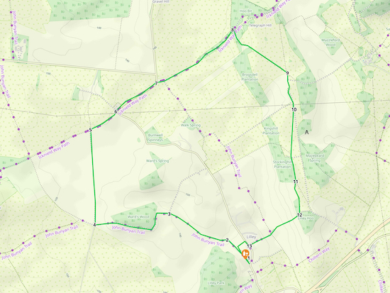 |
Map for Walk 236: Lilley Loop
Click on the map above for a larger version
Created on Map Hub by Hertfordshire Walker
Elements © Thunderforest © OpenStreetMap contributors
There is an interactive map below these directions |
Those with GPS devices can download
GPX or
KML files for this walk. We've added
What3Words location references for those who use that system. If you print these walks you might want to use the green
PrintFriendly icon at the bottom of these directions to delete elements such as photographs.
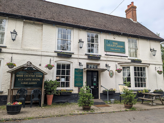 |
| The Lilley Arms, West Street, Lilley |
This walk starts at
The Lilley Arms (location -
https://w3w.co/metro.invest.claim) in the village of
Lilly. The pub was in the process of being sold when we visited. Staff behind the bar were not able to say whether the new owners will keep the pub open, but they did say they expect it to be open until October 2023. Please check with the pub to avoid disappointment. The starting point is six miles SW from Hitchin Station by road.
1: With your back to the Lilley Arms turn left then head NW along West Street for 225m until the road becomes a track (location -
https://w3w.co/sleepy.plank.book), see image below.
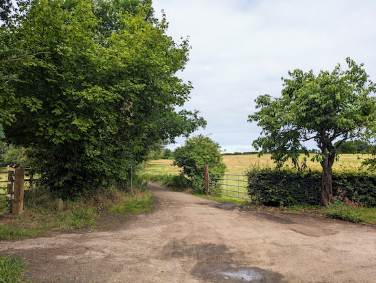 |
| Head NW on Lilley BOAT 22, which is also The John Bunyan Trail |
2: Continue heading NW, now on Lilley BOAT (
byway open to all traffic) 22, which is also
The John Bunyan Trail, for 700m until you reach a junction (location -
https://w3w.co/galaxy.runs.riches), see image below.
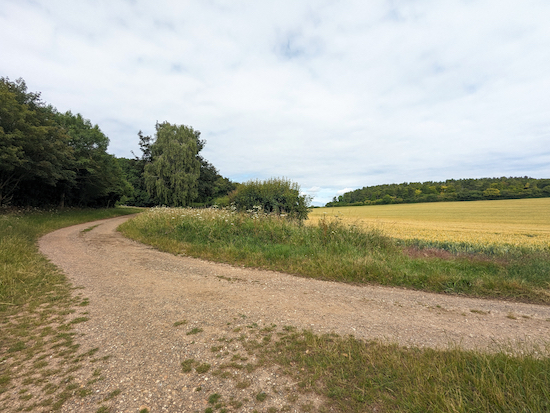 |
| Keep left at the junction, still on Lilley BOAT 22 |
3: Keep left at the junction, still on Lilley BOAT 22, then head W for 145m until you reach Ward's Wood (location -
https://w3w.co/cult.events.shunts) where the byway bends left then heads S for 170m, with the woodland on your right, before bending right at the edge of the woodland (location -
https://w3w.co/grit.sugar.prove), see image below.
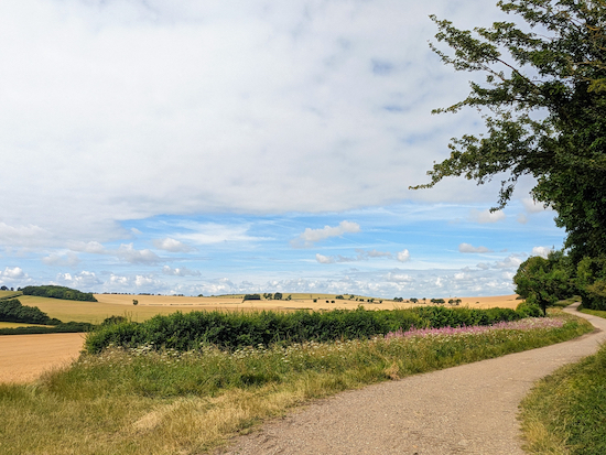 |
| The view to the NW between points 3 & 4 |
Continue on Lilley BOAT 22, now heading W for 560m until you reach a junction (location -
https://w3w.co/useful.nerve.town), see image below.
 |
| Turn right on Lilley bridleway 16 |
4: Turn right then head N on Lilley bridleway 16 for 960m to a junction (location -
https://w3w.co/create.blank.clubs), see image below.
 |
| Turn right at the junction then head ENE |
5: Turn right at the junction then head ENE on a byway which straddles the parish boundary and is both Lilley BOAT 23 and Hexton BOAT 8. Continue for 300m until you reach Hexton Road (location -
https://w3w.co/think.hips.shut), see image below.
 |
| Continue straight, heading ENE on the N (left) side of Hexton Road |
6: Continue straight, heading ENE on the N (left) side of Hexton Road following a footpath that has been cut along the verge, see image below.
 |
| Follow this footpath for 500m until you reach a left-hand bend |
Follow this footpath for 500m until you reach a left-hand bend and a byway on the right (location -
https://w3w.co/verse.money.planet), see image below.
 |
| Lilley BOAT 24 heading ENE off Hexton Road |
7: Cross Hexton Road at the bend then keep heading straight and ENE, now on Lilley BOAT 24, which is also Hexton BOAT 10 and
The Icknield Way, for 940m until you reach a junction (location -
https://w3w.co/worth.wiping.makes), see image below.
 |
| Turn right on Lilley bridleway 9 |
8: Turn right on Lilley bridleway 9 then head SE climbing steadily up Telegraph Hill. After 320m you will pass the site of
a Bronze Age funerary 'bowl barrow' on the right (location -
https://w3w.co/thrusters.just.apartment). Continue for ;400m until you reach to a junction (location -
https://w3w.co/meatball.moral.wake), see image below.
 |
| Keep right at the junction then head S on Lilley bridleway 9 |
9: Keep right at the junction then head S on Lilley bridleway 9 for 65m to a fork (location -
https://w3w.co/dull.spurted.bluffs), see image below.
 |
| Continue on Lilley bridleway 9, with the hedgerow on the right |
Continue on Lilley bridleway 9, with the hedgerow on the right, for 230m until you reach a junction (location -
https://w3w.co/plugs.binder.freezing), see image below.
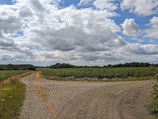 |
| Ignore the track on the right and continue heading S on Lilley bridleway 9 |
Ignore the track on the right and continue heading S, still Lilley bridleway 9, for 90m to a fork (location -
https://w3w.co/asteroid.scribbled.harmlessly), see images below.
 |
| Take the right fork, which is still Lilley bridleway 9 |
 |
| Continue on Lilley bridleway 9 across an arable field |
10: Take the right fork, which is still Lilley bridleway 9, and which cuts across an arable field. Continue heading SSW for 480m until you reach a junction just before the edge of the field you have just crossed (location -
https://w3w.co/dishing.rebounder.promotes), see image below.
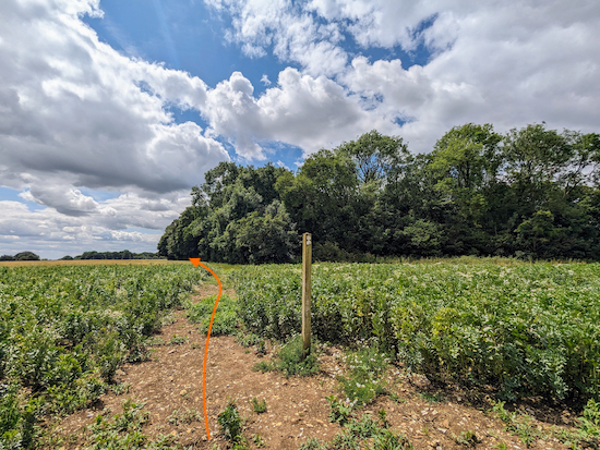 |
| Ignore the path on the right and continue heading S towards woodland |
Ignore the path on the right and continue heading S on Lilley bridleway 9 for 30m until you reach woodland, see image above.
Continue on Lilley bridleway 9, with the woodland on the right and field on the left, for 230m until you reach the end of the woodland (location -
https://w3w.co/peroxide.economies.cowboy).
* Here there should be a fork in the track, but when we tested this walk in July 2023, the bridleway on the left had not been reinstated, but that doesn't affect our route.
11: Keep right at the end of the woodland, now on Lilley bridleway 10, then continue heading S, with the hedgerow on the right and the field on the left, for 340m until you reach the corner of the field where Lilley bridleway 10 cuts through the hedgerow to reach a junction location -
https://w3w.co/revamped.dwarf.resemble), see image below.
 |
| Lilley bridleway 10 cuts through the hedgerow |
 |
| Keep right at the junction then head WSW, still on Lilley bridleway 10 |
12: Keep right at the junction then head WSW, still on Lilley bridleway 10, for 340m until you reach a junction (location -
https://w3w.co/removers.speaking.lamppost), see image below.
 |
| Continue heading WSW on Lilley bridleway 10 |
Continue heading WSW on Lilley bridleway 10 for 250m until you reach East Street (location -
https://w3w.co/trail.sage.cowboy).
13: Turn right on East Street then head NW for 70m until you reach a footpath on the left (location -
https://w3w.co/posed.depend.using), see image below.
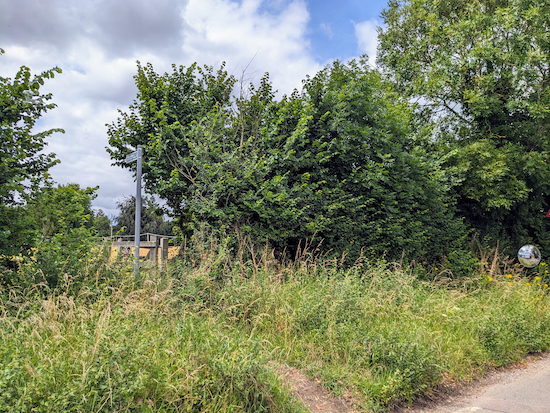 |
| Turn left on Lilley footpath 1 |
Turn left on Lilley footpath 1 then head SW for 80m until you reach a left-hand bend and Lilley restricted byway 25 (location -
https://w3w.co/riots.crown.undulation). Turn left on the byway then follow it SW for 120m back to the starting point.
Interactive map


We really enjoyed this walk yesterday.
ReplyDelete6 humans and 7 dogs.
Very easy to follow directions.
Thankyou
Brilliant. So glad you enjoyed it. Thanks for the feedback.
DeleteManaged this walk 17 March '24. Lots of mud free walking or easily navigated around muddy areas. Point 10? After you cross the arable field was by far the worst area as it was fairly churned up but still do-able in walking boots. This is a good walk if you're not very good with compass points & lots of instructions as a lot of it has long 'walking bits' between instructions. The pub at start/finish point, The Lilley Arms is still a working pub & the restaurant was clearly doing Sunday Roasts. Smelt delish!
ReplyDeleteGreat update. Thanks. Glad you enjoyed the walk.
Delete