5.5 miles (8.8 km) with 75m of total ascent
 |
| The footpath between points 4 & 5 |
This is an excellent walk, one which we both agreed is up there with the best in our growing collection. There are wide, open views across the north Hertfordshire countryside with a gem of a local a short detour from the halfway point. We saw a herd of wild deer, a flock of fieldfare, buzzards and kites, and we walked through a woodland carpeted with snowdrops. What was particularly noticeable was the silence. It is one of those Hertfordshire spots that is out of earshot of the main roads and motorways; it's like stepping back in time. The paths are clear and well-maintained throughout.
Getting there
Parking is difficult for this walk with limited opportunities. There are bus stops opposite Willow Close (location -
https://w3w.co/tumble.tycoons.unionists) in Great Hormead served by the numbers 20 and 38A. You can check bus times at the
Intalink site.
Fly through preview of walk
If you want to check what sort of landscape you will be crossing before you set off on this walk you can view a short 3D video of the route below. It's created using the free version of
Relive.
Directions
 |
Walk 227: Great Hormead North-East Loop
Click here or on the map for a larger version
Map created on MapHub - copyright details here
There is an interactive map below the directions |
Those with GPS devices can download
GPX or
KML files for this walk. We've added
What3Words location references for those who use that system. If you print these walks you might want to use the green
PrintFriendly icon at the bottom of these directions to delete elements such as photographs.
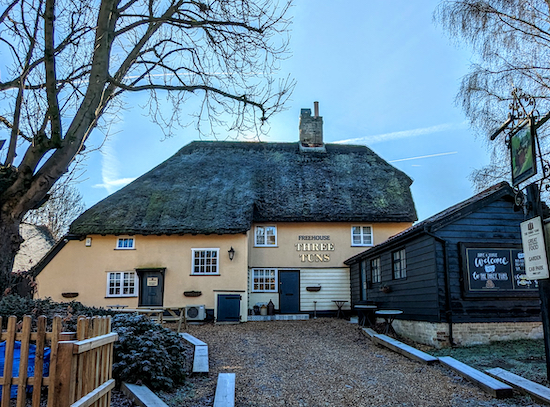 |
| The Three Tuns before it closed |
1: With your back to what was The Three Tuns pub (location -
https://w3w.co/convinced.tentacles.regarding) turn right then head ENE along High Street (B1038) for 320m until you reach a
footpath on the left (location -
https://w3w.co/samplers.suits.verge), see image below.
Note: The first 300m of this stretch has a pedestrian pavement, but the last 20m to the footpath does not, although there is a grass verge where you can step to one side to avoid traffic.
 |
| Turn left on Hormead footpath 8 |
2: Turn left on Hormead footpath 8 then head NE for 730m then N for 480m until you reach a lane (location -
https://w3w.co/mankind.cuddled.scuba).
3: Turn right then head E for 290m passing through a farmyard and continuing until the lane becomes a track (location -
https://w3w.co/silent.sideboard.crunched), see image below.
 |
| Continue heading E, now on Hormead BOAT 5 |
Continue heading E, now on Hormead BOAT 5 (
byway open to all traffic), for 650m. All along this stretch new hedgerow is being planted alongside the public right of way. It will look great when it grows and will be a welcome housing complex for local birdlife.
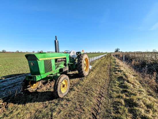 |
| Hedgerow planted alongside Hormead BOAT 5 |
Continue on Hormead BOAT 5 to a junction (location -
https://w3w.co/joints.vitamins.slurs), see image below.
 |
| Turn left on Hormead bridleway 7 |
4: Turn left on Hormead
bridleway 7, another stretch with hedgerow planting underway. Head NNE for 405m until you cross a parish boundary and the track you are on becomes Anstey bridleway 19 (location -
https://w3w.co/happening.iteration.elbow). At this point we saw the soil being ploughed ready for more hedgerow planting, see image below.
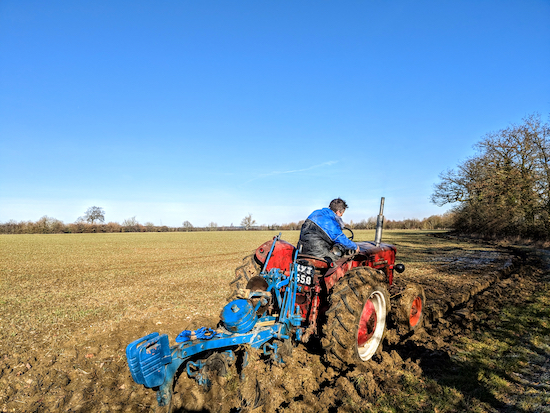 |
| The edge of the bridleway being prepared for hedgerow planting |
Continue heading NNE, now on Anstey bridleway 19, for 225m until you reach a lane (location -
https://w3w.co/sides.airbase.milky).
5: Cross the lane then continue heading NNE, now on Anstey footpath 18, for 1.2km. After 300m the footpath your on runs along the parish boundary and is both Anstey footpath 18 and Brent Pelham & Meesden footpath 18. As you walk this stretch ignore a footpath on the left (location -
https://w3w.co/retrain.toddler.salary) and one on the right (location -
https://w3w.co/endings.animates.tile) and continuing until you reach a T-junction (location -
https://w3w.co/shadowed.november.depended), see image below.
 |
| Turn left on Anstey footpath 7 then head W |
6: Turn left on Anstey footpath 7 then head W. After 450m the footpath zig-zags right and left then continues heading W (location -
https://w3w.co/tops.incurring.flattered), now with the hedgerow on the left, see image below.
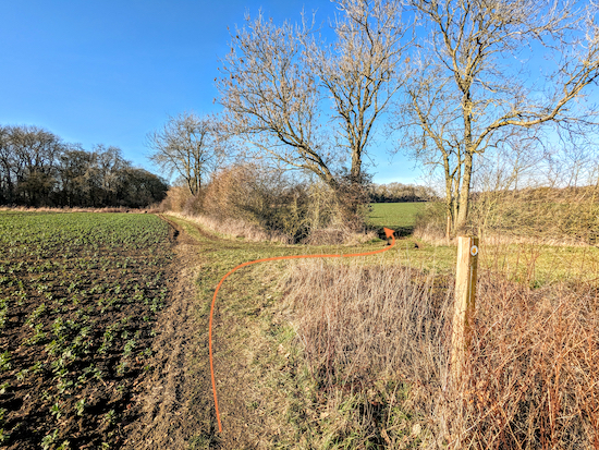 |
| Anstey footpath 7 turns right and left |
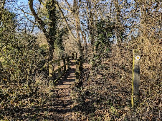
Continue heading W for another 290m to two footbridges (location -
https://w3w.co/hometown.thighs.rejoins), see image below.
 |
| The two footbridges before the snowdrop wood |
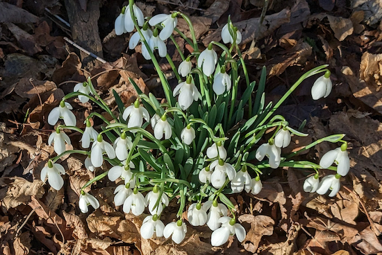
After 60m you will enter a short stretch of woodland (location -
https://w3w.co/threaded.promote.episodes) which, when we were there on February 8, 2023, was carpeted in snowdrops. A lovely spot, see images below.
 |
| Snowdrops along Anstey footpath 7 |
 |
| Snowdrops along Anstey footpath 7 |
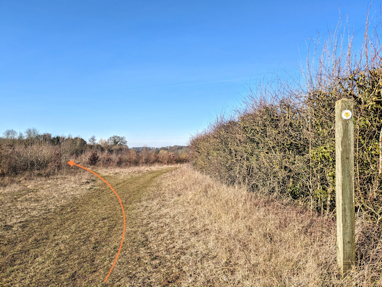
Continue heading W, still on Anstey footpath 7, for 335m passing a footpath that crosses your way on the left and the right (location -
https://w3w.co/youths.reforming.fuse), and continuing until Anstey footpath 7 takes a left hand fork, (location -
https://w3w.co/over.stammer.sensual), see image below.
 |
| Take the left hand fork and continue on Anstey footpath 7 |
Take the left hand fork and continue on Anstey footpath 7 for 280m to a footpath junction (location -
https://w3w.co/affirming.catching.customers).
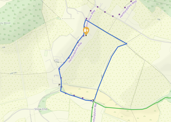
* At this point you could take a detour to visit The Blind Fiddler pub/restaurant in Anstey which served an excellent pint when we visited. To reach the pub turn right at point 7 then head NNE on Anstey footpath 6 for 500m to a junction (location - https://w3w.co/embellish.hogs.lookout). Turn left on Anstey footpath 5 then head NW for 360m until you reach Hare Street, Anstey (location - https://w3w.co/glove.collapsed.respected). Turn left on Hare Street then head S for 100m to reach the pub on your left (location - https://w3w.co/blueberry.rested.tunes). After leaving the pub head SSW then S along Hare Street for 430m looking for a footpath on the left. Take this path, Anstey footpath 7 then head E for 260m to rejoin the walk at point 7. See detour map below.
 |
| The detour to The Blind Fiddler and back is about 1 mile (1.7km) |
7: If you don't take the detour to the pub, turn left on Anstey footpath 6 then head S for 210m until the footpath splits (location -
https://w3w.co/rigs.remind.serious), see image below.
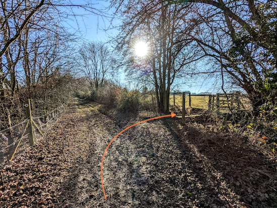 |
| Turn right, still on Anstey footpath 6, then cross a footbridge |
Turn right, still on Anstey footpath 6, cross a footbridge, go through a gate, then head across a field for 145m heading to the left of a cottage (see image below).
 |
| Head across the field heading to the left of a cottage |
On the other side of the field you will reach a gate (location -
https://w3w.co/hobble.centrally.cornfield) see image below.
 |
| Go through the gate then follow Anstey footpath 6 left then right |
Go through the gate then follow Anstey footpath 6 left and right for 60m until you reach a lane (location -
https://w3w.co/dozed.smug.throwaway).
8: Turn right on the lane then immediately left then head S on Anstey footpath 11 for 1km until the footpath turns right then left and crosses a parish boundary on a footbridge (location -
https://w3w.co/snuggle.reverted.mugs), see image below.
 |
| Cross the footbridge then head SSW on Hormead footpath 26 |
Cross the footbridge then head SSW on Hormead footpath 26 crossing a field for 240m heading in the direction of a pylon in the distance and a lane (location -
https://w3w.co/famous.served.pursue), see image below.
 |
| Cross the bridge then head SSW in the direction of a pylon |
9: When you reach the lane turn right then head W for 330m until you reach a footpath on the left (location -
https://w3w.co/shredding.trips.feeds), see image below.
 |
| Turn left on Hormead footpath 27 |
10: Turn left on Hormead footpath 27 then head SSE for 410m until you reach a farm where the footpath turns right (location -
https://w3w.co/candy.handyman.whispers), see image below.
 |
| Turn right at the gate still on Hormead footpath 27 |
Turn right at the gate then head SW, still on Hormead footpath 27, across a field to another gate (location -
https://w3w.co/stunner.supposes.permit), see image below.
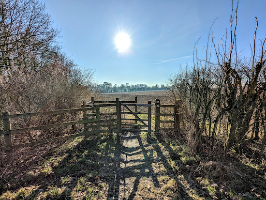 |
| Go through the gate then head S |
Go through the gate then head S for 130m until Hormead footpath 27 cuts left to reach Hall Lane (location -
https://w3w.co/explains.manifests.coarser), see image below.
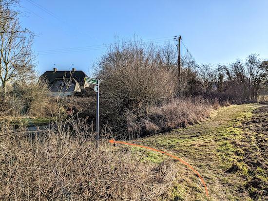 |
| Turn left to join Hall Lane then turn right |
11: Turn right on Hall Lane then head S along Hall Lane for 230m until you reach High Street, Great Hormead (location -
https://w3w.co/intersect.vines.blogging), see image below.
Turn right on High Street then head WSW for 300m until you reach The Three Tuns and the start of the walk (location -
https://w3w.co/landlady.served.monk).
Interactive map


Thanks for publishing what looks like another great walk, unfortunately the interactive map isn't working.
ReplyDeleteHi, thanks for the feedback. I have rebuilt both the Relive fly-through map towards the top of the directions and the MapHub interactive map at the bottom of the page. I hope they work for you now. Please let me know if not. David
DeleteThanks for another lovely walk. The snowdrops were out on 28 Jan 2024, see https://www.instagram.com/p/C2rX6vssrcF/?utm_source=ig_web_copy_link&igsh=MzRlODBiNWFlZA== We also found a memorial to a USAF pilot, very near Gt Hormead though I think we deviated slightly from your route https://www.instagram.com/p/C2rXlqrMkzr/?utm_source=ig_web_copy_link&igsh=MzRlODBiNWFlZA==
ReplyDeleteHi Stephen, nice to see the photos of the snowdrops. Have you joined our friendly Facebook group where fellow walkers are sharing their walking photos and experiences?
Deletehttps://www.facebook.com/groups/hertfordshirewalker
I'm not really on facebook, but thanks for suggesting it. One other thing, The Three Tuns was closed so we went to the Black Horse, 10 mins drive, which was excellent
DeleteHi Stephen - can I ask where you parked please? :-)
DeleteSorry just seen this. We found a space on the main road opposite the pub.
DeleteHi, parking is difficult for this walk. When we tested it the management at The Three Tuns said walkers were welcome to use their car park, but I see that as of 30/01/2024 the pub is closed. Not sure if it will open in the future. Unfortunately there are few other parking opportunities. I will try to see if it's possible to reroute and find a different start point. David
ReplyDelete