3.7 miles (5.9 km) with 79m of total ascent
 |
| One of the footpaths through Sherrardspark Wood |
This is a lovely walk exploring Sherrardspark Wood, a 75-hectares site of ancient woodland within walking distance of Welwyn Garden Station. The area is a
Site of Special Scientific Interest (SSSI) and a
Local Nature Reserve. There are many trails through the woodland making it a great place to just wander and explore. We have chosen some of the prettier paths and created a loop which we hope you enjoy.
According to the
Sherrardspark Wood Wardens site, there are many signs of pre-history in the woodland:
"Fossils have been found and there are signs of early man such as Stone Age artefacts and fragments of ancient pottery, although no surface signs of any settlement within the woods have been found."
The ancient woodland, which is mentioned in the
Domesday Book, has been described as
'probably one of the best two or three oak/hornbeam woods in Britain'.
Many paths weave through the woodland, but we have mapped a circular walk that follows part of the former
Hertford, Luton and Dunstable Railway along the southern edge of Sherrardspark Wood, and then follow a route along the western edge of the woodland before looping back to the former railway line.
We have tested the twists and turns on this route twice, taken photographs, and added
What3Word references to help show the way. As is often the case with routes through woodland, many of the junctions can look similar so we recommend that, if you have a smartphone you follow the free GPS directions for this walk. If you don't have a smartphone perhaps take a compass. We have also embedded a brochure about Sherrardspark Wood at the foot of this page, which shows some of the other paths through the woods.
Click here to view the brochure.
Fly through preview of walk
If you want to check what sort of landscape this walk covers before setting off you can view a short 3D video of the route below. It's created using the free version of
Relive.
Directions
 |
Walk 223: Sherrardspark Wood Loop
Click here or on the map for a larger version
Map created on MapHub - copyright details here
There is an interactive map below the directions |
Those with GPS devices can download
GPX or
KML files for this walk. We've added
What3Words location references for those who use that system. If you print these walks you might want to use the green
PrintFriendly icon at the bottom of these directions to delete elements such as photographs.
1: From Welwyn Garden City Station (location -
https://w3w.co/races.crowned.firms) in the
Howard Centre go down the escalators then leave the shopping complex by the main exit under the clock (location -
https://w3w.co/dull.jukebox.robot) to emerge on Howardsgate. Both the Howard Centre and Howardsgate are named after
Ebenezer Howard, the urban planner and founder of the garden city movement.
Head straight along Howardsgate for 265m until you meet Parkway, a dual carriageway with a fountain in the middle (location -
https://w3w.co/went.goat.cared).
2: Cross Parkway then continue heading WNW, now along Russellcroft Road, for 260m until you reach the junction with Handside Lane (location -
https://w3w.co/shops.else.daisy).
3: Turn right on Handside Lane then head N for 210m until you reach Bridge Road (location -
https://w3w.co/suffice.school.mouse).
4: Turn left on Bridge Road then head WSW for 60m until you reach a
bridleway on the right (location -
https://w3w.co/organ.trip.shall), see image below.
 |
| Turn right on Welwyn Garden City bridleway 13 |
5: Turn right on Welwyn Garden City bridleway 13 then head N for 75m until you reach the route of the former Hertford, Luton and Dunstable Railway (location -
https://w3w.co/keen.blame.bolt).
6: Turn left then follow the former railway line W then WNW for 1.1km until you reach a ramp leading to a junction (location -
https://w3w.co/token.outer.coach), see image below.
 |
| The ramp off the former railway line |
* At this point you could turn left to make a 600m detour W to visit either The Red Lion (location - https://w3w.co/heat.meant.horns) or The Waggoners (location - https://w3w.co/wires.flames.fact), see route on map below.
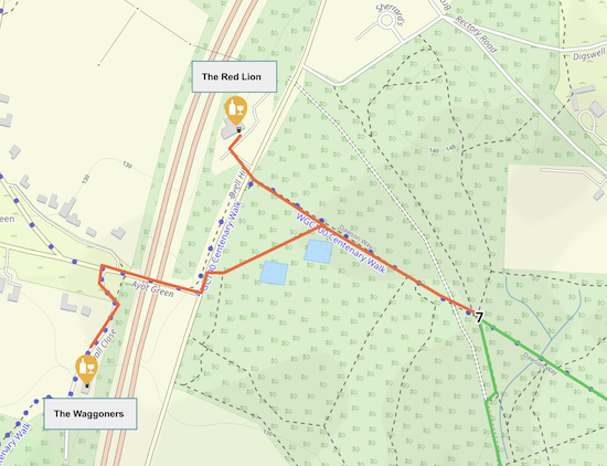 |
The detour to The Red Lion and The Waggoners
Map created on MapHub - copyright details here |
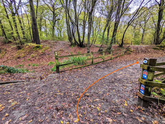 |
| Turn right at the junction on Welwyn Garden City bridleway 18 |
7: If you don't take the detour to the pubs, turn right at the junction on Welwyn Garden City bridleway 18, see image above, then head SE for 215m until you reach a junction called Six Ways (location -
https://w3w.co/forgot.prop.wages) where you will find benches and wood carvings, see image below.
 |
| Welwyn Garden City bridleway 18 approaching Six Ways |
8: When you reach Six Ways take the
footpath to the left of the bench which is etched with the words "Tree Life", see images below. This is Welwyn Garden City footpath 36.
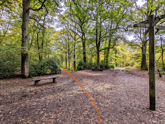 |
| Leave Six Ways on Welwyn Garden City footpath 36 |
 |
| Take the footpath to the left of the Tree Life bench |
Head ENE on Welwyn Garden City footpath 36 for 115m until you reach a footpath on the left (location -
https://w3w.co/task.hiking.fired), see image below.
 |
| Turn left on Welwyn Garden City footpath 39 |
9: Turn left on Welwyn Garden City footpath 39 then head N for 80m to the point where the footpath bends to the right (location -
https://w3w.co/hints.placed.dozen), see image below.
 |
| Welwyn Garden City footpath 39 bending right |
Continue on Welwyn Garden City footpath 39 as it crosses a footbridge (location -
https://w3w.co/soon.yarn.gave), see image below.
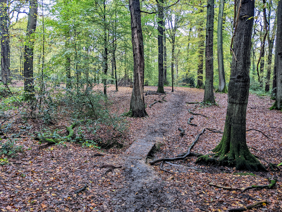 |
| The footbridge then heads NE after the footbridge |
10: After the footbridge, Welwyn Garden City footpath 39 heads NNE for 50m to a fork where you keep left (location -
https://w3w.co/notice.chimp.rests), see image below.
 |
| Keep left at the fork, still on Welwyn Garden City footpath 39 |
Continue heading NNE, still on Welwyn Garden City footpath 39, for 110m until you reach a junction (location -
https://w3w.co/descended.probe.stiff), see image below.
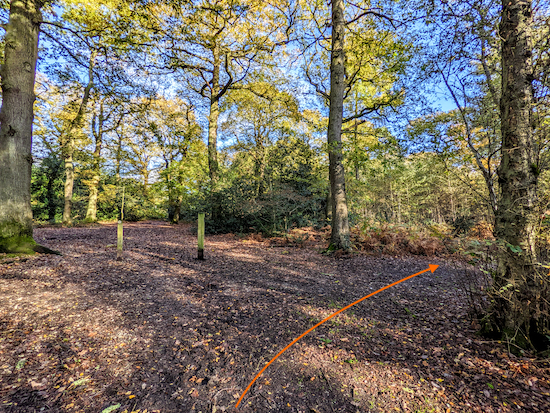 |
| Keep right at the junction on Welwyn Garden City footpath 41 |
11: Keep right at the junction then head NE on Welwyn Garden City footpath 41 for 25m then follow the footpath as it bends right then heads E for 45m then SE for 295m to a junction (location -
https://w3w.co/decks.wiring.afford), see image below.
 |
| Turn left on Welwyn Garden City footpath 36 |
12: Turn left on Welwyn Garden City footpath 36 then head ENE for 40m until you reach a junction (location -
https://w3w.co/things.juror.easy), see image below.
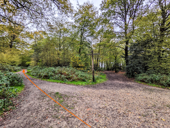 |
| Turn left on Welwyn Garden City bridleway 15 |
13: Turn left on Welwyn Garden City bridleway 15 then head NNE then NNW for 75m to a four-way junction (location -
https://w3w.co/hooks.scarcely.rounds), see image below.
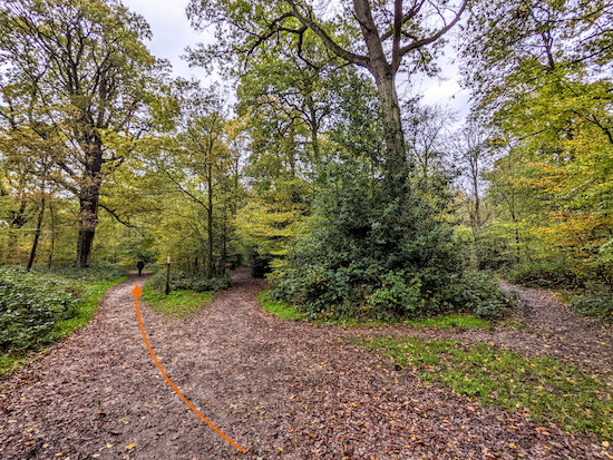 |
| Keep left at the junction, still on Welwyn Garden City bridleway 15 |
14: Keep left at the junction, still on Welwyn Garden City bridleway 15, then head NW for 285m to a junction (location -
https://w3w.co/print.agent.cycles), see image below.
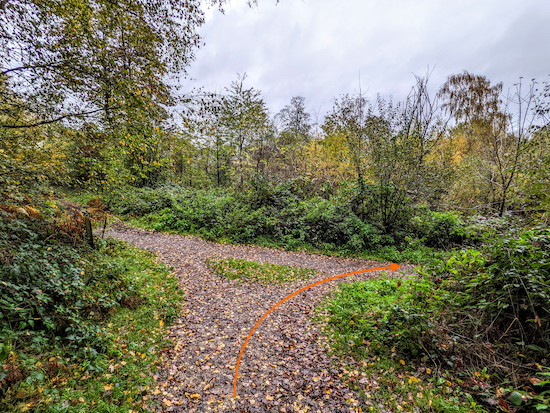 |
| Turn right on Welwyn Garden City bridleway 16 |
15: Turn right on Welwyn Garden City bridleway 16 then head ENE for 160m to a junction (location -
https://w3w.co/planet.slot.fixed), see image below.
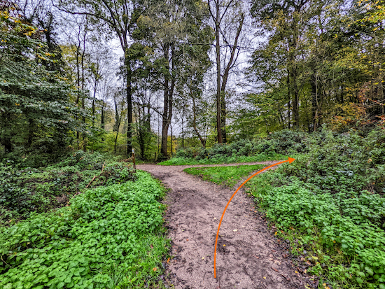 |
| Turn right on Welwyn Garden City footpath 17 |
16: Turn right on Welwyn Garden City footpath 17 then head S for 300m to the junction you crossed at point 13), see image below.
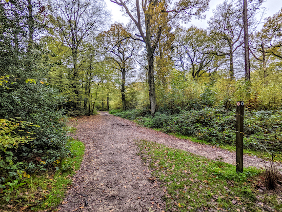 |
| Head S on Welwyn Garden City bridleway 15 |
Head S on Welwyn Garden City bridleway 15 for 415m until you reach a junction (location -
https://w3w.co/moods.looks.fixed), see image below.
 |
| Keep left at the junction then head SSE |
17: Keep left at the junction then head SSE on Welwyn Garden City bridleway 14 for 100m until you reach a road called Reddings (location -
https://w3w.co/cloud.studio.sample), see image below.
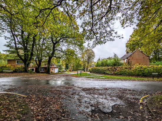 |
| Cross Reddings then head S along Roundwood Drive |
Cross Reddings then head S along Roundwood Drive for 125m keeping to the right at the traffic island (location -
https://w3w.co/seat.fresh.code), see orange arrow on image below, and continuing to a bridleway (location -
https://w3w.co/points.hood.grain), see image below.
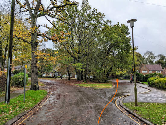 |
| Head for the track at the junction of Roundwood and Reddings |
Head S along Welwyn Garden City bridleway 13 for 80m until you reach the former railway line at the junction you passed at point 6 (location -
https://w3w.co/heats.hood.friend), see image below.
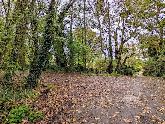 |
| Turn left then follow the route of the former railway line |
18: Turn left then follow the route of the former railway line ENE for 490m until you reach an underpass (location -
https://w3w.co/post.lake.nest) see image below.
 |
| Climb the steps on the right before the underpass |
19: Climb the steps on the right before the underpass then turn right at the top to head SSW on Digswell Road for 250m until you reach The Campus roundabout (location -
https://w3w.co/goat.remit.price).
Cross The Campus roundabout still heading SSW for 140m to reach Bridge Road (location -
https://w3w.co/reject.boxing.jumpy).
Continue heading SSW along Parkway for 200m until you reach Howardsgate on the left (location -
https://w3w.co/rescue.bets.loaf).
Turn left on Howardsgate then head ESE for 340m back to the Howard Centre (location -
https://w3w.co/influencing.congratulations.armed) and Welwyn Garden City Station (location -
https://w3w.co/backs.occurs.reform).
There are many cafes in Welwyn Garden City, and two pubs,
The Two Willows (location -
https://w3w.co/gosh.traded.become) and
Doctors Tonic (location -
https://w3w.co/verse.cult.cakes).
Interactive map
Sherrardspark Wood guide


I had not realised there was such good walking in Sherrardspark wood, though the twist and turns on your route left me a bit baffled, I enjoyed it anyway. Thanks
ReplyDelete