3.2 miles (5.2 km) with 29m of total ascent
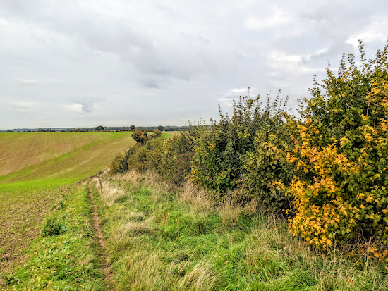 |
| Bramfield bridleway 9 between points 5 & 6 |
This is our fourth walk from Bramfield, this time exploring the countryside to the SE of the village. We have created this route in response to a request in our recent survey for shorter and flatter walks. The route crosses several arable fields. Some of the paths will get ploughed over at certain times of the year and walking can be difficult until the rights of way are reinstated. The walk passes
The Grandison pub/restaurant close to the finish. To see all our walks from Bramfield
click here.
The route doesn't cross any livestock fields. There are two short stretches of lane walking, but they are quiet and there are places to step aside when traffic approaches.
You might notice the sound of shooting as you walk this route. That is because the
Lea Valley Shooting Association organises clay pigeon shooting S of point 5 in the walk (location -
https://w3w.co/units.public.invent).
Getting there
There are bus stops on Main Road in Bramfield (location -
https://w3w.co/foal.files.certified) which are served by the 379 bus. You can check bus times at
Intalink.
Fly through preview of walk
If you want to check what sort of landscape this walk covers before setting off you can view a short 3D video of the route below. It's created using the free version of
Relive.
Directions
 |
Walk 217: Bramfield South-East Loop
Click here or on the map for a larger version
Created on Map Hub by Hertfordshire Walker
Elements © Thunderforest © OpenStreetMap contributors
There is an interactive map below the directions |
Those with GPS devices can download
GPX or
KML files for this walk. We've added
What3Words location references for those who use that system. If you print these walks you might want to use the green
PrintFriendly icon at the bottom of these directions to delete elements such as photographs.
1: With your back to the church of St Andrew on Main Road, Bramfield (location -
https://w3w.co/follow.swift.acted), turn right then head SSE for 150m until you reach a fork in the road (location -
https://w3w.co/ocean.sofa.crunch), see image below.
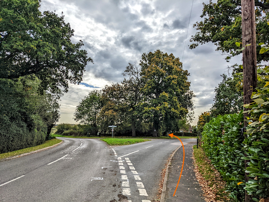 |
| Keep right at the fork then continue heading SE |
Keep right at the fork then continue heading SE, now on Holly Grove Road, for 45m until you reach a junction (location -
https://w3w.co/deed.cube.squad).
2: Take the
footpath to the left of a bungalow on the E side of the junction (location -
https://w3w.co/unique.charge.digs), see image below.
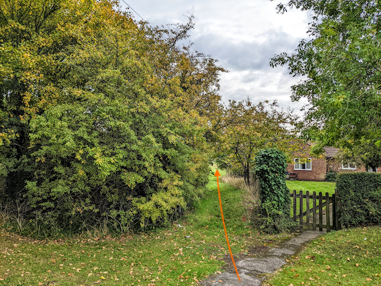 |
| Take Bramfield footpath 10 to the left of a bungalow |
Head SE on Bramfield footpath 10, with the hedgerow on the right, for 40m until you reach a field (location -
https://w3w.co/error.punchy.sample), see image below.
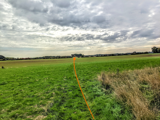 |
| Head SE across two fields for 680m towards woodland |
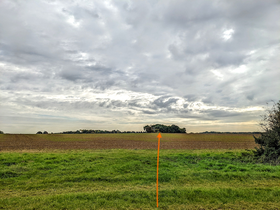
* When we tested this walk (12 October 2022) the field had been cultivated and the public right of way that crosses this field and the next two had not been reinstated. I have added orange arrows to some images to help those who don't follow our routes on their smartphones using our free GPS navigation files.
Head SE across a field for 325m until you reach a line of hedgerow between the field you are walking across and the next field (location -
https://w3w.co/civic.sleeps.send), see image below.
 |
| Cross the next field, still on Bramfield footpath 10 |
Cross the next field, still on Bramfield footpath 10, heading towards a short line of hedgerow (location -
https://w3w.co/wakes.secure.whites) before you reach a patch of woodland, see image below.
 |
| Keep to the right of the line of hedgerow |
Keep to the right of the line of hedgerow (see orange arrow on the image above) then head SE for 125m until you reach the woodland (location -
https://w3w.co/tower.life.trim), see image below.
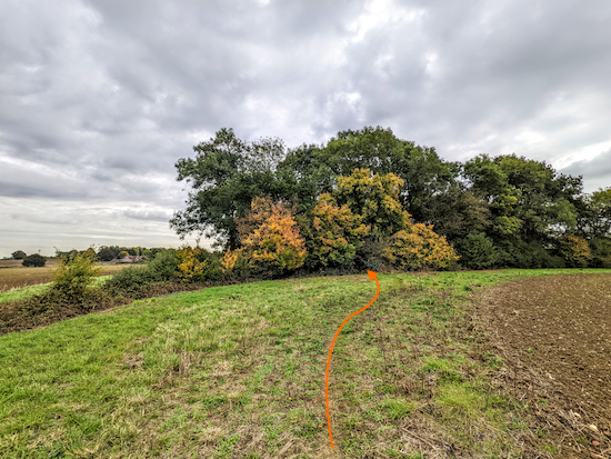 |
| Follow Bramfield footpath 10 through the woodland |
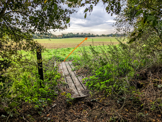
3: Cross a footbridge then follow Bramfield footpath 10 SSE through the woodland for 60m until you reach the other side and another footbridge leading to a field (location -
https://w3w.co/basket.yours.agreed), see image below.
 |
| Leave the woodland then Head SE across the field |
 |
| Cross the field still Bramfield footpath 10 |
Head SE across the field (see the direction of the orange arrow on the images above), still on Bramfield footpath 10, for 450m until you reach Tattle Hill (location -
https://w3w.co/hobby.match.stuck).
4: Turn right on Tattle Hill then head S, SSE, and S for 410m until you reach a
bridleway on the right (location -
https://w3w.co/trace.speech.oils), see image below.
* There isn't a pedestrian pavement along this road, but we didn't encounter any traffic and there are verges where you can step aside if traffic approaches. There is evidence that some walkers choose to walk this stretch inside the field you have just left and walk parallel to the road, but that is not a public right of way.
 |
| Turn right on Bramfield bridleway 9 |
5: Turn right on Bramfield bridleway 9 then head WNW for 1.5km until you reach Holly Grove Road (location -
https://w3w.co/yard.cuts.spent), see image below.
 |
| Turn left on Holly Grove Road |
6: Turn left on Holly Grove Road then head SSW then W then SSW for 360m until you reach a footpath on the right (location -
https://w3w.co/flute.planet.trick), see image below.
* There isn't a pedestrian pavement along this stretch but we met only one vehicle and were able to step aside on the verge.
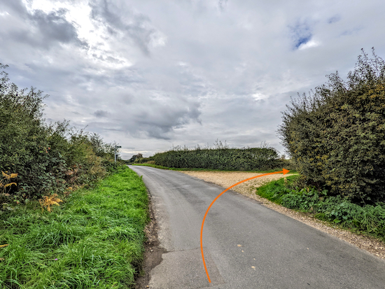 |
| Turn right on Bramfield footpath 8 |
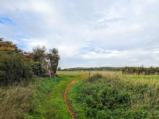
7: Turn right on Bramfield footpath 8 then head W for 210m until you reach a bend (location -
https://w3w.co/boom.smooth.full), see image below.
 |
| Keep right, still on Bramfield footpath 8 |
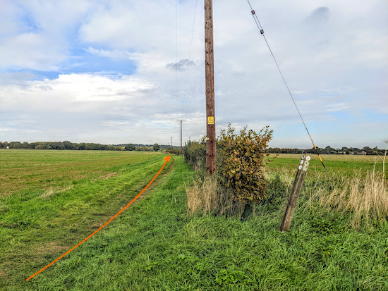
8: Keep right, still on Bramfield footpath 8, then head N for 300m, with the hedgerow on the right and fields on the left, until you reach a junction (location -
https://w3w.co/bland.twigs.teams), see image below.
 |
| Continue heading N, still on Bramfield footpath 8 |
9: Continue heading N, still on Bramfield footpath 8, for 515m, with the hedgerow on your right and fields on the left, until you reach a bend (location -
https://w3w.co/worm.nation.shows), see image below.
 |
| Keep right at the bend then head E |
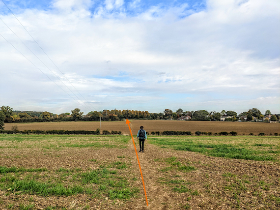
10: Keep right at the bend then head E for 80m, with the hedgerow on the left and field on the right, until you reach a left-hand bend (location -
https://w3w.co/laws.punchy.edit), see image below.
 |
| Turn left, still on Bramfield footpath 8 |
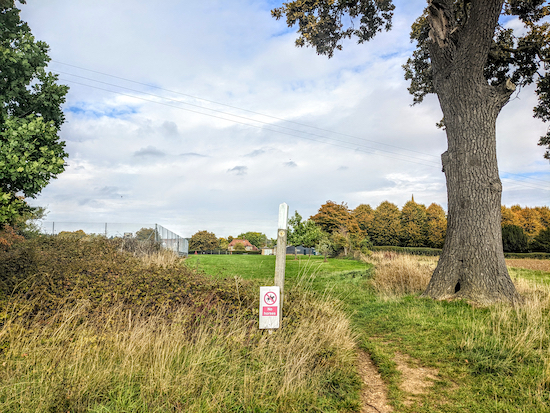
Turn left, still on Bramfield footpath 8, then head NE for 230m crossing two fields until you reach hedgerow on the far side (location -
https://w3w.co/empire.intelligible.guilty), see image below.
 |
| Continue on Bramfield footpath 8 passing playing fields on the left |
11: Continue on Bramfield footpath 8, now heading N, with playing fields on your left for 200m passing the village hall on the left (location -
https://w3w.co/dishes.sector.prompting) and continuing until you reach Bury Lane (location -
https://w3w.co/jacket.shares.social), with The Grandison on your left (location -
https://w3w.co/rapid.arena.sharp), see image below.
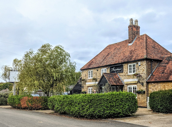 |
| The Grandison on Bury Lane, Bramfield |
12: Turn right on Bury Lane then head E for 95m until you reach Main Road (location -
https://w3w.co/proven.candle.slime). Turn right on Main Road then head S for 55m back to the starting point.
Interactive map


No comments:
Post a Comment
Comments and feedback
If you try any of the walks on this site, please let us know what you thought of them by adding a comment here or on our members-only Facebook group. Comments here are checked before they are published. Comments on the Facebook group go live immediately.