5.7 miles (9.2 km) with 38m of total ascent
 |
| The New River path close to the start/finish point |
This walk follows two riverside long-distance paths. You will head north-west on the
New River Path and then south-east along the
River Lee Navigation Path. The route passes close to two villages that are named in the
Domesday Book,
Great Amwell (
Emmewell) and
Stanstead Abbotts (
Stanstede).
Those wanting to do this walk using public transport can catch the train to Rye House Station and join the route at point 10 in the directions below.
Warning: One of the public rights of way on this route crosses a main railway line on a pedestrian crossing at point 5 in the directions below. It's a busy line and you might not be comfortable following the footpath over the tracks. Walkers with dogs are urged to keep their pets on a lead at this point.
 |
| The New River Path between points 13 & 14 |
According to an information board alongside the New River Path:
"The New River is neither new nor a river. It is an aqueduct built from 1609 - 1613 from near Ware to Islington to bring freshwater from Hertfordshire springs to The City. Today Thames Water still uses the New River as a source for London's drinking water as well as providing a new 25 mile (40km) long-distance footpath."
Fly over the route before you set off
If you want to check what sort of landscape the long version of this walk covers before setting off you can view a short 3D video of the route below. It's created using the free version of
Relive.
Directions
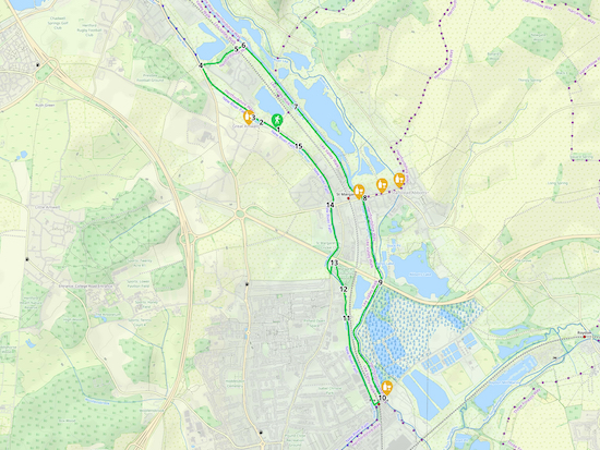 |
Walk 214: Great Amwell Long Loop
Click here or on the map for a larger version
Created on Map Hub by Hertfordshire Walker
Elements © Thunderforest © OpenStreetMap contributors
There is an interactive map below the directions |
Those with GPS devices can download
GPX or
KML files for this walk. We've added
What3Words location references for those who use that system. If you print these walks you might want to use the green
PrintFriendly icon at the bottom of these directions to delete elements such as photographs.
We parked on Amwell Lane at a spot where, at the time of writing on 3 October 2022, there were no parking restrictions (location -
https://w3w.co/famed.penny.name). Several cars were parked along the eastern side of Amwell Lane opposite a set of stairs leading up to the New River Path, see image below.
 |
| Stairs from Amwell Lane leading to the New River Path |
1: Climb the stairs then turn right and head NW along the New River Path for 185m until you reach a bridge (location -
https://w3w.co/icons.swim.fence), see image below.
 |
| The footbridge to Great Amwell village |
* When you reach the footbridge you have the option of crossing the river and heading into Great Amwell to visit the George IV pub/restaurant (location - https://w3w.co/case.select.stump), see image below. Check link for opening hours.
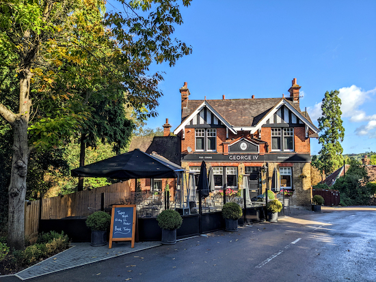 |
| The George IV in Great Amwell |
2: If you don't take the detour to the pub, leave the New River Path at the bridge and continue heading NW along Amwell Lane for 85m until you reach a junction and a gate leading to a continuation of the New River Path (location -
https://w3w.co/badge.chips.talked), see image below.
 |
| Go through the gate then rejoin the New River Path |
3: Go through the gate then rejoin the New River Path and continue to head NW for 755m until you reach a bridge (location -
https://w3w.co/vibrate.mole.raft), see image below.
 |
| Leave the New River Path at the bridge then turn right on Lower Road |
4: Leave the New River Path at the bridge then turn right on Lower Road. Head E on Lower Road for 20m looking out for a footpath on the left (location -
https://w3w.co/action.edits.spill), see image below.
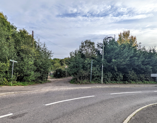 |
| Turn left on Great Amwell footpath 9 |
Turn left on Great Amwell footpath 9 then head E for 195m, at which point the footpath crosses a parish border (location -
https://w3w.co/feeds.nods.aside) and you continue on Ware Town footpath 27, now heading ENE, for 210m until you reach a railway crossing (location -
https://w3w.co/plan.splice.trader), see images below.
 |
| The pedestrian crossing over the railway |
 |
| Two trains passed as we were preparing to cross the track |
5: Cross the railway then continue heading NE for 75m, still on Ware Town footpath 27, until you reach the River Lea Navigation at
Hardmead Lock (location -
https://w3w.co/cake.steps.speaks), see image below.
 |
| Hardmead Lock on the River Lea Navigation |
6: Turn right on the River Lea Navigation tow path, which is also Great Amwell footpath 10, then head SE for 810m until the path rises up a ramp to reach a footbridge (location -
https://w3w.co/worked.gaps.test), see image below.
 |
| Continue heading SE along the River Lea Navigation tow path |
7: Continue heading SE along the River Lea Navigation tow path, with the river on your left, for 1.15km until the tow path goes under High Street, Stanstead Abbotts (location -
https://w3w.co/slick.happen.solo), see image below.
 |
| Continue heading SE along the tow path under High Street |
* At this point you could leave the route and cross the bridge over the River Lea Navigation to visit the pubs in Stanstead Abbotts, including The Jolly Fisherman (location - https://www.oakstansteadabbotts.co.uk/), The Oak (location - https://w3w.co/clever.caves.calms), and The Red Lion (location - https://w3w.co/fingernails.deaf.scar). There is also a cafe on High Street (location - https://w3w.co/agent.tigers.plank).
8: Keep heading SSE along the River Lea Navigation tow path, now on Stanstead St Margarets footpath 5, for 890m until you pass under the A414 (location -
https://w3w.co/noting.scarf.family).
 |
| The view looking back along the River Lea Navigation towards the A414 |
9: As soon as you pass under the A414 you enter a particularly pretty stretch of the walk. Continue heading along the River Lea Navigation tow path as it winds its way in a southerly direction. This section of the path runs along a parish boundary and is both Stanstead Abbotts footpath 14 and Hoddesdon footpath 58. Continue for 1.30km until you reach Rye Road (location -
https://w3w.co/clips.same.brand).
* If you need refreshments, The Rye House pub/restaurant is on the left (location - https://w3w.co/oiled.sorry.trim)
10: Turn right on Rye Road, cross the railway bridge, then go through a gate on the right to join the New River Path (location -
https://w3w.co/plays.task.hints), see image below.
 |
| Follow the New River Path NNW |
Follow the New River Path NNW for 930m until you reach a bridge (location -
https://w3w.co/vast.bolts.budget), see image below.
 |
| Turn right, cross the bridge then turn left, still on the New River Path |
11: Turn right, cross the bridge then turn left, still on the New River Path. Continue heading NNW, with the river on the left, for 270m until you reach the St Margarets Community Woodland (location -
https://w3w.co/friend.indoor.admit), see image below.
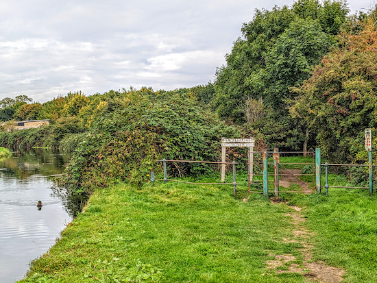 |
| The New River Path goes through the St Margarets Community Woodland |
12: Enter the woodland then keep left at a fork (location -
https://w3w.co/slices.rests.plank) and follow the path NNW for 160m until you reach a fence (location -
https://w3w.co/rugs.farmer.crest), see image below.
 |
| Keep right at the fence then continue through the woodland |
Keep right at the fence then continue heading NNW through the woodland for 120m until you reach Hoddesdon Road (location -
https://w3w.co/expect.issued.online).
13: Turn left on Hoddesdon Road then head S for 125m until you reach a gate on the right signposted the New River Path (location -
https://w3w.co/soap.hangs.fries), see image below.
 |
| Turn right on the New River Path |
Turn right on the New River Path then head in a northerly direction for 160m, passing the
Rye Common Pumping Station, a Grade II listed building, on the right (location -
https://w3w.co/noted.shuts.salon), see image below, and continuing until you reach the underpass beneath the A414 (location -
https://w3w.co/vibe.smiled.rainy).
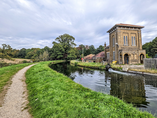 |
| Rye Common Pumping Station on the New River |
It's worth stopping in the underpass to view the magnificent street art, see images below.
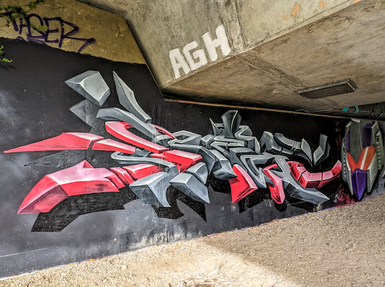 |
| The street art in the A414 underpass |
 |
| The street art in the A414 underpass |
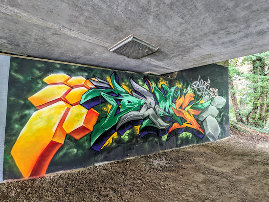 |
| The street art in the A414 underpass |
Continue heading N along the New River Path for 550m until you reach a bridge (location -
https://w3w.co/flags.goat.fully), see image below.
 |
| Cross the bridge then turn left, still on the New River Path |
14: Cross the bridge then turn left, still on the New River Path. Head NNW for 730m until you reach the
Amwell Marsh Pumping Station, a Grade II listed building, on the right (location -
https://w3w.co/finest.bucks.result), see image below.
 |
| Amwell Marsh Pumping Station |
15: Continue heading NNW, with the river on the left, for 270m until you reach the starting point.
Interactive map


Did this walk today in the beautiful autumn sunshine. Really enjoyable walk along the New River Path where we saw dozens of ducks, canada geese and a few swans. Loads of narrow boats moored alongside the footpath to look at and the path also goes close to the marina. We detoured into Stanstead Abbots high street (very disappointing) but then we went to look at Rye House Gatehouse whch was interesting and there were some picnic benches to sit on to enjoy the sun. Crossing the railway felt much safer than when we were crossing the road at point 13 where the cars were coming round the bend very fast. Would certainly do this walk again - slightly different from the usual countryside walks. Thanks for posting it.
ReplyDeleteExcellent summary. Much better than mine. :-) Glad you enjoyed it. Thanks for the feedback.
DeleteWow, Wow , Love Water , Love Boats, Love Wildlife , Love Walking . Perfection . Thank You. . IR .
ReplyDeleteExcellent, glad you enjoyed it Ian. No doubt you added a few miles to our route - very easy to do with that walk. Dave
DeleteWe completed this walk on Monday 10 October in the sunshine after the earlier rain. Very enjoyable and it was good to do some of the northerly New River and Lea Navigation paths as we have done most of the southern sections. We also stopped off at Rye House Gatehouse. When we finished this walk, we went into Amwell Nature Reserve, which is worth a visit if you have time.
ReplyDeleteThanks for sharing those tips, Richard. Glad you enjoyed the walk.
DeleteMy dog & I thoroughly enjoyed this waterside walk a couple of weeks ago. Always something to see with the boats & locks. Plenty of quiet waterway too. A few good spots for my dog to swim safely to. Always popular on a hot day!
ReplyDeleteAgreed, I love walking alongside water, and that walk is perfect. Glad your dog enjoyed it too. If you haven't already done so, please consider of joining our members-only Facebook group where fellow walkers are posting about their walks and sharing photos taken along the way.
Deletehttps://www.facebook.com/groups/hertfordshirewalker