3.4 miles (5.3 km) with 89m of total ascent
 |
| Braughing footpath 11 between points 4 and 5 |
This is our third walk from the village of
Braughing, this time heading SE over fields with excellent views then SW and W to follow the valley of the
River Rib and the
River Quin. The walk starts and finishing at the ford on Maltings Lane.
There are two pubs in Braughing village,
The Brown Bear (location -
https://w3w.co/thin.poem.toads) and
The Golden Fleece (location -
https://w3w.co/princes.slung.snacks).
To create this loop we had to include a 980m section on a pedestrian pavement alongside the B1368 at the end of the walk.
If you have children or a dog you might want to think twice about walking this route. The road can be busy at times. See
comments about this walk on our Facebook page.
The route crosses a livestock field where there are signs requesting that dog owners keep their pets on a lead. The starting point for this walk is 4.5 miles SSE from Buntingford town centre by road.
Fly through preview of walk
If you want to check what sort of landscape you will be crossing before you set off on this walk you can view a short 3D video of the route below. It's created using the free version of
Relive.
Directions
 |
Map for Walk 205: Braughing South-East Loop
Click on the map for larger version
Created on Map Hub by Hertfordshire Walker
Elements © Thunderforest © OpenStreetMap contributors
There is an interactive map below these directions |
Those with GPS devices can download
GPX or
KML files for this walk. We've added
What3Words location references for those who use that system. If you print these walks you might want to use the green
PrintFriendly icon at the bottom of these directions to delete elements such as photographs.
1: From the triangle at the junction of The Ford, The Street, and Malting Lane (location -
https://w3w.co/listen.saves.prove), cross The Street then head SE along Green Hill Close (location -
https://w3w.co/overpower.showcases.stress), see image below.
 |
| Green Hill Close at the start of the walk |
Follow Green Hill Close, which is also Braughing footpath 37, as it winds SE for 80m until the road ends and you continue along the footpath (location -
https://w3w.co/pancake.motive.squirted), see image below.
 |
| Braughing footpath 37 between Green Hill Close and Uplands |
Head ESE on Braughing footpath 37 for 60m until you emerge on Uplands (location -
https://w3w.co/broached.regulator.outings). Continue heading ESE along Uplands for 150m until you reach the junction with Green Lane (location -
https://w3w.co/agreeable.cities.piglet), see image below.
 |
| The junction where Uplands meets Green Lane |
2: Keep left on Green Lane (see direction of orange arrow on the image above), then head NE for 65m looking for a footpath on the right between the houses (location -
https://w3w.co/bandaged.trip.factor), see image below.
 |
| Turn right on Braughing footpath 11 then head SE and uphill |
3: Turn right on Braughing footpath 11 then head SE for 980m until you reach Hill Wood (location -
https://w3w.co/native.flying.intention), see image below.
 |
| Braughing footpath 11 approaching the Hill Wood |
4: Enter Hill Wood via a wooden footbridge then head S through the woodland for 90m to a gate (location -
https://w3w.co/clever.scrum.slouched), see images below.
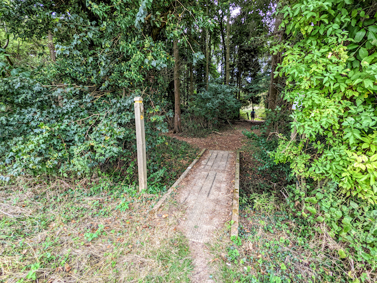 |
| Braughing footpath 11 crosses a footbridge then enters Hill Wood |
 |
Braughing footpath 11 crosses a livestock field
|
5: After exiting Hill Wood, Braughing footpath 11 crosses a livestock field. When we tested this walk cows and calves were grazing. The path across the livestock field is not clear at this point. You need to head directly SSE for 320m aiming to the right of the third fir tree on the other side of the field, see orange arrow on the image above. You are aiming for the corner of the field to the left of woodland, see image below.
 |
| When you reach the corner of the field the footpath bends right |
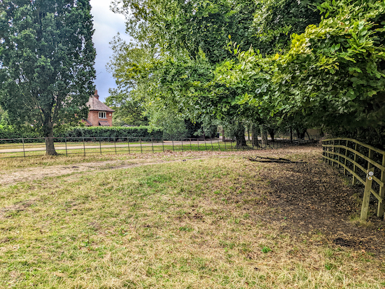
6: When you reach the corner of the field Braughing footpath 11 meets Braughing bridleway 17 (location -
https://w3w.co/mouths.argued.qualified), see image below.
 |
| Turn right then head SW for 45m to a lane called Horse Cross |
Turn right then head SW for 45m to a lane called Horse Cross (location -
https://w3w.co/doubts.waxes.paintings).
Turn left on Horse Cross then head SE for 15m looking for a bridleway on the right (location -
https://w3w.co/dynamic.happening.battling), see image below.
 |
| Take the bridleway on the right off Horse Cross |
7: Turn right on Braughing bridleway 16 then follow it S then SW for 590m, first through a farmyard and then across fields with open views to the right and Standon to the S, see image below.
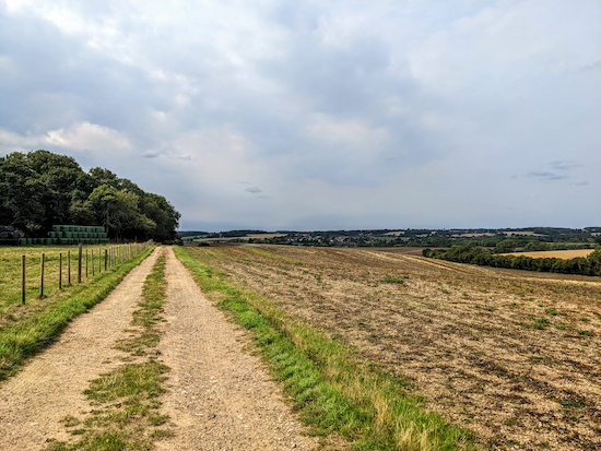 |
| Continue on Braughing bridleway 16 until you reach a footpath on the right |
Continue on Braughing bridleway 16 until you reach a footpath on the right (location -
https://w3w.co/newsstand.conclude.defectors), see image below.
 |
| Turn right on Braughing footpath 19 then head W across a field |
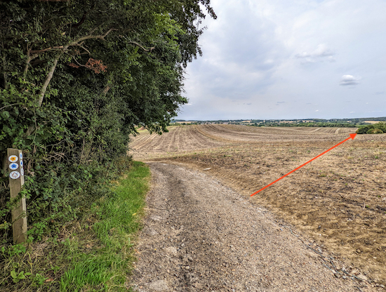
8: Turn right on Braughing footpath 19 then head W across a field for 305m to the left-hand edge of the hedgerow in the distance.
* This path is often ploughed or sown with crops, so I have added a red arrow on the image above to show the way just in case you are walking the route before the public right of way has been restored and it's not clear. If you find the path blocked by crops please consider reporting it to the Hertfordshire County Council's Rights of Way (ROW) team using this link. Thanks.
9: When you reach the opposite side of the field (location -
https://w3w.co/clothed.seeing.coining) cross a track then keep heading W on Braughing footpath 19, see image below.
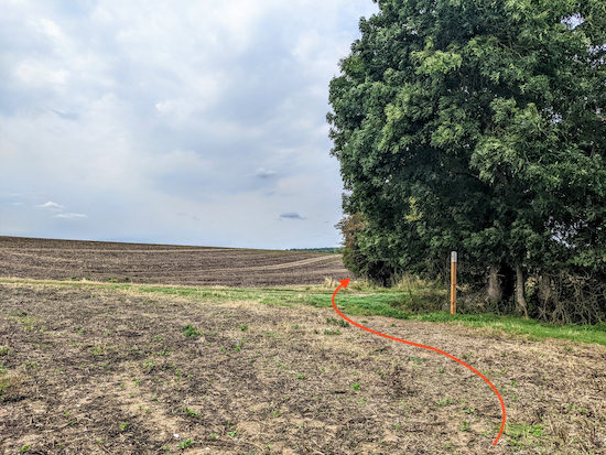 |
| Keep heading W on Braughing footpath 19 |
Follow Braughing footpath 19 W, with hedgerow on the right and a field on the left for 440m until the path makes a slight fork to the right but continues heading W (location -
https://w3w.co/talent.whiplash.hardening), see image below.
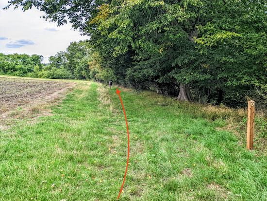 |
| Braughing footpath 19 now heads NW |
10: Braughing footpath 19 now heads NW for 220m until it reaches
Gatesbury Mill and the
Grade II listed bridge and sluice, which were being repaired when we walked the route on 1 September 2022, (location -
https://w3w.co/instance.divorcing.purses) see image below.
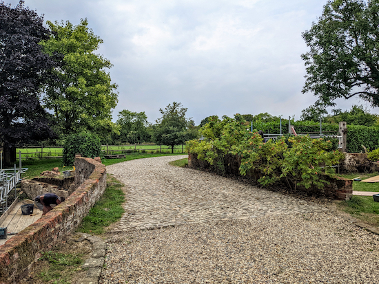 |
| Gatesbury Mill bridge |
11: Turn left then cross Gatesbury Mill bridge and head WNW for 220m, still on Braughing footpath 19 passing Gatesbury Mill sluice on the right (location -
https://w3w.co/vaccines.spectacle.rescue), see image below.
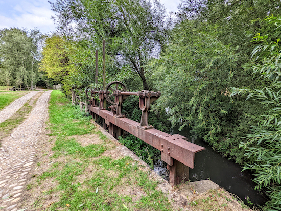 |
| Gatesbury Mill sluice |
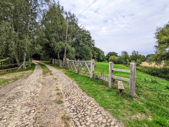
Continue heading WNW on Braughing footpath 19 until you reach a crossing and a footpath on the right (location -
https://w3w.co/corporate.windmill.calls), see image below.
 |
| Turn right on Braughing footpath 35 |
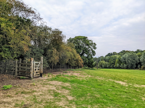
12: Turn right on Braughing footpath 35 which follows what was the route of
the former Buntingford Branch line NNW for 175m before bending right then heading N for 140m to a gate leading to Station Road, the B1368 (location -
https://w3w.co/herb.goats.nurtures), see image below.
 |
| The gate from Braughing footpath 35 to Station Road |
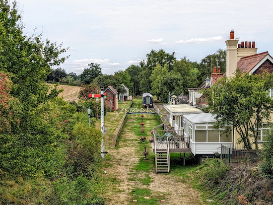
* If you are interested in old railways you might want to turn left when you reach Station Road then head SSW for 90m to a bridge then look down to your right to see what was Braughing station (location - https://w3w.co/modern.polishing.fades), see image below. I have also added a photograph taken from a similar angle in February 1961.
 |
| The former Braughing Station |
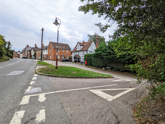
13: Turn right on Station Road, the B1368, then follow it for 980m on a pedestrian pavement until you reach Maltings Lane on the right (location -
https://w3w.co/rekindle.frames.relies), see image below.
* If you want to visit The Golden Fleece before turning right on the Maltings continue heading N for 90m where you will find the pub on the right (location - https://w3w.co/isolated.professed.bottled).
 |
| Turn right on Maltings Lane |
14: Turn right on Maltings Lane then heading ESE downhill for 180m to a footbridge over the River Quin at a ford (location -
https://w3w.co/trap.scans.gossiped), see image below.
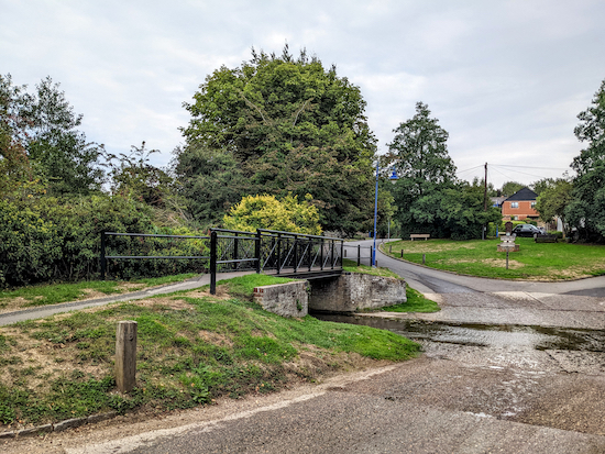 |
| The footbridge over the River Quin at the end of the walk |
Cross the bridge then check the excellent information board on the left before returning to the starting point.
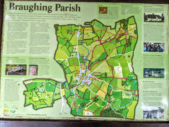 |
| The information board at the end of the walk - click here for larger version |
Our other walks from Braughing are:
Interactive map


Hi David and Ellie Thanks again for another wonderful walk . Open fields and some really pretty paths . As for the Old Railway station plays with your mind while is wing from the bridge . Thank You both once again and a ‘ Happy Christmas ‘ .IR.
ReplyDelete