5.4 miles (8.6 km) with 120m of total ascent
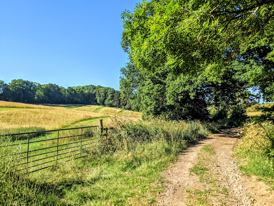 |
| The path between points 9 & 10 |
This walk offers wonderful views across the rolling hills north and west of Kimpton. It includes some paths that feature in other walks in our collection, so regular uses of Hertfordshire Walker might recognise some of the sections from having walked other loops. The walk starts and finishes at The Boot, but can be adjusted if you want to start and finish at the village car park. There is a cafe attached to the village shop which you pass at the end of the walk. The starting point is 4.4 miles NE from Harpenden station by road.
Getting there
There are bus stops close to the start and finish point near The Boot on High Street (location -
https://w3w.co/salad.fame.chair). They are served by the numbers 44, 45, 304, and 315 buses. You can check bus times at
Intalink.
Fly through preview of walk
If you want to check what sort of landscape you will be crossing before you set off on this walk you can view a short 3D video of the route below. It's created using the free version of
Relive.
Directions
 |
Map for Walk 191: Kimpton North-West Loop
Click on the map for a larger version
Created on Map Hub by Hertfordshire Walker
Elements © Thunderforest © OpenStreetMap contributors
There is an interactive map below the directions |
Those with GPS devices can download
GPX or
KML files for this walk. We've added
What3Words location references for those who use that system. If you print these walks you might want to use the green
PrintFriendly icon at the bottom of these directions to delete elements such as photographs.
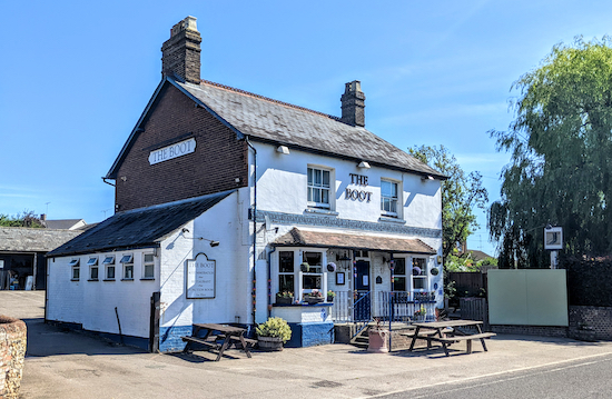 |
| The Boot, High Street, Kimpton |
1: With your back to The Boot (location -
https://w3w.co/reach.grant.nest), turn left then head E along High Street for 40m until you reach Park Lane on the left (location -
https://w3w.co/zeal.circle.shop). Turn left on Park Lane then head N for 100m looking out for a
footpath on the right called Church Path (location -
https://w3w.co/watch.shops.spices). This path is also Kimpton footpath 34.
2: Turn right on Church Path then head E for 210m until you reach Church Lane (location -
https://w3w.co/ozone.vets.harp).
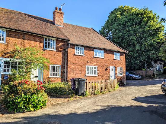 |
| Follow Church Lane past the cottages and the church |
3: Turn left on Church Lane then follow it as it heads N and winds its way past cottages and the
Church of St Peter and St Paul,
a grade I listed building, on the right, see image below.
 |
| Church of St Peter and St Paul, Kimpton |
Continue along Church Lane for 100m until you reach a gate leading to the track leading to Kimpton car park on the left (location -
https://w3w.co/gangs.double.gather), see image below.
 |
| Go through the gate, cross the track, then go through a second gate |
4: Go through the gate, cross the track, then go through a second gate and continue along Kimpton footpath 21, with the hedgerow on the left and the field on the right.
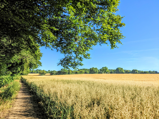 |
| Kimpton footpath 21 between points 4 & 5 |
Continue for 680m, ignoring footpaths to the right and left and continuing until you reach the edge of Horsleys Wood (location -
https://w3w.co/happen.freed.slug).
 |
| Continue with the hedgerow on the left until you reach Horsleys Wood |
5: Continue heading NW, now on St Paul's Walden footpath 20, through Horsleys Wood for 70m until you reach a gate (location -
https://w3w.co/giving.drill.noses), see image below.
 |
| Head NW and to the left of the telegraph pole |
Continue across the field heading NW and to the left of the telegraph pole (following the line of the orange arrow on the image above) for 280m to a stile (location -
https://w3w.co/landed.sparks.simple), see image below.
 |
| Cross the stile then head for a second stile - see orange arrow |
Cross the stile then head NNW for 80m to another stile (location -
https://w3w.co/chained.link.worked), see image below.
 |
| Cross the next field heading to the right of the large tree |
Cross a track and then head N for 70m across the next field walking to the right of a large tree (see orange arrow in image above) to reach a lane called The Holt (location -
https://w3w.co/orders.stews.yards).
6: Turn right on The Holt then head NE for 230m until you reach a track on the left just after a cottage on the left (location -
https://w3w.co/report.cloud.system), see image below.
 |
| Turn left on St Paul's Walden restricted byway 19 |
7: Turn left on St Paul's Walden
restricted byway 19 then head NNW for 860m until the path enters a wooded section before reaching a junction (location -
https://w3w.co/square.secure.proud), see image below.
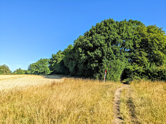 |
| Follow the track through the trees to a junction |
8: Immediately after the path goes through the wooded section it reaches a junction where you keep right, still on St Paul's Walden restricted byway19, see image below.
 |
| Keep right at the tree still on St Paul's Walden restricted byway 19 |
Head NNE for 440m until you reach a junction (location -
https://w3w.co/enough.abacus.lighter), see image below.
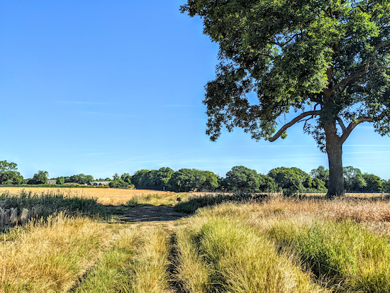 |
| Turn left at the junction on St Paul's Walden UCR1 |
9: Turn left at the junction on St Paul's Walden UCR1 (
unclassified unmetalled county road), then head W then SW for 270m to a junction (location -
https://w3w.co/drip.weaned.satin), see image below.
 |
| Keep right at the first junction and stay on St Paul's Walden UCR1 |
Keep right at the junction, still on St Paul's Walden UCR1 and continue heading SW for 50m to another junction (location -
https://w3w.co/navy.dads.hurray), see image below.
 |
| Keep left at the junction, still on St Paul's Walden UCR1 |
Keep left at the junction, see image above, then continue heading SW along St Paul's Walden UCR1 for 720m until you reach Whitewaysbottom Lane (location -
https://w3w.co/paths.melon.plants). This and the next section have some really great views across the countryside.
 |
| There are some great views between points 9 & 10 |
10: Cross Whitewaysbottom Lane then take Kimpton footpath 54 and head WSW for 400m before the path bends left (location -
https://w3w.co/ties.bump.grapes), see image below.
 |
| The path bends left with the hedgerow on the right and the field on the left |
Keep left here, still on Kimpton footpath 54, then head SSE for 140m with the hedgerow on the right and the field on the left until you reach a gap on the right (location -
https://w3w.co/chips.lame.lively), see image below.
 |
| Go through the gap then head SW |
Go through the gap then head SW across a field for 340m until you reach Barleybeans Road (location -
https://w3w.co/vanish.scrap.camera), see image below.
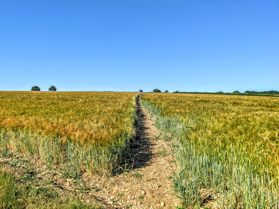 |
| Head SW across the field to Barleybeans Road |
11: Turn left on Barleybeans Road then head SE for 270m looking for a footpath on the right (location -
https://w3w.co/bars.hears.petal), see image below.
 |
| Turn right on Kimpton footpath 43 |
12: Take this path, Kimpton footpath 43, but be sure to walk to the right of the hedgerow. There is a sign advising walkers not to walk along the left of the hedgerow, see image below.
 |
| Head SSW then S with the hedgerow on the left and the field on the right |
Your way is SSW then S with the hedgerow on the left and the field on the right for 500m to a junction (location -
https://w3w.co/zooms.rotate.club), see image below.
 |
| Turn left on Kimpton bridleway 51 then head E |
13: Turn left on Kimpton
bridleway 51 then head E for 500m until you reach Barleybeans Road (location -
https://w3w.co/dress.cheeks.gets).
14: Turn right on Barleybeans Road then head SSE for 270m to Ansells End at the junction with Luton Road (location -
https://w3w.co/neck.puzzle.patch). Turn left on Luton Road then head S for 40m looking for a footpath on the right (location -
https://w3w.co/moons.digits.puddles), see image below.
 |
| Take Kimpton footpath 37 then head SE |
15: Take Kimpton footpath 37 then head SE for 870m until you reach Kimpton Road (location -
https://w3w.co/swan.fend.tides.
16: At this point there is a
permissive path running inside the hedgerow alongside Kimpton Road which heads E for 140m to Luton Road (location -
https://w3w.co/fight.plus.leaned), see image below.
 |
| Take the permissive path that runs parallel to Kimpton Road |
17: Cross Luton Road, then take Kimpton bridleway 33 (location -
https://w3w.co/noisy.radio.park), see image below.
 |
| Kimpton bridleway 33 off Luton Road |
Head E for 580m until you reach Claggy Road (location -
https://w3w.co/emerge.reform.unless). On your left is
a Budgens village store which has a bakery and cafe with outside seating.
18: Turn right on Claggy Road then left on High Street Kimpton then head E for 180m until you reach The Boot and the starting point.
Interactive map


Great walk, just got confused at point 13, somehow end up at at a farm. But managed to sort myself out. I think I know where I went wrong.
ReplyDeleteGlad you sorted it out and it didn't spoil your day. Dave
DeleteDidn’t spoil my walk, amazing scenery.
DeleteGreat, and I agree about the views, particularly between points 9 & 10. Stunning.
DeleteHi Dave another lovely walk and like previous walker commented lovely views across country side . Lots of harvesting going on farmer said it was a month early due to weather . From point 13 onwards some bench’s to take a break and take in the views. Unfortunately the signage at point 9 has been broken ( may be farm traffic. ) However I have reported this to ROW. .IR.
ReplyDeleteWell done reporting the broken sign Ian. I have just reported a blocked footpath and broken stile on a new walk today which we had to abort because it was impossible to get through. It's so important we report these things. It was going to be walk 195.
DeleteWe completed this pleasant walk on Friday 29 July in hot sunny weather - very enjoyable. We started at the car park at 4. Not sure whether it would have been possible at the end of walk to go all the way along Church Path from Claggy Road back to the car park.
ReplyDeleteHi Richard, yes, that option at the end would work. We have done it. Glad you enjoyed the walk. We did too. Dave (and Ellie).
DeleteDid this walk today ( 4 Feb 24)
ReplyDeleteNice walk, quite windy as lots of open areas. Mud had dried up in most places except point 8 or 9 which is impassible but you can jump into the field to get round the 'pond' thats blocking the path.
I did part of this walk Feb 28th - a very nice gentleman recommended the path. I don't remember the exact route I took, but I went up the bridleway and eventually came back down Luton Rd from Kimpton Rd. There were a few very muddy points and I couldn't go around due to thorns, but not so bad that I couldn't get across with caution. My family lived all around this area 400+ years ago before they scarpered off to America, and I enjoyed visiting.
ReplyDelete