2.75 miles (4.4 km) with 89m of total ascent
 |
| The River Mimram, crossed twice during the walk |
This short walk explores the countryside north of Whitwell, crossing the River Mimram twice and visiting the hamlet of St Paul's Walden where you can stop for refreshments at The Strathmore Arms. There is also a pub, The Bull Inn, and Emily's Tea Shop in Whitwell village. This walk has been created in response to a number of followers of Hertfordshire Walker who asked for shorter routes.
Getting there
There are bus stops close to point 2 in the walk (location -
https://w3w.co/aims.fork.trip) which are served by the numbers 305 and 315 buses. You can check bus times at
Intalink.
Fly through preview of walk
If you want to check what sort of landscape you will be crossing before you set off on this walk you can view a short 3D video of the route below. It's created using the free version of
Relive.
Directions
 |
Map for Walk 190: Whitwell North Loop
Click on the map for a larger version
Created on Map Hub by Hertfordshire Walker
Elements © Thunderforest © OpenStreetMap contributors
There is an interactive map below the directions |
Those with GPS devices can download
GPX or
KML files for this walk. We've added
What3Words location references for those who use that system. If you print these walks you might want to use the green
PrintFriendly icon at the bottom of these directions to delete elements such as photographs.
1: With your back to Whitwell sports fields car park on Bradway (location -
https://w3w.co/port.school.puzzle) turn left on Bradway then head WNW for 25m until you reach Oldfield Rise on the right (location -
https://w3w.co/ending.frock.booth). Turn right on Oldfield Rise, which is also St Paul's Walden footpath 28, then head NNE for 95m until you reach the end of Oldfield Rise (location -
https://w3w.co/debate.across.hoping) and St Paul's Walden footpath 28 continues heading NE for 35m before bending to the left (location -
https://w3w.co/cups.window.income) and heading NNE for 60m to reach High Street, Whitwell (location -
https://w3w.co/cars.storm.bleak).
2: Cross High Street then head NNE along The Valley for 85m crossing the River Mimram (location -
https://w3w.co/onion.agrees.encounter).
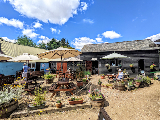
Emily's Tea Shop (location -
https://w3w.co/trails.stacks.kind) is on the right just after you cross the river (location -
https://w3w.co/focus.noting.points), see image below.
 |
| Emily's Tea Shop on the northern side of the Mimram |
 |
| Tea Room opening hours (9 July 2022) |
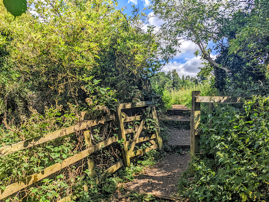
Continuing heading NNE and uphill for 260m to a T-junction (location -
https://w3w.co/online.tune.scuba). Turn left at the junction then head NW for 25m until you reach a gate, a which point you take the path on the right, see image below.
 |
| St Paul's Walden footpath 8 |
3: Follow St Paul's Walden footpath 8 as it heads NNW then WNW for 220m before it bends to the right (location -
https://w3w.co/yarn.enjoy.longer) then heads NNE for 125m until you reach
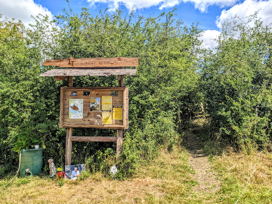
The Living Theatre on the left (location -
https://w3w.co/item.achieving.admits), see image below.
 |
| The sign for The Living Theatre - take the path to the right |
Continue past The Living Theatre for 350m, still on St Paul's Walden footpath 8, until you reach Little Bury Wood (location -
https://w3w.co/select.weedy.belly), see image below.
 |
| St Paul's Walden footpath 8 entering the woodland |
4: Continue heading NNE for 770m, still on St Paul's Walden footpath 8, with Little Bury Wood and Chalkleys Wood on the left and Walk Wood on the right until you reach a junction (location -
https://w3w.co/amused.hope.caked), see image below.
 |
| Turn right at the junction on Church Lane |
5: Turn right at the junction on Church Lane then head SE for 390m until you reach a footpath on the right opposite the church (location -
https://w3w.co/fresh.rising.drips), see image below.
 |
| Turn right on St Paul's Walden footpath 8 then head SSW |
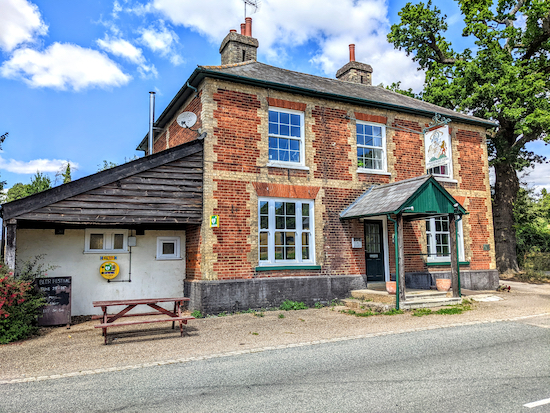
* At this point you could visit the Grade I listed Church Of All Saints, St Paul's Walden on your left, see first image below. If you need refreshments, continue heading E along Church Lane for 120m to visit The Strathmore Arms (location - https://w3w.co/shrimp.adults.toward), see second image below.
 |
| Church Of All Saints, St Paul's Walden |
 |
| The Strathmore Arms, St Paul's Walden |
6: Turn right at the junction opposite the church on St Paul's Walden footpath 3 then follow it SSW then SW for 540m to a junction (location -
https://w3w.co/decent.gazed.scans), see image below.
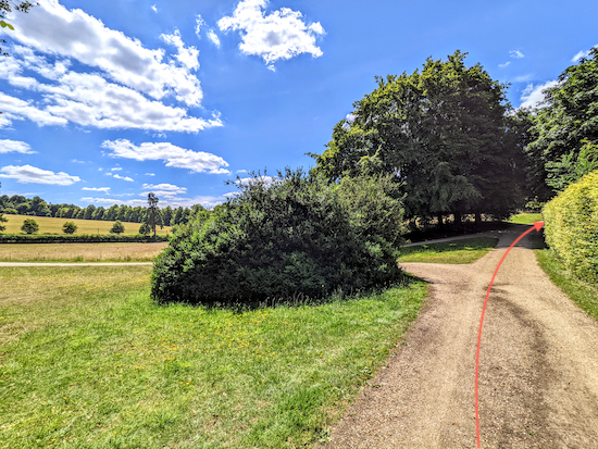 |
| Keep right at the junction, still on St Paul's Walden footpath 3 |
Keep right at the junction, still on St Paul's Walden footpath 3, then head SW for 280m to another junction (location -
https://w3w.co/harsh.plug.paint), see image below.
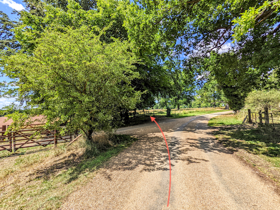 |
| Go through a metal gate then turn left (see orange arrow) |
7: Go through a metal gate then turn left on St Paul's Walden footpath 2, see image below.
 |
| Turn left after the metal gate on St Paul's Walden footpath 2 |
Head SSW and downhill on St Paul's Walden footpath 2 for 470m until you reach the River Mimram (location -
https://w3w.co/activism.chef.aware), see image below.
 |
| St Paul's Walden footpath 2 heading SSW down to the River Mimram |
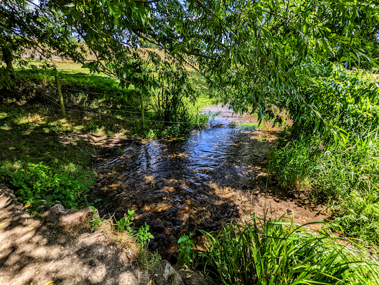 |
| The River Mimram |
Cross the Mimram then continue, still on St Paul's Walden footpath 2, but now heading SSE for 120m until you reach High Street (location -
https://w3w.co/cone.scars.slip).
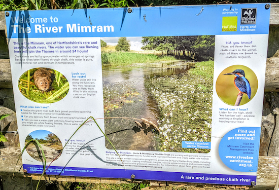 |
| River Mimram information board |
* At this point you could turn right then head WNW for 120m to visit The Bull Inn (location - https://w3w.co/flight.hungry.lots) or Emily's Tea Shop, which you passed towards the start of the walk. There is also The Whitwell Stores (location - https://w3w.co/miss.burst.jolly)
 |
| The Bull Inn, a 120m detour from the route |
8: Turn left on High Street then head ESE for 60m looking out for a footpath on the other side of the road just before a row of houses (location -
https://w3w.co/either.sketch.barn). Turn right on this footpath, St Paul's Walden footpath 33, then follow it SSW for 230m to a junction (location -
https://w3w.co/pushes.demand.nurse), see image below.
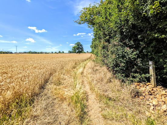 |
| Turn right on St Paul's Walden bridleway 34 |
9: Turn right on St Paul's Walden bridleway 34, then head NW for 250m, ignoring footpaths to the left and right, until you reach a fork in the path (location -
https://w3w.co/mirror.dwell.clash), see image below.
 |
| Keep right, still on St Paul's Walden bridleway 34 |
Take the right-hand fork, then continuing heading NW, still on St Paul's Walden bridleway 34, with the tennis courts on your left for 80m until you reach the car park at the start of the walk (location -
https://w3w.co/kite.answer.stream).
Interactive map


Thoroughly enjoyable walk with outstanding views. Beautiful church en route. Highly recommended.
ReplyDeleteAgreed, we really enjoyed testing this walk. Glad you liked it too. Dave
DeleteThoroughly enjoyable walk. Beautiful church on eroute. Fabulous rolling countryside views. Would definitely highly recommend.
ReplyDeleteHi Dave and Ellie you done it again another amazing walk with a long shaded section through the woods. Glad footpath 3 went past the large heard of grumpy cattle I did not fancy walking through that field 😂🤣😂 Tree down in the woods. Have informed ROW. .IR.
ReplyDeleteHi Ian, we really enjoyed that walk. Glad you did too. Dave and Ellie
DeleteA great walk thank you, perfect for squeezing in three quarters of an hour of fresh air into a busy day. My dad lives in Herts so when I visit I try to do the local AA routes, but having exhausted these I happened upon your website which is a goldmine of new routes. Great directions, mapping etc. I’m going to be exploring more from your site. Thanks & keep up the excellent work! Andy B
ReplyDeleteHi Andy, so glad you enjoyed the walk. I look forward to reading your reports on others you try. Thanks again for taking the time to post feedback. David
Delete