6.5 miles (10.5 km) with 151m of total ascent
 |
| The route between points 4 & 5 |
This lovely walk climbs out of the valley of the River Lea from Wheathampstead up to Gustard Wood and then across undulating countryside with excellent views to the south. The route then drops down to pass through the Batford Springs Nature Reserve before heading back to Wheathampstead along the track of the former
Hertford, Luton and Dunstable Railway. There are several pubs at the start and finish point as well as one near the halfway point. The starting point is 2.5 miles E from Harpenden station by road.
Getting there
There are several bus stops in Wheathampstead that are close to start/finish point of the walk. You can check bus times at
Intalink.
Fly through preview of walk
If you want to check what sort of landscape you will be crossing before you set off on this walk you can view a short 3D video of the route below. It's created using the free version of
Relive.
Directions
 |
Map for Walk 185: Wheathampstead West Loop
Click on the map for a larger version
Created on Map Hub by Hertfordshire Walker
Elements © Thunderforest © OpenStreetMap contributors
There is an interactive map below the directions |
Those with GPS devices can download
GPX or
KML files for this walk. We've added
What3Words location references for those who use that system. If you print these walks you might want to use the green
PrintFriendly icon at the bottom of these directions to delete elements such as photographs.
We parked in the East Lane public car park (location -
https://w3w.co/chains.voices.pill) in Wheathampstead, being careful not to confuse it with the private and restricted car park (location -
https://w3w.co/posed.zone.elbow) which belongs to The Bull pub/restaurant. The entrances to both car parks are close together so make sure you use the council-owned parking area, which is accessed through a yellow metal archway. Be sure to read the parking conditions before leaving your vehicles as they might have changed since this walk was published.
1: From the exit of the East Lane car park (location -
https://w3w.co/fact.bigger.loads) turn right on East Lane then head W for 70m until you reach High Street (location -
https://w3w.co/lower.pays.sends). Cross High Street then continue heading W along King Edward Place for 110m until you reach a path heading W through the park (location -
https://w3w.co/keeps.talked.elbow), see image below.
 |
| The footpath heading W off King Edward Place |
2: Continue along this path for 120m until you reach Ash Grove (location -
https://w3w.co/kept.weeks.mint), then head W along Ash Grove until you reach a footpath on the right (location -
https://w3w.co/mute.smoke.dime), see image below.
 |
| Wheathampstead footpath 64 off Ash Grove |
3: Take this path, Wheathampstead footpath 64, then head WNW then N for 290m to a footbridge crossing the River Lea (location -
https://w3w.co/abode.count.civic). Cross the footbridge then continue along Wheathampstead footpath 64 for 40m until you reach the Lower Luton Road, the B653 (location -
https://w3w.co/slot.remark.clean).
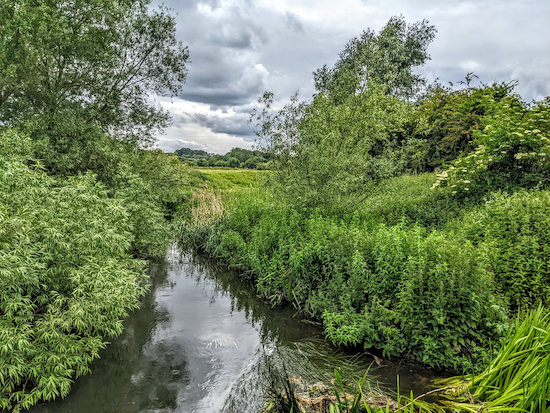 |
| The River Lea from the footbridge at point 3 |
4: Cross the Lower Luton Road then take the footpath on the other side, Wheathampstead footpath 59. Head N and uphill for 345m until you reach a junction at The Dell (location -
https://w3w.co/spirit.water.smug), see image below.
 |
| Wheathampstead footpath 59 approaching The Dell |
5: Keep left at the junction, now on Wheathampstead bridleway 10, then head NNW and uphill for 620m until you reach a junction (location -
https://w3w.co/ranked.bridge.cool).
6: Head N at the junction, now on Wheathampstead bridleway 58, for 260m to a junction (location -
https://w3w.co/choice.kicks.late) just before a barn. Turn right at the junction, still on Wheathampstead bridleway 58, then head E, keeping the barn in your left, then turn left after the barn and head N, with the barn on your left, and continue for 90m to a junction (location -
https://w3w.co/dragon.wheels.fell), see image below.
 |
| Keep heading N at the junction |
7: Keep heading N, now on Wheathampstead bridleway 103, for 520m until you reach a lane called The Slype on the left (location -
https://w3w.co/headed.claps.rinse).
* At this point, if you are in need of refreshments, you could turn right then head NE for 360m to visit The Cross Keys pub (location - https://w3w.co/clock.bought.debit). Check link opening times.
Turn left on The Slype then head W for 270m until you reach a footpath on the left (location -
https://w3w.co/soon.erase.tribes), see image below.
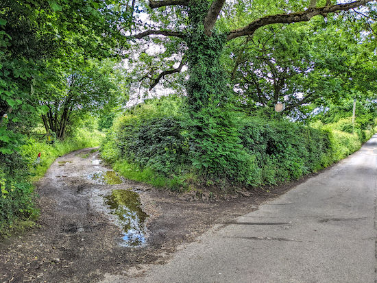 |
| Wheathampstead footpath 35 off The Slype |
8: Take this path, Wheathampstead footpath 35, then head in a westerly direction for 685m until you reach a gap in the hedgerow leading to Marshalls Heath Lane (location -
https://w3w.co/future.drives.brush). Turn left on the lane then head S for 250m looking for a bridleway on the right (location -
https://w3w.co/resist.bend.levels), see image below.
 |
| Turn right on the bridleway and head SW |
9: Turn right on the bridleway then head SW then W for 360m to a junction (location -
https://w3w.co/desk.riders.sobs). Turn left at the junction on Wheathampstead footpath 29 then follow it S, W, then SSW for 435m until you reach a lane called Mackerye End (location -
https://w3w.co/lives.grass.year).
10: Turn right on Mackerye End then head W for 40m to a junction (location -
https://w3w.co/almost.change.faded). Turn left on Mackerye End Lane then head SSW for 135m until the lane bends to the right (location -
https://w3w.co/orbit.universally.scales). Keep right and follow the lane W for 160m looking for a footpath on the left which leaves the lane
after the footpath sign (location -
https://w3w.co/area.soda.cube), see image below.
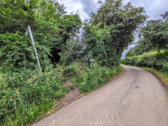 |
| Climb the steps after the footpath sign |
11: Take this footpath then follow it SSW, SW then S as it winds through wooded hedgerow for 750m until it reaches the Lower Luton Road (location -
https://w3w.co/sings.ranges.king).
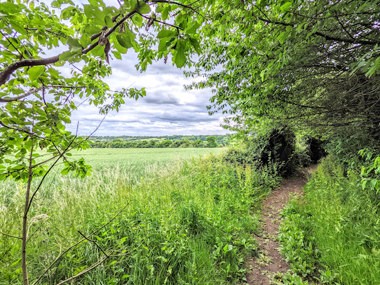 |
| The footpath weaves through wooded hedgerow |
12: Turn right, then head WNW along the Lower Luton Road for 270m until you reach Crabtree Lane on the left (location -
https://w3w.co/healthier.daily.wing). Turn left on Crabtree Lane then follow it S for 150m crossing a footbridge over the River Lea (location -
https://w3w.co/sleeps.sleep.fever), see image below.
 |
| The footbridge over the River Lea, point 12 |
Immediately after the footbridge look for a footpath on the right (location -
https://w3w.co/coherent.vets.monks), see image below.
 |
| The entrance to Batford Springs Nature Reserve |
* At this point you could continue heading SSW for 40m to visit The Marquis Of Granby pub/restaurant (location - https://w3w.co/begun.oath.magma).
13: Turn right on Harpenden footpath 35 then follow it NW through the Batford Springs Nature Reserve for 280m until you reach a junction (location -
https://w3w.co/zips.tree.stream). If you have time it's worth exploring this small nature reserve with its many helpful information boards.
14: Turn left at the junction on Harpenden footpath 24 then head WSW for 100m until you reach Marquis Lane (location -
https://w3w.co/cage.shut.reject).
* At this point, if you are in need of refreshments, you could visit The Amble Inn on Station Road (location - https://w3w.co/insert.door.punch), or The Shop By The Park (location - https://w3w.co/axed.soda.deed) which sells hot and cold snacks.
Turn right then head W on Marquis Lane for 25m until you reach Station Road (location -
https://w3w.co/liked.colleague.stack). Turn left on Station Road, cross the road, then head S for 80m until you reach a bridge going over the old railway (location -
https://w3w.co/boot.bells.pits). Take a track on the right immediately before the bridge and follow it down to what was the railway line (location -
https://w3w.co/gladiators.stacks.submit), see image below.
 |
| Take the path down to the former track |
When you reach the paved footpath that was the railway line, turn left, go under the bridge, see image below, then head ESE for 330m until you cross Crabtree Lane (location -
https://w3w.co/amount.hobby.remit).
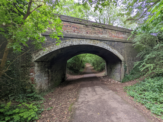 |
| Follow the route of the former railway line ESE |
Continue heading ESE for 315m until you reach Marquis Lane (location -
https://w3w.co/most.value.pushes). Cross Marquis Lane then continue now heading E, for 160m until the track becomes Wheathampstead bridleway 97 (location -
https://w3w.co/agrees.employ.bake).
 |
| Wheathampstead bridleway 97 heading E |
15: Continue heading E for 965m on Wheathampstead bridleway 97 until you reach Leasey Bridge Lane (location
https://w3w.co/slick.parts.boss).
* For those wanting refreshments, the Willow Trees Cafe at Croft Farm (location - https://w3w.co/mint.cherry.fame) is 100m ENE of this point. The cafe's website states that it is open "on weekends during late spring and summer".
16: Turn right on Leasey Bridge Lane then head S for 30m looking for a footpath on the left (location -
https://w3w.co/pull.calls.share). Turn left on Wheathampstead footpath 28 then right just before a bungalow and follow the footpath SE across a field and uphill for 300m to a junction (location -
https://w3w.co/regard.trim.flock), see image below.
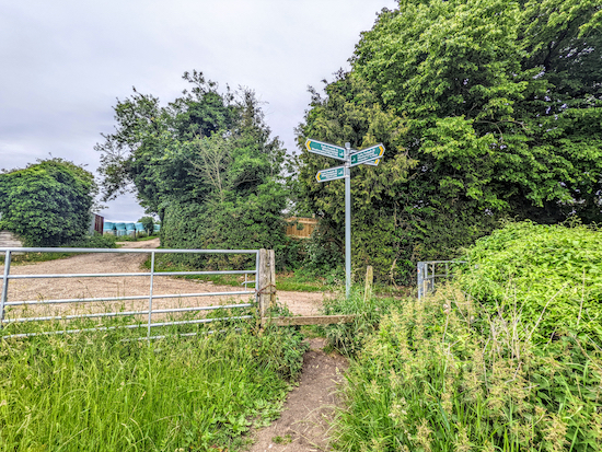 |
| Turn left on Wheathampstead footpath 16 |
17: Turn left on Wheathampstead footpath 16 then follow it E, NE, the ESE for 1.3km until you cross a field before reaching High Meads on the outskirts of Wheathampstead (location -
https://w3w.co/guides.item.clean), see image below.
 |
| Footpath 16 approaching the final field before Wheathampstead |
18: Turn left on High Meads then head N for 35m to Bury Green (location -
https://w3w.co/shall.oppose.plants). Turn right on Bury Green then head E for 165m to Church Street (location -
https://w3w.co/colleague.chip.heads).
At the junction with Church Street look out for a footpath on the left (location -
https://w3w.co/puns.income.flown) which cuts through the churchyard. This is Wheathampstead footpath 66 which heads NE for 150m to High Street (location -
https://w3w.co/talent.cares.boot).
* At this point you could turn right to visit The Reading Rooms (20m S) which is the Farr Brewery's local outlet (location - https://w3w.co/forgot.cooks.when), or continue heading S for another 120m to visit The Swan (location - https://w3w.co/torn.these.chats).
If you don't want to visit either pub, turn left on High Street then head N for 60m until you reach East Lane (location -
https://w3w.co/ramp.rigid.washed). There is a bakery/cafe called
Loafing opposite the East Street turning and
Charlie's cafe a bit further along High Street on the other side of the bridge over the River Lea. Turn right on East Lane, pass
The Bull on the left, then return to the starting point at the East Lane car park.
Walkers have recommended three cafes in Wheathampstead,
Loafing (location -
https://w3w.co/ready.sweat.wooden),
Marley's (location -
https://w3w.co/driven.sheet.cheeks), and
Brewhouse Coffee (location -
https://w3w.co/unions.trace.fats)
If you enjoyed this walk please consider joining our
Hertfordshire Walker members-only Facebook Group where you can share photos and comments on your walking experiences.
Interactive map


Hi, have driven along the Lower Luton Road on numerous occasions now I know what is North and South of it . Lovely walk with open fields and shaded areas especially along the stunning winding Footpath 27a and Railway Track. Thank you . PS arrived in car park at 10.30 I got the last space another chap I spoke to say it was always busy on a Wednesday .IR.
ReplyDeleteGreat, glad you enjoyed it. Thanks for sharing that parking tip. Dave
DeleteI did this walk today - stunning countryside, and a very varied walk, really enjoyed it - thank you. Oh, to live in one of those gorgeous cottages in Gustard Wood!
ReplyDeleteI share your cottage envy. There are some pretty houses along that stretch. Glad you enjoyed the walk. Thanks for the feedback.
DeleteExcellent walk across good mix of landscape, parts of which feel incredibly rural for 'crowded' Hertfordshire. Minor correction - the compass direction at 14 & 15 is wrong ... you have to head West down the old railway track and Wheathampstead bridleway 97 towards Wheathampstead, not East. Equally at 16 (Leasey Bridge Lane) you head North not South.
ReplyDeleteHi, glad you enjoyed the walk. Regarding the compass directions at 14 & 15, and again at 16, both references in my directions are correct. If you headed west as you suggest you would be going the wrong way and be heading towards Luton. The correct direction is first east-south-east then east as it appears in my directions. Similarly, at point 16, the correct direction is south as in the text of the walk, not north as you suggest. If you headed north at that point you would be heading in the wrong direction and end up on the Lower Luton Road. David
DeleteYou are completely correct, My apologies. Dodgy compass reading - that's my excuse. Keep up the great work.
Delete:-) glad you enjoyed the walk.
DeleteGreat walk. Top directions. Polished off a lovely pint in the Reading Rooms. It’s what walking is all about.
ReplyDeleteSounds like a perfect day. Glad you enjoyed it. Thanks for the feedback.
DeleteCan Mackereye End House be viewed either on this walk or on walk 231?
ReplyDeleteNo, but the route does include a lane called Mackereye End.
DeleteGreat walk, I slapped myself wheb I got in.
ReplyDelete