5.1 miles (8.2 km) with 34m of total ascent
 |
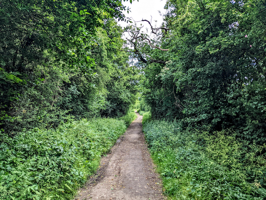
The view between points 4 & 5
Image courtesy of Emma Boylan |
This walk includes a section of
The Alban Way which is the route of the former
Hatfield to St Albans branch line. If you are interested in the history of the Hatfield to St Albans branch line we have embedded
a video at the foot of these directions. The route for this walk passes close to two pubs, both called The Plough, one in Sleapshyde and the other in Tyttenhanger Green. The start of the walk is 3.5 miles WSW of Hatfield station by road. You will be aware of the A414 for much of this walk.
Directions
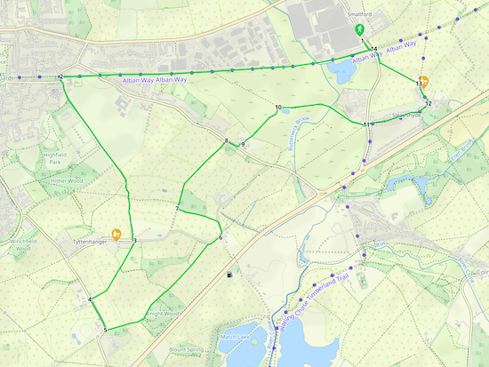 |
Map for Walk 184: Tyttenhanger Green Loop
Click here or on the map for a larger version
Created on Map Hub by Hertfordshire Walker
Elements © Thunderforest © OpenStreetMap contributors
There is an interactive map below the directions |
Those with GPS devices can download
GPX or
KML files for this walk. We've added
What3Words location references for those who use that system. If you print these walks you might want to use the green
PrintFriendly icon at the bottom of these directions to delete elements such as photographs.
 |
| The gates from Smallford station car park to The Alban Way |
1: Park in the car park at what was Smallford station (location -
https://w3w.co/glee.cotton.supporter) then head S and go through the old railway gates, see image above, to reach The Alban Way (location -
https://w3w.co/move.chains.solve). Your way is to turn right on The Alban Way and head W, but, before you do, it's worth reading the information board under the bridge on your left, see image below.
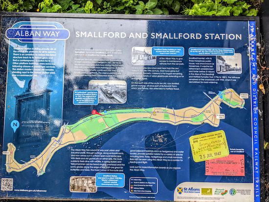 |
| The information board under the bridge near the former Smallford Station |
Part of the text on the information board reads:
"When the station first opened in 1866 it was called Springfield. Renamed Smallford in 1879, It was later referred to as Smallford for Colney Heath. Smallford Station building proudly sits at the end of the platform for all to admire. There is an ambition to restore this listed structure back to its former glory and find a contemporary function for it. Other platform buildings were removed following closure of passenger services."
As you head W along the Alban Way have a look at the old Smallford Station platform and buildings on your right, see image below.
 |
| Smallford Station buildings |
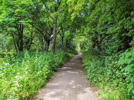 |
| The Alban Way heading west |
Continue heading W along The Alban Way for 1.1km until you reach a sign explaining the significance of what was Butterwick sidings (location -
https://w3w.co/mental.solved.dogs), see image below.
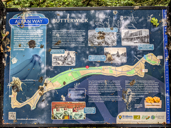 |
| Information board for the Butterwick sidings |
The board has some interesting facts about the area. A couple of paragraphs from the information board are copied below.
"Before the railway was laid in the 1880s this land was part of Butterwick Farm, the farm homestead was to the south of the line and had existed as a minor manor since the fifteenth century. The first non-farming activity in the area north of the line was a timber yard in the 1920s. In 1939 a cold store for fresh meat was built, one of several food warehouses on the outskirts of London. These replaced central London storage facilities in case of bombing. Butterwick railway siding was laid to facilitate the movement of meat to the cold store. The rail sidings have long since disappeared and the area is now a thriving retail and commercial park, home to a large number of manufacturers, retailers and other businesses."
Continue heading W along the The Alban way for 1.4 km until you reach Hill End Lane (location -
https://w3w.co/soda.pencil.names).
 |
| Turn left when you reach Hill End Lane |
2: When you reach Hill End Lane, see image above, turn left then head S for 25m to reach Hixberry Lane on the left (location -
https://w3w.co/fired.defend.blame). This is Colney Heath BOAT 54 (
byway open to all traffic).
 |
| Follow Colney Heath BOAT 54 until you reach Tyttenhanger Green |
Follow Colney Heath BOAT 54 SSE for 1.2km until you reach Tyttenhanger Green (location -
https://w3w.co/pace.length.prompting).
 |
| The Plough at Tyttenhanger Green |
* At this point you could turn right and head W for 100m to visit The Plough at Tyttenhanger Green (location - https://w3w.co/dream.bets.note). We discovered that they offer a great range of real ales, and there is a pleasant beer garden out the back.
 |
| Colney Heath footpath 28 heading SW off Tyttenhanger Green |
3: To continue along the route, cross Tyttenhanger Green then take the footpath opposite, Colney Heath footpath 28 (location -
https://w3w.co/reds.raves.scar). Head SW for 200m until you pass through the hedgerow to reach a field (location -
https://w3w.co/dusty.defeat.hunter).
 |
| Keep heading SW until you reach Highfield Lane |
Follow Colney Heath footpath 28 through the hedgerow then keep heading SW across the field, see image above, for 290m until you reach Highfield Lane (location -
https://w3w.co/bumps.lend.scenes).
4: Turn left on Highfield Lane then head SSE for 220m until you reach a track on the left (location -
https://w3w.co/nation.wrong.puts), see image below.
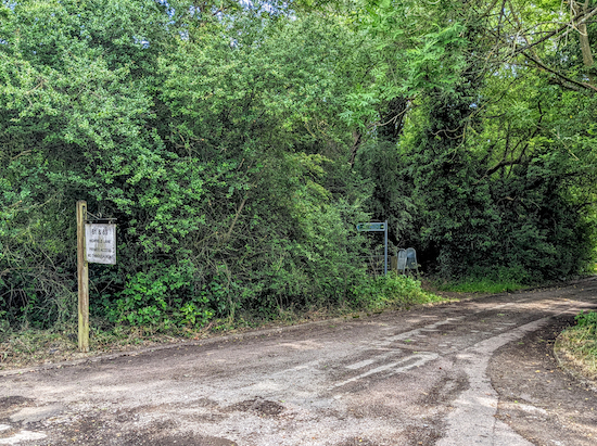 |
Track leading to Colney Heath footpath 27 on the left
|
Take the track then take the footpath and permissive bridleway on the left (location -
https://w3w.co/winks.shape.achieving), see image below.
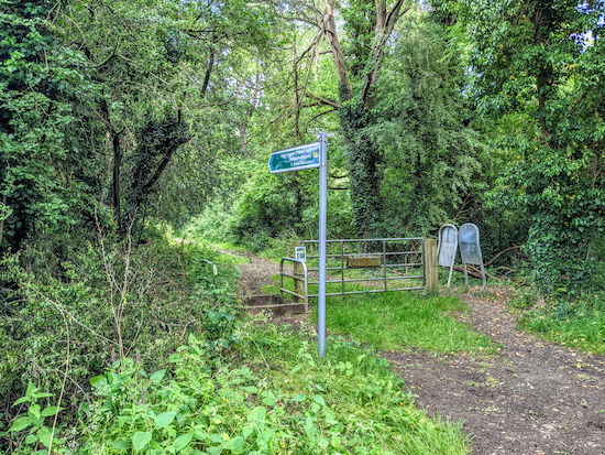 |
| Colney Heath footpath 27 |
5: Turn left on Colney Heath footpath 27 then head ENE then NE for 520m along the edge of woodland until you reach a field (location -
https://w3w.co/ears.pens.worked), see image below.
 |
| Leave the woodland then continue across a field on Colney Heath footpath 27 |
Continue across the field for 220m until you reach a wooden footbridge (location -
https://w3w.co/town.legs.stud), see image below.
 |
| Cross the wooden footbridge then head NE across the field |
Cross the wooden footbridge then continue, still on Colney Heath footpath 27, across the field for 270m aiming for the left of the houses in the distance until you reach Woodrake Lane, which is also Colney Heath BOAT 60 (location -
https://w3w.co/dimes.hobby.along).
6: Turn left on Woodrake Lane then immediately turn right on Barley Mow Lane. Head NE for 20m on Barley Mow Lane then follow it as it bends left and heads NNW for 80m to a footpath on left (location -
https://w3w.co/inform.necks.asks), see image below.
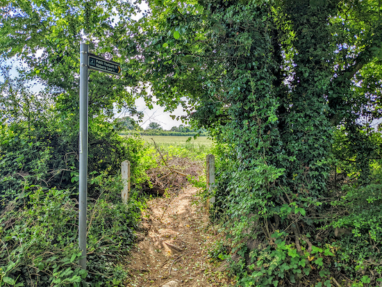 |
| Turn left off Barley Mow Lane on Colney Heath footpath 16 |
Head WNW on Colney Heath footpath 16 for 280m until you reach a junction (location -
https://w3w.co/hood.orchestra.builds).
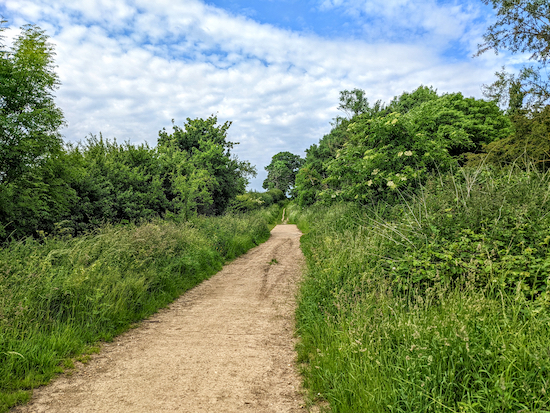 |
| Head NNE on Colney Heath footpath 38 |
7: Turn right then head NNE on Colney Heath footpath 38 for 375m, passing woodland on your right then continuing NE, with the hedgerow on your left and the field on your right, until you reach a point where the footpath cuts left through the hedgerow just before a tree (location -
https://w3w.co/poster.statue.wake), see image below with an orange arrow showing the way.
 |
| Colney Heath footpath 38 crosses the hedgerow see orange arrow |
Continue heading NE, still on Colney Heath footpath 38, but now with the hedgerow on the right and the field on the left, for 185m until you reach Colney Heath Lane (location -
https://w3w.co/panic.stop.outer).
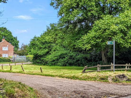 |
| Turn left on the drive off Colney Heath Lane |
8: Turn right on Colney Heath Lane then head SE for 90m looking out for a drive on the left (location -
https://w3w.co/worth.fishery.paths), see image above.
 |
| Colney Heath footpath 39 to the left of the house |
Go down this drive for 35m looking out for a footpath on the left (location -
https://w3w.co/stale.assets.trout), see image above.
 |
| Head NE on Colney Heath footpath 39 until you reach a pond on the right |
9: Head NE on Colney Heath footpath 39 for 385m. The path goes across open land that is abundant with wild flowers in the summer. A great place for dragonflies and butterflies; it's also a good spot for ornithologists. The right of way markers along this stretch have been set in concrete and have green plastic surrounds, see image above. Continue until you reach a pond on the right (location -
https://w3w.co/orders.moons.honest), see image below.
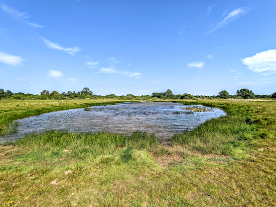 |
| Walk past the pond then turn right and head E along the northern bank |
10: Keep to the left of the pond then just beyond it turn right and follow Colney Heath footpath 11 as it heads along the northern bank of the pond and then E for 300m before bending SE to cross Butterwick Brook (location -
https://w3w.co/sofa.flops.short), see image below.
 |
| Colney Heath footpath 11 approaching Butterwick Brook |
Continuing for 330m to a metalled track leading to Smallford Lane (location -
https://w3w.co/invest.courier.scope).
 |
| The metalled track leading to Smallford Lane |
11: Cross Smallford Lane then head ENE on Sleapshyde Lane for 440m until you reach a junction (location -
https://w3w.co/catch.fingernails.poker), see image below.
 |
| Turn left at the junction then head ENE to the Plough |
12: Turn left at the junction then head NNW for 130m until you reach
The Plough on your right (location -
https://w3w.co/trips.food.ahead), see image below.
 |
| The Plough at Sleapshyde |
13: Just beyond The Plough you will see Colney Heath bridleway 2 (location -
https://w3w.co/humble.exchanges.upgrading), see image below.
 |
| Colney Heath bridleway 2 just beyond The Plough |
Follow this bridleway NW for 295m, ignoring a footpath on the right, and continue until the bridleway bends right just before it reaches Smallford Lane (location -
https://w3w.co/vivid.bowls.rescue), see image below.
 |
| Keep right then head NNW with the hedgerow on the left |
Head NNW for 100m until you reach The Alban Way (location -
https://w3w.co/fell.weep.digit).
14: Turn left on The Alban Way, see image below, then head W for 30m under the bridge, then turn right and head back to the car park and the starting point (location -
https://w3w.co/full.tower.defend).
 |
| Turn left on The Alban Way then return to the starting point |
Interactive map


Did this walk today and enjoyed it very much. The first part along the old railway track was busy with cyclists but most were families and were going at a sensible speed. Stopped for some local ales at the Plough at Tyttenhanger Green and sat outside in the garden. Missed the sign to footpath 38 at point 7 because the sign was a bit overgrown (and we hadnt look at your photo of where to go off) so had to retrace our footsteps after wading through the long grass etc. Good walk and mostly quiet. Would certainly do this one again.
ReplyDeleteHi Dave Have cycled The St Albans Way many times from WGC. Was nice to walk it and see the area between it and the A414 . Am pleased to say managed it before any field ploughing 😂😂😂 Again Thanks for the Walk. .IR.
ReplyDeleteWell done getting there before the ploughs. :-)
DeleteWalked this today in the snow, although a bit cold still enjoyable but definitely going back in the spring
ReplyDeleteIt must have been lovely in the snow. Thanks for the feedback.
DeleteDid this walk last Sunday ( Nov 23) Nice walk but the drown of A1 can be heard on most of it.
ReplyDeleteCouple of things to note. At instruction No 4 the white sign in the photo has come off its post & now sits on the ground. I did take a photo but it didn't show the other signs as well as curent photo.
Secondly at instruction No 8 dont be tempted to turn too early at the tree turn in the photo. There are a couple of breaks in the hedge you could use but you need the one close to the big tree. Other than that a nice walk.
Thanks for the feedback, Christine. I have added two notes to the walk. In the introduction I have added "you will be aware of the A414 for much of this walk" and at point 8 I have added "just before a tree". If you are not already a member please consider joining our Facebook group where fellow walkers are sharing photos and feedback from their walks.
Deletehttps://www.facebook.com/groups/hertfordshirewalker