4.5 miles (7.3 km) with 11m of total ascent
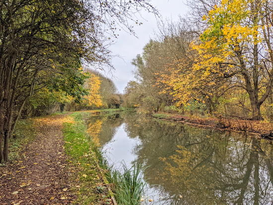 |
| The River Stort (Navigation) along Walk 161 |
This is a linear walk from Harlow to Sawbridgeworth, mostly following the towpath alongside the River Stort (Navigation) towpath. There are regular train services connecting the two towns. The first part of the walk is alongside industrial units, but you are soon into open countryside. Birdwatchers should take their binoculars. The walk starts in Essex, close to the Hertfordshire border, then dips in and out of both counties before ending in Hertfordshire.
Fly through preview of walk
If you want to check what sort of landscape you will be crossing before you set off on this walk you can view a short 3D video of the route below. It's created using the free version of
Relive.
Directions
 |
Map for Walk 161: Sawbridgeworth South Linear
Click on the map for a larger version
Created on Map Hub by Hertfordshire Walker
Elements © Thunderforest © OpenStreetMap contributors
There is an interactive map below these directions |
Those with GPS devices can download
GPX or
KML files for this walk. We've added
What3Words location references for those who use that system. If you print these walks you might want to use the green
PrintFriendly icon at the bottom of these directions to delete elements such as photographs.
Getting there
By bus: The nearest bus stop to the start of the walk is Harlow Town Station (location -
https://w3w.co/narrow.soap.stand), which is served by the numbers 23, 347, 724 buses. You can check bus times at
Intalink.
By train: Those travelling to this walk by train (or bus) should turn right on leaving Harlow Town station (location -
https://w3w.co/film.acute.grass) then head SW along Station Approach for 240m until you reach a roundabout and the A414 on the right (location -
https://w3w.co/raced.undulation.assets). Turn right then head NW alongside the A414 for 250m until you reach Burnt Mill Lane on the right (location -
https://w3w.co/remind.lived.cake). Turn right down Burnt Mill Lane then head E for 150m until you reach a junction (location -
https://w3w.co/effort.print.piles). Keep left at the junction, still on Burnt Mill Lane, then head NE for 45m until you reach a bridge (location -
https://w3w.co/glory.spoon.carbon). Here you turn right on the towpath alongside Burnt Mill Lock. This is the start of the walk.
 |
| The cut-through from the Moorhen car park to Burnt Mill Lane |
By car: The management at
The Moorhen pub/restaurant told us that it's okay to use their car park if we were returning for refreshments after the walk, which we were. If you park here it's probably best call them first to check this is still the case (01279-423066). From the car park take the cut through in the NW corner (location -
https://w3w.co/basis.cage.ranked), see image above, then turn left on Burnt Mill Lane and head SW for 15m crossing the River Stort, then take the towpath on the left, immediately after the bridge (location -
https://w3w.co/sector.robots.values). This is the start of the walk.
 |
| The Harcamlow Way at the start of the walk |
1: From the towpath mentioned above head ESE then ENE passing the lock and crossing a bridge before reaching a metal gate, see image above (location -
https://w3w.co/escape.visa.armed). This part of the towpath is also the
Harcamlow Way which you follow NE for 850m until you reach the
Harlow Marsh Nature Reserve (location -
https://w3w.co/drew.wonderfully.about) and a footbridge on the left, see image below.
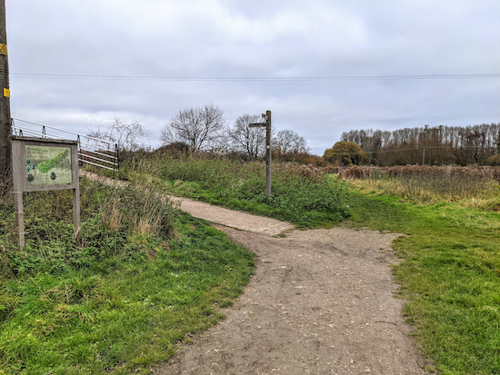 |
| Turn left on Eastwick and Gilstone footpath 33 then cross the River Stort |
2: Turn left on Eastwick and Gilstone footpath 33, cross the River Stort, then turn immediately right and follow the towpath on the NW side of the river. This is still Eastwick and Gilstone footpath 33 which you follow NE for 380m to a footpath junction (location -
https://w3w.co/level.sober.hint).
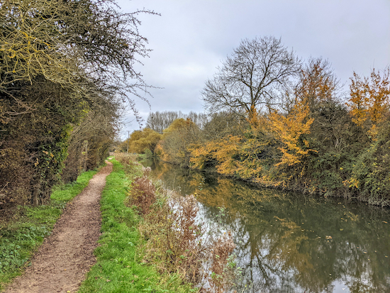 |
| The towpath where it becomes Sawbridgeworth footpath 43 |
3: Keep to the right at the junction, now on Eastwick and Gilstone footpath 35 which you follow E for 300m until the towpath you are on becomes Sawbridgeworth footpath 40 (location -
https://w3w.co/inform.bake.rocky), and continues heading E for another 200m until the towpath becomes Sawbridgeworth footpath 43 (location -
https://w3w.co/spike.palace.middle).
 |
| Keep on the left side of the River Stort at the lock |
4: Continue along the towpath (Sawbridgeworth footpath 43) heading E then NE for 1.2km until you reach a footpath junction (location -
https://w3w.co/fuels.works.delay).
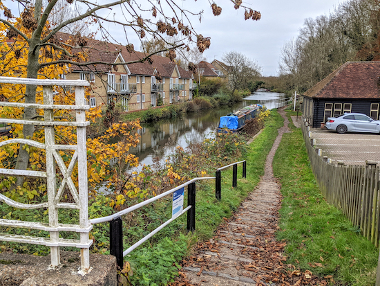 |
| Cross the bridge at Cambridge Road then take the towpath on the left |
5: Turn right on Sawbridgeworth footpath 19, which is still the towpath, and continue heading NE and E for 490m until you reach Cambridge Road (location -
https://w3w.co/lasts.drain.spun). Leave the towpath, turn right on Cambridge Road, and cross the River Stort looking out for a path on the left leading down to the towpath (location -
https://w3w.co/crowned.juices.emerge).
* At this point you could visit The Harlow Mill pub restaurant on the S bank of the River Stort (location - https://w3w.co/traded.proper.maker).
6: Turn left on the towpath, which is also Harlow District footpath 31, and, with the River Stort now on your left, head E for 1km until the towpath becomes Sheering footpath 23 (location - https://w3w.co/skins.stop.square).
7: Continues heading NE and N along the towpath, still on Sheering footpath 23, for another 1km until you reach a footpath junction (location - https://w3w.co/lights.shapes.keen).
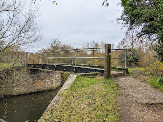 |
| Cross the River Stort on the footbridge then turn right on the towpath |
8: You are now in Hertfordshire. Turn left on Sawbridgeworth footpath 39, cross the River Stort, then turn immediately right on the other side to follow the towpath, still Sawbridgeworth footpath 39, with the River Stort on your right, for 1.5km until you reach Station Road, Sawbridgeworth (location -
https://w3w.co/needed.clever.decent).
You will notice some old buildings on the right just before you leave the towpath. These are the maltings. The history of Hertfordshire's hop industry, and how the River Stort was used to transport the hops to the breweries in London, is fascinating. You can
read about it on the Bishop's Stortford Town Council's website.
9: Turn right on Station Road then walk NE for 180m to Sawbridgeworth station (location -
https://w3w.co/loves.agents.major), where you can catch a train back to Harlow Town station.
* If you arrive at point 9 and are too early for your train home, or if you just want to explore the historic town of Sawbridgeworth and have a drink, turn left on Station Road and you will find six pubs, the first, The George IV, just 440m NW along Station Road.
When you arrive back at Harlow Town station and if you have parked at
The Moorhen pub/restaurant, then follow the '
By Train' steps set out at the top of these directions to return to the car park.
The Dusty Miller pub/restaurant is 520m from the starting point.
Interactive map


Lovely walk, but probably best done in Autumn so you can see the colours of the leaves reflecting on the River Stort. This is a VERY flat walk where the first half was mud free but after point 6.4ish it gets quite muddy and slippery for quite a while. If you have small children please be careful on this walk as the water is very close by for most of the walk
ReplyDelete