6.1 miles (9.9km) with 148m of total ascent
 |
This walk starts in the Buckinghamshire village of Chenies then follows two long-distance paths, The Chiltern Heritage Trail and The Chess Valley Walk as it loops into Hertfordshire before returning along the River Chess. There are two pubs close to the start and finish point, The Red Lion and The Bedford Arms, both in Chenies, and another pub, The Cock Inn, in Sarratt, Hertfordshire, two-thirds of the way around.
Fly through preview of walk
If you want to check what sort of landscape you will be crossing before you set off on this walk you can view a short 3D video of the route below. It's created using the free version of Relive.
Directions
GPX or KML files for this walk. We've added What3Words location references for those who use that system. If you print these walks you might want to use the green PrintFriendly icon at the bottom of these directions to delete elements such as photographs.
 |
| Chenies footpath 24 heading W off Latimer Road |
 |
| Rows of wildflowers alongside Chenies footpath 24 |
 |
 |
| Chenies footpath 48 |
4: Turn left on Chenies bridleway 35, then head W for 810m until you reach Stoney Lane (location - https://w3w.co/saves.spits.urban).
5: Turn right just before Stoney Lane on a permissive path (which avoids walking on the lane) then head NW on the path for 90m until you cross Stoney Lane to reach a bridleway on the opposite side (location - https://w3w.co/farms.deep.canny).
 |
| Keep left on Chenies bridleway 35 and walk uphill through the woods |
6: Turn right on Chenies footpath 44, then head NW for 170m to a junction in the tracks (location - https://w3w.co/frogs.float.fade).
 |
| The footpath leaving the woodland down towards Latimer Road |
 |
| Chenies footpath 49 |
 |
| The two options at point 8 |
 |
| Latimer footpath 30 heading ESE with views over the Chess Valley |
 |
| The River Chess at point 8 |
9: Take the footpath on the opposite side of Stoney Lane. This is Chenies footpath 55 which is also The Chess Valley Walk and The Chiltern Heritage Trail along this stretch. Continue heading E for 510m until the path merges with Chenies bridleway 56 (location - https://w3w.co/post.almost.types).
10: Continue heading E, now on Chenies bridleway 56, for 680m until you reach Chenies Hill (location - https://w3w.co/movie.ports.spits).
11: Turn left on Chenies Hill, then head NE for 110m looking out for a footpath on the right (location - https://w3w.co/wake.crew.manual). Take this path, Chenies footpath 60, then head ENE for 500m until you reach woodland (location - https://w3w.co/glue.worry.hero). At this point you leave Buckinghamshire and enter Hertfordshire.
 |
| Frogmore Meadows nature reserve |
13: Cross Holloway Lane and continue heading E on Sarratt footpath 37 for 440m until you reach Moor Lane (location - https://w3w.co/locate.garden.affair).
14: Turn right on Moor Lane then head SE for 230m until you reach Dawes Lane on the left (location - https://w3w.co/nest.heave.panic). Turn left on Dawes Lane then heads NE for 65m looking for a footpath on the right (location - https://w3w.co/thing.panels.stuff).
15: Turn right on Sarratt footpath 39 then follow it SE for 760m until you reach a gate leading into the churchyard of The Church of the Holy Cross (location - https://w3w.co/limp.spider.singer). Once in the churchyard follow Sarratt footpath 53 SE for 75m until you reach Moor Lane (location - https://w3w.co/earth.actor.flying).
* At this point you could turn left to visit The Cock Inn (location - https://w3w.co/fault.played.tasty).
 |
| Sarratt footpath 40 heading down to the Chess Valley |
17: Turn right then head NW for 370m along Sarratt footpath 41, which at this point is also the Chess Valley Walk, until you reach a junction in the tracks (location - https://w3w.co/rider.pump.feels). At this point you enter Buckinghamshire.
 |
| Chenies footpath 15 crossing the River Chess |
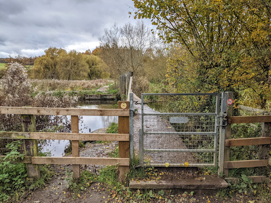
19: Continue heading WSW, now on Chenies footpath 15 for 1.2km until you reach Latimer Road (location - https://w3w.co/cuts.dock.cowboy).
20: Turn right on Latimer Road then return to the starting point.
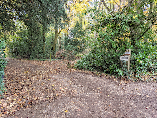
* The Red Lion, Chenies is 180m further along Latimer Road (location - https://w3w.co/lanes.tame.blitz), and The Bedford Arms another 260m further on (location - https://w3w.co/successes.seated.report).This walk was recommended by our occasional walking companions Sophie and Mike Brewer. Sophie took the picture of the autumn leaves in West Wood, Latimer, at the top of these directions.


We did this walk in bad weather, wellingtons required. But it was a great combination of woods, open views and water features. There is a car park at point 5. We started there and stopped two-thirds of the way round at the Cock Inn - great lunch there.
ReplyDeleteHi Hester, glad you enjoyed the walk despite the need for wellies. And thanks for the tip about the car park and alternative starting at point five. We have also had a great meal and pint at The Cock in Sarratt. Two good pubs on this walk. Thanks again for the feedback.
DeleteDavid
Did this walk yesterday, 29 January, and made sure we had wellies for the mud but it wasnt muddy at all. Really enjoyed the views and the woods on this walk and we will definitely do it again and stop at one of the pubs. Went on a short way down a footpath to have a closer look at the DeVere Latimer Hotel from the outside and were amused by their notice at the boundary fence overlooking the grounds saying "no peeking". We had a good look anyway! Found it easy to park at the start of the walk near the Red Lion but the tip about the other starting point will be useful at busier times. Another great walk with easy to follow directions. Thank you.
ReplyDeleteGlad you enjoyed it. We like this walk, too. And the Red Lion in Chenies and The Cock in Sarratt are great pubs. We have used them both on our walks. David
DeleteGreat walk with autumn colours and a warm soup at the The Cock pub. Thank you!
ReplyDeleteGlad you enjoyed it. We love that walk. And we have also enjoyed refreshments at The Cock. Thanks for the feedback. David
DeleteGreat walk and finished up at the Red Lion for a fab meal. River Chess was flooded so had to cross knee deep water at point 18 but walk was worth the wet feet!
ReplyDeleteWow, knee deep water. And still you had a great day! Respect! If you haven't already done so please consider joining our friendly Facebook group where fellow walkers are sharing their experiences and photos.
Deletehttps://www.facebook.com/groups/hertfordshirewalker
An excellent walk with superb views over the beautiful Chess Valley. The mid section, following close to the river floor, is inevitably muddy at this time of year
ReplyDeletePlease note that there are cattle in the field as you approach the churchyard of The Church of the Holy Cross around point 15. You start separated from them, but soon the fence vanishes so you are effectively in the field with them.
ReplyDeleteThanks for the tip Gerry.
DeleteBeautiful walk, in spring sunshine, thank you for the recommendation
ReplyDelete