5.8 miles (9.3 km) with 106m of total ascent
 |
| Cholesbury Camp, an iron age hill fort |
This walk starts in the village of Wigginton then follows well-defined paths and tracks through beautiful woodland steeped in history. At one point you walk along the moat the borders
Cholesbury Camp, an Iron Age hill fort. The route crosses the border into Buckinghamshire, and Cholesbury, where you can visit
The Full Moon pub/restaurant in Hawridge at the halfway point before returning to Wigginton.
After testing this route in November 2021 we both decided it is now one of our favourite walks on the site. This is our second circular walk from Wigginton, the other is
Walk 158: Wigginton East Loop.
Getting there
There are bus stops close to The Greyhound at the start of the walk (location -
https://w3w.co/office.adjuster.pulse), which are served by the numbers 199 and 397 buses. There are also bus stops in the village served by the 207 and 398. You can check bus times at
Intalink.
Fly through preview of walk
If you want to check what sort of landscape you will be crossing before you set off on this walk you can view a short 3D video of the route below. It's created using the free version of
Relive.
Directions
 |
Map for Walk 159: Wigginton South-West Loop
Click on the map to reveal a larger version
Created on Map Hub by Hertfordshire Walker
Elements © Thunderforest © OpenStreetMap contributors
There is an interactive map below these directions |
Those with GPS devices can download
GPX or
KML files for this walk. We've added
What3Words location references for those who use that system. If you print these walks you might want to use the green
PrintFriendly icon at the bottom of these directions to delete elements such as photographs.
1: With your back to
The Greyhound pub/restaurant (location -
https://w3w.co/essays.preoccupied.promises), turn right then head SSW along Chesham Road for 75m until you reach a footpath on the right (location -
https://w3w.co/clubbing.cheater.tagging) leading to a car park and the
Wigginton Village Shop and cafe (location -
https://w3w.co/torso.vague.reforming).
Turn right on this footpath, Wigginton footpath 9, then head N for 100m until you reach Wick Road (location -
https://w3w.co/budgeted.progress.cemented).
2: Turn left on Wick Road, then head WSW for 260m until you pass Osborne Way on the right (location -
https://w3w.co/announced.infringe.storage). At this point Wick Road becomes a track known as The Wick. This is also Tring Town footpath 22 for 40m before becoming Tring Town footpath 18.
 |
| The Wick, which is also Tring Town footpath 18, between points 2 and 3 |
Continue along The Wick (Tring Town footpath 18 ) continuing for 1.4km to a junction (location -
https://w3w.co/walls.stumps.mixer).
3: Turn left on Kiln Road then head SSE for 400m until you reach a footpath on the right (location -
https://w3w.co/cure.reviews.armrests).
 |
| Tring Town footpath 15 heading SSW off Kiln Road |
4: Take this footpath, Tring Town footpath 15, then head SSW through the woodland for 700m to a footpath junction (location -
https://w3w.co/committee.purple.silence).
 |
| At the fence turn left on Tring Town byway open to all traffic 77 |
5: At the junction, turn left on Tring Town BOAT (byway open to all traffic) 77 and head SE for 730m until you reach a footpath crossing your path (location -
https://w3w.co/fillers.budgeted.island).
 |
| Turn right on Tring Town footpath 12 |
6: Turn right then head SW on Tring Town footpath 12 for 200m until you reach Shire Lane (location -
https://w3w.co/surpasses.tourist.wager). At this point the walk enters Buckinghamshire.
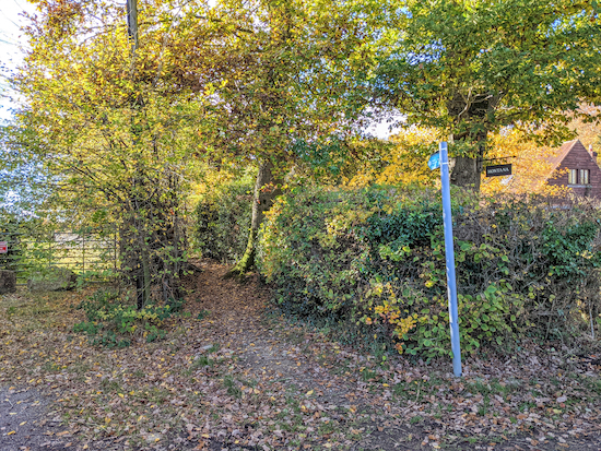 |
| Cholesbury-cum-St Leonards footpath 27 heading SW off Shire Lane |
Turn left on Shire Lane then head SE for 20m looking out for a footpath on the right. This is Cholesbury-cum-St Leonards footpath 27 which heads SW for 280m to a footpath junction (location -
https://w3w.co/erupts.envoy.northward).
 |
| Head SSE on Cholesbury-cum-St Leonards footpath 26 |
7: Turn left, then head SSE on Cholesbury-cum-St Leonards footpath 26 for 150m until you reach another footpath junction (location -
https://w3w.co/heartened.fevered.keeps).
 |
| Take the path on the left, Cholesbury-cum-St Leonards footpath 24 |
8: Turn left on Cholesbury-cum-St Leonards footpath 24 then head SE for 260m to a footpath junction (location -
https://w3w.co/huts.encoded.sleepy). This is
the site of Cholesbury Camp.
 |
| Walk along the side of what was the moat for the Iron Age hill fort |
Turn left on Cholesbury-cum-St Leonards footpath 23 then head E then SE walking along the edge of the moat for the Iron Age hill fort. Continue for 130m to a footpath junction (location -
https://w3w.co/retailing.whites.socialite) to the left of a tree, see image below.
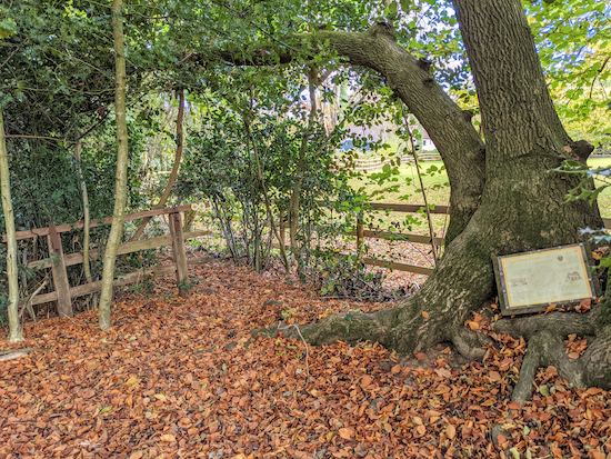 |
| Turn left at the fence then head NE for 130m until you meet Shire Lane |
9: Turn left then head NE for 130m on Cholesbury-cum-St Leonards footpath 23A until you reach Shire Lane (location -
https://w3w.co/bonfires.unite.splash).
 |
| The footpath off Shire Lane leading towards Cholesbury Common |
Turn left on Shire Lane then head NW for 30m then take a footpath on the right, Cholesbury-cum-St Leonards footpath 48R, then head SE for 120m until you reach Cholesbury Road (location -
https://w3w.co/afflicted.firmly.speared).
 |
| Take the path onto Cholesbury Common then take the middle path of three |
10: Cross Cholesbury Road, then take the path across Cholesbury Common. Keep to the middle path of three and continue across the common for 500m until you reach Cholesbury Lane and
The Full Moon pub/restaurant at Hawridge (location -
https://w3w.co/sidelined.leaned.evaporate).
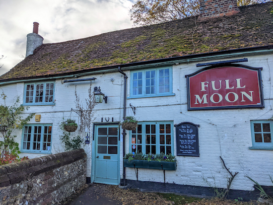 |
| The Full Moon at the halfway point in the walk |
11: After leaving the Full Moon turn left then head WNW for 10m before taking the first path on the right across the common, see image below.
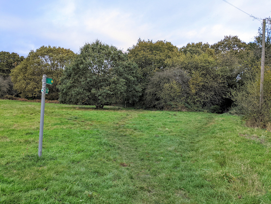 |
| Take the path on the right which leaves the common and heads NNE |
This is Cholesbury-cum-St Leonards footpath 48P which you follow NNE then NE for 130m to a footpath junction (location -
https://w3w.co/hours.interlude.gilding). At this point you enter Hertfordshire and continue heading NE, now on Tring Town footpath 1, for 650m to a footpath junction (location -
https://w3w.co/calibrate.convey.occupations).
 |
| Tring town bridleway 3 heading N |
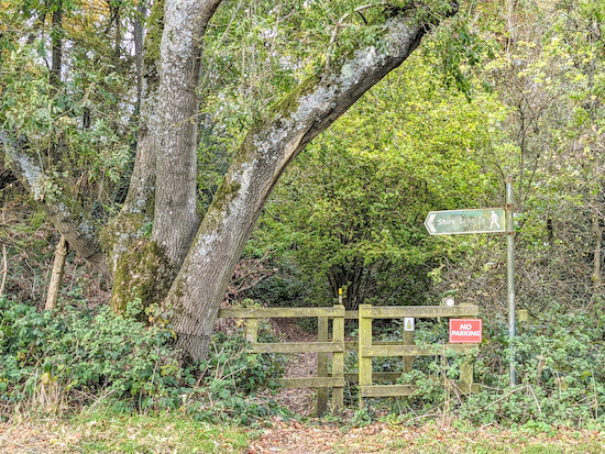
12: At the junction turn left on Tring town bridleway 3, then head N for 760m to Cholesbury Road (location -
https://w3w.co/wades.generally.riches).
 |
| Cross Cholesbury Road then take Tring Town footpath 8 |
13: Cross Cholesbury Road, then take Tring Town footpath 8 and head NNW then N for 1.2km to a footpath junction (location -
https://w3w.co/studio.tonality.sued).
 |
| Wigginton footpath 17 to the right of the tree |
14: At the junction turn right on Wigginton footpath 17, which at this stage is also The Chiltern Way, then head ENE for 130m until you reach Chesham Road (location -
https://w3w.co/tastier.request.violinist).
 |
| Wigginton footpath 21 off Chesham Road |
Cross Chesham Road then head SSE for 15m until you reach a footpath on the left (location -
https://w3w.co/dentistry.doses.bonds) see image above. Continue on
The Chiltern Way, which is now also Wigginton footpath 21, then head ENE for 240m until you reach Wigginton Bottom (location -
https://w3w.co/message.ignoring.chainsaw).
 |
| Take Wigginton footpath 7 off Wigginton Bottom |
15: Turn left on Wigginton Bottom then head NW for 100m looking out for a footpath on the right (location -
https://w3w.co/auctioned.gloves.envy).
 |
| Keep to the track in the grass and not the farm track on the right |
Take this footpath, Wigginton footpath 7, keeping to the track in the grass and
not the farm track on the right, see image above. Then head NNE then NNW for 410m to a footpath junction (location -
https://w3w.co/sideburns.thatched.marine).
16: Turn left on Wigginton footpath 8, then head W for 260m back to Chesham Road and the starting point.
Interactive map


2/4/2023
ReplyDeleteA lovely walk but muddy in places (no surprise after wettest March in history). Excellent directions (there is now a gate direct out of the Greyhound carpark so no need to do first bit along road, it takes you straight on to path leading to Wick Road, and the post in picture for point 7 is now missing). Full Moon pub slightly further than half way if starting at the Greyhound and does NOT allow muddy shoes inside. Excellent food at the Greyhound but booking essential, especially on a Sunday.
We can see why it is one of your favourite walks, thanks for sharing. Elizabeth
Thank you Elizabeth, so glad you enjoyed it. It is a lovely route. Thanks, too, for the updates and tips. David
DeleteLovely walk if quite muddy and wet today …. We did however fail to find the Chiltern Way route once we’d crossed Chesham Road - we think it might have been blocked off! Instead we ended up walking along Chesham Road to get back into Wiggington …. Enjoyed a coffee at the village farm shop which was lovely too!
ReplyDeleteGlad you enjoyed it, but sorry to hear you got lost. Did you check the What3Words reference I gave for that point? If you click the link and view in satellite mode you can see both paths where they cross Chesham Road at point 14 then continue on the Chiltern Way. I also add photograph of the two gates at point 14 which show what you should be looking for and can be seen if you view the link. It's a pity you went wrong because you missed a nice part of the route. Do you have a smartphone? If so you could also follow the GPX files to make sure you are in the right spot. I have written some tips that might help. David
Deletehttps://www.hertfordshirewalker.uk/p/sat-nav.html
Once again, thanks for the feedback. I have added a few more words and an extra What3Words link at point 14 which I hope helps. If not, and if the public right of way has been blocked off. Would you mind reporting it to Hertfordshire County Council please. I have not been informed by HCC that that right of way has been closed. Thanks for your help.
Deletehttps://www.hertfordshire.gov.uk/services/highways-roads-and-pavements/report-a-problem/report-a-highway-fault/public-rights-of-way/public-rights-of-way.aspx