5.6 miles (9 km) with 64m of total ascent
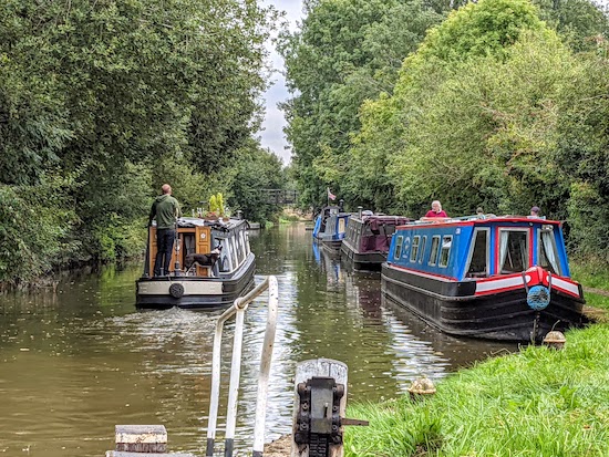 |
| The Grand Union Canal, Tring |
This walk visits the four reservoirs that make up the
Tring Reservoirs Nature Reserve, which is managed by the
Herts and Middlesex Wildlife Trust. The route follows towpaths along
the Grand Union Canal and passes three rural pubs. There are two car parks to choose from. Our walk starts and finishes at the Wilstone Reservoir car park but you can also leave the car at Startop's End and join the route from there.
Getting there
For those travelling by bus there is a bus stop on Tring Road in Wilstone which is at point 3 in the walk (location -
https://w3w.co/supposes.retina.fragment), which is served by the number 62 bus. You can check bus times at
Intalink.
Fly through preview of walk
If you want to check what sort of landscape you will be crossing before you set off on this walk you can view a short 3D video of the route below. It's created using the free version of
Relive.
Directions
 |
Map for Walk 157: Wilstone Loop
Click on the map for a larger version
Created on Map Hub by Hertfordshire Walker
Elements © Thunderforest © OpenStreetMap contributors
There is an interactive map below these directions |
Those with GPS devices can download
GPX or
KML files for this walk. We've added
What3Words location references for those who use that system. If you print these walks you might want to use the green
PrintFriendly icon at the bottom of these directions to delete elements such as photographs.
 |
| Wilstone Reservoir at the start of the walk |
The route starts at the car park at the NW of Wilstone Reservoir just S of the B489 (location -
https://w3w.co/interlude.kickbacks.spicy). Wilstone Reservoir is a prime location for watching birds (and bats!). It is the largest of the four Tring reservoirs. Record-breaking catfish and carp have been caught in its waters.
At the time of writing (September 2021) this car park was free of charge. If it is full, you might want to drive to the car park in Startop's End (location -
https://w3w.co/correct.vibrate.otherwise) and start the walk at point 10 in the directions below. At the time of writing the Startop's End car park was pay and display.
1: From the Wilstone Reservoir car park climb the steps to reach the edge of the reservoir. Turn left on the embankment then head NE along Tring Rural footpath 44 for 200m with the reservoir on your right before the footpath bends to the right (location -
https://w3w.co/resembles.yappy.jumpy) then heads SE, still along the edge of the reservoir, for 190m until it reaches steps leading down to a gate and a footpath junction (location -
https://w3w.co/swarm.thud.party), see image below.
 |
| Tring Rural footpath 43 leaving Wilstone Reservoir |
2: Go through the gate then turn left on Tring Rural footpath. Follow the footpath NW for 180m to a point where the footpath splits. You take the left hand fork (location -
https://w3w.co/fatherly.timidly.sleepless) to reach the B489, Lower Icknield Way (location -
https://w3w.co/files.hunter.slurping).
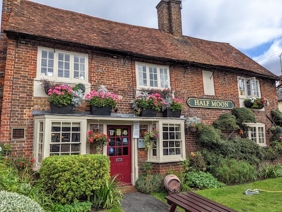 |
| The Half Moon, Wilstone village |
Cross the road then head NNW along Tring Road. There is a verge along this road where you can step aside if faced with oncoming traffic. After 300m you reach the village of Wilstone. There is a cafe in the
Wilstone Community Shop on your right (location -
https://w3w.co/openings.seaweed.education). After 100m you will reach the
Half Moon pub/restaurant on your right (location -
https://w3w.co/calls.inserting.started), see image above.
3: When you reach the Half Moon take the lane opposite on the left. This is Sandbrook Lane, which you follow WSW for 130m until you reach the end of the lane and a footpath junction (location -
https://w3w.co/slogans.alley.lamppost).
4: Turn right on Tring Rural footpath 18, then head NW for 150m until you reach a footpath junction (location -
https://w3w.co/flagpole.raking.rosette), see image below.
 |
| Turn right at the junction on Tring Rural footpath 20 |
Take the right fork then follow Tring Rural footpath 20 NNW for 120m until it cuts through the hedgerow on the right and crosses a wooden footbridge (location -
https://w3w.co/weaved.known.idealist). Cross the wooden footbridge then continue following Tring Rural footpath 20 NNW for another 60m until you reach the Grand Union Canal - Aylesbury Arm (location -
https://w3w.co/prep.luring.growth).
 |
| One of the locks along the Grand Union Canal - Aylesbury Arm |
5: Turn right before the bridge over the canal, then follow the towpath along the Grand Union Canal - Aylesbury Arm for 1.6km until the canal goes under Watery Lane (location -
https://w3w.co/support.cleans.fetching).
 |
| Cross Church Lane then follow the Grand Union Canal towpath N |
6: When you reach the Watery Lane bridge, leave the towpath then turn left and head NW for 120m until you reach the junction with Church Lane (location -
https://w3w.co/stance.quits.scales), see image above. Cross Church Lane then take the towpath heading N alongside the Grand Union Canal, following it for 300m until you reach Vicarage Road (location -
https://w3w.co/downsize.rooftop.hides).
 |
| Leave the canal then turn right on Vicarage Road then cross the bridge |
7: Here you leave the towpath then turn right to cross the canal via a road bridge then head SE along Vicarage Road for 80m to
The Red Lion (location -
https://w3w.co/bundles.vanished.estuaries).
 |
| The Red Lion, Marsworth |
After passing The Red Lion continue heading SE and uphill along Vicarage Road for 90m until you reach All Saints Church, Marsworth on your right.
8: When you reach the churchyard, turn right on a path (location -
https://w3w.co/developed.clauses.smirks) that goes to the right of the church then swings round to the left to leave the churchyard and meet Church Lane (location -
https://w3w.co/pounces.notion.pace).
 |
| Turn left after the white timber frame house |
9: Turn right on Church Lane then head SW for 80m until you reach a lane on the left just after a white timber frame house (location -
https://w3w.co/performed.throats.bonkers), see image above. Turn left on this lane then head SW for 100m until you reach a gate leading into a field. Go through the gate then follow the footpath downhill for 200m until you reach Startop's End and the B489, Lower Icknield Way (location -
https://w3w.co/slimming.mornings.statue), see image below. There is a cafe,
The Waters Edge (location -
https://w3w.co/chitchat.chickens.uttering).
 |
| The footpath as it meets Lower Icknield Way, the B489 |
Turn right, cross the canal via the bridge, then head SW along the pavement alongside the B489 for 130m until you reach
The Anglers Retreat pub/restaurant (location -
https://w3w.co/wrist.whistling.whispers), see image below.
 |
| The Anglers Retreat at Startop's End |
10: Cross the road then take the footpath opposite The Anglers Retreat and follow it into the Startop's End Reservoir car park (location -
https://w3w.co/parts.outlooks.tulip). Follow the path as it heads SE for 300m with Startop's End Reservoir on the right and the canal on your left until you reach a footpath junction (location -
https://w3w.co/atoms.posting.broached).
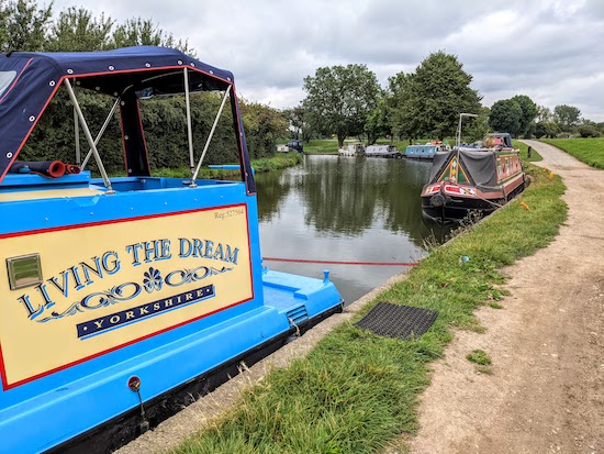 |
| Barges on the Grand Union Canal at Startop's End |
11: Turn right along Tring Rural footpath 41 which runs between Startop's End Reservoir on your right and Marsworth Reservoir on the left.
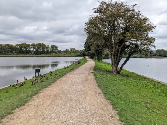 |
| The path between Startop's End Reservoir and Marsworth Reservoir |
Follow this footpath as it heads SSW for 380m until you reach Tringford Road (location -
https://w3w.co/downcast.remainder.swan).
12: Turn right when you reach the road then follow the footpath alongside Tringford Road heading NW for 130m with Tringford Reservoir on the left until you reach a footpath on the left (location -
https://w3w.co/spaceship.flap.impresses).
13: Take this footpath along the northern edge of Tringford Reservoir. This is Tring Town footpath 55, which heads SW for 260m until the footpath bends to the left (location -
https://w3w.co/renewals.expressed.snappy) then heads SSE for 370m until you reach a footpath junction (location -
https://w3w.co/debating.scarves.buildings).
 |
| Tring Town footpath 55 weaving through woodland |
14: Turn right on Tring Rural footpath 59 then head WNW for 120m until you reach Little Tring Road (location -
https://w3w.co/overused.mentioned.milkman). Head N along Little Tring Road for 30m looking out for a footpath on the left (location -
https://w3w.co/incur.spins.herring).
15: Take this footpath, Tring Rural footpath 47, which follows the route of the
Wendover Arm of the Grand Union Canal, currently being restored by the
Wendover Arm Trust, to what the trust describes as the canal's "former glory".
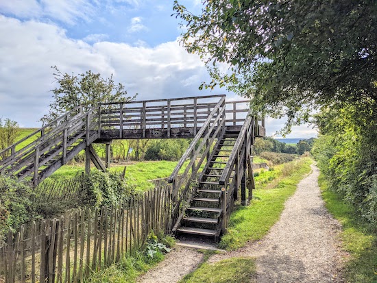 |
| The footpath alongside the Wendover Arm of the Grand Union Canal |
Follow this footpath as it heads W, NW, then SW for 630m until you reach a footpath junction (location -
https://w3w.co/clasping.thickens.raft), see image above.
 |
| Tring rural footpath 47 heading SW |
Ignore footpaths to your right and left and continue heading SW for another 340m until you reach a footpath on the right (location -
https://w3w.co/underline.elaborate.pickup), see image below.
 |
| Tring Rural footpath 49 leaving the Wendover Arm |
16: Take this footpath, Tring Rural footpath 49, then head W, SW, then W, with the hedgerow on the right and fields on the left, for 700m. At this point you leave Hertfordshire and enter Buckinghamshire (location -
https://w3w.co/decimals.scooped.should).
 |
| From point 16 to 17 keep the hedgerow on the right and field on the left |
17: Continue NW for 410m until you reach a footpath junction (location -
https://w3w.co/plus.overgrown.plug).
18: You are now back in Hertfordshire where you continue heading NW along Tring Rural footpath 44 for 250m until the footpath bends to the right (location -
https://w3w.co/failed.holds.chips), with Wilstone Reservoir on your right.
 |
| Wilstone Reservoir towards the end of the walk |
19: Head NE for 500m, still on Tring Rural footpath 44, following it back to the car park at the start of the walk.
Interactive map


This is a lovely walk with lots of birds and views of water. Mostly very flat. It was fascinating to see canal construction in progress.
ReplyDeleteWe started at point 9 and parked at the large carpark at Startop Reservoir (£4). The Angler's Retreat was not doing food. We had lunch at the Half Moon, an ancient place with a real fire, various dogs, friendly staff and delicious low-priced food.
Glad to hear you enjoyed the walk. And thanks for the report on the Half Moon.
ReplyDeleteDavid
Did this walk today in the bright sunshine. We got a bit lost at point 6 but got back on the route. A really good walk with varied scenery - open views, canals and reservoirs and pubs of course. We visited Mead Farm Shop at the end and sat overlooking the fields having a coffee watching the sheep and lambs. Interesting seeing the work taking place to reinstate the canal at the Wendover Arm. Would certainly do this walk again and stop at one of the pubs.
ReplyDeleteGlad you enjoyed it. We really liked that walk too. Sorry it was a bit confusing at point 6. Do I need to reword that bit?
DeleteDavid
I think we didnt realise we were at the Watery Lane bridge. You probably dont need to reword it - we need to concentrate more on where we are going! Its easy to get distracted looking at the boats etc and just carry on walking straight on.
ReplyDeleteGreat hike, thnx so much for the clear directions. We also got a little lost at nr. 6 (entered the town from the church side- left the trail too early) but figured it out quickly enough. Beautiful landscapes and the trail is easy on the legs.
ReplyDeleteHi James, sorry you got a little lost at point six, but glad you found your way and enjoyed the walk. If you haven't already done so please consider joining our friendly Facebook group where more than 3.5k members are posting about their walking experiences and sharing photos. David
Deletehttps://www.facebook.com/groups/hertfordshirewalker
Did Walk 157 Wilstone loop today. Great walk particularly if you like water. Reservoirs & canals aplenty.
ReplyDeleteAs others have mentioned point 6 got us a little confused, my fault, but quickly retraced our footsteps to get back on track - literally.
Something odd going on near Black Jacks Lock. One side of that lock the canal is so low it must be unuasable. While after the next one along the water level is only a couple of inches from the top. More useful info. Starting car park is still free, & bigger than I expected, so easily got parked ( it was a chilly day in March) & whole walk was almost entirely mud free.
Will deffinately do this walk again
Thanks for the car parking tip, Christine.
Delete