7.2 miles (11.5 km) with 188m of total ascent
 |
| St Paul's Walden restricted byway at point 7 |
This walk circles the village of Whitwell, following footpaths, bridleways, and byways, over rolling hills with views across open countryside. It has a fair amount of up and down as it crosses the River Mimram twice before dropping down towards Kimpton then looping back. The walk starts and finishes at
The Bull Inn, Whitwell, then passes close to
The Strathmore Arms at St Paul's Walden.
Emily's Tea Shop (location -
https://w3w.co/riches.grand.starts) is close the start/finish point as is
The Whitwell Stores (location -
https://w3w.co/miss.burst.jolly).
Getting there
There are bus stops on High Street, Whitwell (location -
https://w3w.co/loving.kept.clubs) close to the start of the walk which are served by the number 304 and 315 buses. You can check bus times at
Intalink.
Fly through preview of walk
If you want to check what sort of landscape you will be crossing before you set off on this walk you can view a short 3D video of the route below. It's created using the free version of
Relive.
Directions
 |
Map for Walk 154: Whitwell Loop
Click on the map for a larger version
Created on Map Hub by Hertfordshire Walker
Elements © Thunderforest © OpenStreetMap contributors
There is an interactive map below the directions |
Those with GPS devices can download
GPX or
KML files for this walk. We've added
What3Words location references for those who use that system. If you print these walks you might want to use the green
PrintFriendly icon at the bottom of these directions to delete elements such as photographs.
1: With your back to The Bull Inn on High Street Whitwell (location -
https://w3w.co/once.heavy.guard) turn left then head SE for 150m until you reach a footpath on the left which passes between buildings (location -
https://w3w.co/using.moving.blunt), see image below.
 |
| St Paul's Walden footpath 2 heading NNE from High Street Whitwell |
Turn left on St Paul's Walden footpath 2 then head NNE for 45m until you reach a cottage (location -
https://w3w.co/issues.dress.stars) where you keep left then head NNW for 75m to a bridge over the
River Mimram (location -
https://w3w.co/input.decreased.cotton).
 |
| Sign at the approach to the River Mimram |
Cross the bridge, then head NNE and uphill for 30m to a track (location -
https://w3w.co/engine.scouts.mobile). Cross the track then continue heading NNE and uphill, still on St Paul's Walden footpath 2, for 460m to a junction (location -
https://w3w.co/fetch.drain.intelligible).
 |
| The junction where St Paul's Walden footpath 2 meets footpath 3 |
2: Turn right at the junction on St Paul's Walden footpath 3, then keep left heading NE for 270m until you reach a junction (location -
https://w3w.co/dads.brief.season).
 |
| Take the left fork at the junction still on St Paul's Walden footpath 3 |
Take the left fork at the junction then head NNE, now on a gravel track, which is still St Paul's Walden footpath 3. On your right you will pass the
Within The Walls Garden Project. Continue heading NNE for 540m until you reach a junction, with St Paul's Walden church opposite (location -
https://w3w.co/fresh.rising.drips).
* Here you have the option of turning right then heading E for 130m to visit The Strathmore Arms (location - https://w3w.co/woes.brings.quit).
3: Turn left at the church then head NW on a lane for 410m until you reach a junction (location -
https://w3w.co/book.gums.knee). Continue heading NW, now on St Paul's Walden footpath 9, for 430m until you reach a junction (location -
https://w3w.co/strike.good.owls).
 |
| Keep right when you reach the sign to the Sue Ryder Care Centre |
4: Turn left at the junction, still on St Paul's Walden footpath 9, then head W for 80m until you reach the entrance sign for the
Sue Ryder Neurological Care Centre at Stagenhoe (location -
https://w3w.co/walks.caked.lies). St Paul's Walden footpath 9 runs to the right of the sign (see yellow arrow on image above), then continues heading WNW for 190m to a junction (location -
https://w3w.co/estate.proof.strong).
At the junction turn left on St Paul's Walden footpath 12 then head SW for 460m until you reach a junction (location -
https://w3w.co/acting.factor.hopes) see image below.
 |
| Keep heading S on St Paul's Walden footpath 12 |
Keep heading S at the junction, still on St Paul's Walden footpath 12, at first with the fence on the left and woodland on the right as you climb the hill. Continue for 1.4 km, over rolling countryside with open views, until you reach Lilley Bottom Road (location -
https://w3w.co/closer.humble.locals).
 |
St Paul's Walden footpath 12 heading S
|
5: Turn left on Lilley Bottom Road then head SSE for 30m looking out for a footpath on your right (location -
https://w3w.co/waddled.bridge.sticks). Turn right on St Paul's Walden BOAT 36 (byway open to all traffic) then head SSW for 130m until you reach Bendish Lane (location -
https://w3w.co/glare.jets.chins). Cross Bendish Lane then continuing heading SSW, still on St Paul's Walden BOAT 36, for 460m until you reach a junction (location -
https://w3w.co/miles.amuse.film).
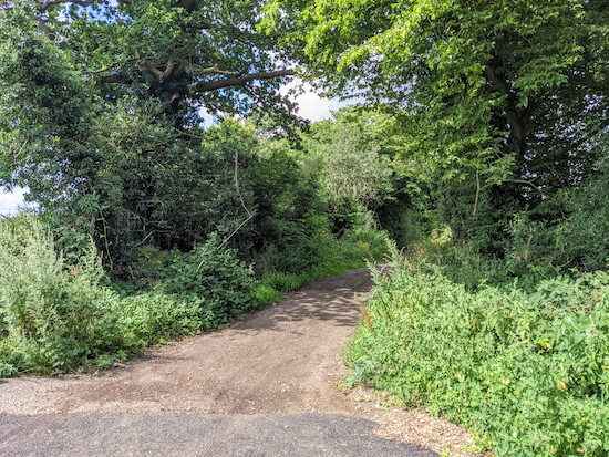 |
| St Paul's Walden UCR 1 heading WNW |
6: Turn right on St Paul's Walden UCR 1 (unclassed, unmetalled country road) then head WNW for 1.3 km to a junction (location -
https://w3w.co/earlobe.inflation.volume).
 |
| Turn left on St Paul's Walden restricted byway 19 |
7: Turn left on St Paul's Walden restricted byway 19. This byway was not signposted when we walked this route in August 2021, so please check the image above and What3Words location link. Head S on St Paul's Walden restricted byway 19 for 440m to a junction (location -
https://w3w.co/acid.empty.wishes) where the byway bends left then right at a fallen tree (an option for a picnic spot), see images below.
 |
| At the junction the byway bends left... |
 |
| ... then the byway bends right before heading SSE |
Continue heading SSE, still on St Paul's Walden restricted byway 19 for 860m until you reach a lane (location -
https://w3w.co/varieties.boats.gets).
8: Turn right on the lane then head SW for 230m looking for a footpath on the left (location -
https://w3w.co/help.blunt.minds).
 |
| St Paul's Walden footpath 20 heading S |
Turn left on St Paul's Walden footpath 20 then follow the footpath S across a paddock to a stile. Cross the stile then walk SE across another paddock for 350m heading to the left of a telegraph pole and continuing until you reach a gate in the woodland (location -
https://w3w.co/pays.comb.loser), see image below.
 |
| The gate into woodland on St Paul's Walden footpath 20 mentioned above |
Continue heading SE through Horsleys Wood until you reach a field. At this point the footpath you are on becomes Kimpton footpath 21. Continue heading SE 200m until you reach a junction with a path on the left (location -
https://w3w.co/sports.bucks.cafe), see image below.
 |
| Turn left on Kimpton footpath 22 |
9: Turn left on Kimpton footpath 22 then head NE for 430m until you reach the B651 (location -
https://w3w.co/reef.baking.fallen).
10: Turn right on the B651 then head S for 20m looking out for a footpath on the left (location -
https://w3w.co/jumped.client.author). Take this path, Kimpton footpath 23, then head E for 280m until the footpath cuts across the crop (location -
https://w3w.co/sunset.drives.belong), see image below.
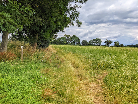 |
| Keep right, still on Kimpton footpath 23, then cross the crop to a junction |
Head ESE crossing a field, still on Kimpton footpath 23, for 210m until you reach a junction (location -
https://w3w.co/shack.tides.homes).
11: Turn left on St Paul's Walden footpath 30 (which is also Kimpton footpath 23 at this point), then head NNE for 150m to a gap in the hedge and a junction (location -
https://w3w.co/logic.rats.pigs), see image below.
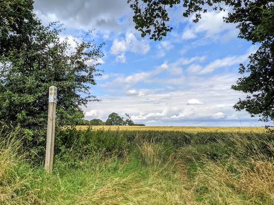 |
| Continue through the gap on Kimpton footpath 30 |
Go through the gap, then continue across a field, still on Kimpton footpath 30, then head NNE, for 660m until you reach a gap in the hedgerow (location -
https://w3w.co/formed.anyway.lines).
 |
| Follow Kimpton footpath 30 across the crop heading NNE |
Continue across another field, still on Kimpton footpath 30, now heading N, for 430m to a junction (location -
https://w3w.co/slams.shunts.goals), see image below.
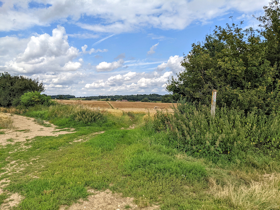 |
| Head N at N the junction, now on Kimpton footpath 27 |
12: Continue heading N, now on Kimpton footpath 27 for 230m until you reach a junction (location -
https://w3w.co/runs.toxic.focal), see image below.
 |
| Turn right at the junction on Kimpton footpath 32 then head NE |
13: Turn right at the junction on Kimpton footpath 32 then head NE for 140m until you reach the hedgerow and a junction (location -
https://w3w.co/figure.puns.souk). Turn left on Kimpton bridleway 34 then head NW for 20m until you reach a footpath on the right (location -
https://w3w.co/alert.tubes.tender), see image below.
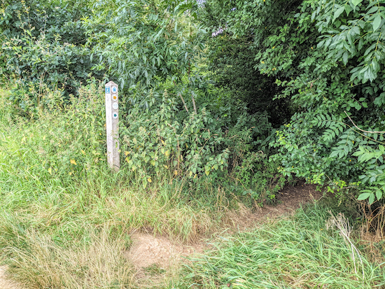 |
| Turn right, still on Kimpton footpath 32 then head NE |
14: Turn right on Kimpton footpath 32 then head NE for 210m back to High Street Kimpton where you turn left then head NW for 90m back to The Bull Inn at the start point (location -
https://w3w.co/leaps.pirate.polite).
Interactive map
GPX


Lovely quiet walk this morning with great views over open countryside- only 1 ploughed field with path not reinstated but wasn’t a problem as it wasn’t wet enough to stick to boots. Excellent gpx file to follow and pleasant variety of woods, tracks, fields and lanes with hardly any of it shared with traffic 👍 thanks as always
ReplyDeleteExcellent. Glad you enjoyed it and the the gpx was a help. David
DeleteA great walk with vast swathes of open countryside. Lovely tea and cakes at Emily's tea room. I park at St Paul's Walden church, sign says anyone can park there in daylight hours. Thanks for a great route .
ReplyDeleteHi Carolyn, great tip about the parking. Glad you enjoyed the walk. If you are not already a member please consider joining our friendly Hertfordshire Walker Facebook group where fellow walkers are sharing their tips and photos from the walks they have done. David
Deletehttps://www.facebook.com/groups/hertfordshirewalker
This is a beautiful route , lots of open spaces and lovely countryside . The big house on left after the first mile or so was the Queen Mum's, God bless her.
ReplyDeletePint in the Bull after was very welcome. The link in your notes David is for a different Bull - the one in Gosmore.
Thanks Mick, sorry about that. I have changed the link. Thanks for the feedback. Glad you enjoyed the walk. David
Delete