5.8 miles (9.4 km) with 138m of total ascent
 |
| St Paul's Walden UCR1 heading SW |
Fly through preview of walk
If you want to check what sort of landscape you will be crossing before you set off on this walk you can view a short 3D video of the route below. It's created using the free version of Relive.
Getting there
The nearest bus stops to the start of the walk are on Oxford Road (location - https://w3w.co/objective.though.slot) and Chappell Road (location - https://w3w.co/foot.differ.libraries) in Breachwood Green close to The Red Lion pub. That stop is served by the number 88. Alternatively, you could start the walk at The Green in Peter's Green (location - https://w3w.co/loved.assist.gallons) close to The Bright Star between points 9 & 10. That stop is served by the number 44. You can check the local bus schedule at Intalink.
Directions
GPX or KML files for this walk. We've added What3Words location references for those who use that system. If you print these walks you might want to use the green PrintFriendly icon at the bottom of these directions to delete elements such as photographs.
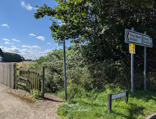
1: From the junction of Oxford Road, Pasture Lane, and Lower Road, in Breachwood Green, take the footpath on the E side of the junction to the right of the last house (location - https://w3w.co/across.toxic.juicy), see image below.
 |
| Kings Walden footpath 20 at the start of the walk |
2: Turn left on the lane then head NE for 15m looking for a footpath on the right (location - https://w3w.co/scare.ditched.snowy). Turn right on St Paul's Walden footpath 24, then head SE, NNE, then SE for 400m until you reach a junction (location - https://w3w.co/trace.bedrock.lads).
3: Ignore the footpath on the right and take the second turn on the right, a metalled track, which you follow S for 130m until you reach the last house on the left. At this point the track becomes unsurfaced and continues SW, S, then SE for 480m to a junction (location - https://w3w.co/reason.urgent.became), see image below.
 |
| At the junction turn right on St Paul's Walden UCR1 |
 |
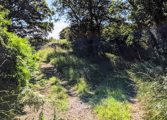
| St Paul's Walden UCR1 heading SW |
 |
| Kimpton footpath 54 heading WSW off Whitewaybottom Lane |
 |
| Turn left before the line of trees, still on Kimpton footpath 54 |
 |
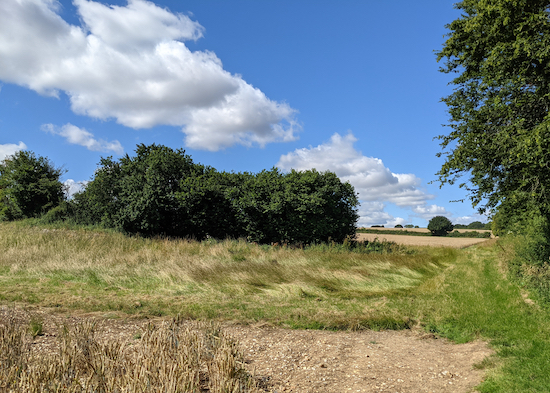
| Go through the gap then head SW across a field |
6: Turn left on the lane then head SE for 250m looking out for a footpath on the right (location - https://w3w.co/moss.decreased.cloud), see image below.
 |
| Turn right on Kimpton footpath 43 then head SW |
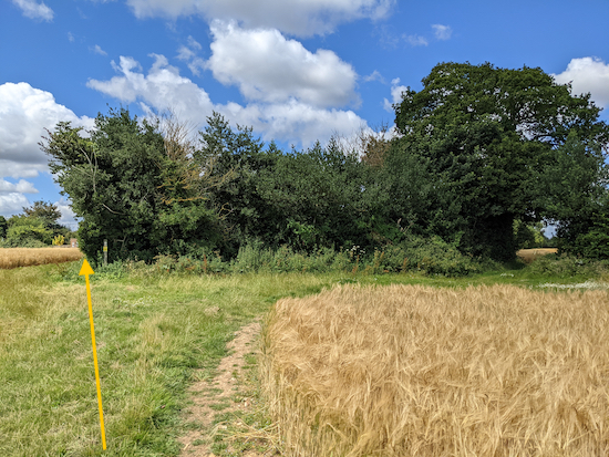
8: Turn right on Kimpton bridleway 51 then head W and WSW, with the hedgerow on the left and the field on the right for 870m, until you reach a junction (location - https://w3w.co/give.heavy.dock), see image below.
 |
| Stay on Kimpton bridleway 51 following the line of the yellow arrow |
9: Turn right on Kimpton Road then head WNW along Kimpton Road for 170m passing The Bright Star pub/restaurant on the left (location - https://w3w.co/return.useful.speaks), see image below.
 |
| The Bright Star |
10: Turn right on Lawrence End Road then follow it NE and N for 1.6km until you reach a lane (location - https://w3w.co/means.soft.donor). Lawrence End Road has a grass verge most of the length which will enable you to step out of the way if there is any traffic. We met two cyclists and one vehicle when we walked this stretch. In both cases we were able to step on the verge.
11: Turn left on the lane then head WNW for 95m looking out for a footpath on the right (location - https://w3w.co/fees.repair.refuse), see image below.
 |
| Kings Walden footpath 4 heading NE |
 |
| Kings Walden footpath 4 crossing the crop |
 |
| The gap in the hedge on Kings Walden footpath 4 - mentioned above |
12: Turn left on Pastures Lane then head NNE for 390m until you return to the starting point.
There is a pub, The Red Lion at the junction of Oxford Road and Chapel Road 240m from the start point (location - https://w3w.co/unsightly.regret.monk).


Did this walk yesterday and as you say in your description there are some great views all round and we hardly met a soul. It was a great day for sitting outside the Bright Star pub with a drink half way round the loop.
ReplyDeleteThanks again for another lovely walk - there cant be much of Hertfordshire left for you to cover!
:-) well we have about 10 more walks which I have mapped out and which need testing, so we should be fine up to about walk 165. After that it might get a bit tricky, but I have some ideas. We are keen to explore the countryside around Tring.
ReplyDeleteDavid
We look forward to all the new walks. There are some good walks round the reservoirs at Tring.
DeleteYes, we intend to add a few walks there, including the reservoirs. Thanks
DeleteDavid
But don't trust what the Red Lion's website says about opening hours. The ACTUAL opening hours (as shown on blackboard outside the pub) are:
ReplyDeleteMon-Thurs 14:00-21:00
Fri 12:00-23:00
Sat 12:00-23:00
Sun 12:00-22:00.
Thanks for the update.
ReplyDeleteFYI In Oxford Road , a few yards from the start of this walk there is a bus shelter where you can change into your boots in comfort, there are also books available!
ReplyDelete