5.7 miles (9.2 km) with 124m of total ascent
 |
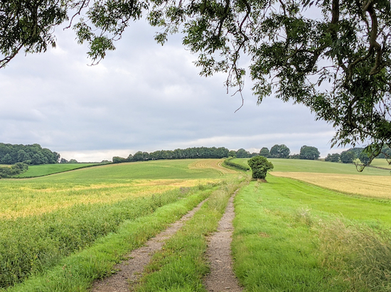
| The footpath between points 4 & 5 |
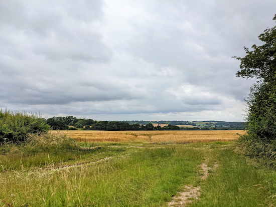
This is an excellent walk for those who want to stride out across rolling hills with some open views over the north-east Hertfordshire countryside. The walk starts in the village of Great Offley then heads west to Mangrove Green where you will find the King William IV pub/restaurant at the halfway point. The route then returns over fields and through woodland.
There is a fair amount of up and down involved, with narrow paths cutting through crops. We have added two detours to avoid a bull in a field and paths that had become too overgrown. Because of this there is a short stretch of lane walking, but the lane is quiet and there is a verge to avoid traffic.
Fly through preview of walk
If you want to check what sort of landscape you will be crossing before you set off on this walk you can view a short 3D video of the route below. It's created using the free version of
Relive.
Directions
 |
Map for Walk 151: Great Offley West Loop
Click on the map for a larger version
Created on Map Hub by Hertfordshire Walker
Elements © Thunderforest © OpenStreetMap contributors
There is an interactive map below the directions |
Those with GPS devices can download
GPX or
KML files for this walk. We've added
What3Words location references for those who use that system. If you print these walks you might want to use the green
PrintFriendly icon at the bottom of these directions to delete elements such as photographs.
 |
| The gate and footpath at the start of the walk |
1: From the small layby in Salisbury Lane, Great Offley (location -
https://w3w.co/repaid.liver.frown), take Offley footpath 12 (location -
https://w3w.co/became.pimples.pursue) then follow it uphill and across a field heading SSE for 250m to a gate (location -
https://w3w.co/carbonate.chucked.uniform), see image below.
 |
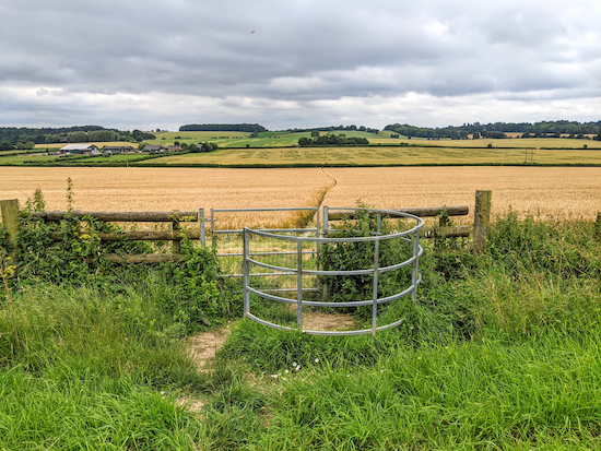
| The gate leading to Offley footpath 13 |
Go through the gate then turn right on Offley footpath 13 heading SW for 400m, at first with the hedgerow on the right and the field on the left until you pass through the hedgerow, see image below, then continue to a junction (location -
https://w3w.co/aliens.lived.kickers).
 |
| The gate on Offley footpath 13 |
2: Turn right at the junction then head W, still on Offley footpath 13, for 150m to another junction (location -
https://w3w.co/grandson.couch.resources), see image below.
 |
| Turn left at the junction, still on Offley footpath 13 |
Turn left then head S, still on Offley footpath 13, for 60m then head SW for 480m, with the woodland on your left and field on your right, until you enter woodland and head downhill for 30m to a metal gate (location -
https://w3w.co/sneezed.panels.sapping). There is a great view from this point.
 |
| The gate and view mentioned in point 2 |
3: Go through the gate then head SW downhill for 730m, still on Offley footpath 13, crossing three fields until you reach a lane called Lilley Bottom (location -
https://w3w.co/flood.form.baked).
 |
| Offley footpath 13 approaching Lilley Bottom, with footpath 44 opposite |
4: Cross the lane and continue heading SW, now on Offley footpath 44, heading SW for 1.3km until you reach a T-junction (location -
https://w3w.co/player.cheese.wakes). Turn right, still on Offley footpath 44, then head WNW for 50m to a junction (location -
https://w3w.co/garage.punks.soils), see image below.
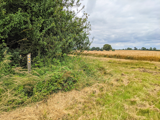
 |
| Turn left on Offley footpath 50 then head south with the hedgerow on the left |
5: Turn left on Offley footpath 50 and head S for 300m to Mangrove Green where you will find the
King William IV Inn the on left (location -
https://w3w.co/proof.glee.chop).
6: Continue heading S through Mangrove Green for 170m until you reach a footpath on the left at the point where the lane bends right (location -
https://w3w.co/bells.spell.vest). We suggest you ignore this footpath for the reasons set out below, and instead continue heading S on Mangrove Road for 240m to a junction (location -
https://w3w.co/desire.blame.last).
* When we took Offley footpath 25 there was a 'Bull In Field' sign that had been painted over. On the other side of the gate was a large black bull and a herd of cattle. We walked past them slowly and they ignored us. But others might prefer to avoid this footpath. The route set out below shows an alternative.
Also, after heading SE across the field with the bull and cows for 190m on Offley footpath 25 we reached a gate which we went through and turned left on Offley footpath 27 (location - https://w3w.co/highs.takes.move) then headed NE for 200m before reaching a footpath on right (location - https://w3w.co/sheets.driver.flash). Unfortunately this public right of way had not been reinstated after the crop had been sown, so we continued on Offley footpath 27 until it reached a second field where the path had not been reinstated.
Rather than push our way through the crops we decided to create the alternative route (below) and have reported the matter to the Hertfordshire County Council ROW (rights of way) team. See map below with our preferred route in orange and the detour to avoid the bull and walking through crops in green.
 |
The route we had hoped to take in orange - the detour along the lane in green
Map created on Map Hub by Hertfordshire Walker
Elements © Thunderforest © OpenStreetMap contributors
There is an interactive map below the directions |
7: When you reach the junction referred to in point 6 above, turn left on Chalk Hill (a quiet country lane when we walked it) then head NE for 730m to a bend where you will see a footpath on the right (location -
https://w3w.co/income.marked.thanks).
 |
| Offley footpath 7 heading off Chalk Hill |
8: Turn right on Offley footpath 7 heading first ESE with the hedgerow on the left and the field on the right before bending to the left through woodland and heading NE, ESE, and NE for 1km to lane called Lilley Bottom (location -
https://w3w.co/curve.rash.bubble).
9: Turn right on Lilley Bottom then head ESE for 350m looking out for footpath on left (location -
https://w3w.co/period.edit.dice).
 |
| Kings Walden footpath 38 heading NNE off Lilley Bottom |
10: Turn left on Kings Walden footpath 38 then head uphill and NNE for 140m until you reach a gate leading into Furzen Wood (location -
https://w3w.co/slips.served.sands). Walk through the wood, still on Kings Walden footpath 38 and still heading NNE, for 100m until you reach a T-junction (location -
https://w3w.co/invest.throw.quest).
11: Turn left, still on Kings Walden footpath 38, then head NW for 240m to a junction (location -
https://w3w.co/takes.finds.went).
12: Turn right down the left side (the northeast edge) of the field break, still on Kings Walden footpath 38, then head NE for 460m until the path reaches a field (location -
https://w3w.co/brief.slices.knee), see image below.
 |
| Kings Walden footpath 38 heading through the crop |
Kings Walden footpath 38 now crosses the crop, still heading NE, for 120m before reaching Judkin's Wood (location -
https://w3w.co/frock.quiet.levels). Turn right when you reach Judkin's Wood, still on Kings Walden footpath 38, then turn right heading ENE for 130m until you reach the end of the wood and a junction (location -
https://w3w.co/soft.dared.tight), see image below.
 |
| Turn left on Kings Walden footpath 39 |
13: Turn left on Kings Walden footpath 39 and head NNW for 290m, with the woodland on your left and the field on your right, until you reach the point where the footpath cuts across the crop (location -
https://w3w.co/busy.tried.duke).
 |
| Kings Walden footpath 39 heading NNE across the crop |
Take this path, still Kings Walden footpath 39, and head NNE for 120m across the crop until you reach a junction (location -
https://w3w.co/guidebook.signal.windy).
14: Continue, still on Kings Walden footpath 39, heading NNE with the woodland on your left and field on your right for 110m until the path goes through the crop (location -
https://w3w.co/braved.installs.donates), see image below and follow the line of the yellow arrow.
 |
| Kings Walden footpath 39 continue through the crop |
Follow the footpath through the crop for 200m until you reach Angel's Wood where the footpath becomes Offley footpath 24 (location -
https://w3w.co/donation.issue.eggshell).
* At this point we were hoping to take Offley footpath 12 to the right, but the path has not been reinstated since the crop was sown. Rather than force our way through and damage the crop, we chose to continue on Offley footpath 24. We have reported this blocked public right of way to the Hertfordshire County Council ROW team.
 |
The route we had hoped to take in orange - the detour in green
Map created on Map Hub by Hertfordshire Walker
Elements © Thunderforest © OpenStreetMap contributors
There is an interactive map below the directions |
15: Continue on Offley footpath 24 heading NE for 320m to the junction you passed at point 2 in these directions. Turn right on Offley footpath 13 then retrace your steps back to the starting point.
There are two pubs in Great Offley,
The Red Lion near the start/finish point (location -
https://w3w.co/abstracts.blink.minority) and
the Green Man at the other end of the village (location -
https://w3w.co/interrupt.coherent.florists).
The Dream Bean Cafe is a short distance by car from the start and finish point (location -
https://w3w.co/realm.ballparks.spit).
If you enjoyed this walk you might like to try another in the same area. It's
Walk 150: Great Offley East Loop.
We have a friendly
Hertfordshire Walker Facebook group where fellow-walkers are sharing their walking experiences and photographs. Come and join us.
Interactive map


No comments:
Post a Comment
Comments and feedback
If you try any of the walks on this site, please let us know what you thought of them by adding a comment here or on our members-only Facebook group. Comments here are checked before they are published. Comments on the Facebook group go live immediately.