5.6 miles (9km) with 93m of total ascent
 |
| Hertingfordbury footpath 1 between points 5 & 6 |
This walk includes elements from two earlier walks in this series that both share a 2-mile stretch of
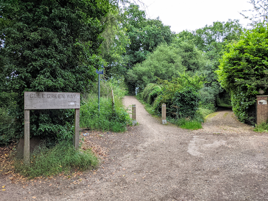
The Cole Green Way, a former branch line between Hertford and Welwyn Garden City which is now a long-distance recreational route. The other walks are
Walk 35: Letty Green Loop (3 miles) and
Walk 93: Grotto Wood Loop (4.3 miles). This walk, which is the longest of the three, follows a footpath and part of a bridleway which are not featured in the other walks and which were both ablaze with wild flowers when we tested the route in July.
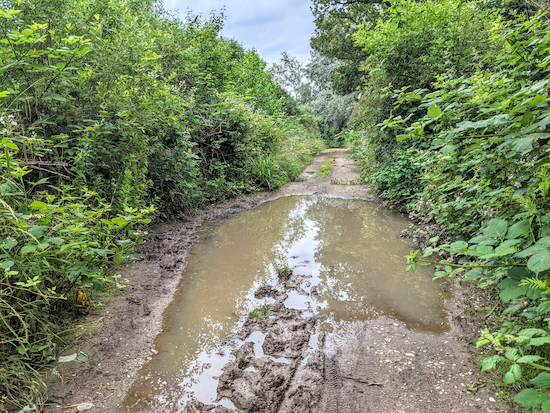
There is a section of lane walking, but the lane is quiet with plenty of space to stand to the side if vehicles approach. There is also one spot on one of the bridleways which was waterlogged when we did the walk, but we managed to get round the short stretch without a problem. Waterproof footwear is recommended.
In the summer, some of the footpaths, particularly between points 5 and 6, can be a bit overgrown, so you might want to pick up a stick to push back any nettles.
Fly through preview of walk
If you want to check what sort of landscape you will be crossing before you set off on this walk you can view a short 3D video of the route below. It's created using the free version of
Relive.
Directions
 |
Map for Walk 149: Cole Green Way Loop
Click on the map for a larger version
Created on Map Hub by Hertfordshire Walker
Elements © Thunderforest © OpenStreetMap contributors
There is an interactive map below the directions |
Those with GPS devices can download
GPX or
KML files for this walk. We've added
What3Words location references for those who use that system. If you print these walks you might want to use the green
PrintFriendly icon at the bottom of these directions to delete elements such as photographs.
Park in the small car park at the site of the former Cole Green Station off Station Road south of Cole Green (location -
https://w3w.co/debate.gladiators.atomic).
1: Standing on the former station platform and facing what would have been the track, turn right and walk along the platform to the western end then go down the ramp to reach The Cole Green Way (location -
https://w3w.co/fear.axed.loft).
 |
| Head W from the platform at the former Cole Green station |
2: Join The Cole Green Way and head W for 890m until you reach a track on your left heading uphill into woodland. This track is 40m
before a junction in the track and a tunnel under the A414 (location -
https://w3w.co/drain.harsh.woof), see image below.
 |
| Take the path on the left and head SW |
Follow this footpath SW through woodland for 160m until you reach a junction (location -
https://w3w.co/aims.stews.trunk). At the junction turn left on Hertingfordbury BOAT (byway open to all traffic) 22 (which is also known as Deadfield Lane). Head ESE then ENE for 840m until you reach Letty Green (location -
https://w3w.co/change.bunks.raves).
 |
| Hertingfordbury BOAT 22 heading ESE |
3: Turn right on Letty Green and head SSE for 90m looking out for a byway on the left (location -
https://w3w.co/fend.income.held). This is Hertingfordbury restricted byway 20. Follow this byway for 260m, first ESE then E until you reach Woolmers Lane (location -
https://w3w.co/dizzy.exit.cards).
 |
| The start of Hertingfordbury restricted byway 20 off Letty Green |
4: Turn right when you reach the lane and head SSE for 60m then follow the lane as it bends left and heads SE then ENE for 820m until you reach East End Green (location -
https://w3w.co/lifted.clever.novel).
5: Turn right at East End Green and head S looking out for Hertingfordbury footpath 1 which cuts between the houses (location -
https://w3w.co/muddy.insect.judge), see image below.
 |
| Hertingfordbury footpath 1 goes to the left of the house on the right |
Follow Hertingfordbury footpath 1 as it heads SSW then SSE for 800m until you reach a permissive footpath on the left just before wooden steps (location -
https://w3w.co/takes.regard.radar).
* This permissive path has been put in place to guide walkers away from the official public right of way which goes through a working quarry. We chose to ignore the permissive path because it was heavily overgrown with brambles and nettles. But if you want to take this permissive path turn left and rejoin the route 70m north of point 7 below (location - https://w3w.co/landed.grades.wages).
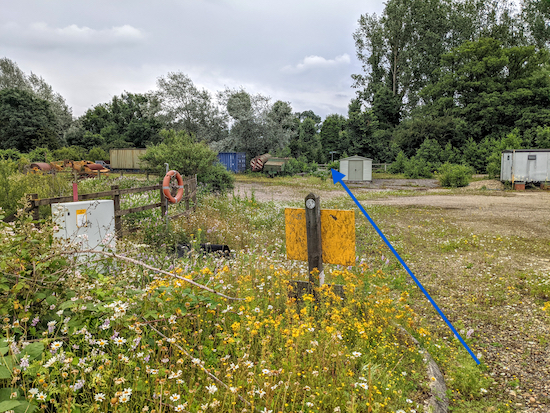
6: Continue heading SSE for 260m crossing a quarry track and eventually reaching a T-junction (location -
https://w3w.co/fool.herb.trunk).
 |
| Hertingfordbury footpath 1 crossing the quarry |
 |
| Cross the quarry track in the direction of the blue arrow |
 |
| Hertingfordbury bridleway 2 after the quarry where you turn left |
7: Turn left on Hertingfordbury bridleway 2 and head NE. After 120m we came across a small waterlogged section of the bridleway (location -
https://w3w.co/trades.luck.rots), see image below.
 |
| The puddle along Hertingfordbury bridleway 2 |
We were able to proceed by walking to the left of the water and holding onto a wooden fence for support. Continue for 630m until the bridleway bends to the left and then turns right (location -
https://w3w.co/finger.unwanted.each).
* At this point you could take a short detour to explore Grotto Wood which is a Baroque Garden listed by Historic England (location - https://w3w.co/struck.record.issue). The wood is 140m NW along Hertingfordbury footpath 3. If you do explore Grotto Wood take a stick to push back the nettles and brambles along the path.
8: If you don't take the detour, turn right, still on Hertingfordbury bridleway 2 and head NE for 900m at which point the bridleway becomes Hertford bridleway 57 and continues heading NE for 350m to St Mary's Lane (location -
https://w3w.co/copy.spring.pass).
 |
| Continue heading NE on Hertingfordbury bridleway 2 - point 8 |
9: Turn left on St Mary's Lane and head N for 150m until you reach a track on the right just before a railway bridge (location -
https://w3w.co/task.verge.values). Turn right before the bridge and take the track on the left up the embankment of the old branch line leading to The Cole Green Way (location -
https://w3w.co/manage.couches.credit), see image below.
 |
| Take the track up the embankment to join The Cole Green Way |
10: Turn left on The Cole Green Way and head SW then WSW for 1.3km until the track crosses a lane called Staines Green (location -
https://w3w.co/raft.digits.leaves).
 |
| The Cole Green Way heading W |
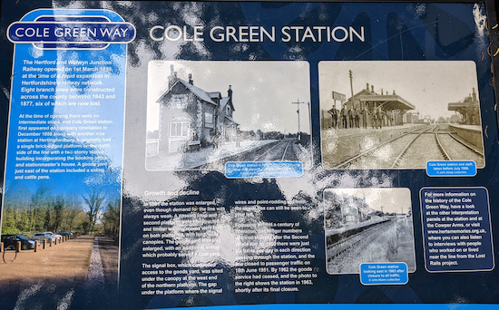
11: Cross Staines Green and rejoin The Cole Green Way heading W for 1.4km back to the start point. When you return to the starting point you might want to read the information boards alongside the track beneath the platform. Sadly, one of them has been vandalised. Pity.
 |
| The approach to Cole Green station with the platform on the right |
If you want refreshments after your walk
The Cowper Arms is a 150m W of the car park.
Interactive map


I decided not to visit Grotto Wood on this walk but will do the Grotto Wood loop another time
ReplyDeleteIt will probably be very overgrown at this time of the year.
Delete