6.2 miles (10.1 km) with 137m of total ascent
 |
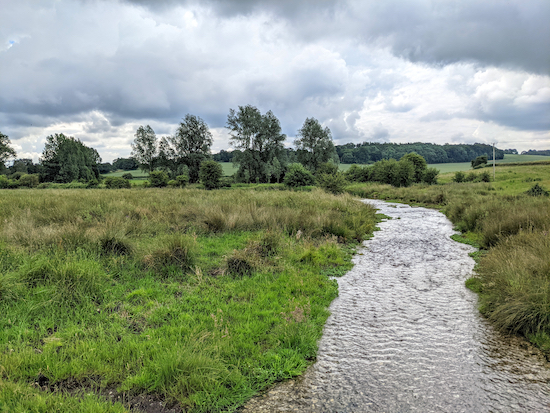
| The footbridge over the River Gade between points 7 & 8 |
This walk has a pleasant mix of some great tree-lined byways as well as footpaths that cross fields which, when we visited in July, were ablaze with wild flowers. The walk starts in Jockey End where there are parking options along Gaddesden Row, please check that parking restrictions haven't been introduced since this walk was published. You will cross the River Gade twice.
The
Coffee Haven cafe is a short detour from point 11 in the walk. There are no pubs on the route, but
The Crown & Sceptre in Briden's Camp and
The Red Lion at Water End are close by.
Fly through preview of walk
If you want to check what sort of landscape you will be crossing before you set off on this walk you can view a short 3D video of the route below. It's created using the free version of
Relive.
Directions
 |
Map for Walk 148: Jockey End South Loop
Click on the map for a larger version
Created on Map Hub by Hertfordshire Walker
Elements © Thunderforest © OpenStreetMap contributors
There is an interactive map below these directions |
Those with GPS devices can download
GPX or
KML files for the walk. We've added
What3Words references for those who use that system. If you print these walks you might want to use the green
PrintFriendly icon at the bottom of these directions to delete elements.
1: Walk SE along Gaddesden Row in Jockey End until you reach a footpath on the left immediately after the last house on the left (location -
https://w3w.co/numeral.thinnest.play). Turn left and head NNE on Great Gaddesden footpath 9 for 320m until you reach a gap in the hedgerow leading to a junction (location -
https://w3w.co/casino.leopard.ruling).
2: Turn right on Great Gaddesden BOAT (byway open to all traffic) 73, which is also known as Dean Lane, then head E for 630m until you reach a lane (location -
https://w3w.co/deluded.fidgeting.stone).
3: Cross the lane then head SSE on Flamstead restricted byway 57 for 960m until you reach a junction (location -
https://w3w.co/dried.lunges.urgent).
 |
| Flamstead restricted byway 57 - point 3 |
4: At the junction keep right then head SW on Great Gaddesden restricted byway 82, which along this stretch is part of
The Chiltern Way, (see image below). Continue for 320m until you reach Gaddesden Row (location -
https://w3w.co/bonfires.tensions.issues).
 |
| Keep heading SW on Great Gaddesden restricted byway 82 |
Cross Gaddesden Row and head SW down Great Gaddesden footpath 23, which at this point is also a metalled lane (see image below).
 |
| Great Gaddesden footpath 23 heading SW off Gaddesden Row - point 4 |
Continue down Great Gaddesden footpath 23 for 200m until you reach a gate (location -
https://w3w.co/obey.users.budgeted), see image below. Don't go through the gate.
 |
| Turn left before the gate on Great Gaddesden footpath 23 and head SE |
When you reach the gate turn left, still on Great Gaddesden footpath 23, and head SE for 140m with the hedgerow on the right and the field on the left until the path bends to the right through the hedgerow (location -
https://w3w.co/uniform.speedily.jiffy) and then heads SW for 320m to a junction (location -
https://w3w.co/happily.surgical.strongman).
 |
| Great Gaddesden footpath 23 heading SW along The Chiltern Way |
5: At the junction bear right and head SW, still on Great Gaddesden footpath 23 which is still part of The Chiltern Way at this point. Continue for 760m until Great Gaddesden footpath 23 goes off to the right of the track you are on and through woodland (location -
https://w3w.co/arming.enough.subway), see image below.
 |
| Great Gaddesden footpath 23 entering woodland - point 5 |
6: Continue through the woodland on Great Gaddesden footpath 23 for 400m. You will cross a track (location -
https://w3w.co/spectacle.renews.dugouts) before leaving the woodland and reaching a field (location -
https://w3w.co/unfounded.stuck.stalemate).
7: Head SW and downhill for 280m until you reach a telegraph pole on the left at which point the path you are on becomes Great Gaddesden footpath 18. Continue heading SW then S for 190m until you reach a gate on your left (location -
https://w3w.co/shack.sleeps.couple), see image below.
 |
| The gate mentioned in points 7 & 8 |
8: Go through the gate and walk uphill with the fence on your right and the field on your left for 100m until you reach a gate on your right (location -
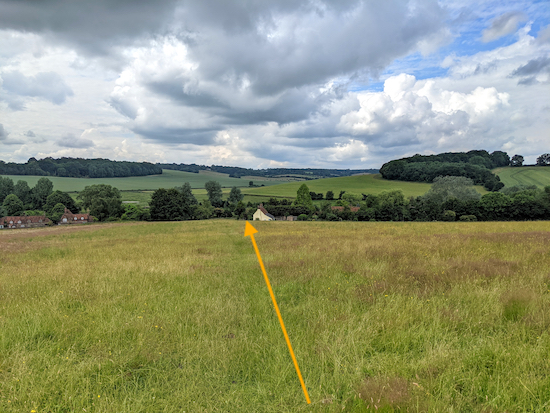
https://w3w.co/lungs.arena.translated). Turn right on Great Gaddesden footpath 21 and follow it for 640m heading SW and downhill, first with the hedge on your left and the field on your right. Go through a gate and continue heading SW to another gate in the fence on your left. Go through this gate and continue downhill and through a small copse, then across a field heading to the left of a cottage painted cream (see image below). Continue downhill until you reach Leighton Buzzard Road (location -
https://w3w.co/actual.chained.others).
 |
| Follow the footpath downhill heading to the left of the cottage - point 8 |
9: Cross Leighton Buzzard Road and then turn right and head NW for 10m looking for a footpath between cottages on the left. Take this path, Great Gaddesden footpath 66, and head W for 90m until you reach a footbridge crossing the River Gade (location -
https://w3w.co/moons.define.fast), see image at the top of these directions. This is a good spot to stop and look out for herons and white egrets.
 |
| When crossing the River Gade look out for egrets and herons |
Cross the footbridge and continue heading WNW, now on Great Gaddesden footpath 67, for 170m to a junction (location -
https://w3w.co/stack.punks.during).
10: Turn right on Great Gaddesden footpath 68 and head NNW for 530m until you reach Piper's Hill in Great Gaddesden (location -
https://w3w.co/units.discrepancy.love).
* The final stretch of this footpath, from (location - https://w3w.co/amused.hills.sober) to (location - https://w3w.co/chains.looked.prop) can be overgrown with nettles and, because we were both walking in shorts we got stung. So pick up a stick to push back the nettles and a handful of dock leaves before you venture down this stretch.
11: Cross Piper's Hill, turn right then head NE for 15m until you reach Church Meadow on the left.
* The Coffee Haven cafe (location - https://w3w.co/harps.snowboard.chariots), which is part of the Hemel Hempstead Garden Centre, is a 215m detour NE along Pipers Hill from point 11.
Turn left on Church Meadow then follow it NNW for 230m to a play area with a footpath on the right (location -
https://w3w.co/pickle.slamming.deploying).
* Church Meadow could be an alternative parking option if you find it difficult to park at Jockey End at the start of the walk. We didn't notice any parking restrictions, but please do check in case some have been introduced since this walk was published.
 |
| Great Gaddesden footpath 2 heading NE off Church Meadow |
12: Turn right on Great Gaddesden footpath 2 and head NE for 180m until you reach a boardwalk crossing the River Gade (location -
https://w3w.co/medium.petulant.bespoke). After crossing the river head E, still on Great Gaddesden footpath 2 and continue until you reach Dagnall Road (location -
https://w3w.co/whirlwind.revolts.should).
13: Cross Dagnall Road and follow Great Gaddesden footpath 4 NE for 130m before it bends to the left and heads N for 270m, first with the hedgerow on the right and the field on the left and then across a field and through the crop until you reach Hoo Wood.
* At this point there is a well-placed bench affording a great view over the valley of the River Gade.
14: Enter Hoo Wood and immediately take the left-hand fork at a junction just inside the woodland. This is still Great Gaddesden footpath 4 which you follow through a clearing. When we were there the area was covered in foxgloves and other wild flowers. We both agreed that this section of Great Gaddesden footpath 4 is one of our favourite stretches. Continue heading N through Hoo Wood for 750m until you reach a gate (location -
https://w3w.co/models.bronzed.unframed).
 |
| Great Gaddesden footpath 4 going through Hoo Wood |
 |
| Foxgloves in Hoo Wood |
15: Go through the gate and head downhill, still on Great Gaddesden footpath 4, until you reach Bradden Lane (location -
https://w3w.co/depended.delusions.haggling).
 |
| The charming Great Gaddesden footpath 4 leaving Hoo Wood |
Turn right on Bradden Lane and head NE and uphill for 250m until you reach Great Gaddesden restricted byway 14 on the right (location -
https://w3w.co/binds.mixers.united).
 |
| Great Gaddesden restricted byway 14 leaving Bradden Lane - point 15 |
16: Turn right and follow Great Gaddesden restricted byway 14 SE for 560m ignoring paths to your left and right and continuing until you reach a T-junction (location -
https://w3w.co/incurring.lawfully.homes).
17: Turn left, still on Great Gaddesden restricted byway 14, and head NE for 55m to a junction. Ignore the turn on your right and continue heading NE, now on Great Gaddesden footpath 13, crossing two fields to a gate (location -
https://w3w.co/overhear.export.stable).
 |
| Great Gaddesden footpath 13 heading across the crop - point 17 |
18: Immediately after the gate take the right-hand fork (location -
https://w3w.co/indicated.unlisted.tabloid), which is still Great Gaddesden footpath 13, and follow it NNE for 430m eventually passing allotments on the left before emerging on Gaddesden Row.
 |
| Take the right fork after the gate to continue on Great Gaddesden footpath 13 |
19: Turn left on Gaddesden Row and head WNW for 130m back to the starting point.
Interactive map


Did this walk on Sunday and the foxgloves were gorgeous. That certainly is a lovely footpath through Hoo Wood.
ReplyDeleteHi,
ReplyDeleteWe absolutely agree. The footpath through Hoo Wood is wonderful. Glad you enjoyed it.
David
The bluebell-filled woodlands for much of the route make this the perfect time to undertake this excellent walk
ReplyDeleteGood to know, I will pass on the tip via our Facebook page. Thanks.
DeleteDavid
I have shared your comment on our Facebook page. Thanks for the tip. https://www.facebook.com/hertfordshirewalker/posts/418761916915589
DeleteHi Guys
ReplyDeleteI’ve tried to walk this route twice and both times I was unable to pick up a signal
So be aware
Hi, we had a signal when we first mapped and tested the route. Perhaps it's a problem with your network. However you can still follow the route successfully by downloading the route to your mobile phone and following it by reading the directions step-by-step. If you have a map and compass that will also help you. I write the directions catering for all walking preferences - many of our followers managing to follow the routes without the sat nav. I hope this helps.
DeleteIf you haven't already done so please consider joining our friendly Facebook group where fellow walkers are sharing their walking experiences and photographs. David
https://www.facebook.com/groups/hertfordshirewalker