4.5 miles (7.3km) with 111m of total ascent
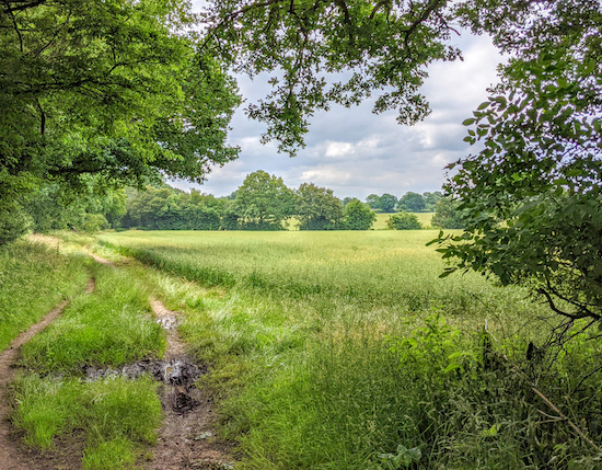 |
| Kings Walden restricted byway 36 between points 3 & 4 |
We really enjoyed this walk because it goes through some attractive, rolling countryside, and the bridleways, byways and footpaths are all well maintained and easy to follow. We particularly enjoyed bridleway 6 between points 5 & 6, and bridleway 14 between points 7 & 8. There are two pubs in the village of Great Offley, one at the start/finish point, the other 550m NW.
Fly through preview of walk
If you want to check what sort of landscape you will be crossing before you set off on this walk you can view a short 3D video of the route below. It's created using the free version of
Relive.
Directions
 |
Map for Walk 150: Great Offley East Loop
Click on the map for a larger version
Created on Map Hub by Hertfordshire Walker
Elements © Thunderforest © OpenStreetMap contributors
There is an interactive map below the directions |
Those with GPS devices can download
GPX or
KML files for this walk. We've added
What3Words location references for those who use that system. If you print these walks you might want to use the green
PrintFriendly icon at the bottom of these directions to delete elements such as photographs.
1: Facing
The Red Lion in Great Offley (location -
https://w3w.co/abstracts.blink.minority) turn left then head SE along Harris Lane (which is also Offley URC1 - unmetalled, unclassed country road) for 350m to a junction (location -
https://w3w.co/resides.exactly.newsreel), see image below.
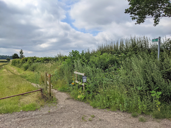 |
| The start of Offley bridleway 22 heading SE |
2: Keep right and continue heading SE, now on Offley bridleway 22, for 890m until you reach woodland and a metal gate (location -
https://w3w.co/troubled.smallest.sundial). Go through the gate and head diagonally SSE across the field for 230m to another metal gate (location -
https://w3w.co/teachers.lines.motorist), see the line of the yellow arrow in the image below.
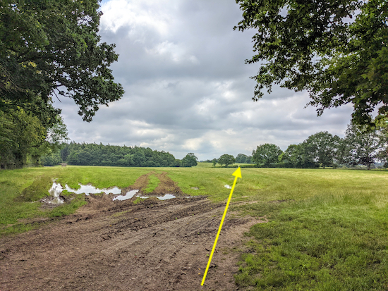 |
| Follow the line of the yellow arrow across the field - point 2 |
Go through this gate and turn left heading SE for 140m with the hedgerow on the left and field on the right until you reach West Wood on the left (location -
https://w3w.co/hides.called.stared).
3: At this point the track you are on becomes Kings Walden restricted byway 36 which you follow for 540m to a junction on your left (location -
https://w3w.co/qualified.envy.daffodils), see image below.
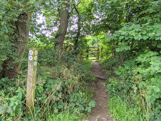 |
| The junction where Kings Walden footpath 27 heads NE |
4: Turn left on Kings Walden footpath 27 and head NE with the hedgerow on the right and the field on your left for 230m until you reach woodland at a gate. Soon after entering the woodland you come to a junction (location -
https://w3w.co/headline.beginning.mull) where you go through a gate then keep left and continue heading NE, now on Preston footpath 7, for 250m with the woodland on the left and field on the right until Preston bridleway 6 joins from the right (location -
https://w3w.co/healers.overlaid.alleyway).
5: At this junction keep left, now on Preston bridleway 6, and head N with the woodland on the left and the field on your right for 310m until the path dips to the left through woodland then heads NNE then NE for 700m to a junction (location -
https://w3w.co/chart.acids.sobered).
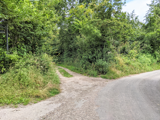 |
| Preston UCR2 heading N - point 5 |
6: Turn left at the junction on Preston UCR2 and head N for 790m to a junction (location -
https://w3w.co/wept.housework.unloaded).
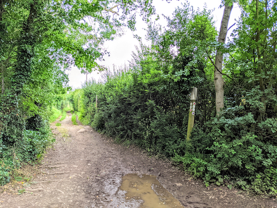 |
| Hitchin BOAT 28 heading NNW |
At the junction continue straight ahead now on Hitchin BOAT 28 (byway open to all traffic) for 380m heading NNW to a junction (location -
https://w3w.co/summit.glows.natural).
 |
| Turn left on Offley bridleway 14 and head WSW |
7: Turn left on Offley bridleway 14 and head WSW for 680m before the track swings to the left and heads SW for 360m to a right-hand bend (location -
https://w3w.co/grub.folds.crib).
 |
| Offley footpath 14 heading SW |
8: Turn right on Offley footpath 14 and head first WNW for 100m before the track swings to the left and heads SW for 310m to a gate leading to a gravel track (location -
https://w3w.co/depend.nobody.intruded), see image below.
 |
| Cross the gravel track and head WSW uphill |
9: Go through the gate and cross the gravel track heading WSW and uphill (in the direction of the yellow arrow in the image above). Continue, still on Offley footpath 14, for 490m, with the woodland on the left and the field on the right, until you reach the top of the hill.
10: Go through a gate and continue, still on Offley footpath 14, heading WSW for 560m back to Kings Walden Road, Great Offley.
There is a second pub in Great Offley, the
Green Man, which is 550m NW from the start/finish point.
The Dream Bean Cafe is a short distance by car from the start and finish point (location -
https://w3w.co/realm.ballparks.spit).
If you enjoyed this walk you might like to try another in this area. It's
Walk 151: Great Offley West Loop.
We have a friendly
Hertfordshire Walker Facebook group where fellow-walkers are sharing their walking experiences and photographs. Come and join us.
Interactive map


No comments:
Post a Comment
Comments and feedback
If you try any of the walks on this site, please let us know what you thought of them by adding a comment here or on our members-only Facebook group. Comments here are checked before they are published. Comments on the Facebook group go live immediately.