3.8 miles (6.2 km) with 113m of total ascent
 |
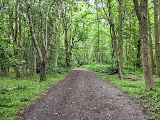
| The view looking back along Harpenden Rural bridleway 1 |
This is a short walk around Rothamsted Park, Harpenden. It includes a permissive route called the Manor Walk which goes through woodland with large redwood trees and passes Rothamsted Manor and various fields
being used for agricultural research. If you are driving, there is a
pay-and-display car park on Amenbury Lane at the start and finish point. If you are travelling by train,
Harpenden station is 440m E from the starting point.
Fly through preview of walk
If you want to check what sort of landscape you will be crossing before you set off on this walk you can view a short 3D video of the route below. It's created using the free version of
Relive.
Directions
 |
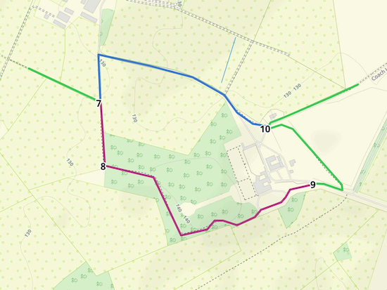
Map for Walk 145: Rothamsted Park Loop
Click on the map for a larger version
Created on Map Hub by Hertfordshire Walker
Elements © Thunderforest © OpenStreetMap contributors
There is an interactive map below these directions |
Those with GPS devices can download
GPX or
KML files for the walk. We've added
What3Words references for those who use that system. If you print these walks you might want to use the green
PrintFriendly icon at the bottom of these directions to delete elements.
1: From Amenbury Lane car park (location -
https://w3w.co/feared.eaten.bring) turn left and head W along Amenbury Lane for 230m until you reach a right-hand bend with Harpenden footpath 13 on the left (location -
https://w3w.co/wells.undulation.chins), see image below.
 |
| Harpenden footpath 13 heading W off Amenbury Lane - point 1 |
2: Follow this footpath W as it weaves its way behind houses on the right and with playing fields on the left for 800m until the path leaves the playing fields (location -
https://w3w.co/vent.opera.posed), see image below. This path is also part of the Rothamsted Park Trail.
 |
| Harpenden footpath 13 leaving the playing fields |
3: Continue on Harpenden footpath 13 heading NW, W, then NW for 390m until the footpath heads W. Follow Harpenden footpath 13 with the hedgerow on the left and the field on the right for 430m until you reach a junction (location -
https://w3w.co/hails.early.sung), see image below.
 |
| The junction on the left leading to Harpenden Rural footpath 11 - point 3 |
4: Turn left on Harpenden Rural footpath 11 and head S for 30m before turning right, still on Harpenden Rural footpath 11 (see image below), and head SW for 380m until you reach
The Nickey Line (location -
https://w3w.co/gangs.dozed.admits). The Nickey Line footpath and cycle way is
the former Harpenden to Hemel Hempstead railway line and is approximately seven miles long.
 |
| Harpenden Rural footpath 11 heading SW towards The Nickey Line |
* When you reach The Nickey Line you could take a short cut by heading SSE along route of the former railway line for 430m to rejoin between points 6 & point 7, but, if you do, you will miss a short section of shaded woodland which, when we did this walk, was rich in birdsong.
5: Cross The Nickey Line, still on Harpenden Rural footpath 11, and head W for 50m until you reach a golf course on the right. Here the path goes through woodland (location -
https://w3w.co/trim.trail.poet) and continues W, SSW, W, and SW to a junction (location -
https://w3w.co/sweep.fills.slurs). This section is also
The Chiltern Way.
6: Turn left on Harpenden Rural bridleway 1, see image below, and head ESE and uphill for 280m until you reach The Nickey Line again (location -
https://w3w.co/cheer.terms.photo).
 |
| Harpenden Rural bridleway 1 heading ESE and uphill |
Cross The Nickey Line and continue for 240m until Harpenden Rural bridleway 1 bends left and heads NE (location -
https://w3w.co/drum.double.given). Continue heading NE on Harpenden Rural bridleway 1 for 60m before the bridleway turns right and heads SE for 400m to a junction (location -
https://w3w.co/laptop.cove.atoms).
 |
| The junction where Harpenden Rural bridleway 1 meets the permissive path |
* Here you have two choices (we recommend taking the first option having walked both).
1) If open, you can take a permissive route called the Manor Walk, marked in purple on the map below, which, in our opinion is far more interesting because it goes through the grounds of Rothamsted Manor and through woodland with large redwood trees and information boards about the work carried on at the research establishment.
2) You can continue on the public right of way, Harpenden Rural bridleway 1, marked in blue on the map below, and head N for 130m before turning right (location - https://w3w.co/riding.chefs.below) and then heading ESE for 510m to a left turn (location - https://w3w.co/silk.sound.hurray) and rejoin the route at point 10.
 |
The permissive route - the Manor Way - in purple
Created on Map Hub by Hertfordshire Walker
Elements © Thunderforest © OpenStreetMap contributors
|
 |
| The official sign inviting walkers to use the Manor Walk |
7: Turn right on the permissive route, the Manor Walk, and head S for 180m until you reach a left turn heading into the woodland (location -
https://w3w.co/listed.stuff.invent).
 |
| The permissive path heading through Rothamsted Manor woodland |
8: Turn left here and follow the path, still the Manor Walk, as it weaves through woodland, and follow the path past information boards and redwood trees, before passing Rothamsted Manor on the left and continuing until you reach a lane (location -
https://w3w.co/afford.manliness.haven).
 |
| Rothamsted Manor |
 |
| Information board at Rothamsted Manor |
 |
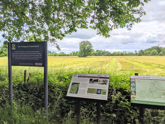
| One of the many information boards in Rothamsted Park |
 |
Information boards alongside Harpenden Rural bridleway 1
|
9: Turn right on the lane and head E for 85m until you reach a bridleway on the left. Take this bridleway, Harpenden Rural bridleway 2, and head NW for 280m to a junction (location -
https://w3w.co/mile.loops.link).
 |
| Harpenden Rural bridleway 2 heading NW |
10: Turn right on Harpenden Rural bridleway 1 and head NE for 650m to a junction (location -
https://w3w.co/cheese.deputy.when).
11: Turn left at the junction and continue heading NE, now on Harpenden footpath 12 and head NE along a tree-lined metalled track for 340m until you reach a left turn (location -
https://w3w.co/agreed.title.caller).
12: Turn left just after passing the leisure centre on your left and head N, still on Harpenden footpath 12, for 220m back to the car park.
There are many places to eat and drink close to the start and finish point, and several pubs in Harpenden, but we have listed the four closest pubs. They are
The Oddfellow Arms, the
Inn On The Green,
The Harpenden Arms, and
The George of Harpenden.
Interactive map


26/06/21: You can no longer walk 7, 8, 9: the permissive path has been closed. From 7, turn left and then right and go directly to 10.
ReplyDeleteThanks for the update. The permissive path was open two days ago when we walked this route (on Thursday 24 June). We have included the alternative route you mentioned. Is there a sign saying the permissive path is closed and, if so,for how long?
ReplyDeleteDavid
Did this walk yesterday and the permissive path was open. Lovely walk in an area we havent been before.
ReplyDeleteYes, a nice walk. I have just heard back from Rothampsted (who I contacted after receiving the comment from Anonymous on Saturday 26 June), and they replied...
Delete"As far as we know the permissive path remains open, but we will check with the Lawes Agricultural Trust who manage the estate. As you may be aware, the Manor regularly hosts events which may restrict access from time to time, but these do not normally impinge on footpath access."
David
An update from Rothamsted: "We have followed up with our estate team and there has been some work on the trees along that path which has necessitated its closure for short periods. However it remains a permissive footpath that the public may use."
ReplyDeleteDavid