5.7 miles (9.1 km) with 96m of total ascent
 |
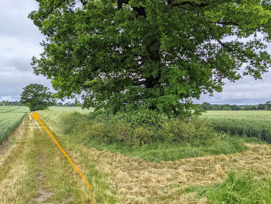
| The view from Widford footpath 8 just before point 10 |
This walk explores the countryside north of Hunsdon and includes sections from two other walks in this series. They are
Walk 96: Hunsdon West Loop (points 11 to the end), and
Walk 105: Hunsdon East Loop, (points 1 to 3). As with the other walks, this route starts in the village of Hunsdon where there are two pubs,
The Crown and
The Fox & Hounds.
Fly through preview of walk
If you want to check what sort of landscape you will be crossing before you set off on this walk you can view a short 3D video of the route below. It's created using the free version of
Relive.
Directions
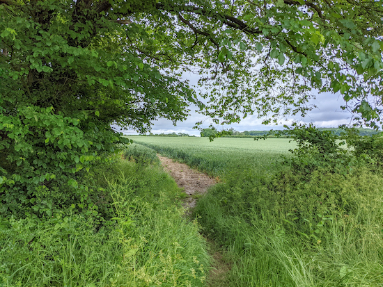
When we did this walk in June 2021 a day after heavy rain, the paths through crops between points 2 & 6 and then between points 11 & 12 were muddy with thick clay which stuck to the boots making walking slow. At other times of the year the paths will be probably be rock hard and rutted.
There is also a short section, immediately after point 2 when the route enters Black Hut Wood, where the footpath was overgrown in places, so long trousers and a stick to push away nettles would be worth considering at certain times of the year.
 |
Map for Walk 144: Hunsdon North Loop
Click on the map for a larger version
Created on Map Hub by Hertfordshire Walker
Elements © Thunderforest © OpenStreetMap contributors
There is an interactive map below these directions |
Those with GPS devices can download
GPX or
KML files for the walk. We've added
What3Words references for those who use that system. If you print these walks you might want to use the green
PrintFriendly icon at the bottom of these directions to delete elements.
 |
| The start of Hunsdon footpath 17 - point 1 |
1: Head NE along Drury Lane (location -
https://w3w.co/hobby.remark.send) for 270m until you reach Hunsdon footpath 17 (location -
https://w3w.co/output.elaborate.emerge). Continue along this footpath heading NE for 680m to a junction just before you reach Black Hut Wood (location -
https://w3w.co/boxing.digits.fries).
 |
| Hunsdon footpath 22 heading into Black Hut Wood |
2: Head E through Black Hut Wood on Hunsdon footpath 22 which later becomes Eastwick and Gilston footpath 3. This section of the route was fairly overgrown when we did this walk. Long trousers and a stick to push back the nettles would be useful. Soon after entering Black Hut Wood you will notice a
WWII pill box on your right (location -
https://w3w.co/much.known.trash). Continue for 560m until you leave the woodland and reach a concrete track (location -
https://w3w.co/juices.sling.ritual).
 |
| The WWII pillbox in Black Hut Wood |
Turn left on this concrete track and head NNE for 15m before turning right (location -
https://w3w.co/salad.trout.manliness) and heading ESE, still on Eastwick and Gilston footpath 3, for 80m with the woodland on your right and the field on your left (see image below) until you come to the end of the woodland (location -
https://w3w.co/stale.brands.chefs).
 |
| Eastwick and Gilston footpath 3 heading ESE |
Here is where it gets muddy after heavy rain. Continue heading ESE, still on Eastwick and Gilston footpath 3, but now across the crop for 140m until you reach a crossing in the middle of the field, (location -
https://w3w.co/look.goals.loved), see image below.
 |
| Continue ESE on footpath 3 to a crossing in the middle of the field - point 2 |
3: Turn left on Hunsdon bridleway 19, which is also Eastwick and Gilston bridleway 2 at this point, and head NNW for 290m before following the bridleway to the right and heading NE for 110m to a junction (location -
https://w3w.co/liability.themes.farm), see image below.
 |
Turn left on Hunsdon footpath 18 - point 4
|
4: Turn left on Hunsdon footpath 18 and head N for 360m across a field to a junction (location -
https://w3w.co/shovels.folds.handle).
 |
| At the junction head NW on Widford footpath 6 - point 5 |
5: Head NW on Widford footpath 6 for 190m (see yellow arrow above) until you reach a footpath crossing and a footbridge (location -
https://w3w.co/banana.horns.ample), see image below. Cross the footbridge and head NNW for 200m until you reach a T-junction (location -
https://w3w.co/handed.settle.rails).
 |
| The footbridge mentioned in point 5 |
6: Turn left and head WNW for 160m until you reach a junction (location -
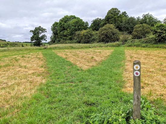
https://w3w.co/just.hulk.lace) where Widford footpath 6 goes off to the right and crosses the crop, but a permissive path points walkers to continue heading WNW for 220m before the permissive path bends right (location -
https://w3w.co/exam.clay.double) and heads N for 240m to rejoin Widford footpath 6 (location -
https://w3w.co/caller.nature.scope), see map and photograph below.
 |
Right of way in blue, permissive path diversion in green
Created on Map Hub by Hertfordshire Walker
Elements © Thunderforest © OpenStreetMap contributors |
 |
| The permissive path, marked with a yellow arrow - point 6 |
Continue heading N on Widford footpath 6 for 140m before it turns left and heads NW through woodland, see image below (location -
https://w3w.co/sunset.tennis.clouds). Continue for 90m until you reach Nether Street (location -
https://w3w.co/loaded.spine.fleet).
 |
| Widford footpath 6 heading NW through woodland - point 6 |
7: Turn left on Nether Street and head W for 300m. Ignore the first footpath on the left but take the second on left (location -
https://w3w.co/washed.sits.season), see image below.
 |
| Widford footpath 8 heading WSW off Nether Street |
8: Turn left on Widford footpath 8, and climb a hill first heading WSW then WNW for 240m before reaching High Street, Widford (location -
https://w3w.co/kinks.muddy.zones). Turn left on High Street and head SSW for 90m until you reach a footpath on the right (location -
https://w3w.co/pardon.feel.insect).
9: Turn right on Widford footpath 18 and head NW for 75m before the path bends to the right alongside a metal fence for 40m before reaching Benningfield Road (location -
https://w3w.co/leans.retire.paying). Turn left on Benningfield Road and head WSW for 20m before taking a footpath on the right between houses (location -
https://w3w.co/intelligible.wiser.sound). Head NW, still on Widford footpath 18, for 320m until the path forks (location -
https://w3w.co/scare.desire.basin), see image below.
 |
| Take the left fork and head WNW for 90m - point 10 |
10: Widford footpath 18 continues straight, but we found that path to be impassable with deep mud 80m further on so we returned to the fork and took the left fork heading WNW for 90m before turning right at a junction (location -
https://w3w.co/loud.nodded.remit) and heading NNE on Widford bridleway 16 for 50m to another footpath junction (location -
https://w3w.co/hero.crass.tapes) where we rejoined Widford footpath 18, see detour map below where blue is the official route and green the diversion.
 |
Detour to avoid flooded section between points 10 and 11
Created on Map Hub by Hertfordshire Walker
Elements © Thunderforest © OpenStreetMap contributors
|
 |
| Rejoining footpath 18 - between points 10 and 11 |
Go through the gate and head W, still on Widford footpath 18, with the hedge on the right and field on the left for 40m before crossing a footbridge over the River Ash and continue heading W for 140m to a junction in the tracks (location -
https://w3w.co/locked.twist.avoid).
 |
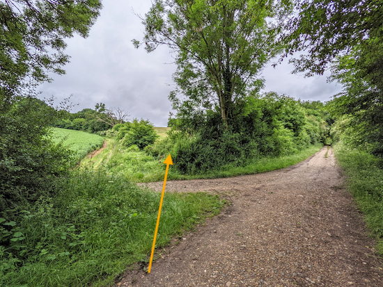
| Take the left fork on byway 84/18 |
11: Turn left on a byway which, at this point is both Wareside restricted byway 84 and Widford restricted byway 18, and head SW for 780m until you reach a road (location -
https://w3w.co/frosted.gender.decks).
12: Turn right and head W on the road for 190m until you reach a bridleway on left at the point when the road bends to the right (location -
https://w3w.co/really.origin.fire). This is a difficult crossing point so take care. Follow Widford bridleway 19 SW through woodland for 160m until the bridleway joins a track (location -
https://w3w.co/forks.legs.study). As we walked this track we met several
Roman / Burgundy snails - see image below.
 |
| Roman or Burgundy snail on Widford bridleway 19 |
Continue along the track, still on Widford bridleway 19, for 150m until you reach a gap in the hedgerow on the left (location -
https://w3w.co/vibe.green.trip), see image below.
 |
| Turn left at the gap then immediately right crossing a footbridge - point 13 |
13: Turn left through the gap then turn right and cross a footbridge. Immediately after the footbridge the right of way crosses the field heading SW and uphill for 200m to a junction (which is indistinct), (location -
https://w3w.co/privately.oddly.energy).
14: Turn left on Wareside footpath 19 then head SE for 240m until you reach a stile and a bench at the top of the hill (location -
https://w3w.co/scar.nurse.regard).
 |
| Wareside footpath 19 heading SE and uphill |
The path across the field is unclear and it looks like walkers have turned left after crossing the footbridge then headed SSE for 360m with the field on the right and the hedgerow on the left to reach the stile and a bench at the top of the hill. See detour map below where green is the official rights of way and blue represents a route that appears to have been trodden by walkers as an alternative.
 |
Official right of way in green. Detour apparently trodden by walkers in blue
Created on Map Hub by Hertfordshire Walker
Elements © Thunderforest © OpenStreetMap contributors
|
 |
| The stile and bench at the top of the hill - point 14 |
15: Cross the stile and continue on Wareside footpath 19 and head SSE, S, then SE across fields for 580m until you reach the end of Thistly Wood where the path becomes Hunsdon footpath 13. Continue heading SE until you reach a gap in the hedge and a footbridge (location -
https://w3w.co/forces.rewarding.boil).
 |
| Hunsdon footpath 13 passing Thistly Wood - point 15 |
16: Cross the footbridge and continue heading SE on Hunsdon footpath 13 for 450m until you reach a junction (location -
https://w3w.co/lamp.scary.fits).
17: Turn right on Hunsdon restricted byway 12 and head S, SE then E for 1.2km to High Street Hunsdon where The Fox & Hounds pub/restaurant will be on your right (location -
https://w3w.co/shift.fire.ashes) and The Crown pub/restaurant will be on your left (location -
https://w3w.co/badge.credit.finds).
Interactive map


Hi Dave . Now after my recent walks I should have taken more notice of pictures on this walk, lots of crop fields ! Means some paths will be ploughed and were 🤣😂😂 at mark 3-4 and 4-5 paths missing . When I got to the concrete track just before point 3 should keep going and pick up at point 5 later on . I did all sorts of things to stay on route . Hence my walk was a lot longer than you suggest . Still loved it and Thank You Again. .IR.
ReplyDeleteHi Ian, thanks for the feedback. Yes, a big problem this time of the year. I hope it didn't cause too much trouble. Hopefully the paths will be reinstated soon.
DeleteDave