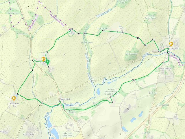
5.4 miles (8.6 km) with 117m of total ascent
 |
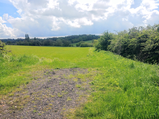
| View looking north on the last leg of the walk |
There is a pub at the start/finish point, The Robin Hood and Little John at Tonwell, a pub at Chapmore End, The Woodman, which has a cafe called The Conservatory and which involves a short detour, and a pub in Wadesmill, The Feathers Inn, at the halfway point.
Some of the route can be muddy after rain but the walk is mainly on well-defined and good paths and bridleways. The walk crosses a golf course.
Fly through preview of walk
If you want to check what sort of landscape you will be crossing before you set off on this walk you can view a short 3D video of the route below. It's created using the free version of Relive.
Directions
GPX or KML files for this walk. We've added What3Words location references for those who use that system. If you print these walks you might want to use the green PrintFriendly icon at the bottom of these directions to delete elements you don't need.
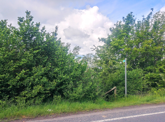
1: Park in the village of Tonwell and head W until you meet the A602 at the northern end of the village just beyond the primary school. Approach this busy road to the N of the junction (location - https://w3w.co/issued.organs.digit) where you will find a crossing point. Cross the road here heading for the footpath sign on the W side of the road (location - https://w3w.co/voices.caller.closes), see image below.
 |
| Cross the road and take Bengeo Rural footpath 7 on the other side |
3: Go through the gap, cross the footbridge, then follow Bengeo Rural footpath 7 uphill and heading SW at first with the telegraph poles on the right for 280m to the point (location - https://w3w.co/forced.boring.crate) where the path goes under the telegraph wires and continues heading SW with the hedgerow on the right and the field on your left for another 310m until you reach a lane at Chapmore End (location - https://w3w.co/legend.union.labels).
* At this point you could take a short detour for refreshments at The Woodman Inn (location - https://w3w.co/slide.angel.mats) at Chapmore End by turning right and following the lane round to the left for 170m.4: Turn left on the lane, which is called Chapmore End, and head SE, E, then SE again for 540m until you reach Wadesmill Road (location - https://w3w.co/pizza.ladder.souk). This is not a busy lane and, although there is no pavement for pedestrians, there is a verge you can hop onto if a car is coming.
5: Cross Wadesmill Road and take Bengeo Rural footpath 10 on the opposite side, see image below.
 |
| Bengeo Rural footpath 10 heading ESE with the hedgerow on the right |
 |
| Go through the tunnel and turn right |
 |
| Turn right on the lane, cross the bridge, then head S looking for path on left |
7: Take this path, Thundridge footpath 23, and follow it uphill heading E and ENE for 900m passing the golf course on the left and old quarries on the right until you reach a right-hand bend with good views to your left (location - https://w3w.co/flame.firms.baked). Turn right here and head SE for 50m before turning left and following the footpath between buildings heading E for 55m until you reach a footpath on your left (location - https://w3w.co/plans.snail.bake).
8: Take this path, Thundridge footpath 22, and follow it NNE and downhill for 110m until you reach a marker post where the path turns right just before the golf course (location - https://w3w.co/roof.mental.rinse), see image below.
 |
| Follow the path to the right of the marker post and head ENE |
Look left to check whether any golfers are hitting balls in your direction before continuing across the fairway, still on Thundridge footpath 22, but now heading NE with the hedgerow on your right and the golf course on your left for 190m until you reach another fairway (location - https://w3w.co/sharp.quite.flops).
Here you need to look to your right to check for golfers in action. Cross the fairway and continue heading ENE for another 250m until you leave the golf course (location - https://w3w.co/taken.judge.slap).
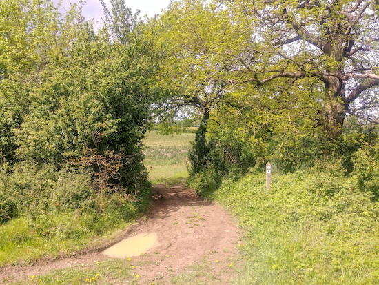
10: Cross a track and continue on Thundridge footpath 22, see image below, and head ENE then NE with the hedgerow on your right and fields on your left for 510m until you reach Ermine Street, which was once a major Roman road and which you join at the point where you reach allotments on your left. Continue along Ermine Street, which at this point is just a track, for another 200m until you reach Cambridge Road (location - https://w3w.co/misty.float.shapes)
 |
| Thundridge footpath 22 heading ENE after the golf course |
12: When you reach Cambridge Road again turn right, cross a bridge over the River Rib, and turn left at the roundabout at the junction of Anchor Lane and Cambridge Road (location - https://w3w.co/modes.luck.quarrel).
* There used to be a pub called The Anchor on the corner at this point but at the time of writing (May 2021) it was closed and we discovered planning permission had been submitted for a change of use to residential. But if you want refreshments you could head NE along Cambridge Road from the roundabout for 60m to visit The Feathers Inn (location - https://w3w.co/ropes.dent.carbon).Head SW along Anchor Lane for 200m looking out for a footpath on your right (location - https://w3w.co/game.image.chart).
13: Turn right here and head NNW and uphill on Thundridge bridleway 35 for 270m, with the hedgerow on the right and the field on the left, until you reach a junction (location - https://w3w.co/window.global.look), see image below.
 |
| Turn left at the junction mentioned in point 13 |
 |
| Go through the gap in the hedge and continue on Bengeo Rural footpath 4 |
 |
| Cross the farm track and head W and to the left of the oak tree |
 |
| Walk to the south and east side of Lord’s Wood |
18: Continue heading W and uphill, still on Bengeo Rural footpath 4, for 110m until you reach a footpath on your right (location - https://w3w.co/boom.local.wash), see image below.
 |
| Leave the track and turn right on the footpath leading to a footbridge |
20: Turn left here and with the farm buildings on your left head SW to a junction. Continue heading SW now on Bengeo Rural footpath 3 past a pond on your right. This footpath becomes a tree-lined for a short distance with a moated farmhouse on your left. Continue on Bengeo Rural footpath 3 heading SW for 700m until you reach a residential road called Temple Lane (location - https://w3w.co/cable.over.eggs). There are some good views to your right and left along this stretch, see image at the top of this page.
21: Head SW down Temple Lane for 140m until you reach Ware Road and the start of the walk. The pub The Little John and Robin Hood will be on to the right when you reach Ware Road (location - https://w3w.co/those.update.pint).


A lovely walk with good views, but there was a flood at point 17 where the field borders Lords Wood.
ReplyDeleteAh, pity, I hope it didn't spoil your walk. Did you get round the flood okay? Something to expect in the winter months, but not July.
ReplyDeleteDavid
Really loved this walk . Need a stick for the nettles . No flood on Tuesday
ReplyDeleteYes, a stick for pushing back the nettles is a must at this time of the year. I am not sure we have seen so many nettles; perhaps they have had a particularly good growth year. I noticed that they are fading back a bit now.
DeleteDavid
Great walk.Thanks for the brilliant clear instructions and pictures that helped us know we were where we were meant to be! A recommendation for a quick food break: just before you turn right onto Cambridge road (step12), there's a place called 'Thundridge Village Stores' which has a cafe inside. They do baguettes, toasties, cake and hot drinks.
ReplyDeleteExcellent, glad you enjoyed it. And thanks for sharing the tip about the cafe in the village store. Good to know.
DeleteDavid
Very much enjoyed this walk today - unexpected sunshine was the icing on the cake. There was plenty of mud, but no floods. Just one note - at Step 5, the tunnel goes under "Westmill Road" (the A602), not "Wadesmill Road" (which is the road that was previously crossed above ground).
ReplyDeleteGlad you enjoyed the walk despite the mud. And thanks for pointing out the error. I have fixed the mistake. Appreciate the feedback.
DeleteDavid
Did this walk again and really enjoyed it especially as it was a glorious sunny day. Lots of open areas and great views - also too early for lots of overgrown nettles etc and not muddy anywhere so a perfect walk. The recommendation from another comment someone made about the Village Store was a good tip - its now called Ermines and we had coffee and a croissant - no room in the outside space where everyone had the same idea so sat inside. Lots of delicious cakes etc. Another excellent walk, thank you for posting it.
ReplyDeleteThe perfect time of the year for a walk with less mud and no overgrowth to fight against. We must try this one again. And thanks for the tip about the cafe.
DeleteDavid
Completed this perfect walk on 19/2/2025. All signs and waypoints correct and a really, lovely walk with ideal conditions underfoot alongside rivers and a golf course.
ReplyDeleteHad a lunch at the halfway point in Ermines - very highly recommended and popular with locals, cyclists and walkers - always a good sign.
Beware parking in Robin Hood Pub car park in Tonwell (start & finish) unless you have a booking. We were planning to, but owner was unfriendly and we moved the car to street and spent our money elsewhere; in this case for the best.
Hi Andrew, thanks for the update. Good to know about the parking. David
Delete