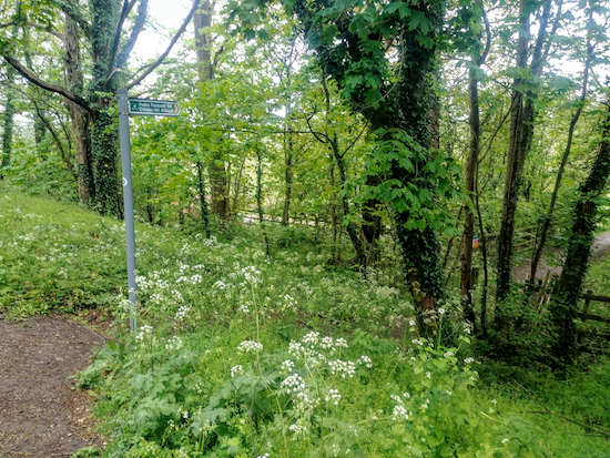
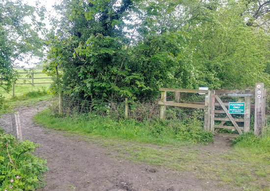
6.6 miles (10.5 km) with 161m of total ascent
 |
| The ford and bridge just before point 11 |
This walks starts in Shenley Park before exploring the countryside between Shenley and Radlett. The route crosses rolling countryside but also includes some walking along residential roads, alongside main roads with pedestrian pavements, and walking along rights-of-way close to a railway line.
There is a shorter version of this walk,
Walk 254: Shenley Short Loop, which is 4.8 miles long with 97m of total ascent. The shorter route involves less walking in built-up areas but also misses a couple of stretches of really nice countryside which we enjoyed.
Both routes pass two
WWII pillboxes which were part of the
Outer London Defence Ring. There is a car park and
The Cafe in the Orchard at the start/finish point. You can check opening times on the
Shenley Park website.
Fly through preview of walk
If you want to check what sort of landscape you will be crossing before you set off on this walk you can view a short 3D video of the route below. It's created using the free version of
Relive.
Directions
 |
Map for Walk 136: Shenley West Long Loop
Click on the map above for a larger version
Created on Map Hub by Hertfordshire Walker
Elements © Thunderforest © OpenStreetMap contributors
There is an interactive map below these directions |
You can download
GPX or
KML files for the long version of walk. We've added
What3Words location references for those who use that system. If you print these walks you might want to use the green
PrintFriendly icon at the bottom of these directions to delete elements you don't need.
 |
| Shenley bridleway 38 leaving the car park and heading NW |
1: From the car park in Shenley Park take Shenley
bridleway 38 which heads NW from the left of the car park immediately after you enter the gate (location -
https://w3w.co/line.rotate.woods), see image above.
Take this bridleway, which is also the
Watling Chase Timberland Trail, then follow it as it bends N, NE, then N for 880m with houses on your right and hedgerow and fields on your left before reaching a footpath junction soon after you enter woodland (location -
https://w3w.co/glitz.noses.career), see image below.
 |
| At the junction keep to the left, still on Shenley bridleway 38 |
Continue heading N through the woodland for another 200m until you reach another junction (location -
https://w3w.co/take.couches.bend). Here you keep left, now on Shenley bridleway 36, then head NW for 60m until you reach a field (location -
https://w3w.co/froth.liver.rush).
2: Cross the field, now on Shenley
footpath 36, then head NNW for 260m until you reach a junction (location -
https://w3w.co/brief.entire.hook), see image below.
 |
| Turn left at the junction on Shenley footpath 12 then head W |
3: Turn left at the junction on Shenley footpath 12 then head W for 120m until you leave the woodland and climb uphill across an arable field (location -
https://w3w.co/flank.diner.guides). At this point your path becomes St Stephen footpath 25 which continues heading W to the right of a tree heading (location -
https://w3w.co/frog.dimes.plot). Continue heading W for another 220m ignoring a farm track on your left until you reach a junction (location -
https://w3w.co/cotton.answer.reduce), see image below.
 |
| Turn left then head SSE on St Stephen footpath 63 |
4: Turn left then head SSE on St Stephen footpath 63 for 260m at which point the path becomes Aldenham footpath 58 and continues heading SE for 1km until you reach The Warren, a residential road on the outskirts of Radlett (location -
https://w3w.co/circle.along.forms).
5: Turn left on The Warren then head S for 150m until you reach The Avenue (location -
https://w3w.co/picked.gravy.dame). Turn left on The Avenue then head SSE for 180m until you reach Shenley Hill (location -
https://w3w.co/link.dice.period). Turn right on Shenley Hill then head SW for 75m looking out for a byway on your left (location -
https://w3w.co/echo.spite.doors), see image below.
 |
| Aldenham restricted byway 53 off Shenley Hill |
* At this point you could take a detour for refreshments at The Red Lion in Radlett by heading SW along Shenley Hill for 430m then turning right on Watling Street then heading NNW for 210m to visit The Red Lion (location - https://w3w.co/oils.cone.equal). There are also shops and a cafe in Radlett.
6: If you don't take the detour head SSE along Aldenham
restricted byway 53, see image above. Continue for 370m first between houses, then along Canons Close, then continuing, still on Aldenham restricted byway 53, between houses until you reach the junction of Newberries Avenue and Craigwell Avenue (location -
https://w3w.co/firmly.images.wider). Walk down Newberries Avenue heading SE for 65m looking out for a footpath on the right (location -
https://w3w.co/beyond.square.issues), see image below.
 |
| Aldenham footpath 53A off Newberries Avenue |
7: Take this path, Aldenham footpath 53A then head SSW for 130m until you reach Theobald Street (location -
https://w3w.co/mint.finest.strain). Turn left on Theobald Street then head SE for 140m looking for a footpath on the right (location -
https://w3w.co/zoom.today.hips).
 |
| Turn right off Theobald Street on Aldenham footpath 54 |
Turn right off Theobald Street on Aldenham footpath 54 then head WSW for 200m until you go through a tunnel under the railway line and turn right, still on Aldenham footpath 54. Head NW then SW for 240m until you reach Cobden Hill (location -
https://w3w.co/laying.areas.bits).
8: Turn left on Cobden HIll then head SSE uphill for 400m until you reach the top of the hill and a footpath on the left (location -
https://w3w.co/oils.gent.battle) between house numbers 61 and 63.
9: Take this footpath, Aldenham footpath 70, then head first ENE for 100m until you reach a junction (location -
https://w3w.co/yarn.echo.petty). Turn right then head SE for 330m through the sports club car park to the SE corner where you will reach a footpath, see image below.
 |
| The footpath in the SE corner of the car park |
Continue along Aldenham footpath 70 until you reach a footpath junction (location -
https://w3w.co/joke.loser.alien), see image below.
 |
| At the junction head SE, now on Aldenham footpath 18 |
10: At the junction turn left then continue heading SE, now on Aldenham footpath 18, for 400m at which point the path turns left (location -
https://w3w.co/spends.punchy.cure) then heads ENE for 300m passing through a tunnel under the railway before reaching a ford and a footbridge and another footpath junction (location -
https://w3w.co/stable.broke.legend), see image below.
 |
| The ford on the left and bridge on the right just before point 11 |
11: Cross the footbridge then take Elstree & Borehamwood footpath 50 on the right, Head ENE for 120m until you reach Theobald Street (location -
https://w3w.co/paper.rested.state).
12: Cross Theobald Street (be careful here because it’s a blind bend) then take the byway opposite. This is Elstree & Borehamwood restricted byway 49 which you follow NE for 980m at which point the track becomes Shenley restricted byway 45 and continues NE then SE for another 220m until you reach a junction (location -
https://w3w.co/safety.stump.hood), see image below.
 |
| Turn left at the junction, still on Shenley restricted byway 45 |
13: Turn left at the junction, still on Shenley restricted byway 45, then head NE for 340m until you reach a junction (location -
https://w3w.co/tune.icon.amuse), see image below.
 |
| Continue on Shenley restricted byway 45 ignoring the path to the right |
Keep left then head N, still on Shenley restricted byway 45, for 390m until you reach Woodhall Lane (location -
https://w3w.co/silly.grab.melon).
14: Turn right on Woodhall Lane then head E then NE for 440m looking out for a bridleway on the left (location -
https://w3w.co/flags.dime.tones), see image below. Just before the bridleway you will pass a WWII pill box on the left (location -
https://w3w.co/walks.cigar.tells).
 |
| Shenley bridleway 10 heading NW off Woodhall Lane |
15: Take this track, Shenley bridleway 10 then head NW then NNW for 930m until you reach Radlett Lane (location -
https://w3w.co/improving.memo.dash). Along the way you will pass another WWII pill box on your right (location -
https://w3w.co/tunnel.dine.secure).
* Soon after the start of this path you have the option of turning right on Shenley footpath 11 then heading NE for 250m to visit The White Horse (location - https://w3w.co/hers.length.trunk).
16: Cross Radlett Lane then take the bridleway immediately opposite, see image below. This is Shenley bridleway 38 which heads left running parallel to Radlett Lane. Follow Shenley bridleway 38 WSW for 350m back to the car park. Soon after taking this bridleway you could branch to your right and follow a parallel path in Shenley Park in order to enjoy the orchard.
 |
| Shenley bridleway 38 which heads back to the car park |
Interactive map


Today our 'Walk & Talk' group - 6 of us - did the Shenley West Short Loop which was absolutely lovely. It was a little muddy in places. On my Fitbit it registered 5.3 miles. We ended up with a great lunch at the Cafe in the Orchard (where we parked).
ReplyDeleteHi Pat, really glad you enjoyed it. We did too when we tested the route before publishing. And yes, the mud can be a problem this time of the year. We didn't try the cafe, but good to know you had a "great lunch". Thanks for the feedback.
DeleteDavid