5.7 miles (9.2 km) with 137m of total ascent
 |
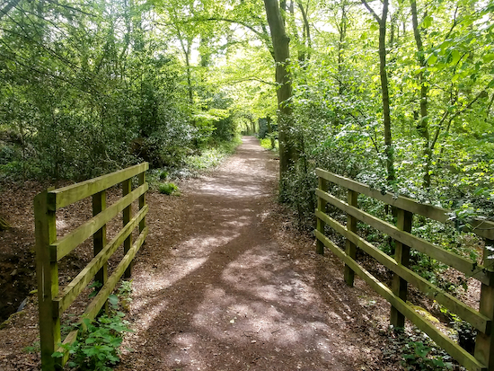
| Shenley bridleway 38 towards the end of the walk |
This walk starts in Shenley Park, which has a car park and a
Cafe in the Orchard. The car park has an overflow section if it is busy. A sign states that the park is open all year round, but best check opening times
on the park’s website. This walk includes a 2.2km section of another walk in our collection,
Walk 133: Ridge W Loop (5.1 miles), but in this walk that shared section is walked in reverse, so you can enjoy it from another perspective. Along the way you pass two
WWII pillboxes, part of the
Outer London Defence Ring.
Fly through preview of walk
If you want to check what sort of landscape you will be crossing before you set off on this walk you can view a short 3D video of the route below. It's created using the free version of
Relive.
Directions
 |
Map for Walk 135: Shenley East Loop
Click on the map below for a larger version
Created on Map Hub by Hertfordshire Walker
Elements © Thunderforest © OpenStreetMap contributors
There is an interactive map below these directions |
Those with GPS devices can download
GPX or
KML files for this walk. We've added
What3Words location references for those who use that system. If you print these walks you might want to use the green
PrintFriendly icon at the bottom of these directions to delete elements such as photographs.
 |
| The bridleway to the right after the entrance to the car park |
1: Take the bridleway on the right immediately after passing the gate into Shenley Park car park (location -
https://w3w.co/spoke.tight.taking). This is Shenley bridleway 38 which is also the
Watling Chase Timberland Trail. Follow it as it bends left then heads ENE parallel to Radlett Lane for 370m, crossing a wooden bridge along the way, before taking a right turn to cross Radlett Lane (location -
https://w3w.co/improving.memo.dash).
 |
| Shenley footpath 10 heading S off Radlett Lane |
2: After crossing the lane take Shenley footpath 10, which is still the Watling Chase Timberland Trail, then head S
for 650m until you reach a WWII pillbox on your left (location -
https://w3w.co/tunnel.dine.secure), see image below.
 |
| A WWII pillbox on the left of Shenley footpath 10 |
This pill box - and another you will pass shortly - are both part of the Outer London Defence Ring.
* 100m after the pillbox you will come to a footpath on your left. If your walk coincides with pub opening hours and you fancy refreshments you could take a short detour by turning left here on Shenley footpath 11 then heading NE for 270m to The White Horse on London Road. Otherwise continue with the directions below.
Continue heading SE on Shenley footpath 10 for another 300m until you reach Woodhall Lane (location -
https://w3w.co/slips.photo.loss).
 |
| Shenley footpath 10 heading SE |
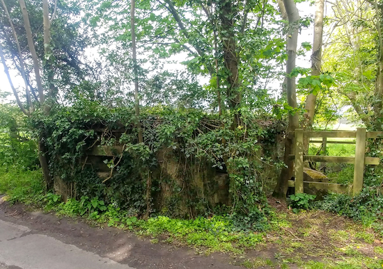
3: Turn right on Woodhall Lane. After 10m look to your right where you will see the second WWII pillbox (location -
https://w3w.co/walks.cigar.tells), see image below.
 |
| The second WWII pillbox on the right after joining Woodhall Lane |
Continue heading SW then W along Woodhall Lane for 440m until you reach a track on the left (location -
https://w3w.co/silly.grab.melon), see image below.
 |
| Shenley restricted bridleway 45 leaving Woodhall Lane and heading S |
4: Turn left on Shenley restricted bridleway 45 then head S, SE, the SSW for 430m until you reach a junction in the track (location -
https://w3w.co/handed.spits.hype), see image below.
 |
| Go through the gate then head SE in the direction of the yellow arrow |
5: Turn left, go through a gate, then take Shenley footpath 7 heading SE and uphill for 470m (follow the direction of the yellow arrow in the image above) until you reach another gate (location -
https://w3w.co/headed.sailor.pens).
6: Here you have the option of staying on Shenley footpath 7, which branches to the left, or taking a permissive path. Both end up in the same place so it doesn’t really matter except that footpath 7 looks a bit boggy at the start. (
Susie Jackson pointed out in our Hertfordshire Walker Facebook group that the public right of way was overgrown in August 2023 and the permissive path was clear and the best route to take). Whichever you take continue heading SE for 240m until you reach Green Street (location -
https://w3w.co/voters.intend.artist).
7: Turn left on Green Street then head NNE for 150m looking out for a track on your right (location -
https://w3w.co/quiz.twig.years), see image below.
 |
| Shenley footpath 5 heading NE off Green Street |
Turn right on Shenley footpath 5 then head NE for 560m until you reach London Road (location -
https://w3w.co/lifts.equal.rushed).
8: Cross London Road then turn left on a bridleway cut through the verge then head NW for 230m until you reach a track on the right (location -
https://w3w.co/dusty.cubs.path), see image below. (
Susie Jackson pointed out in our Facebook group that nettles blocked the public right of way in August 2023, so perhaps take a stick to push them away.)
* At this point you have a second chance for a short detour to The White Horse which is 500m further along London Road heading NW.
 |
| Shenley footpath 18 starts through a farmyard |
9: Take this track Shenley footpath 18, then follow it through a farmyard, see map below.
 |
Green line showing route through farmyard
|
At the end of the farmyard continue heading NE for 1km until you reach a junction in the track (location -
https://w3w.co/drew.hush.broker), see image below.
 |
| We turned left, walking round the edge of the field to avoid trampling the crop |
10: At this point the official right of way, Shenley footpath 18, continues heading NE across the crop (see light green line on map below). However when we did this walk the crop was growing and the path had not been reinstated. So, rather than trample the crop, we decided to take a detour (see orange line on map below) by turning left and heading NW along the perimeter of the field with the hedgerow on the left and the field on the right for 510m before rejoining Shenley footpath 18 at a gap in the hedgerow (location -
https://w3w.co/units.friend.rotate). On the map below the dark green lines indicate the other rights of way, Shenley footpaths 20 and 22, crossing the same field. Points 10 and 11 on the map indicate the directions on this page which the detour links.
 |
| The detour mentioned in point 10 above |
11: Turn left on Shenley footpath 18, cross Mimms Lane, then continue, still on Shenley footpath 18 heading NW for 250m, cross a stile (location -
https://w3w.co/brands.violin.adults), then continue heading NW for another 260m until you reach Rectory Lane (location -
https://w3w.co/sake.agrees.fire).
12: Cross Rectory Lane then head NNW on Shenley footpath 21 for 330m until you reach a gate where Shenley footpath 21 goes off to the right (location -
https://w3w.co/ages.trace.common), see image below.
 |
Keep left then head downhill through woodland on Shenley footpath 30
Photograph courtesy of Susie Jackson |
13: Here you leave Shenley footpath 21 then keep to the left heading NW, now on Shenley footpath 30, and head WNW through the woodland and downhill for 1km until you reach a wooded area followed by a junction (location -
https://w3w.co/yoga.pages.cigar), see image below.
 |
| Take the right fork and follow Shenley footpath 30 to a churchyard |
14: Take the right fork, still Shenley footpath 30, then continue to head WNW to a churchyard, see yellow arrow in image above. Go through the churchyard then down some steps to reach the B5378 at Shenleybury (location -
https://w3w.co/wage.deed.pinks). Turn left on the B5378 then head SSE for 110m looking out for a track on your right (location -
https://w3w.co/notes.bags.poet), see image below.
 |
| Shenley footpath 12 heading WSW off the B5378 |
15: Take this track, Shenley footpath 12, then head WSW. The first part of this track can be both muddy and messy. It looks as if people have used part of it to dump unwanted rubbish. But the untidy section is soon over. Continue on this footpath for 480m until you reach a junction (location -
https://w3w.co/soda.hers.blend), see image below.
 |
| Turn left on Shenley footpath 36 and head SSE |
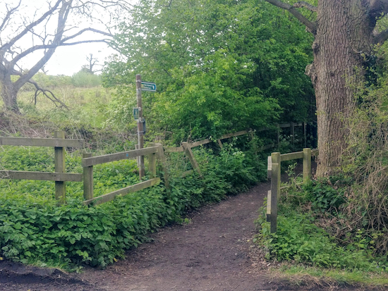
16: Turn left on Shenley footpath 36 then head SSE across a field for 270m until you reach woodland. At this point your track enters the woodland where it becomes Shenley bridleway 36 which you follow SE for 60m at which point it becomes Shenley bridleway 38.
At this point ignore the path joining from the left and turn right heading SSW on Shenley bridleway 38 ignoring paths off to the left and right, see image at the top of these directions.
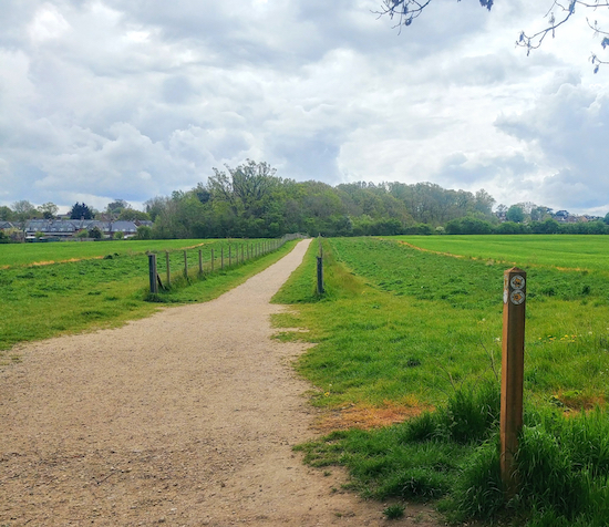
17: Follow this bridleway S through the woodland, then S and SW, with the houses on your left and the field on your right for 860m until you reach Porters Park Drive (location -
https://w3w.co/return.curving.strut), see image below.
 |
| When Shenley bridleway 38 meets Porters Park Drive keep to the right |
18: Turn right on a track (location -
https://w3w.co/choice.blunt.never) that heads SE for 230m back to Shenley Park car park and the starting point.
Interactive map


We did this walk today in the beautiful May bank holiday sunshine. The walk was really lovely and well described. The paths were good and the directions clear. We took a short cut back along quiet roads from point 12 to point 2 as it was getting late and the car park closes at 18:00.
ReplyDeleteHi Yossi,
ReplyDeleteGlad you enjoyed it. Thanks for the feedback.
David
we did this walk yesterday with our well behaved dog (who was on a lead and is not reactive to horses) please be aware when crossing the field towards 'rectory lane' in Shenley (description item 11) that there is a white horse that came galloping over to us and would not let us pass through the field. It reared up at us and my husband had to put the dog over a fence on the side of the path and walk through brambles. It was quite scary to be honest. I would strongly advise you avoid this field if you have a dog.
ReplyDeleteSo sorry to hear about the incident with the horse. I hope it didn't spoil your day. Thanks for pointing it out and sharing that warning for other dog owners.
DeleteDavid
thanks, it was an absolutely lovely walk otherwise, we try a different walk off this website every week - its such a great resource. I just felt I had an obligation just to mention this incase other dog walkers do this route to look for a detour if there are horses in this field.
DeleteIt's great when walkers share tips for the benefit of others. Thanks.
DeleteDavid
Just checked Shenley Park website & it says car park is shut Christmas day 2023. Still planning to do this walk as I've read it isnt too muddy.
ReplyDeleteThanks for that. If you are not already a member please consider joining our Hertfordshire Walker Facebook group where fellow walkers are sharing tips about the walks - such as car park closures etc. Thanks
Deletehttps://www.facebook.com/groups/hertfordshirewalker
David I am a member of F/B group, not sure why I'm 'annoymous' on this post. Do I need to sign in somewhere? But I'll add my info to F/book too.
DeleteChristine Johnson
Hi Christine, this website is not part of Facebook. It's on Google Blogger. So you can sign in if you are on Google, or just add your name, but it's not able to link the comment feature to our Facebook group.
ReplyDeleteDid this walk this morning, found it to be very pleasant and well mapped out as usual, I didn’t have any trouble walking through the field of horses with my dog (thank fully) but that part was very muddy.
ReplyDeleteYes, mud is an increasing problem as the wet autumn weather arrives. I am glad it didn't spoil you walk.
ReplyDelete