4.9 miles (7.9km) with 205m of total ascent
 |
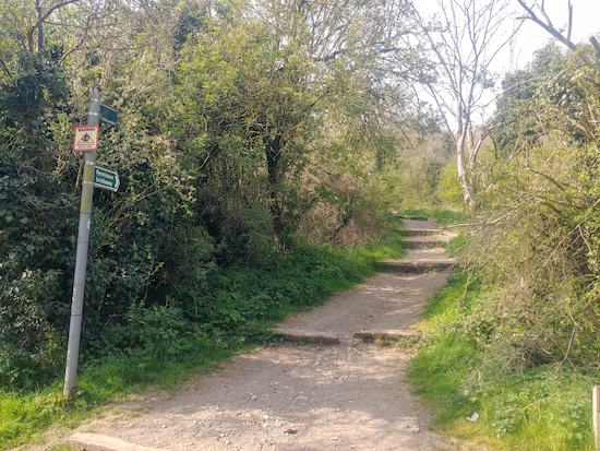
| Great Gaddesden footpath 67 crossing Nettleden Road (point 8) |
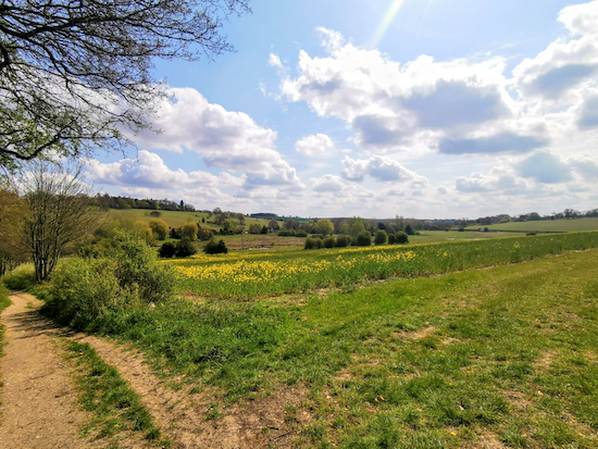
Several sections of this walk cut through woodland which, in late April, have impressive displays of bluebells.
If you have children walking with you they might enjoy looking for the fairy doors attached to fences and trees from point 8 to point 12, see image below.
The fairy doors started as an initiative to keep children busy and get them out in the fresh air during lockdown as part of locally organised ‘wellbeing Wednesdays’. The idea was to place hand-coloured fairy doors around Great Gaddesden village and in the local woods.
All the fairy doors had messages on them. According to one of the organisers, “We did this in the hope of cheering up just one person on their walks, and in the hope that those with young children would go out and see our fairy doors and just enjoy the beautiful surroundings”.
From that simple beginning the idea took off with others contributing to the Great Gaddesden fairy door wellbeing project. Look out for them as you enjoy the walk.
 |
| One of the many fairy doors attached to fences and posts in Great Gaddesden |
Directions
 |
| Map for Walk 131: Frithsden East Loop Created on Map Hub by Hertfordshire Walker Elements © Thunderforest © OpenStreetMap contributors There is an interactive map below these directions |
 |
| The footpath opposite The Alford Arms heading SW and uphill (point 1) |
 |
| The footpath heading SW from Frithsden Copse (point 2) |
 |
| Take the second left turn on Nettleden with Potten End bridleway 24 (point 2) |
 |
| Nettleden with Potten End bridleway 22 heading SE off Nettleden Road |
4: Turn left on The Common then head ENE for 60m before turning right on Hempstead Lane and heading SE for 130m where you will find Martins’ Pond, a pub/restaurant opposite the village pond (location - https://w3w.co/rail.stroke.basis).
From Martins Pond head N with the village pond on your left and along The Green for 120m until you reach The Common, again. Turn right on The Common and head ENE for 170m until you reach a road on your left. Cross the road heading NE to a footpath on the left at the side of an access road (location - https://w3w.co/broken.rock.dozed).
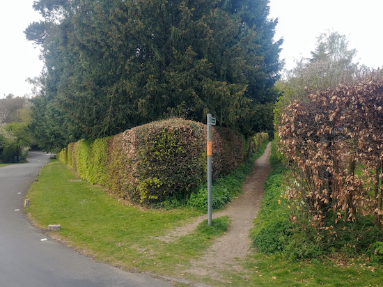
5: This is Nettleden with Potten End footpath 5 which you follow NE for 150m until the path forks. (location - https://w3w.co/banks.liability.tubes), see image below.
 |
| Take the left fork and head NE |
6: Take this path Nettleden with Potten End bridleway 6 and head SE for 80m crossing a path along the way and continuing until you reach a residential road (location - https://w3w.co/fact.rock.divide).
This is Browns Spring. Turn left here and head NE up the road for 130m until you reach the end where you will find a footpath (location - https://w3w.co/visits.record.ashes), see image below.
 |
| The footpath mentioned in point 6 above |
Turn left on Nettleden with Potten End footpath 31 and head NE for 380m until the footpath bends to the left and heads NW for 130m to a junction in the track (location - https://w3w.co/finds.curry.office), see image below.
 |
| The junction mentioned in point 7 where you turn right |
* Tell any children walking with you to start looking out for fairy doors from this point onwards.
 |
| A walker standing at the start of Great Gaddesden footpath 67 (point 8) |
 |
| Cross Nettleden Road and continue uphill towards the woodland |
9: When you enter Highpark Wood continue straight and uphill heading NNE along Great Gaddesden footpath 67 for 90m until you reach a junction (location - https://w3w.co/settle.punch.loudly). Here Great Gaddesden footpath 67 bends to the right (see image below - follow the direction of the yellow arrow).
 |
| At the junction follow Great Gaddesden footpath 67 as it bends to the right |
 |
| The path emerging from Highpark Wood |
 |
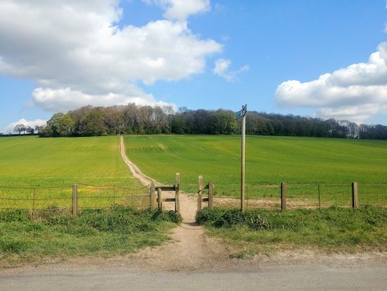
| Turn left at the gate and head NNW |
10: Turn left at the gate, now on Great Gaddesden footpath 68, and follow it NNW for 520m until you reach Piper’s Hill (location - https://w3w.co/behave.mental.putty).
11: Turn right on Piper’s Hill and then turn left on Church Meadow and up to St John the Baptist church.
Turn right at the front of the church and follow the path round the right side of the church and up to a path leading through the churchyard to Great Gaddesden footpath 1 (location - https://w3w.co/paints.vital.debate), see image below.
 |
| The gate leading to Great Gaddesden footpath 1 |
12: Here you turn left for 10m and take the footpath on your right just before a house. This is Great Gaddesden footpath 76 (location - https://w3w.co/form.thorax.corrupted).
Follow this footpath SSW, with the Amaravati Buddhist Monastery on your right, and continue for 330m until you reach the end of the monastery’s grounds (location - https://w3w.co/fries.trendy.shares). At this point the path becomes Nettleden with Potten End footpath 9 and continues heading S for 640m until you reach Nettleden Road in Nettleden (location - https://w3w.co/walks.rooms.flock).
13: Here you turn left and head E for 20m before taking a track on your right called Roman Road (location - https://w3w.co/since.lung.nails).
This road, or more accurately a track which goes through a steep cutting, is also known locally as Spooky Lane which goes under Devil’s Bridge and is said to be haunted, see image below.
 |
| Devil’s Bridge along Spooky Lane (Roman Road) |
* If you are spooked by the local superstitions you can take Nettleden with Potten End footpath 8 which runs parallel to Roman Road and end up in the same place further down this route. The entrance to footpath 8 is on the left at the start of Roman Road just before the cutting. It rejoins Roman Road just beyond Devil’s Bridge (location - https://w3w.co/diner.wallet.market). When footpath 8 rejoins Roman Road turn left and continue heading S for 500m to the starting point.If you enjoy this walk we have another that starts and finishes in Frithsden. It is Walk 116: Frithsden NW Loop (5.9 miles).
This walk was inspired by our occasional walking companions Sophie and Mike who introduced us to Frithsden and this part of Hertfordshire, and who accompanied us when we tested this walk before publishing.


Very good walk with a good mix of countryside. Not too muddy for the time of year and very quiet. I started in Potten End stage 4) - easier to park by the village pond than in Frithsden.
ReplyDeleteHi Martin,
ReplyDeleteGlad you enjoyed it. Thanks for the Potten End tip.
David
Thank you to Martin for the parking tip - Having seen this, we also elected to park at Potten End, where it was no problem at about 11am on a Sunday. As we passed through towards the end of the walk, Frithsden was incredibly busy with cars outside the pub, so we think it was a good move. Thanks again for another lovely walk!
ReplyDeleteGreat that Martin's tip helped; I love it when fellow walkers share tips for the benefit of others - wonderful! We love this walk, and the pub, in fact I think I might be doing it again, and eating at the pub as a birthday treat soon. I think my son has a plan. :-)
DeleteDave
Hi. Can dogs be off lead on this walk? Thank you
ReplyDeleteJust looking back at the photographs I think there are some signs on some paths saying dogs have to be kept on a lead. I don't know about the rest of the walk where there aren't signs. I would guess there are sections where a dog could walk off the lead.
Delete