5.6 miles (9 km) with 97m of total ascent
 |
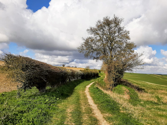
| The Icknield Way heading W out of Wallington |
This is an excellent walk from the village of Wallington across the hills of north Hertfordshire along well-defined paths with wide open views across to Cambridgeshire. On the return leg of this circular walk you will pass some excavation where drainage ditches dug by prisoners from the
Napoleonic wars have been unearthed.
When you get back to the village at the end of the walk you pass Manor Farm, which features in
George Orwell’s novel
Animal Farm, as well as
the cottage where Orwell lived for four years between 1936 and 1940.
Fly through preview of walk
If you want to check what sort of landscape you will be crossing before you set off, you can view a short 3D video of the route below. It's created using the free version of
Relive.
Directions
 |
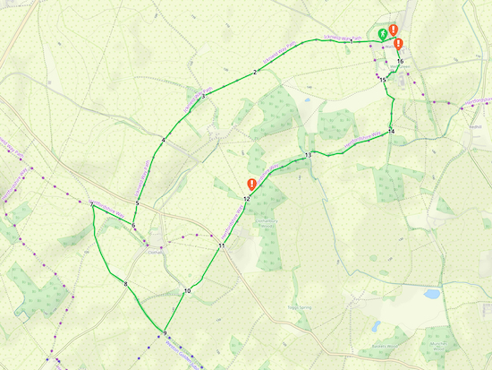
Map for Walk 127: Wallington South-West Loop
Click on the map for a larger version
Created on Map Hub by Hertfordshire Walker
Elements © Thunderforest © OpenStreetMap contributors
There is an interactive map below these directions |
Those with GPS devices can download
GPX and
KML files for this walk. We've added
What3Words location references for those who use that system. If you print these walks you might want to use the green
PrintFriendly icon at the bottom of these directions to delete elements such as photographs.
There are a few parking opportunities in Wallington and we didn't notice any restrictions, but please do double check in case things have changed since these directions were published. The two options we found were on the south side of Kits Lane (location -
https://w3w.co/suddenly.giving.bordering), and in a small car park off The Street (location -
https://w3w.co/noble.competing.reported).
Please note that a walker who completed this walk in February 2025 reported that crossing the A507 at point 5 needs care. They posted (at the bottom of these directions) that
"it’s a fast road and visibility in one direction isn’t great".
1: From the junction of Kits Lane and The Street in Wallington (location -
https://w3w.co/unsightly.steadily.pats) head W for 400m until you reach a bridleway on the left just past the national speed limit sign. This is Rushden and Wallington bridleway 21, which is also
the Icknield Way (location -
https://w3w.co/debate.cover.fallback), see image below.
 |
| The Icknield Way heading W out of Wallington |
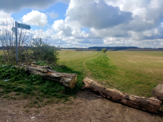
Head first W then SW for 960m at which point the route becomes Clothall bridleway 5 (location -
https://w3w.co/vineyard.lunching.everyone), see image below.
 |
| The start of Clothall bridleway 5 mentioned in point 1 above |
2: Continue through the gap in the hedge and head WSW for 450m until you reach a junction in the track (location -
https://w3w.co/receiving.terribly.bubbles), see image below.
 |
| The junction along Clothall bridleway 5 mentioned in point 2 above |
3: Here you continue straight, still on Clothall bridleway 5, and head SW for 480m until you reach Warren Lane (location -
https://w3w.co/niece.buzz.reach), see image below.
 |
| Clothall bridleway 5 after crossing Warren Lane |
4: Cross Warren Lane and continue heading SSW, now on Clothall bridleway 5, for 620m until you reach the A507, Clothall Road.
 |
| Clothall bridleway 5 after crossing the A507 Clothall Road |
5: Cross the A507 then head S for 190m, still on Clothall bridleway 5, until you reach a footpath crossing with a gate on the left (location -
https://w3w.co/cringe.curl.outwards). Ignore the gate on the left and turn right on Clothall footpath 6, see image below.
 |
| With the gate on your left, turn right on Clothall footpath 6 |
6: With the gate on your left, turn right on Clothall footpath 6, then follow it NW for 420m as it cuts through the crop until it reaches another footpath junction (location -
https://w3w.co/ironic.values.protests), see images below.
 |
| Clothall footpath 6 heading NW across an arable field |
 |
| When you reach the junction turn left on a byway |
7: When you reach the junction turn left on a byway which is both Clothall BOAT (
byway open to all traffic) and Weston BOAT 39, see image below.
 |
| Follow Clothall BOAT 12 SSE |
Follow the byway SSE for 800m until you reach a lane (location -
https://w3w.co/patch.tribune.duos) see image below.
 |
| Turn right on the lane |
8: Turn right on the lane then head SE for 60m until the lane bends right and Clothall BOAT continues with a left turn just before the bend (location -
https://w3w.co/qualify.weekend.contrived), see image below.
 |
| Turn left on Clothall BOAT 12 as the lane bends right |
Turn left on Clothall BOAT 12 at the point where the lane bends right then follow it SE for 530m until you reach a byway junction (location -
https://w3w.co/slant.tuxedos.changed), see image below.
 |
| Turn left on Clothall footpath 10 |
9: Turn left on Clothall footpath 10 then follow it NE for 410m with the hedgerow on the left and field on the right until the footpath cuts through the hedgerow to reach a lane (location -
https://w3w.co/shots.nightfall.fooling), see image below.
 |
| Follow Clothall footpath 10 through the hedgerow to the lane |
Follow Clothall footpath 10 through the hedgerow to the lane then turn right then head NE for 45m to the point where the lane bends left and you reach a footpath on your right (location -
https://w3w.co/splashes.etchings.chief), see image below.
 |
| Clothall footpath 9 mentioned in point 8 below |
10: Turn right at the bend on Clothall footpath 9 then head NNE for 180m keeping to the left before you reach a gate (location -
https://w3w.co/rams.brilliant.tidying).
 |
| The gate mentioned in point 8 above |
Go through the gate and continue on Clothall footpath 9 heading NNE for 340m until you reach Clothall Road, the A507 (location -
https://w3w.co/blissful.shielding.tight).
 |
| Clothall footpath 9 continuing after you cross Clothall Road, the A507 |
11: Cross Clothall Road and continue heading NNE, still on Clothall footpath 9, for 470m until you reach a footpath junction (location -
https://w3w.co/potions.regaining.disbanded), see image below.
 |
| The footpath junction mentioned in point 10 below |
12: Ignore the footpath to the left and continue heading NE, still on Clothall footpath 9, with the ditch and Clothallbury Wood on your right, for 300m until you come to the end of the wood.
 |
| The excavated area NE of point 10 and mentioned below |
* This stretch of the public right of way has been recently excavated (we did this walk on Monday 12 April 2021). Signs have been placed at each end of the excavated area explaining why the land has been disturbed. A pdf of the sign has been embedded at the bottom of these directions below the interactive map.
Click here to jump to the notice. The wording on the sign reads:
As part of an exciting farm-wide regeneration program we have recently discovered pipes buried 1.5m below the surface - believed to date back to the Napoleonic era where captured soldiers were bought across from France and were made to dig these pipes underground providing drainage and increased crop yield for the land owner as well as feeding into a ditch and drainage system that served 4 ponds in the woods (believed at one time to be carp and duck ponds).
As current tenants of this farm we have taken it upon ourselves to restore this environment. These ditches are dug at a level where we intercept this network and we have re-established ditches that feed this water into the 4 ponds (you can see one where this path enters the wood).
We are sorry for the disruption caused to the footpath but we will restore the footpath as soon as weather conditions allow, we hope to have this work completed in the late spring in the meantime please bear with us and if possible, can you please walk on the field edge around the ditch and spoil pile.
Hertfordshire County Council, Countryside and Rights Of Way Service are aware of this conservation work and this temporary footpath walk-around. Any problems please do not hesitate to give us a call. Our contact details can be found on our website: https://www.kaiapoi.co.uk/.
Regards
Rob and Jo
 |
| The footbridge where Clothall footpath 9 becomes Rushden and Wallington footpath 23 |
At the end of the excavated area continue along Clothall footpath 9 heading ENE for 430m through woodland called Bush Spring until you reach a footbridge (location -
https://w3w.co/beads.camcorder.blues), see image above. This is the parish boundary.
13: From here your path becomes Rushden and Wallington footpath 23 and continues ENE for 800m until you reach a junction.
14: Turn left at the junction and head N for 510m now on Rushden and Wallington bridleway 24 until you reach a lane on your right (location -
https://w3w.co/straying.trifle.drifters) leading to the
Church of St Mary, a Grade II listed building.
 |
The lane to the Church of St Mary, Wallington
|
15: Turn right on this lane and head NE, then E with the church on your left and a pond on your right, then NE again before reaching another pond on your left at the junction with The Street (location -
https://w3w.co/pounces.domain.thumb).
 |
| Manor Farm made famous in Orwell’s Animal Farm |
16: Turn left on The Street and walk 100m NNW looking out for Manor Farm, which features in George Orwell’s Animal Farm, on the right (location -
https://w3w.co/possible.gazed.retailing).
 |
| The 16c timber-framed house |
Another 40m further along The Street on your left you will pass a 16th century timber-framed house (location -
https://w3w.co/templates.averts.hydration). Continue along The Street for another 100m until you reach the junction with Kits Lane.
 |
| The cottage where George Orwell lived for four years |
Here you turn left and the cottage that George Orwell lived in between 1936 and 1940 is on your right (location -
https://w3w.co/rugs.dripping.cyber). From here make your way back to your parking spot.
We have a second walk from Wallington. It’s
Walk 128: Wallington E Loop. The route passes through a nature reserve containing rare grassy marshland. It’s a 6.4 mile circular.
Interactive map


Thanks for this, really enjoyed it, despite a wrong turn! A good place to get lost - https://blog.rowleygallery.co.uk/walking-wallington/
ReplyDeleteGlad you enjoyed the walk. Great blog post. Thanks for sharing. If you have a smartphone consider following the free GPS files, you should never get lost if you do. Dave
ReplyDeleteCompleted this great walk on 25/2/2025. Fantastic directions and waypoints all spot on. Great care needed for crossing the A507 at point 5 - it’s a fast road and visibility in one direction isn’t great…
ReplyDeleteSome lovely sweeping views of the countryside and Wallington is very nice. Recommend Mill End Plants cafe for lunch, it’s about 2mi from finish. Thank you David
Hi Andrew, thanks for the feedback and the point about the A507. It must have been a quiet day when we tested the walk. But good to know that people need to take extra care at that point. I have added a note to the directions warning walkers of the issue. Thanks for taking the time to let me now. David
Delete