3.5 miles (5.7 km) with 74m of total ascent
 |
| Downstream from Cassiobury Weir at point 3 on the walk |
This walk winds through ancient woods that once formed part of the
Cassiobury Estate and is now owned by
Watford Borough Council and designated as a
public open space. Historically, the woodland was managed for timber, firewood, and game. Between 1766 and 1880 the northern part of
Whippendell Wood was largely cleared and replanted with a mixture of conifers and broad leaved trees. This walk crosses a golf course.
Fly through preview of walk
If you want to check what sort of landscape you will be crossing before you set off on this walk you can view a short 3D video of the route below. It's created using the free version of
Relive.
Whippendell Wood is a
site of special scientific interest (SSSI) due to its diverse habitats, including a broad variety of fungi and insects.
According to a noticeboard just near the car park, more than 270 species of plant have been found in the area, including more than 60 types of moss, and 10 kinds of
liverwort. In 1995 the fungus
Crepidotus cinnabarinus was discovered here, the first time it had been identified in Britain, and only the fourth recording in Europe. Material from this find is now held by the
National Herbarium at Kew.
Common woodland butterflies have been recorded in the area, including the
speckled wood,
ringlet and
holly blue. The woodland is also rich in bird life, including the
tawny owl and
sparrow hawk. Standing dead wood provides feeding and nesting sites for woodpeckers, with all three British species known to breed here.
Direction
 |
Map for Walk 126: Whippendell Woods Loop
Click on the image for a larger version
Created on Map Hub by Hertfordshire Walker
Elements © Thunderforest © OpenStreetMap contributors
There is an interactive map below these directions |
Those with GPS devices can download
GPX or
KML files for this walk. We’ve added
What3Words location references for those who use that system. If you print these walks you might want to use the green
PrintFriendly icon at the bottom of these directions to delete elements such as photographs.
Park in the car park in the NE corner of Whippendell Woods off Grove Mill Lane (location -
https://w3w.co/earth.lawn.juror).
 |
| Watford Borough bridleway 30 heading S from the car park |
1: Head S out of the car park on Watford Borough bridleway 30 and then head SSE for 460m until the path veers to the left (see image below).
 |
| The junction known as The Rond Pont - continue heading SSE |
2: This junction is referred to as The Rond Pont (sometimes called the roundel) and was a formal junction with rides leading off into the rest of Cassiobury Park at the time when the estate was the home of the
Earls of Essex (location -
https://w3w.co/casual.cheat.grit).
Follow the path, still Watford Borough bridleway 30, SE then SSE for 820m. On your way you will cross one of the fairways owned by the
West Herts Golf Club where there are signs warning walkers to look to their right (when heading S) to avoid being hit by flying golf balls (location -
https://w3w.co/lame.lows.branded).
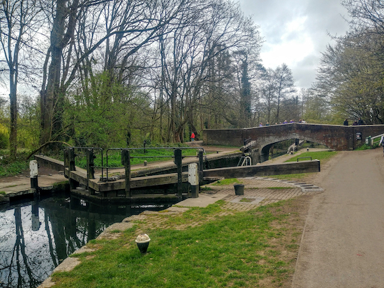 |
| The bridge over the Grand Union Canal |
After crossing the golf course continue as the path veers to the right before reaching a junction in the track. Here you turn right and head W, but before you do look to your left where you will see a bridge over the
Grand Union Canal (location -
https://w3w.co/unions.shells.orchestra).
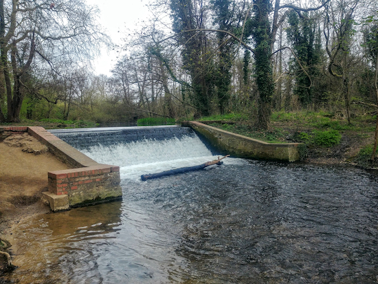 |
| Cassiobury Weir |
At this point it’s worth crossing the bridge to see Cassiobury Weir (see image above) and visit a small beach south of the weir where dogs and children might fancy a paddle (see image at the top of these directions). After visiting the weir return over the bridge to the W side of the canal in order to continue the walk.
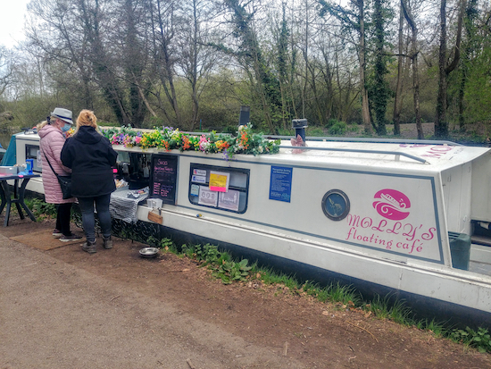 |
| Molly’s floating cafe on the Grand Union Canal |
When we did this walk
Molly’s floating cafe was moored on the west bank of the canal (see image above). According to its Facebook page the cafe moves to a new location along the Grand Union Canal every two weeks. It seemed to be doing brisk business the day we did this walk on Saturday 10 April 2021.
3: From the bridge over the canal head W for 740m on Watford Borough footpath 31 crossing three more fairways where you will be prompted by signs to look to your left or right to check that there are no golfers in action. At the first fairway look to your left (location -
https://w3w.co/store.random.tigers). At the second fairway look to your right (location -
https://w3w.co/ranges.remote.proven). And at the third fairway look left again (location -
https://w3w.co/proven.heats.list).
 |
| The path downhill through woodland to Rousebarn Lane |
After crossing the fairways continue heading W and downhill, now through woodland (see image above) and continue until you reach Rousebarn Lane (location -
https://w3w.co/hops.oddly.deck).
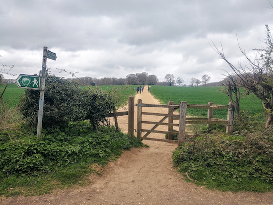 |
| Cross Rousebarn Lane and climb the hill up to Dolly’s Wood |
4: Cross Rousebarn Lane and go through the gate directly opposite. (see image above) You now climb a hill and head W for 340m before reaching Dolly’s Wood on the left. Continue heading W for 1.1km passing Newland’s Spring and Dell Wood before reaching a junction (location -
https://w3w.co/change.linen.sober).
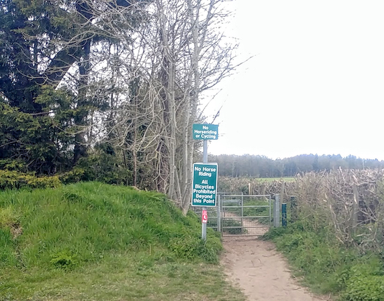 |
| The track becomes a footpath at this gate - see point 5 below |
5: Turn right at the junction and head NNW for 500m, first along a track and then a footpath (see image above) and continue until you reach Harrocks Wood.
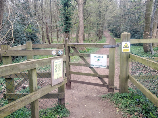 |
| The entrance to Harrocks Wood - take the right fork once through the gate |
6: Go through the gate, enter Harrocks Wood (location -
https://w3w.co/haven.tones.sends), and then take the right-hand turn and head NE for 490m until you reach Rousebarn Lane again.
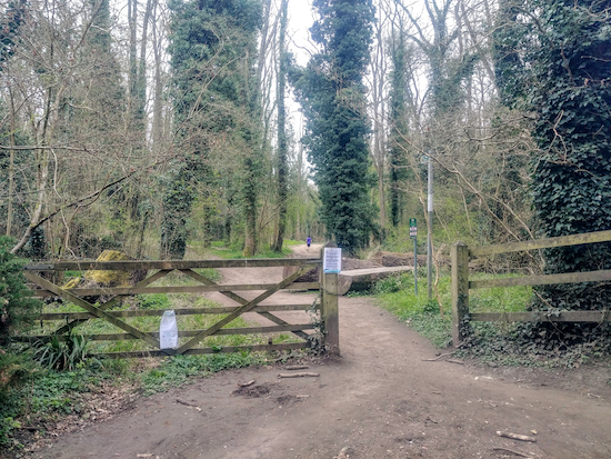 |
| The gate leading back to Whippendell Wood from Rousebarn Lane |
7: Here you have several options (marked in orange on the map above) for wandering round the many paths in Whippendell Wood as you make your way back to the car park. The shortest route is to head ENE for 1km directly back to the start point, but we wandered around enjoying the many paths that meander through the woodland.
Thanks to our occasional walking companions, Sophie and Mike, for introducing us to this part of Hertfordshire and Whippendell Wood in particular.
Interactive map


Glorious walk early this morning . Plenty of nettles just before point 5 . One of my favourites.
ReplyDeleteHi Mick, pity about the nettles. Always a problem this time of the year. Glad you enjoyed the walk. David
DeleteLovely walk in an corner of the county I don't know very well. A perfect length for a lunch hour trot! Thanks, Andy B
ReplyDeleteGlad you enjoyed it Andy. It's a new area for us. We were introduced to it by our son and his wife to be. Dave
DeleteMy wife and I really enjoyed this walk today. The bluebells made it very magical.
ReplyDeleteThat's lovely, thanks for sharing. It's a good year for bluebells.
Delete