4 miles (6.5km) with 61m of total ascent
 |
| Cottages in the village of Therfield |
This is a gentle walk from the village of Therfield in a quiet corner of north-east Hertfordshire. The route follows some winding byways and footpaths, passes a remote nature reserve, and crosses a ford on the River Rib. Parts can be muddy and slippy after rain, particularly the sections after points 1 and 4. When it’s open you can get refreshments at the
Fox and Duck in Therfield.
Fly through preview of walk
If you want to check what sort of landscape you will be crossing before you set off on this walk you can view a short 3D video of the route below. It's created using the free version of
Relive.
Directions
 |
Map for Walk 121: Therfield South Loop
Click on the map for a larger version
Created on Map Hub by Hertfordshire Walker
Elements © Thunderforest © OpenStreetMap contributors
There is an interactive map below these directions |
Those with GPS devices can download
GPX or
KML files for this walk. We've added
What3Words references for those who use that system. If you print these walks you might want to use the green
PrintFriendly icon at the bottom of these directions to delete elements.
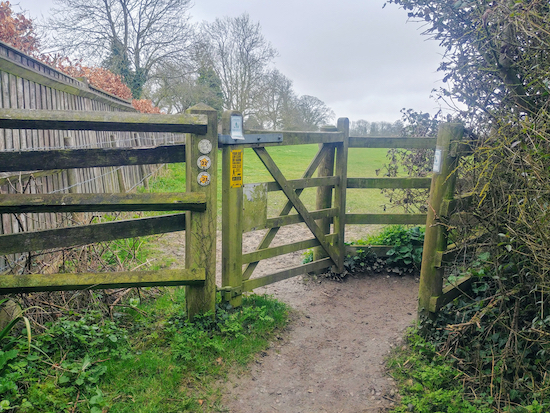 |
| The gate mentioned in point 1 below where you take the left-hand footpath 22 |
1: Park in
Therfield village (location -
https://w3w.co/ketchup.aunts.tulip) then head SE along Police Row for 170m until you reach a footpath on the right (location -
https://w3w.co/notch.monks.flannel). Take this path. When you reach a gate (see image above) take the path to the left, Therfield footpath 22, then head SSE for 530m going through another two gates. Continue until you reach a junction in the tracks (see image below) where you take the left fork then head down to the hedgerow on the left (location -
https://w3w.co/gliding.sobered.tomato).
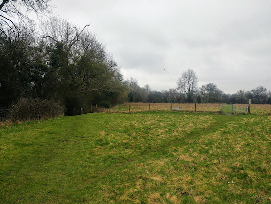 |
| The fork in the track mentioned in point 1 above |
2: Go through a gate then turn right on Therfield BOAT 36 (
byway open to all traffic) and head SSW, SSE, then SE for 1.5km until you cross a footbridge to reach a track on your right, Therfield BOAT 41 (location -
https://w3w.co/blissful.manage.action), which runs along the S side of the River Rib (see image below).
 |
| The bridge before the junction mentioned in point 2 above |
3: Turn right on Therfield BOAT 41 then head WSW following the Rib for 1km before it bends to the left at a junction in the tracks. Along the way look out for
Hawkins Wood on your left, a
Herts and Middlesex Wildlife Trust nature reserve which is worth exploring if you have time - especially when the bluebells are out.
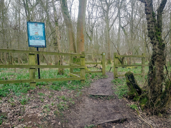 |
| The entrance to Hawkins Wood mentioned in point 3 above |
4: When you reach the junction in the track mentioned above where Therfield BOAT 41 turns left, you turn right on Kelshall footpath 17 (location -
https://w3w.co/tangent.streetcar.riots) then head NNW and uphill for 720m, first with Philpott's Wood on your left and then with Lord's Wood on your right, continuing until you reach a junction in the tracks (location -
https://w3w.co/amuses.parsnips.span).
 |
| Footpath 17 meets UCR1, mentioned in point 5 below |
5: Turn right on Kelshall UCR1 (unmetalled, unclassed country road) which is also known as Whites Lane, and head NE for 650m until you reach a junction (location -
https://w3w.co/inflates.round.soldiers).
6: Here you turn left on Kelshall Street and head NW for 250m looking out for a footpath on your right on the outskirts of the village of Kelshall (location -
https://w3w.co/veal.cashier.shifters), which, according to Wikipedia, is the site of
one of the five most significant finds of Roman artefacts in recent years.
 |
| Footpath 7 mentioned in point 7 below |
7: Take this footpath, Kelshall footpath 7, and head NNE for 120m passing through three gates. After the third gate continue with the hedgerow on your left and the field on your right and ignore a path on your left (by a pink farmhouse) and one on the right but continue, now heading NNW for 100m until you reach a footbridge.
8: After the footbridge keep following Kelshall footpath 7 NNE for 130m until the path splits (see first image below). Here you take the right-hand fork, Kelshall footpath 6, and head for NE for 170m until you reach a gate.
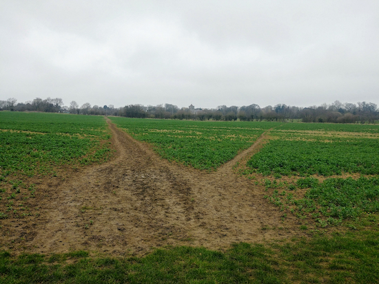 |
| Take the right hand fork where the path splits, mentioned in point 8 above |
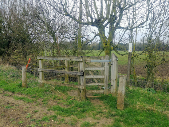
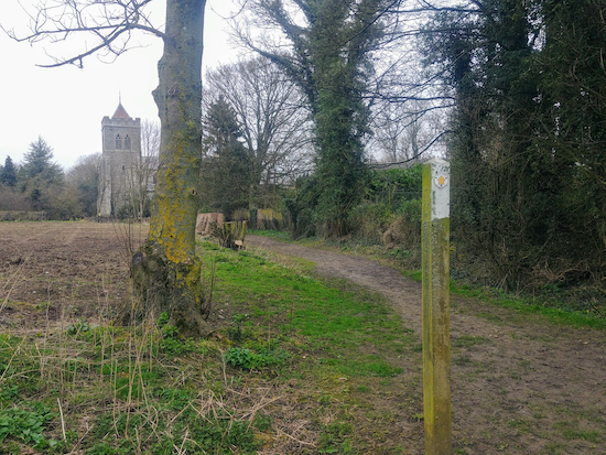
9: Go through the gate (see image below) and continue heading NE across a field for 250m until you reach a track. Turn left here and walk up to the church and through the churchyard back to the start of the walk.
 |
| The gate leading to footpath 19 mentioned in point 9 above |
 |
| Follow the track through the churchyard and back to the start of the walk |
We have another walk from Therfield village. It’s
Walk 122: Therfield Loop North.
Interactive map


Did the walk on Sunday. Was stunning scenery and a little tough and hilly, as expected. What 3 words worked like a charm and very accurate. Thanks for detailed walk, well recommended.
ReplyDeleteHi Bruce and Mandy,
DeleteGlad you enjoyed the walk. Thanks for the feedback. We had a great time exploring that area of Hertfordshire.
David
Lovely walk with plenty of bluebells and birdsong including skylarks.
ReplyDeleteHi Helen, yes, I remember that walk well. We loved it. I had recently got my hearing aids fitted and was able to hear the skylarks for the first time. Magic. Thanks for the reminder.
DeleteDavid
Just finished the walk. Absolutely loved it. Beautiful countryside and rolling hills. Highly recommend this walk.
ReplyDeleteHi Lorraine & Neil, glad you enjoyed the walk. We love that one, too, and have done it several times. Nice to hear you loved it. Thanks for the feedback.
DeleteDavid