4.4 miles (7.1 km) with 89m of total ascent
 |
| The view just before point 2 |
This walk starts with a steady climb along a track that runs along the border between NW Hertfordshire and Bedfordshire. As you climb you will pass
Deacon Hill, a site of special scientific interest, on the right and then, when you reach the
Pegsdon Hills and Hoo Bit nature reserve, also on the right, you will then turn left staying in Hertfordshire. There is a permissive path out of the car park if you want to explore Deacon Hill after the walk.
Fly through preview of walk
If you want to check what sort of landscape you will be crossing before you set off on this walk you can view a short 3D video of the route below. It's created using the free version of
Relive.
Directions
 |
Map for Walk 114: Little Offley Loop
Click on the map for a larger version
Created on Map Hub by Hertfordshire Walker
Elements © Thunderforest © OpenStreetMap contributors
There is an interactive map below the directions |
Those with GPS devices can download
GPX or
KML files for this walk. We've added
What3Words references for those who use that system. If you print these walks you might want to use the green
PrintFriendly icon at the bottom of these directions to delete elements.
Park in the Hexton Road car park (location -
https://w3w.co/curable.modifies.lame) off the B655. This is a small car park with space for about eight cars, so it could get busy at weekend. We did it midweek and early in the day.
If you find the car park is full you might want to drive 1.8 miles west to Hexton where there you can park close to The Raven pub for
Walk 240: Hexton South-West Loop or
Walk 237: Hexton South-East Loop.
 |
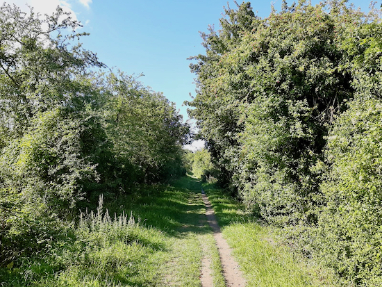
| Offley BOAT 53 (also the Icknield Way) heading SW out of the car park |
1: Take the byway heading SW out of the car park. This is Offley BOAT 53 (
byway open to all traffic), which at this point is also
The Icknield Way. Follow this byway climbing steadily uphill for 1.5km.
 |
| The view from the Pegsdon Hill and Hoo Bit nature reserve |
You will reach a path on your right leading to the Pegsdon Hill and Hoo Bit nature reserve (location -
https://w3w.co/outlooks.bead.zaps).
* Here you have a choice of nipping into the nature reserve to look at the view (see image above).
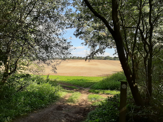
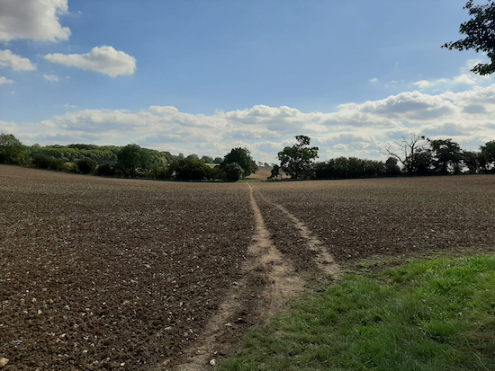
2: Our route ignores this path and continues SW along Offley BOAT 53 for another 70m until you reach Lilley bridleway 20 on the left (location -
https://w3w.co/goal.disco.ballooned). Take this bridleway then head SSE for 175m until you reach a junction where Lilley bridleway 19 joins from the left (location -
https://w3w.co/touchy.hissing.growth).
Continue heading SSE, now on Lilley bridleway 19 for 510m until you reach a bridleway junction (location -
https://w3w.co/meatball.moral.wake).
 |
| Lilley bridleway 20 leaving the woodland, mentioned in point 2 |
 |
| Lilley bridleway 20 continuing across open fields, mentioned in point 2 |
3: At the bridleway crossing head S on Lilley bridleway 9 for 690m until you reach woodland on the left. Continue for another 120m ignoring a track on the left and continuing until you reach a bridleway cutting through the woods on the left (location -
https://w3w.co/glorious.heartless.brass).
 |
| The unmarked Lilley bridleway 21 on the left, mentioned in point 3 |
 |
| Leaving the wood on Lilley bridleway 21, mentioned in point 4 |
 |
| Crossing a field heading ESE on Lilley bridleway 21 - point 4 |
4: Turn left on Lilley bridleway 21 then head SE for 230m through Mazebeard Spring until you come to a junction. Turn left, still on Lilley bridleway 21, leave the wood heading NE then cross a field and head ESE for a total 710m until you reach another junction (location -
https://w3w.co/timer.exactly.superhero).
 |
| Lilley bridleway 11 on the left, mentioned in point 5 |
5: Turn left on Lilley bridleway 11 then head NE for 350m until you reach woodland at which point the track becomes Offley bridleway 35 and continues NE for another 400m until it reaches a farm road (location -
https://w3w.co/momentous.kiosk.business).
 |
| The point where Lilley bridleway 11 becomes Offley bridleway 35 |
6: Cross the farm road then continue heading NE for 200m passing cottages on the right until you reach the point where Offley bridleway 34 joins from the right (location -
https://w3w.co/smokers.arch.waged).
7: Continue heading NE then NNW, now on Offley bridleway 34, then follow the track as it heads N then NE again for 1.2km to Lodgefield Plantation (location -
https://w3w.co/flesh.corrupted.upstairs).
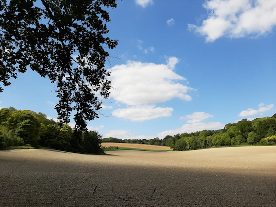
 |
| The view to the left off Offley bridleway 35, between points 7 and 8 |
8: Turn left, still on Offley bridleway 34, and follow it NNE for 760m back to the B655 (location -
https://w3w.co/mashing.evoke.sushi).
9: Turn left then walk along the side of the B655 (there is a path in the verge) for 260m back to the car park.
 |
| Deacon Hill, accessed via a permissive path from the car park |
Those with energy to spare at the end of this walk could take the permissive path at the end of the car park in order to explore Deacon Hill, see image above.
If you enjoyed this walk please consider joining our friendly
Hertfordshire Walker Facebook group where fellow-walkers are sharing their walking experiences and photographs.
Interactive map


Did this walk again yesterday in the sunshine. Some really great views especially on a clear day and the walk up the big hill at the end is fun - not as bad as it looks once you get going. At point 3, as you point out, the bridleway 21 is unmarked and we missed it the second time as well, not having remembered what happened the first time! Lovely varied walk with ups and downs, open countryside and great views. Only muddy at a couple of points but we had welly boots on anyway.
ReplyDeleteLovely to read your latest feedback. Well done walking up that hill in wellies. :-)
ReplyDeleteThe last part of the walk was along the verge of the B655 for 260m, it starts quite narrow but does get wider as you get nearer to the car park which is good as it was quite busy and the vehicles are travelling at 50mph+ along there so be careful with small children and dogs.
ReplyDeleteThanks Gerry, there is a path in the verge so I felt that section was safe to include. But it's good to warn people that it is a busy road, especially if they have small children and/or dogs.
Delete