4.3 miles (7 km) with 45m of total ascent
 |
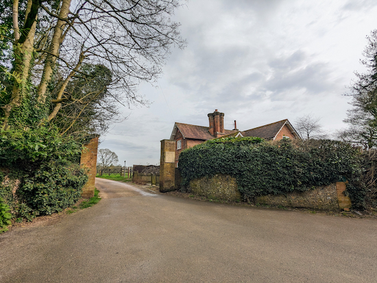
| The bridleway between points 1 and 2 |
Fly through preview of walk
If you want to check what sort of landscape you will be crossing before you set off on this walk you can view a short 3D video of the route below. It's created using the free version of Relive.
Directions
GPX or KML files for this walk. We've added What3Words references for those who use that system. If you print these walks you might want to use the green PrintFriendly icon at the bottom of these directions to delete elements.
 |
| The Brocket Arms |
 |
| Turn left on Ayot St Lawrence bridleway 10 |
 |
| Turn left on Codicote footpath 37 |
 |
| Go through the gate then head S |
 |
| Take the footpath on the left Kimpton footpath 11 |
Continue until you reach a footpath on the left (location - https://w3w.co/such.send.spit). Take this path, Kimpton footpath 14, then head W for 410m until you reach Bibbs Hall Lane (location - https://w3w.co/tooth.paths.robots).
5: Turn left on Bibbs Hall Lane then head SSE for 260m until you reach a track on the right at the point where the lane bends to the left (location - https://w3w.co/pace.shack.looks).
6: Turn right on the track then head SSW for 130m until you reach a footpath crossing (location - https://w3w.co/leader.trials.stand).
7: Turn right on Wheathampstead footpath 36 then head W for 775m until you reach a gate (location - https://w3w.co/still.solar.salads).
8: Continue heading W, now on Kimpton footpath 12, for 315m to a gate (location - https://w3w.co/serves.oasis.intervals).
 |
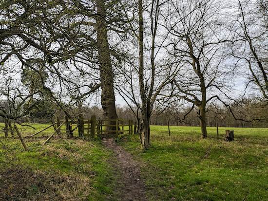
| Wheathampstead footpath 36 heading W - point 7 |
10: Go through the gate then continue on Kimpton footpath 12 now heading W for 195m until you reach the B651 Ballslough Hill (location - https://w3w.co/flap.coffee.always).
11: Turn left walk past the Cross Keys pub on your right (location - https://w3w.co/alien.smooth.paint). Head SW along Ballslough Hill for 70m until you reach a bridleway on the left.
12: Turn left on Wheathampstead bridleway 101 (location - https://w3w.co/memory.topped.spin) then head SSE through woodland for 155m until you cross a track (location - https://w3w.co/fruit.cared.rats).
13: Cross the track then continue on Wheathampstead bridleway 101, now heading SSE for 450m until you reach the B651 Lamer Lane (location - https://w3w.co/fishery.snail.sobs).
14: Turn left and then turn left again down a lane (location - https://w3w.co/hill.badge.toxic) which, after the last house on your right joins up with Wheathampstead footpath 37 then heads ENE and uphill along a metalled lane for 600m until the track bends to the left. (location - https://w3w.co/lanes.month.theme).
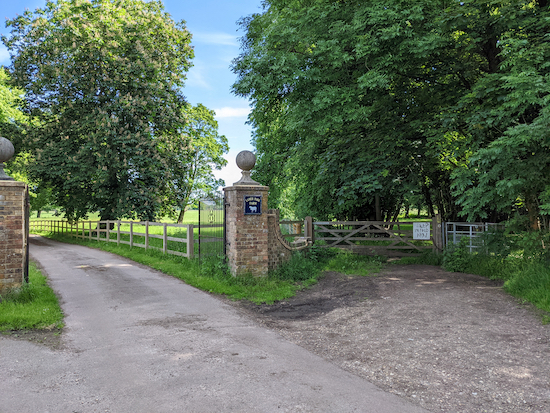
15: Follow the metalled lane (which is still Wheathampstead footpath 37) as it bend turn left, hen head N for 180m on Wheathampstead footpath 41 until you reach the gates of Lamer Park Farm (location - https://w3w.co/critic.harsh.pills), see image below.
 |
| Take the footpath to the right of the wooden gate - point 10 |
17: Turn right on Kimpton footpath 13 then head ENE for 210m before reaching a footpath junction (location - https://w3w.co/bricks.powder.filed).
18: Continue straight taking Wheathampstead footpath 99. Head ESE for 350m until you reach Bride Hall Lane (location - https://w3w.co/trying.tile.reef).
19: Turn left on the lane then head NNE for 280m passing Shaw's Corner on the left (location - https://w3w.co/gent.going.bars) before the lane bends to the right (location - https://w3w.co/rival.copy.transit).
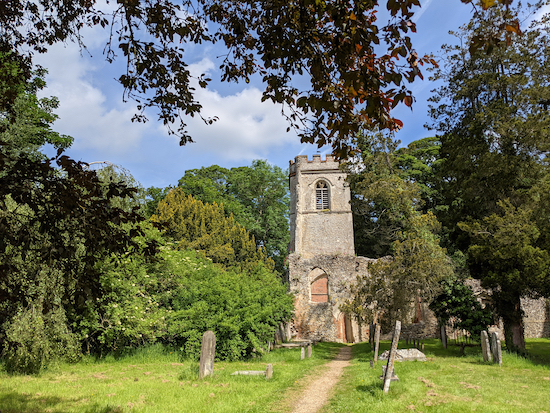
20: Keep right then walk past Ayot St Lawrence old church (location - https://w3w.co/grapes.basket.flips), see image below, then continues for 120m heading NE back to the start point.
 |
| Ayot St Lawrence old church - point 11 |


I am told this walk came up as suitable for wheelchair users. It isn’t. The paths, even when dry, are very rutted, and some are completely impassable because of rocks and roots. The gates are very difficult to get through. One stretch going across a field is (quite tall) grass, which challenged my mobility scooter, never mind a manual wheelchair. We had to give up at the halfway point. Lovely views, however
ReplyDeleteHi Lynne,
ReplyDeleteI am really sorry to hear this. Walk 111 is certainly not suitable for wheelchairs or mobility scooters. Unfortunately not many walks in our collection are. Who told you this walk was suitable for wheelchair users? And where did they get that information? I am really sad to hear you had a bad experience.
David
Been walking regularly for several years now, but today went on this our first walk from this website. Thoroughly enjoyed it, and really appreciated the excellent directions. Also found the What3Words references very useful. One disappointing thing to note was that, unfortunately, somebody (it looks like a deliberate act) has uprooted the signpost near step 2 of the walk (Codicote footpath 37), and simply thrown it to one side. However, we were still able to clearly see which route to take through the field. Looking forward to our next walk and keep up the great work, David!
ReplyDeleteGreat to hear that you enjoyed the walk. And nice to know the W3W references were useful. I sometimes wonder whether I add too many. They are particularly helpful when trying to describe complicated junctions in deep woodland. But, of course, not everyone carries a smartphone. Sad to hear about the sign. I often find signs on their side, some seem to have rotted at the base, others might have been knocked accidentally. If you have time you can report rights of way faults directly to Hertfordshire County Council. Here is the link. https://www.hertfordshire.gov.uk/services/highways-roads-and-pavements/report-a-problem/report-a-highway-fault/public-rights-of-way/public-rights-of-way.aspx.
ReplyDeleteThanks for the feedback. I hope you enjoy the next walk. Any idea which one you will be trying?
David
I did this walk the other, and extended it to include the Codicote mill. Brilliant walk for 4.8 miles or with extended bit pushing to about 6.2.
ReplyDeleteGreat idea. Well done. We include the mill in another walk. Never thought of joining the two. Good tip. Thanks for sharing.
DeleteDavid