4.5 miles (7.3 km) with 63m of total ascent
 |
| A sink hole in Gobions Wood |
Getting there
There are bus stops in Brookmans Park village close to the start of the walk (location - https://w3w.co/bulb.ranges.rates), which are served by the number 200, 201, 242, 305, 355, 610 buses. You can check bus times at Intalink.
Fly through preview of walk
If you want to check what sort of landscape you will be crossing before you set off on this walk you can view a short 3D video of the route below. It's created using the free version of Relive.
Please note, it is important that walkers stay on the footpaths during this walk and DO NOT wander off to explore the swallow holes; they can be dangerous and must not be walked on.
Those who have walked around Gobions Wood may have noticed many crater-like hollows in the ground. The majority are swallow holes or sink holes. However, there is one theory that at least one of the craters was caused by bomb damage.
In the booklet "On The Home Front", published by the former North Mymms Local History Society, Leslie Abbot recalls the night during WWII when a German bomber dropped bombs over the area with several falling on Gobions:
"on the way home (he) decided to deposit a string of bombs he did not want and unkindly decided to deposit them on Brookmans Park. The string, to my knowledge went in a straight line, and one went in the middle of Moffats Lane and the other, I know for certain, fell over Gobions Open Space. If you go there, there is a seat by an old oak tree trunk and one fell there. If you had a ruler you could plot where the others fell. They were all in a straight line and some were further down in Gobions and probably over near the station."The spot where it is thought that one of the bombs landed (location - https://w3w.co/honey.bend.lend) is marked on the maps below and with an orange icon.
According to Michael Howgate, the rest of the dips, hollows and craters we inspected during our walk were either sink holes or swallow holes. The British Geological Survey explains the difference.:
"sinkholes are often saucer-shaped hollows that are the result of some kind of collapse or removal of an underlying layer of rocks that used to support the layer of material at the surface. However, sinkholes can appear in a variety of different shapes and settings depending on the composition of the rocks and different interacting processes. Streams or rivers may enter a sinkhole and disappear underground. This type of sinkhole is often called a swallow hole".
Directions
Those with GPS devices can download GPX or KML files for this walk. We've added What3Words references for those who use that system. If you print these walks you might want to use the green PrintFriendly icon at the bottom of these directions to delete elements such as photographs.
This walk starts and finishes in Brookmans Park village if you want to travel by public transport using train or bus. Alternatively, for those wanting to drive, there is a free car park which is managed by North Mymms Parish Council (location - https://w3w.co/legal.basin.pump) 120m N of point 3 in the directions below.
1: From Brookmans Park station (location - https://w3w.co/bumpy.press.point) walk S on Bluebridge Road for 470m until you reach Bluebridge Avenue on the left (location - https://w3w.co/coast.fall.crops). Turn left on Bluebridge Avenue then head NE for 200m until you reach a gate (location - https://w3w.co/create.enjoy.vets) leading to Moffats and Gobions Open Spaces.
2: Go through the gate, turn right then head SE for 65m before going through a gap (location - https://w3w.co/knee.large.these). Turn left then head E for 310m, with the hedge on your left and the field on your right, heading for a gap in the trees ahead (location - https://w3w.co/scans.leaps.good).
3: Go through the gap, ignoring a footpath to the right (location - https://w3w.co/bravo.courier.humid), and continuing until you reach a play area on the left. Just behind the play area, 120m N, is the North Mymms Parish Council (NMPC) owned free car park off Jonas Way (location - https://w3w.co/wash.seat.fears), which those who want to travel to this walk by car are welcome to use.
 |
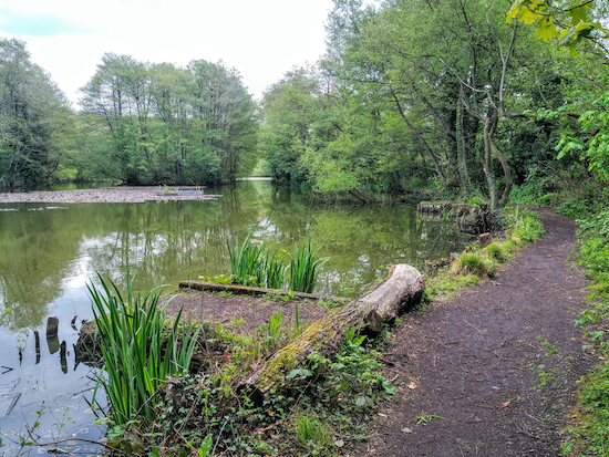
| Follow the path along the southern edge of Gobions Pond |
4: Go through the gate then follow the path S for 240m passing a small pond on the right (location - https://w3w.co/exact.jumped.golf) and continuing into Gobions Wood and on to a wooden footbridge (location - https://w3w.co/riders.slot.wiping). Immediately after the footbridge turn right then head W over another footbridge.
5: Continue along this path following it for 120m as it dips down to run along the S side of Ray Brook until you reach a set of wooden steps on the left (location - https://w3w.co/pushed.family.beams). Climb the steps before bending to the right then continuing heading W through Gobions Wood.
 |
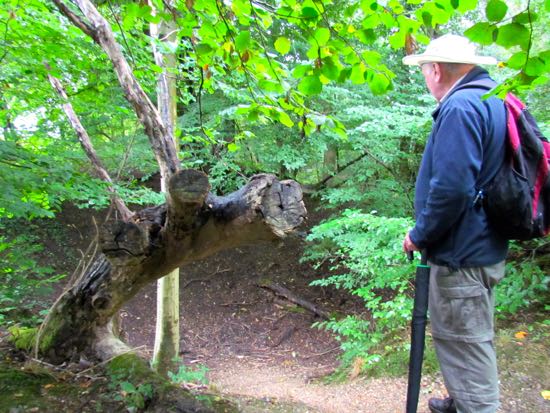
| Michael Howgate inspecting what might be a bomb crater |
As you continue to head W you will notice a number of dips in the land on both sides of the footpath. Some are swallow holes and others are sink holes. Please be sure to stay on the footpath and do not explore the area. Some of the swallow holes have been fenced off, but in some cases the fences have fallen.
 |
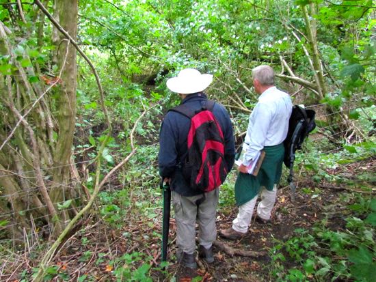
| Michael Howgate (left) surveying swallow holes after point 5 |
7: Cross Bluebridge Road then take the footpath directly opposite, still North Mymms footpath 11, and continue heading W until you reach the railway embankment (location - https://w3w.co/others.tell.give). Turn left at the embankment then head S, with the railway on your right and the field on your left, until you reach Hawkshead Lane (location - https://w3w.co/shins.valley.spirit).
8: Turn right on Hawkshead Lane, cross the railway bridge, then take the footpath on your right, which is still North Mymms Footpath 11 (location - https://w3w.co/pass.pulse.forgot). Head N with the railway on your right for 380m until you reach a footpath on your left (location - https://w3w.co/train.beats.yarn).
9: Turn left on the footpath, which is still North Mymms footpath 11, then descend some steep wooden steps. At the bottom continue to follow the footpath for 570m as it heads first NW and then W with the hedge on your right and the field on your left ignoring a footpath on your right (location - https://w3w.co/expert.poetic.last) and continuing until you reach the end of a field (location - https://w3w.co/sides.match.salad).
10: When you reach the end of the field turn right, cross a wooden bridge, turn left and go through a gate (location - https://w3w.co/slice.shades.slower). This footpath, which is still North Mymms Footpath 11, is known locally as Wise's Lane. On your right will be Brick Kiln Wood. Continue heading W for 520m with the brook on your left, ignoring a footpath on your left (location - https://w3w.co/much.accent.decide), and continuing until you reach a wooden walkway leading to a concrete footbridge spanning Mimmshall Brook (location - https://w3w.co/booth.stews.organ).
11: It's worth stopping at this point to see if you can spot a kingfisher from the bridge. If you see a flash of blue skimming across the water you have seen a kingfisher in flight. Check the wind direction. If the wind is blowing towards you, look that way. Once across the bridge turn right then walk N along Warrengate Road passing Bradmore Lane on your right (location - https://w3w.co/script.tones.index) and continuing for 340m until you reach The Woodman Inn at Water End (location - https://w3w.co/coherent.email.allow).
12: Just before you reach The Woodman Inn, turn right through the pub car park then take the footpath on your right, North Mymms Footpath 7 (location - https://w3w.co/dangerously.battle.shut).
 |
| Nettles surround one of the swallow holes at Water End |
"During the milking time, when the cows was suppose to come home, save a man going down to fetch the cows, we used to send an old dog after ‘em. This old dog used to go and fetch these cows up on his own. The cows used to sometimes fall in the swallow holes, like if you’d bought any fresh cows, they didn’t know the swallow holes, because the old cows used to know them. And it was nothing to go down there and find a cow had been drowned in ‘em.
"Then they used to take the gate off the hinges and get a horse with a rope on the end of it and pull the cow back up the farm on this gate. Just shows how sudden them swallow holes used to come up, there wouldn’t be no water perhaps, when the cows went over in the morning. They got over there because there was a nice bit of fresh grass beside the swallow holes. We’d get a storm a hell of a lot of rain and before they come home at night, the holes was up - used to have to swim across."Michael Howgate described the Water End swallow holes as follows:
"This is an SSSI (Site of Special Scientific Interest) because it is where a group of swallow holes takes the entire flow of the Mimmshall Brook and the southwards draining Potterells Stream. That is except at times of very heavy rainfall, when the whole area can become a lake, and then it can overflow along the channel through North Mymms Park to become the headwaters of the River Colne. At different times of year the stream can be a trickle, totally dried up or totally impassable. "In 1937, tests were carried out to determine the "chemical and bacteriological" contamination of the local water supply. Fluorescent dye was poured into the swallow holes at Water End. Three days later the dye appeared 10 miles away in springs feeding into the River Lea.
13: When you reach the field (location - https://w3w.co/port.feast.fixed) the path heads E and slightly uphill across the crop to Bradmore Lane. However this path is often ploughed over and rarely reinstated, so, instead, turn right at the field then head SE and S for 250m, with the hedgerow on your right and the field on your left, until you reach a gap in the hedge leading to Bradmore Lane (location - https://w3w.co/soap.thus.cheek).
14: Turn left on Bradmore Lane, then follow it as it heads E for 820m until you reach Station Road (location - https://w3w.co/cloak.former.stops). Turn right on Station Road then head S then W for 290m to Brookmans Park village.
There are many opportunities for refreshments in Brookmans Park, including Tealicious (location - https://w3w.co/solve.lace.flag), Brookmans Bakery (location - https://w3w.co/meant.roof.chill), and Brookmans pub/restaurant (location - https://w3w.co/prone.cycle.straw).
If you are on Facebook and would like to discuss this walk with fellow-walkers, please join our friendly Facebook group where members are sharing photographs and comments about their walks in the Hertfordshire countryside.


Our walking group, VCV U3A did this walk today and it was one of the most interesting walks we have found with a host of information regarding the history of the area throughout. We finished with a Pub lunch at The Woodmans Inn
ReplyDeleteHi Neil, so glad that you and your group found the walk interesting. Thanks for the feedback.
DeleteDid this one today David. Enjoyed it. Not too muddy and loved the section around Gobion's Pond especially.
ReplyDeleteHi Emma, glad you enjoyed it. It's an interesting walk. Thanks for the feedback. David
Delete