7 miles (11.2 km) with 76m of total ascent
 |
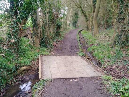
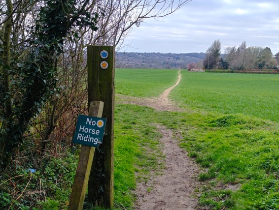
| The path between points 6 and 7 below |
This is an excellent walk that goes through deep woodland, across open fields, has sweeping views over rolling Hertfordshire countryside, passes through several cute villages with interesting pubs, has a really good restaurant at the halfway point, and the whole walk can be done via public transport starting and finishing at Welwyn North station.
Getting there
There are bus stops close to Welwyn North Station at the start of the walk (location -
https://w3w.co/surely.agent.sailor), which are served by the numbers 203 and 204 buses. There are also stops close to The Plough and The Tilbury at point 10 in the walk (location -
https://w3w.co/select.labels.friday), if you prefer to start the walk there. They are served by the numbers 203, 378, and 379 buses. You can check bus times at
Intalink.
Fly through preview of walk
If you want to check what sort of landscape you will be crossing before you set off on this walk you can view a short 3D video of the route below. It's created using the free version of
Relive.
Directions
 |
Map for Walk 89: Welwyn North-East Loop
Click on the map above for a larger version
Created on Map Hub by Hertfordshire Walker
Elements © Thunderforest © OpenStreetMap contributors
There is an interactive map below these directions |
Those with GPS devices can download
GPX or
KML files for this walk. We've added
What3Words location references for those who use that system. If you print these walks you might want to use the green
PrintFriendly icon at the bottom of these directions to delete elements such as photographs.
1: Leave Welwyn North station via the car park on the W side (location -
https://w3w.co/groups.minute.pitch) and take the footpath through to Woodside Road. Turn right and then right again down Warren Way. Keep walking NE along Warren Way, then take a right turn, also down Warren Way, and continue until you reach Welwyn Footpath 54 (location -
https://w3w.co/city.scam.visit). Take this path ENE for 40m then NNE for 40 to a footpath junction.
 |
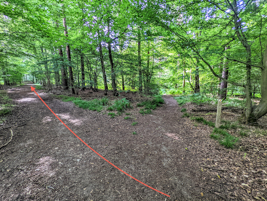
| The permissive path mentioned in point 2 below |
2: When you reach a footpath crossing (location -
https://w3w.co/live.inspector.chief), continue straight along a permissive path cut through the woodland for 150m. A sign inviting walkers to use the permissive path reads:
“Take nothing but photographs; leave nothing but footprints”.
 |
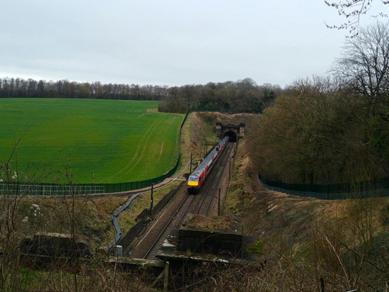
| The railway cutting mentioned in point 3 below |
3: When the path joins Welwyn Footpath 53 (location -
https://w3w.co/allows.army.august) keep left and head N for 200m until you come to the top of the railway cutting (location -
https://w3w.co/scores.snap.bikes), see image above. Here you turn right and then take the first footpath on your left (location -
https://w3w.co/slide.same.asserts). This is Welwyn Footpath 29, which you follow for 900m as it heads NNE with the railway on your left in a cutting. Continue until you reach a large air ventilation shaft on the right (location -
https://w3w.co/laws.tribal.grand), see image below. The ventilation shafts along this part of the route service the railway tunnels beneath. Don't be surprised if you hear a loud roar as a train passes below.
 |
| Pass the ventilation shaft then turn right |
4: Immediately after the ventilation shaft veer right then head NE for 40m until you reach a track. Turn right at the track then take the right fork (location -
https://w3w.co/lamps.feed.finger), see image below.
 |
| Keep right at the large tree then follow the main track SE |
Continuing heading SE for 210m to a junction where footpath 27 goes off to the right, see image below.
 |
| Ignore the path on the right and continue heading SE on the main track |
Ignore footpath 27 on the right and continue on the main track still heading SE for 160m until you reach a gate (location -
https://w3w.co/snack.task.drum).
5: Go through the gate then head SE on Welwyn Footpath 27, with the hedgerow on your left and the field on your right for 280m until you reach a junction (location -
https://w3w.co/ideal.blitz.loads), see image below.
 |
| Turn left on Welwyn bridleway 26 then head N |
6: Turn left and head N on Welwyn Bridleway 26 and continue along this bridleway for 920m until you reach a footpath crossing (location -
https://w3w.co/woke.jolly.epic).
7: Continue heading N for 500m on Woolmer Green Bridleway 24 until you reach Robbery Bottom Lane (location -
https://w3w.co/lied.famed.faded).
 |
| Robbery Bottom Lane heading east mentioned in point 8 below |
8: Continue N on Robbery Bottom Lane for 90m and follow the lane as it turns right turn and heads ENE for 500m until you reach White Horse Lane (location -
https://w3w.co/shins.yours.glee).
9: Cross White Horse Lane and take the bridleway immediately opposite, Woolmer Green bridleway 9, and continue heading NE along this bridleway for 950m until you reach Datchworth Green (location -
https://w3w.co/dull.dizzy.visual).
 |
| Woolmer Green Bridleway 9 mentioned in point 9 above |
10: There are a couple of pubs in the village if you want a break.
The Plough (location -
https://w3w.co/silver.wings.mirror) is an excellent real ale pub. No frills, just good beer. Across the road is
The Tilbury (location -
https://w3w.co/rated.likely.shower) which has a great menu and serves delicious food. There is also a coffee shop,
Datchworth Coffee, and a village store.
At the road crossing continue E for 340m along Watton Road looking out for a byway open to all traffic (BOAT) on your right (location -
https://w3w.co/deputy.count.images). This is Datchworth BOAT 19. There is no pavement on this short stretch of lane, so walk against the traffic on the right hand side of the road until you reach the byway on the right.
 |
| Datchworth BOAT 19 heading south mentioned in point 10 above |
11: Head SSE on this BOAT, also known as Back Lane for 610m. Ignore the first footpath on your right. The path enters woodland.
12: Shortly after entering the woodland turn right on Watton-At-Stone Footpath 27 (location -
https://w3w.co/quench.cave.learn) and follow the path as it heads SW for 550m until it meets Bramfield Road (location -
https://w3w.co/member.older.police).
 |
| Watton-At-Stone Footpath 27 mentioned in point 12 above |
13: Turn left on Bramfield Road then take the first turn on your right along Coltsfoot Lane. Here you pass
The Horns restaurant and pub.
 |
| The Horns mentioned in point 13 above |
14: Head W on Coltsfoot lane for 500m ignoring the first footpath on your left. When you reach Coltsfoot Farm on your right, take Datchworth Footpath 17 on your left (location -
https://w3w.co/happy.refers.march). Follow this path SW for 780m until you reach Whitehorse Lane in Burnham Green (location -
https://w3w.co/boring.grape.bands). There is the
White Horse pub in the village if you want refreshments.
 |
| The White Horse mentioned in point 14 above |
15: Turn left on Whitehorse Lane and head S for 170m, then turn right on Harmer Green Lane heading W for 210 along Harmer Green Lane looking out for Welwyn Footpath 34 on your left (location -
https://w3w.co/blur.club.fluid).
16: Take this footpath and head SW for 830m until you reach Pennyfathers Lane (location -
https://w3w.co/summer.decide.judges).
17: Cross Pennyfathers Lane taking Welwyn Bridleway 50 opposite and continue heading SW for 1.1km. This bridleway becomes Welwyn Footpath 34b and drops down to a road (location -
https://w3w.co/twig.visual.tonic).
 |
| Welwyn Footpath 34b mentioned in point 18 above |
18: Turn right then left on Harmers Green Lane and head N back to Welwyn North station (location -
https://w3w.co/divide.muddy.print).
* The Cowper Arms pub/restaurant (location - https://w3w.co/paint.moss.atoms) is 150m W of the station. To reach the pub either turn left out of the car park then right on Station Road and right again on Colyer Close.
Interactive Map


Thank you for another comprehensive routed walk. This is a lovely quiet walk that winds its way through changing landscapes, with the added bonus of a few stop offs for a drink and some food. Thanks
ReplyDeleteHi Robbie,
DeleteYes, this is one of our favourites. We catch the train, have a few beers at The Plough, then lunch at the Tilbury. Then walk it off on the 3.5 miles return to the station with the option of a stop at a couple of pubs along the way. Great day out.
David
Really enjoyable walk. Nice quiet paths and some great recommendations for food and drink on the way . Also really handy walk for us using public transport. Would be a great addition to the page if those walks starting near or within reach of a train station or decent bus service were marked up in some way . Fabulous guides and great website. Thank you .
ReplyDeleteHi, glad you enjoyed it. Funny you should mention public transport, I have just mapped two linear walks using the rail network. One from Welwyn Garden City to Knebworth and the other in reverse but using different paths. We are going to test them thoroughly and publish over the next few weeks weather permitting.
DeleteDavid
Nice walk, thank you. This is the first of your walks that I've done but I will definitely do more.
ReplyDeleteHi James, great to hear. Glad you enjoyed it. Keen to hear how you get on with the other walks. Thank for the feedback. David
DeleteThank you for this lovely walk, which we did today as one from the 'accessible by train' list. The instructions and images were clear and helped us round the route which was varied and scenic. We stopped around halfway to have lunch at the Horns pub (point 13) which was good. A good day out!
ReplyDelete