4.3 miles (6.9 km) with 103m total ascent
 |
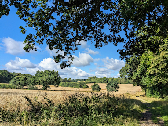
| The view between points 6 & 7 |
Fly through preview of walk
If you want to check what sort of landscape you will be crossing before you set off on this walk you can view a short 3D video of the route below. It's created using the free version of Relive.
Directions
GPX or KML files for this walk. We've added What3Words location references for those who use that system.1: Park along St Mary's Church Lane (location - https://w3w.co/recent.chief.holly), making sure you don't block any of the gates leading to the fields.
Head SSW for 520m along the lane, which is also North Mymms Bridleway 2, until the paved part of the road swings to your right (location - https://w3w.co/lions.keen.ends).
2: Continue heading SSW, still along North Mymms Bridleway 2, for 770m at first with fields on either side.
Keep heading SSW as the bridleway climbs up through Cangsley Grove - look out for Purple Emperor butterflies in July and August - before reaching the top of the hill where you have a view over Potwells valley (location - https://w3w.co/skins.enable.really).
This is a fascinating area and you might want to read more about the geology of the landscape in this area.
3: Here you turn right and follow North Mymms bridleway 90, which later becoming Ridge bridleway 44, heading SW and then S for 460m until you meet a gate on the right (location - https://w3w.co/owls.speeds.last). This is an area of geological importance, as described by geologist Mike Howgate.
Don't go through the gate, but head SE on Ridge bridleway 10 with the woodland on your right and field on your left for 150m dropping down to cross a footbridge (location - https://w3w.co/cling.meal.chop).
After the footbridge continue heading SE for 240m, still on Ridge bridleway 10, crossing a field until you meet a gate leading to a T-junction in the track (location - https://w3w.co/darker.adopt.storms).
 |
| The view over Potwells near Cangsley Grove - turn right here |
* At this point you could continue heading S for refreshments at The Black Horse (620m).
5: Turn left on the track just beyond the cottage, Ridge restricted byway 11, and head NE and NNE for 280m. Just after the farm on your right this track becomes North Mymms restricted byway 3 and heads NNE, NE then E through Mymmshall Wood for 1.4km until you reach a junction (location - https://w3w.co/bottle.cake.sands) just before the A1(M).
 |
| The path through Mymmshall Wood between points 5 & 6 on this walk |
 |
| The wind-pump and well on the W side of Love Lane |
 |
| Love Lane between points 7 & 8 on this walk |
9: Turn left on North Mymms BOAT 5 and head N for 150m until you reach Tollgate Road. Here you turn right and head north.
10: Go under the footbridge and take the path on your left leading through the bushes to a gate leading to a field (location - https://w3w.co/glitz.ever.hurry).
* If you want refreshments you can cross the A1(M) and visit The Woodman Inn on Warrengate Lane, Water End.
 |
| Go through the gate into the field mentioned in point 10 above |


Beautiful walk with some fair inclines and declines. Beautiful views and right on my doorstep too. Highly recommended:)
ReplyDeleteGreat, glad you enjoyed it. Thanks for the feedback. David
ReplyDeleteDid this walk this morning in glorious sunshine. Didn't see a sign at point 6 tho walking further on towards the footbridge over the A1 we saw it. Also no bench at point 7. We followed a sign to St Mary's Church across a field to avoid walking beside the road! Lovely walk
ReplyDeleteHi, I don't think there is a sign at point 6. I don't mention one in the directions. But you did the correct thing by turning left before reaching the bridge over the A1(M). The bench was just beyond the remains of the windpump at point 7. I will check whether it's been removed next time we are up there. Glad you enjoyed the walk. David
ReplyDelete