3.3 miles (5.3 km) with 39m total ascent
 |
| Footpath 15 as it runs west along the north side of Potters Bar Brook |
Directions
 |
| Map for Walk 68: Brookmans Park South-West Linear Created on Map Hub by Hertfordshire Walker Elements © Thunderforest © OpenStreetMap contributors There is an interactive map at the foot of the page |
1: Leave Potters Bar station via the westerly exit leading out to the car park. Turn right and walk N for 100m heading through the car park to a footpath on your right that runs NNW alongside the track (location - https://w3w.co/obey.paused.judge). This is Potters Bar footpath 9. Follow it for 1km until you reach the Cranbourne Industrial Estate on your left (location - https://w3w.co/joined.roofs.video).
 |
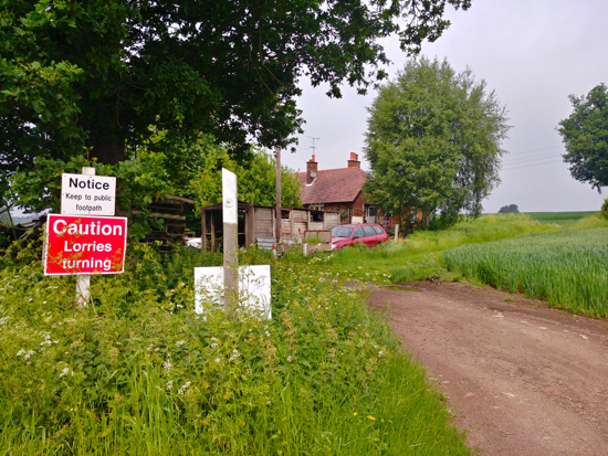
| The start of footpath 15 mentioned in point 2 below |
Follow the footpath for 160m as it heads SW with Potters Bar Brook on your left before emerging on Cranbourne Road. Cross the road but ignore the green gates leading to Furzefield Wood. Do not go through those gate because you will end up on the wrong side of the river and reach a dead end.
Instead, turn right and, just past the green gates you will see a footpath sign on your left, often hidden by the overgrown hedgerow (location - https://w3w.co/local.cape.care).
Take this path, a continuation of Potters Bar footpath 15 and head W for 600m with Potters Bar Brook on your left until you reach Warrengate Farm (location - https://w3w.co/data.else.future).
 |
| The right turn on Footpath 14 mentioned in point 3 below |
Take the right fork, Potters Bar footpath 13, and head NE for 240m until you reach Pilvage Wood (location - https://w3w.co/bigger.fear.wipes).
Here your path heads NW across a field and then NNE for 310m before reaching Hawkshead Lane (location - https://w3w.co/desire.beam.thank).
 |
| The footpath mentioned in point 4 below |
 |
| The footbridge mentioned in point 5 below |
Take this path and head N, NW and N across two fields, through a couple of metal gates with some steps in between, across another field, and then go through a gate to reach a footbridge leading to the footpath (location - https://w3w.co/thank.bossy.forms).
 |
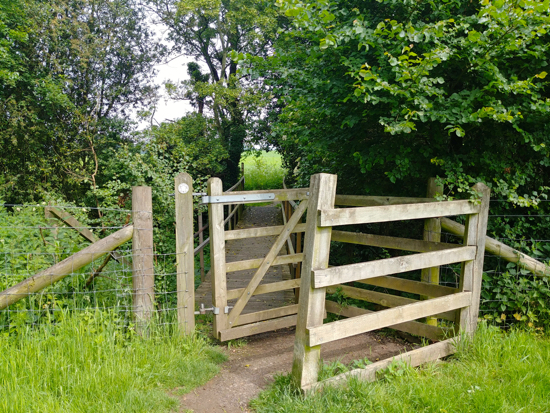
| The second gate mentioned in point 6 below |
After crossing the footbridge turn left and continues heading E for 300m, still on North Mymms footpath 11, with the hedgerow on the left and the fields on your right until you reach another gate (location - https://w3w.co/forces.object.damp).
7: Turn left, cross a footbridge, and then continue heading NE and N for 580m on North Mymms footpath 9, past Brookmans Park Station on your right, and on to Station Road (location - https://w3w.co/flown.book.tried).
When you reach Station Road turn right and head S for 210m back to Brookmans Park village, the station and shops.


No comments:
Post a Comment
Comments and feedback
If you try any of the walks on this site, please let us know what you thought of them by adding a comment here or on our members-only Facebook group. Comments here are checked before they are published. Comments on the Facebook group go live immediately.