2.7 miles (4.3 km) with 45m total ascent
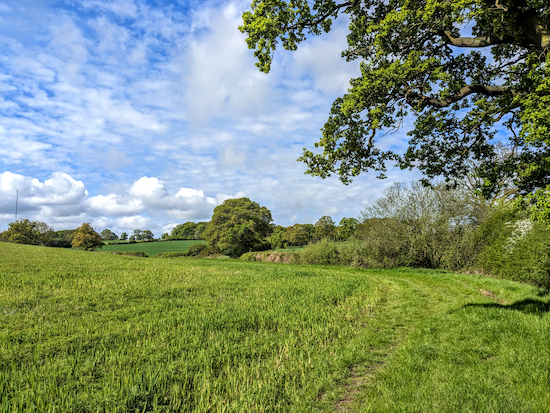 |
| The footpath between points 2 & 3 |
This walk starts across fields which can be fairly muddy after rain. It includes a sheltered stretch along a wooded bridleway which weaves along a ridge offering excellent views S towards Brookmans Park. There are a few short stretches along quiet country lanes. The starting point is two miles NE of Welham Green station by road.
The walk has the benefit of beginning and ending at
The Woodman, Wildhill (location -
https://w3w.co/luxury.woods.march) please check for opening times. The landlord says walkers are welcome to use the pub car park if they intend to purchase refreshments before or after their walk.
Fly through preview of walk
If you want to check what sort of landscape you will be crossing before you set off on this walk you can view a short 3D video of the route below. It's created using the free version of
Relive.
Directions
 |
Map for Walk 6: The Wildhill Loop
Click here or on the map above for a larger version
Created on Map Hub by Hertfordshire Walker
Elements © Thunderforest © OpenStreetMap contributors
There is an interactive map at the foot of this page |
Those with GPS devices can download
GPX or
KML files for this walk. We've added
What3Words references for those who use that system. If you print these walks you might want to use the green
PrintFriendly icon at the bottom of these directions to delete elements such as photographs.
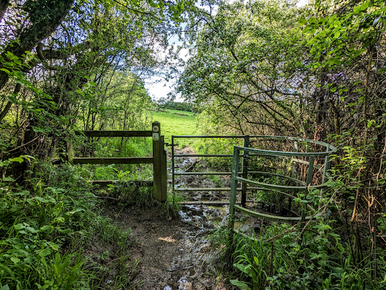 |
| Go through the gate in the SW corner of The Woodman car park |
1: Go through the gate in the SW corner of The Woodman car park (location -
https://w3w.co/bigger.jeeps.taxi) then follow Hatfield footpath 84, for 300m as it heads SSW. This section of the walk can be extremely boggy after rain.
Cross a wooden bridge (location -
https://w3w.co/charge.ranks.likes), then go through another gate (location -
https://w3w.co/owner.moods.darker), see image below.
 |
| Keep following Hatfield footpath 84 to the corner of the field |
Keep following Hatfield footpath 84 to the corner of the field where it crosses another wooden footbridge (location -
https://w3w.co/jumpy.sofa.became) then bends to the left.
2: After crossing the second footbridge, go through a gate in the hedgerow on your left (location -
https://w3w.co/snap.fuzzy.gave) then turn right, see image below.
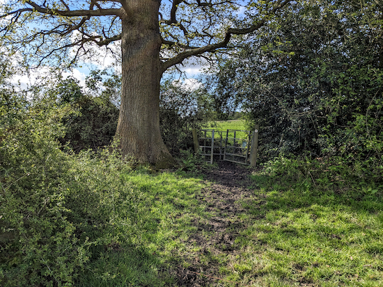 |
| Go through a gate in the hedgerow on your left then turn right |
Follow the footpath with the field on your left and the hedgerow on the right for 200m as the path bends to the left until you reach a gap in the hedge on the right (location -
https://w3w.co/scan.monks.closed), see image below.
 |
| Go through the gap, and follow the path uphill heading SW |
3: Go through the gap, and follow the path uphill heading SW with the field on your left and the hedgerow on your right.
4: After 80m the path veers left (location -
https://w3w.co/swift.sushi.enhancement) heading diagonally uphill towards a tree on the left (location -
https://w3w.co/begins.papers.torch). At the top of the hill follow the path as it bends to the right, see image below.
 |
| Continue SW with the woodland on your right and the field on your left |
Continue SW with the woodland on your right and the field on your left for 95m until you reach the end of the woodland (on your right) and reach a field (location -
https://w3w.co/social.move.gravel), see image below.
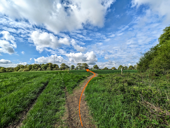 |
| Continue across the field, still on Hatfield footpath 84 |
Continue across the field, still on Hatfield footpath 84, for 195m until you reach a gate leading to Grubbs Lane (location -
https://w3w.co/animal.hoot.diner).
5: Turn right and walk NW along the lane for 230m.
6: Soon after Westfield Lodge, take a footpath on your right, Hatfield footpath 82 (location -
https://w3w.co/holly.onion.shakes), see image below.
 |
| Turn right off Grubbs Lane on Hatfield footpath 82 |
Cross the fields for 200m walking diagonally NNW heading to the left of a pylon, see image below.
 |
| Cross the first field heading to the left of a pylon |
Continue across another field for 210m heading for the edge of the woodland (location -
https://w3w.co/deals.ridge.throw), see image below.
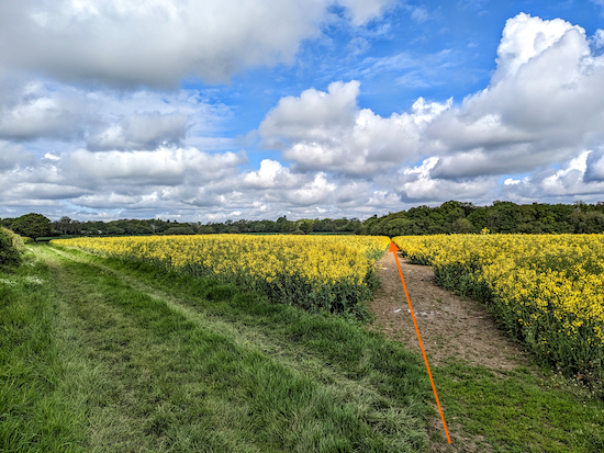 |
| Continue across another field heading for the edge of the woodland |
7: Continue, now heading NW, with the woods on your right, see image below.
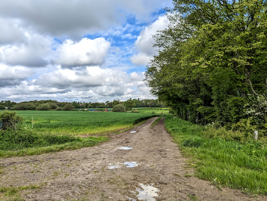 |
Continue, now heading NW, with the woods on your right
|
After 180m Hatfield footpath 82 bends left (location -
https://w3w.co/life.bared.home) then heads W for 70m until it reaches a farm storage yard (location -
https://w3w.co/love.poem.flips).
Take the track on the right, Hatfield footpath 81 (location -
https://w3w.co/gravel.large.term), see image below.
 |
| Head NNW on Hatfield footpath 81 |
Head NNW on Hatfield footpath 81 for 250m until you reach Wildhill Road (location -
https://w3w.co/smiles.moment.bucks), see image below.
 |
| Cross Wildhill Road then head N along Hatfield UCR1 |
8: Cross Wildhill Road then head N along Hatfield UCR1 (
unmetalled unclassed county road) for 450m to a byway junction (location -
https://w3w.co/vest.voters.fumes), see image below.
 |
| Turn right then head E along Green Street |
9: Turn right at the junction and head E along a byway called Green Street. This is Hatfield BOAT 80 (
byway open to all traffic). Look right for some excellent views across the valley. Continue along this byway for 880m until you reach West End Lane (location -
https://w3w.co/record.decent.rots), see image below.
 |
| Turn right on West End Lane |
10: Turn right on West End Lane and follow the lane downhill and S for 500m to Wildhill (location -
https://w3w.co/fuel.full.rental).
11: Turn left at the junction and head W. After 100m The Woodman will be on your right.
Interactive map


Hi Dave, been enjoying your walks recently. Did the Wild Hill one - lovely but bit muddy, nice pint after in The Woodman. I remember you from Bridge Street long ago! I'm now living in Cuffley with Richard B.
ReplyDeleteHi Jackie,
DeleteNice to hear from you. Ah yes, the BBC Parliamentary Unit. Happy days. Glad you enjoyed the walk; you are always guaranteed a wonderful pint at The Woodman at Wildhill - our local.
We tested another great walk today. Number 147 which I'll publish tomorrow. Two cracking pubs, both serving excellent beer and the one we ate at was superb.
Great to have your feedback on the walks. Hope you are keeping well.
Dave