3 miles (4.7 km) with 91m total ascent
 |
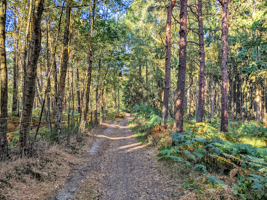
| The path through Mymmshall Wood towards the end of the walk |
Directions
 |
| Map for Walk 51: Mymmshall Wood Loop Click here or on the map above to reveal a larger version Created on Map Hub by Hertfordshire Walker Elements © Thunderforest © OpenStreetMap contributors There is an interactive map at the foot of this page |
1: From the access lane that runs parallel to Swanland Road, cross the road heading for the footbridge over the A1(M). The track leading up to the footbridge is Potters Bar restricted byway 79 (location - https://w3w.co/stem.assure.legend). As you cross the footbridge you will be on North Mymms restricted byway 83.
After crossing the footbridge, turn right (location - https://w3w.co/visit.remark.ranch) and follow North Mymms restricted byway 3 NNW for 170m with the A1(M) on your right. This track is also known as Love Lane. You will notice a signpost on your right along this stretch indicating that you are on byway 5, ignore it, it's wrong.
Continue along this byway until it bends left (location - https://w3w.co/places.actors.poem) and becomes North Mymms BOAT 4 (byway open to all traffic).
 |
| North Mymms BOAT 4 between points 1 and 2 |
Keep left at the bench and continue heading NW, now on North Mymms bridleway 4 until you reach a footpath/track crossing (location - https://w3w.co/action.tight.career).
2: Turn left and head SW along North Mymms bridleway 1 for 530m with Cangsley Grove on your right. Look out for Purple Emperor butterflies here in July and August. Continue along the path through the woods until you reach a footpath gate on your left opening into the field (location - https://w3w.co/image.grabs.horn).
3: Take this path, North Mymms footpath 1, and head SW for 450m. This field is used for grazing sheep and there will be signs at certain times of the year warning that dogs should be kept on a lead. Cross the field, then cross a footbridge (location - https://w3w.co/bolt.moving.singer), before climbing uphill (*) across the next field until you reach a gate leading to a bridleway (location - https://w3w.co/vows.flesh.hears).
* At this point, if you want to avoid the sun, you could keep left after crossing the footbridge then walk round the edge of the field with the trees on the left and the field on the right until you reach the gate at the top of the hill.4: When you reach the top of the hill go through the gate then turn left on North Mymms bridleway 2 and follow it S for 770m through Redwell Wood and Hawkshead Wood heading down the hill towards Blackhorse Lane. Just before reaching Blackhorse Lane you come to a small cottage on the left (location - https://w3w.co/finger.clay.quest).
* At this point you could take a detour 670m south to The Black Horse at South Mimms (location - https://w3w.co/dined.swan.descended).5: Immediately after the cottage, turn sharp left on Ridge restricted byway 11 and head NE past Woodhill Farm on your right. Just past the farm the track becomes North Mymms restricted byway 3 and continues for 1.5km heading NNE and then NE through Hawkshead Wood and Mymmshall Wood and then E down to the footbridge over the A1(M) where you started the walk.
 |
| The byway through Hawkshead Wood |
* At this point you could walk 1.1km N on Warrengate Road to The Woodman Inn at Water End (location - https://w3w.co/laws.arrow.stick).


One of my favourite short walks, the dogs love it - nice , safe and very relaxing .
ReplyDeleteBut in the 12 months since I last did it - such a shame to see the footpath sign and post broken and thrown in the undergrowth at the start of the walk and the lovely old bench near the half way point (and footpath junction) also missing - presume it was damaged and not replaced . Hopefully the council will get round to fixing both at some point .
Yes, we did that walk yesterday and saw the broken sign. And we met a couple who also pointed out the bench was missing.
Delete