3 miles (4.8 km) with 10m of total ascent
 |
| Barges from the footbridge between points 11 & 12 |
This short walk explores part of the middle section of the
Lee Valley Regional Park. The entire park is 26 miles long and covers 10,000 acres. It was created to act as a “green lung” for Hertfordshire, Essex, and London. This short walk is the first of three we have planned in this area. The others will explore the southern and northern sections. Please be aware that many of the tracks along this route are shared with cyclists and horse riders. If you are into birdwatching be sure to take your binoculars on this walk.
Fly through preview of walk
If you want to check what sort of landscape you will be crossing before you set off on this walk you can view a short 3D video of the route below. It's created using the free version of
Relive.
Directions
 |
Map for Walk 24: Lee Valley Middle Loop
Click on the map above for a larger version
Created on Map Hub by Hertfordshire Walker
Elements © Thunderforest © OpenStreetMap contributors
There is an interactive map below these directions |
Those with GPS devices can download
GPX or
KML files for this walk. We've added
What3Words location references for those who use that system. If you print these walks you might want to use the green
PrintFriendly icon at the bottom of these directions to delete elements such as photographs.
This route starts and finishes at the Turnford Brook Car Park (location -
https://w3w.co/causes.paid.found) which, at the time of writing (28/10/2023) was free-of-charge.
Please check before leaving your car that this hasn't changed.
There are several other parking opportunities which are marked on the map below with blue icons. Those wanting to travel by public transport could catch the train to Cheshunt Station (location -
https://w3w.co/when.orbit.before) then make their way to point 12 and join the loop there.
There are no pubs or cafes along the route, but the excellent
Wildlife Discovery Centre at point 7 (location -
https://w3w.co/heads.slick.mirror) has a hot drink vending machine where you can purchase tea, coffee or hot chocolate. When we visited on October 2023 it was £2 a cup.
There are public toilets (location -
https://w3w.co/smiled.with.robe) a short detour from point 8 close to the Fishers Green Car Park (location -
https://w3w.co/garden.maps.danger). You will pass a picnic area called The Glade on your left if you take that detour (location -
https://w3w.co/lawn.lamp.extend). Youngsters might like to see if they can find the Giant Wood Ant sculpture in The Glade, see image below.
 |
| Giant Wood Ant in The Glade |
1: As you leave the Turnford Brook Car Park turn left on the access road then head E for 20m to a gate (location -
https://w3w.co/pram.vibes.loses), see image below.
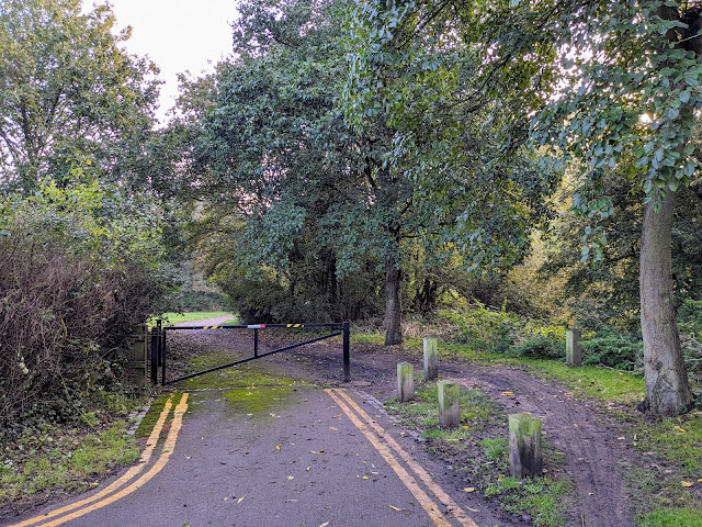 |
| The gate at the end of the car park access road |
Go through the gate then head E, ignoring paths to your right and left, and continue until you reach a footbridge over the Hertford East to London Liverpool Street railway line (location -
https://w3w.co/name.roofs.watch).
2: Cross the footbridge then continue heading straight and E for 155m until you reach a junction (location -
https://w3w.co/both.handy.mull), see image below.
 |
| Turn left at the junction |
3: Turn left at the junction then head NNE for 55m until you reach a junction and a path on the right (location -
https://w3w.co/chimp.softly.saving), see image below.
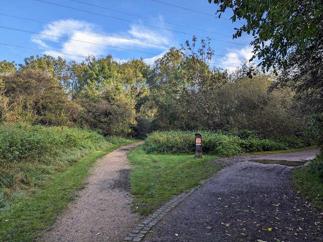 |
| Turn right at the junction then head ENE |
4: Turn right at the junction then head ENE for 530m until you reach a junction (location -
https://w3w.co/scan.ashes.loose), see image below.
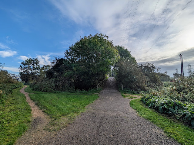 |
| Keep straight at the junction then cross the River Lee Navigation |
5: Keep straight at the junction then cross the
River Lee Navigation via a footbridge (location -
https://w3w.co/locker.toxic.motion). You will notice the different spelling between the River Lee Navigation and the
River Lea which runs alongside. It is not a typo. The valley is known as the River Lee Valley and the river goes by both names, Lee and Lea.
Cross the footbridge then continue heading E for 125m to another junction (location -
https://w3w.co/ruler.noon.dark), see image below.
 |
| Turn right at the junction |
6: Turn right at the junction. Before going any further have a look at the information board on the right (location -
https://w3w.co/serve.stages.camera). If you have young ones with you they might like to see how many of the wildlife benches they can spot along the way, see images below.
 |
The wildlife benches information board
Click on the image for a larger version |
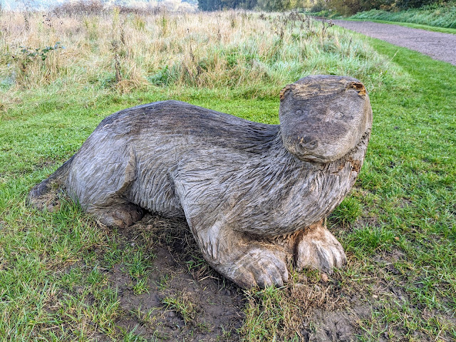 |
| The otter close to the wildlife bench at point 6 in the walk |
Follow the track first S then in a SE direction for 820m until you reach the amazing Lee Valley Wildlife Discovery Centre (location -
https://w3w.co/this.payer.found), see image below. This is well worth a visit, especially if you are a birdwatcher. There is also a wonderful discovery room with interactivity for young and old. And there is a vending machine for hot drinks. There are also helpful staff on hand to explain the significance of the nature surrounding the centre.
 |
| The Lee Valley Wildlife Discovery Centre |
7: After visiting The Lee Valley Wildlife Discovery Centre continue heading SE for 70m until you reach a junction with a footbridge on the left (location -
https://w3w.co/wasp.blast.vivid), see image below.
 |
| Cross the green footbridge if you want to visit the toilets |
8: If you need to visit the toilet, or would like to visit The Glade picnic area and look for the Giant Wood Ant sculpture, turn left then cross the footbridge.
If you want to continue with the walk, ignore the footbridge and head straight through a gate then continue following the track as it meanders in a southerly direction for 830m.
 |
| The winding track between points 8 & 9 |
As you walk this track look out herons and swans on the left, see images below.
 |
| A heron between points 8 & 9 |
 |
| Swans between points 8 & 9 |
Continue along this track until you reach a wooden gate leading to a junction (location -
https://w3w.co/pack.myself.digits), see image below.
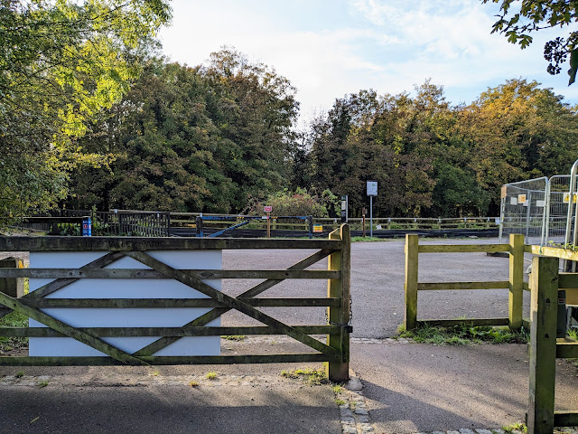 |
| Go through the gate then turn right |
9: Go through the gate then turn right and head SW for 30m until you reach another junction (location -
https://w3w.co/unions.royal.photos) with a path going straight ahead and another forking off to the right through a section of car park. Take the right fork here, see orange arrow on the image below.
 |
| Follow this path WNW for 370m until you reach a junction |
Follow this path WNW for 370m until you reach a junction (location -
https://w3w.co/locate.retail.twig).
10: Keep right at the junction then head WNW for 155m to another junction (location -
https://w3w.co/harp.passes.shack).
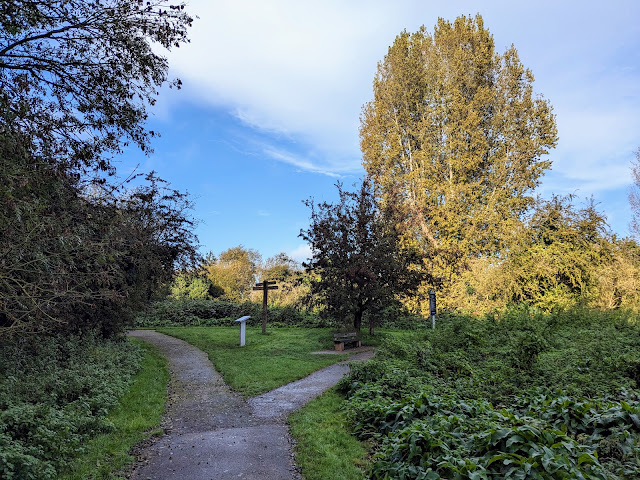 |
| Keep left at the junction then follow the path W |
11: Keep left at the junction then follow the path W for 85m until you cross a bridge over the River Lee Navigation then reach a footpath on the right leading down to the towpath (location -
https://w3w.co/farmer.lungs.fend), see image below.
 |
| Turn right then follow the path down to the towpath |
At this point, if you need refreshments, you could take an 850m detour S along the River Lee Navigation then W to reach Cheshunt (location - https://w3w.co/invest.boring.jokes) were there are three pubs and a cafe.
12: If you don't take the detour, turn right then follow the path down to the towpath where you turn left then head N alongside the River Lee Navigation. After 270m you will reach Cheshunt Lock (location -
https://w3w.co/water.landed.lights), see image below.
 |
| Cheshunt Lock on the River Lee Navigation |
Continue along the towpath N for 580m until you reach a path on the left immediately before the footbridge you crossed earlier at point 5 in the walk (location -
https://w3w.co/opens.saving.rally), see image below.
 |
| Turn left then leave the towpath |
13: Turn left then leave the towpath. You are now retracing the steps you took at the start of the walk. Head W for 285m until you reach the junction you passed at point 4 in the walk (location -
https://w3w.co/script.spoil.flute).
Turn left at the junction then head SSW for 55m to the junction you crossed at point 3, see image below.
 |
| Turn right then follow the path back to the starting point |
Turn right then follow the path back to the starting point at Turnford Brook Car Park (location -
https://w3w.co/mouse.fortunate.rather).
If you enjoyed this walk please consider joining our
Hertfordshire Walker members-only Facebook Group where you can share photos and comments on your walking experiences.
Interactive map


No comments:
Post a Comment
Comments and feedback
If you try any of the walks on this site, please let us know what you thought of them by adding a comment here or on our members-only Facebook group. Comments here are checked before they are published. Comments on the Facebook group go live immediately.