6.1 miles (9.8 km) with 215m total ascent
 |
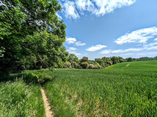
| Essendon footpath 13 at the start of the walk |
This undulating walk along footpaths, byways and quiet lanes taking in woodland, rivers, and open spaces involves a lot of up and down with a total elevation gain of almost 400ft. There are refreshment opportunities at Little Berkhamsted, Wildhill, and West End where you can also join the walk. The route involves 1.4km of lane walking, but there are options to step aside on the grass verge in the case of traffic. The route passes over a golf course.
Emmie Murphy's village store, which is a short detour from point 16 in the walk, serves hot drinks and snacks.
Fly through preview of walk
If you want to check what sort of landscape you will be crossing before you set off on this walk you can view a short 3D video of the route below. It's created using the free version of Relive.
Directions
 |
Map for Walk 11: West End Long Loop
Created on Map Hub by Hertfordshire Walker
Elements © Thunderforest © OpenStreetMap contributors
Click on the map above for a larger version
There is an interactive map embedded at the end of these directions |
Those with GPS devices can download
GPX or
KML files for this walk. We've added
What3Words references for those who use that system. If you print these walks you might want to use the green
PrintFriendly icon at the bottom of these directions to delete elements such as photographs.
You could also start this walk at The Woodman, Wildhill (point 7), or in Essendon village (point 21).
 |
| Take the footpath to the left of The Candlestick |
1: Park in the lane outside
the Candlestick pub at West End (location -
https://w3w.co/later.linen.cute). As you face the pub, take Essendon
footpath 13, to the left of the building (location -
https://w3w.co/paid.entry.influencing) , see image above.
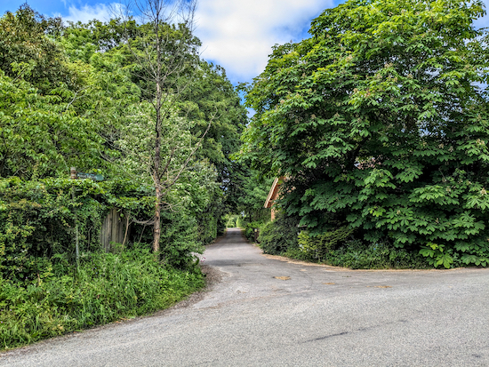
Follow this footpath as it heads SE and downhill for 430m, keeping the hedge on your left and the field on your right until the path goes through the woods and reaches a byway (location -
https://w3w.co/forget.organ.saves), see image below.
 |
| Turn right on Essendon BOAT 14 |
2: Turn right on Essendon BOAT 14 (
byway open to all traffic) then head S for 520m downhill and then uphill until you reach the top of a hill where you will see a sign on the left with a yellow arrow pointing to a footpath and a gate (location -
https://w3w.co/fits.finely.forced), see image below.
 |
| Ignore the footpath on the left and continue along Essendon BOAT 14 |
3: Ignore the path on the left and continue on Essendon BOAT 14, now heading WSW for 590m until you reach West End Lane (location -
https://w3w.co/limes.engage.gains).
4: Turn left on West End Lane then follow it S for 115m then SW for 160m until you reach a left hand bend (location -
https://w3w.co/bigger.lend.shady).
5: Follow West End Lane to the left then SSE and downhill for 760m as it winds its way to Wildhill.
6: When you reach Wildhill Road (location -
https://w3w.co/fuel.full.rental), turn left then head ESE for 110m until you reach
The Woodman on the right (location -
https://w3w.co/lucky.pints.forum), see image below.
 |
| Turn right into the car park just beyond The Woodman |
7: Turn right into the car park just beyond the pub. Head S through the car park with the beer garden on the left for 50m until you reach a footpath gate on the left (location -
https://w3w.co/star.yard.oppose), see image below.
 |
| Turn left on Hatfield footpath 85 |
Turn left on Hatfield footpath 85 then head uphill and SE for 140m until you reach a gate in the hedgerow (location -
https://w3w.co/could.tent.force), see image below. (There are often inquisitive and sometimes frisky horses in this field. )
 |
| Go through the gate then continue on Hatfield footpath 85 |
Continue on Hatfield footpath 85 heading SSE for 110m across an arable field to another gate (location -
https://w3w.co/mess.garage.sticks) then head SE for 280m, with the woodland on the left and field on the right, until you reach Kentish Lane (location -
https://w3w.co/bared.wallet.opera).
8: Cross Kentish Lane, the B158, then turn left and walk NNE for 305m until you reach a bend, with a footpath on the right (location -
https://w3w.co/filed.author.dame), see image below.
* The next stage is a slight dogleg is in order to avoid crossing the B158 on a blind bend. We added it for safety reasons. If you don't want to take the detour continue heading along Kentish Lane to point 12.
 |
| Turn right on Essendon footpath 19 |
9: Turn right on Essendon footpath 19, which is a paved driveway at this point, then head SE for 140m until the path bends left and leaves a paved road (location -
https://w3w.co/period.swung.racing), see image below.
 |
| Essendon footpath 19 leaves the paved drive at a fence |
Continue heading SE for 75m until you reach a gate on the left (location -
https://w3w.co/gender.splice.funny), see image below.
 |
| Turn left on Essendon footpath 20 |
10: Turn left on Essendon footpath 20 then head NE for 130m until you reach a gate on the right BEFORE you reach a house on the right (location -
https://w3w.co/pilots.hiking.jokes), see image below.
 |
| Go through the gate then continue Essendon footpath 20 to Hornbeam Lane |
Go through the gate then continue heading NE for another 65m until you reach Hornbeam Lane (location -
https://w3w.co/trucks.limbs.tube), see image below.
11: Turn left on Hornbeam Lane then head NW for 160m until you reach the B158 (location -
https://w3w.co/desks.votes.shiny).
12: Cross the B158 then head NW for 150m on Essendon footpath 15 until the path bends right (location -
https://w3w.co/sing.strain.bunk), then continue heading NE for 480m through woodland then down to a footpath crossing (location -
https://w3w.co/wheels.deed.worm), see image below.
 |
| Go through a gate then turn right on Essendon footpath 16 |
13: Go through a gate then turn right on Essendon footpath 16 and head SSE for 35m before the footpath bends left then heads E crossing a bridge, see image below.
 |
| Cross the bridge and continue on Essendon footpath 16 |
Cross the bridge and continue for 105m until you reach the B158 (location -
https://w3w.co/awake.risk.bank), see image below.
 |
| Cross the B158 then continue on Essendon footpath 16 |
14: Cross the B158 then continue, still on Essendon footpath 16, for 340m with a field on your right and a hedge on your left. Take care through a patch of nettles. The path veers right (location -
https://w3w.co/island.fake.love) then heads SE. Ignore a footpath on the left, see image below.
 |
| Ignore a footpath on the left and continue heading SE |
Continue for 130m until you reach a bungalow on your right and the path reaches Cucumber Lane (location -
https://w3w.co/magma.valley.rods).
15: Cross Cucumber Lane then head NE down Berkhamsted Lane opposite. Unfortunately, this part of the walk requires 1.4km of lane walking, however the lane is pleasant and we met one car and two horses only on the day we mapped this walk. There are verges where you can step aside to avoid traffic.
16: When you reach the outskirts of Little Berkhamsted you come to a 30mph sign. Immediately after you will see a bridleway sign to the left by two white gates and a lodge (location -
https://w3w.co/lines.expert.deny), see image below.
* At this point you could continue heading NE for 360ms into the village of Little Berkhamsted village where there is a pub, The Five Horseshoes or the village shop which sells refreshments (location - https://w3w.co/bonus.depend.intervals).
 |
| Turn left on Little Berkhamsted bridleway 17 |
If you don't need a break, turn left on Little Berkhamsted
bridleway 17, then follow the track NW for 310m until you pass a farm on the right and reach a sandy, gorse-lined track (location -
https://w3w.co/outfit.wooden.smart), see image below.
 |
| Continue heading NW for 1km on Little Berkhamsted bridleway 17 |
17: Continue heading NW for 1km along a ridge-route path with excellent views on all sides. This sandy path drops down through woodland to a small cottage on the edge of the golf club (location -
https://w3w.co/forced.fled.grain), see image below.
 |
| Head W and uphill on Essendon bridleway 4 |
18: Keep the cottage on your left, cross a stream (location -
https://w3w.co/cloth.flash.rocky), then continue heading W and uphill on Essendon bridleway 4 as it passes through the golf club.
19: After 200m the path reaches a wooden-faced building (location -
https://w3w.co/broker.rated.puff). There is often a snack truck at this point, see image below.
 |
| Turn right, keeping the wooden building on your left |
Turn right, keeping the wooden building on your left and a series of water features on your right. Continue round the building following the yellow arrows. The bridleway climbs NW uphill and crosses a fairway. Watch out for golfers teeing off to your left (location -
https://w3w.co/strain.spite.wipe).
Cross the fairway and, at a point where a golf club path turns right, continue straight ahead, leaving the golf course (location -
https://w3w.co/design.brains.taped), see image below.
 |
| Leave the golf course then follow Essendon bridleway 4 into the woods |
Follow Essendon bridleway 4 into the woods. After 250m the bridleway reaches to School Lane, Essendon (location -
https://w3w.co/files.gender.rips).
20: Turn left on School Lane then head W for 190m until you reach the junction with the B158 (location -
https://w3w.co/shin.boat.boost).
21: Turn left on the B158 then head S for 70m until you reach a footpath sign and a gate on the right (location -
https://w3w.co/owners.probe.remind), see image below.
 |
| Turn right on Essendon Footpath 13 |
22: Turn right on Essendon Footpath 13 then head WSW with the cricket pitch on your right and the wall on your left, until you reach the club house. Keep to the left of the club house then go through a gate (location -
https://w3w.co/cities.point.crowd), see image below.
 |
| Go through the gate then follow Essendon Footpath 13 downhill |
23: Essendon Footpath 13 now drops downhill heading WSW through the woodland for 470m to a footbridge crossing the stream (location -
https://w3w.co/hoot.length.crown), see image below.
 |
| Cross the footbridge then head uphill on Essendon Footpath 13 |
24: Cross the footbridge then keep going straight through another gate and then straight on heading W up the hill with fields on either side.
25: After 240m beyond the footbridge you will reach Essendon BOAT 14 (location -
https://w3w.co/nodded.transfers.doing) which you walked earlier, see image below.
 |
| Turn right on Essendon BOAT 14 |
Turn right then head NW for 330m to West End Lane (location -
https://w3w.co/unique.vibrate.flows).
26: Turn left on West End Lane then head SW for 270m until you reach the Candlestick pub and the starting point (location -
https://w3w.co/danger.cooks.refuse).
Interactive Map


No comments:
Post a Comment
Comments and feedback
If you try any of the walks on this site, please let us know what you thought of them by adding a comment here or on our members-only Facebook group. Comments here are checked before they are published. Comments on the Facebook group go live immediately.