7.1 miles (11.4 km) with 88m total ascent
 |
| North Mymms footpath 11 at point 29 in the walk |
This walk offers some great views of the rolling countryside around Brookmans Park following good footpaths and passing by or close to a number of local pubs. The route takes you through the middle of
Gobions Wood, which is managed by the
Herts and Middlesex Wildlife Trust. The walk starts and finishes at
Brookmans Park Station.
Fly through preview of walk
If you want to check what sort of landscape you will be crossing before you set off on this walk you can view a short 3D video of the route below. It's created using the free version of
Relive.
Directions
 |
Map for Walk 10: Brookmans Park Long Loop
Click on the map for a larger version
Created on Map Hub by Hertfordshire Walker
Elements © Thunderforest © OpenStreetMap contributors
Click on the map for a larger version
There is an interactive map embedded at the end of these directions |
Those with GPS devices can download
GPX or
KML files for this walk. We've added
What3Words references for those who use that system. If you print these walks you might want to use the green
PrintFriendly icon at the bottom of these directions to delete elements such as photographs.
This is a good walk for those who want to use public transport. There is restricted parking in Brookmans Park village centre and surrounding roads (check signs for penalty hours), but you can pay to park in the station car park (location -
https://w3w.co/basis.ripe.jabs).
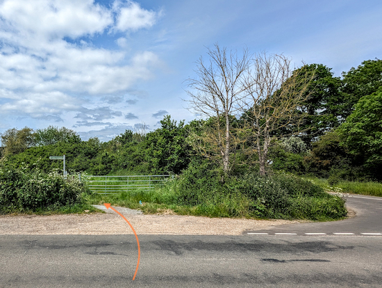
1: From Brookmans Park village centre walk W towards the station, cross the railway bridge, then turn right and follow Station Road N for 160m until you reach a
footpath on the left just before you reach Bradmore Lane on the left (location -
https://w3w.co/probe.wasp.treat), see image below.
 |
| Turn left on North Mymms footpath 9 |
2: Turn left on North Mymms footpath 9, which doubles back on the way you have just walked to take you S, parallel to the railway track. Continue along this route for 570m until you reach a bridge crossing a small brook (location -
https://w3w.co/neon.remark.grow), which is often dry, see image below. This is a continuation of Ray Brook which flows through Gobions Wood.
 |
| Cross the footbridge then turn left on North Mymms footpath 11 |
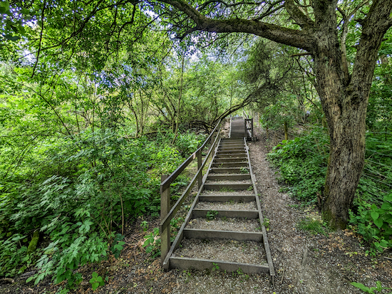
3: Cross the footbridge then turn left on North Mymms footpath 11 and head E following this path with the brook on your left and the field on your right. After 260m you will reach wooden steps leading to a footpath alongside the railway (location -
https://w3w.co/goad.vase.each), see image below.
 |
| Climb the steps. When you reach the top turn right |
4: Climb the steps, there are 42. When you reach the top, turn right then head S, still on North Mymms footpath 11, for 375m until you reach Hawkshead Lane (location -
https://w3w.co/serves.covers.scores), see image below.
 |
| Turn left on Hawkshead Lane then cross the railway bridge |
5: Turn left on Hawkshead Lane, cross the railway bridge, then look out for a footpath sign on your left immediately after you cross the track. This is still North Mymms footpath 11 (location -
https://w3w.co/vision.large.oldest), see image below.
 |
| Turn left on North Mymms footpath 11 |
6: Take the path and head N downhill with the railway track on your left. After 400m you will come to a right-hand bend and a stream at the backs of the houses (location -
https://w3w.co/spoken.retain.lied). Here the path heads E before reaching Bluebridge Road at a set of wooden steps (location -
https://w3w.co/pans.agreed.wizard), see image below.
 |
| Climb the steps, cross the road then take the footpath opposite |
7: Climb the steps, cross the road, then take the footpath opposite. This is still North Mymms footpath 11. Follow this narrow path as it heads E for 130m until you reach a footpath gate on the right (location -
https://w3w.co/digit.flank.swear), see image below.
 |
| Go through the gate then head ESE diagonally across a field |
8: Go through the gate then head ESE diagonally across a field, which sometimes has horses grazing. Continue for 130m until you reach another gate (location -
https://w3w.co/movies.fence.crowds), see image below.
 |
| Go through the gate then enter Gobions Wood |
9: Go through the gate (location -
https://w3w.co/clever.invite.crest) then enter
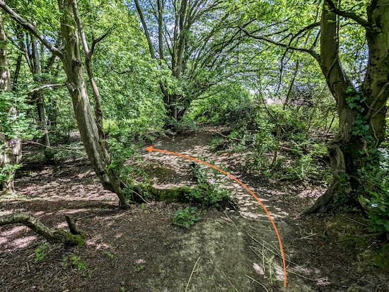
Gobions Wood at a section of the woodland called Little Rye Plantation. Continue heading ESE for 180m until you reach a wooden footbridge (location -
https://w3w.co/formed.burn.fake), see image below.
 |
| Turn left after the footbridge |
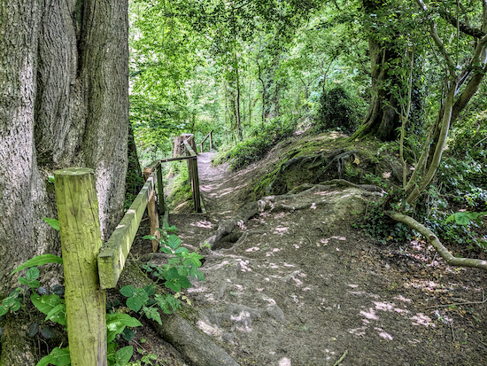
10: Turn left after the footbridge then continue for 30m until the path forks (location -
https://w3w.co/saying.lasts.energy). Take the right fork then head E for 310m until the path reaches a set of steps on the left see image below.
 |
| Turn left down the steps then turn right |
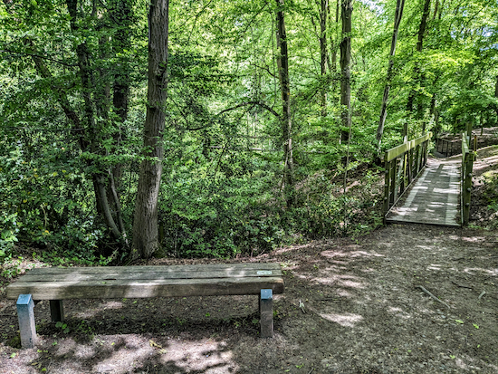
Turn left down the steps then turn right at the bottom and continue heading E for 150m until you reach a wooden footbridge, see image below.
 |
| Cross the footbridge then turn left and cross another bridge |
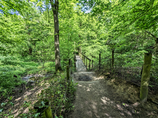
11: Cross the footbridge then turn left and cross another footbridge (location -
https://w3w.co/cubs.mobile.vibrates), see image below.
 |
| Cross the second bridge then head N uphill |
Cross the second bridge then head N and uphill for 95m until you leave the woodland at a footpath (location -
https://w3w.co/serves.sprint.fire), see image below.
 |
| Follow the path N for 150m until you reach a wooden gate |
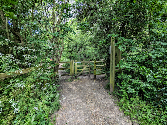
Follow the path N for 150m until you reach a wooden gate (location -
https://w3w.co/catch.snail.luck), see image below.
 |
| Go through the gate then keep right |
12: Go through the gate. Keep right then head N for 60m, passing the end of Gobions Pond on the left. Keep right at the next fork then head NNE for 160m until you reach a gate (location -
https://w3w.co/cities.nearly.locals). Go through the gate then continue heading NE for 130m until you reach Mymms Drive (location -
https://w3w.co/desks.planet.foil).
13: Turn left on Mymms Drive then continue NW uphill for 310m to Georges Wood Road.
14: Turn left on Georges Wood Road then take the first turn on the right and head N down Golf Club Road, which is also North Mymms footpath 68, leading to Brookmans Park Golf Club.
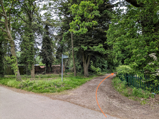
15: When you reach the golf club you will see a track on the right (location -
https://w3w.co/rank.point.activism), see image below.
 |
| Turn right on the track, still North Mymms footpath 68 |
Turn right on the track, still North Mymms footpath 68, then head NE for 300m walking behind
Chancellor's School and continuing to the top of Pine Grove (location -
https://w3w.co/defeat.shop.silver), see image below.
 |
| Take the road on the left, which is still North Mymms footpath 68 |
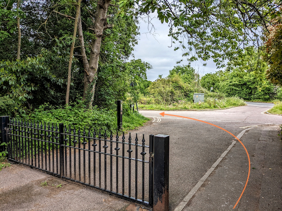
Take the road on the left, The Drive, which is still North Mymms footpath 68, then head NNE for 200m until you reach Bell Lane (location -
https://w3w.co/noted.author.oath), see image below.
 |
| Turn left on Bell Lane then head WSW for 310m |
* At this point there is the option of a short detour NW along the Great North Road for refreshments at either The Dutch Marketplace (location - https://w3w.co/rises.focus.gold) or the Cock o' the North pub/restaurant, (location - https://w3w.co/open.skips.liked).
16: Turn left on Bell Lane then head WSW for 310m until you meet a footpath gate on the left at the point where the lane bends to the right (location -
https://w3w.co/cups.mint.civil), see image below.
 |
| Go through the gate then follow North Mymms footpath 33 NW |
17: Go through the gate then follow North Mymms footpath 33 which heads NW then W for 1.2km with the woods on the left and the fields on the right, until it bends right at the end of the field to reach a metal gate leading to a wooden footbridge spanning a ditch (location -
https://w3w.co/certified.brings.liner), see images below.
 |
| North Mymms footpath 33 bends right into the trees |
 |
| North Mymms footpath 33 reaches a gate and a wooden footbridge |
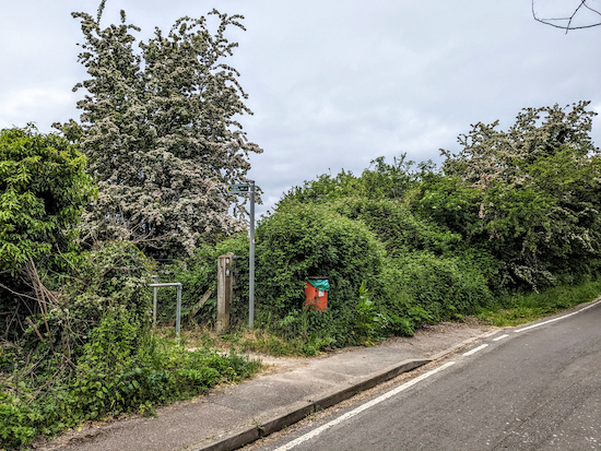
18: Go through the gate, turn left, then cross the bridge and continue, now heading W, still on North Mymms footpath 33 as it runs parallel to Bulls Lane for 430m until you reach a railway bridge (location -
https://w3w.co/jolly.brave.salad). Go under the railway bridge then, immediately after, turn left on North Mymms footpath 34 (location -
https://w3w.co/traps.sudden.films), see image below.
 |
| Turn left then follow North Mymms footpath 34 |
19: Turn left then follow North Mymms footpath 34 for 460m as runs alongside the railway line on the left and continues until it passes a football pitch on the left (location -
https://w3w.co/leaned.bridge.lovely) then continues through woodland before reaching a ramp with a fence on the left leading down to a track (location -
https://w3w.co/tower.habit.earth), see image below.
 |
| Turn right then follow the track until crosses a brook |
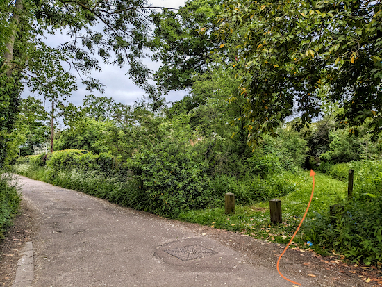
Turn right then follow the track until crosses a brook and emerges in a car park behind North Mymms Youth and Community Centre (location -
https://w3w.co/closed.string.wells). Continue heading W for 30m until you reach a footpath on the right (location -
https://w3w.co/candy.modern.stray), see image below.
 |
| Turn right, still on North Mymms footpath 34 |
20: Turn right, still on North Mymms footpath 34 then follow it NW then WSW for 95m until you reach Station Road (location -
https://w3w.co/hips.storm.random).
Turn right on Station Road then head NNW for 80m until you reach a footpath in the hedge across the road on the left (location -
https://w3w.co/hurt.landed.transit), see image below.
* At this point there is an option of a short detour along Bulls Lane to Welham Green to visit The Sibthorpe Arms on Station Road (location - https://w3w.co/fines.spends.state).
 |
| Turn left on North Mymms footpath 8 |
21: Turn left on North Mymms footpath 8 then follow it across a field for 360m until you reach woodland (location -
https://w3w.co/tribes.vase.blaze), see image below.
 |
| Here North Mymms footpath 8 turns right then heads WSW |
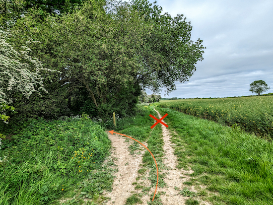
Here North Mymms footpath 8 turns right then heads WSW for 100m, with the field on the right and the hedgerow on the left until it cuts left through the woodland (location -
https://w3w.co/laws.tile.third), see image below.
 |
| Turn left, still on North Mymms footpath 8 |
22: Turn left, still on North Mymms footpath 8 then head S crossing two wooden footbridges, see images below.
 |
| North Mymms footpath 8 crosses a footbridge without guard rails |
 |
| North Mymms footpath 8 crosses a second footbridge with guard rails |
Cross both footbridges then continue heading S and uphill for 55m until the path reaches a field (location -
https://w3w.co/trials.park.copies). When you reach the field turn right on North Mymms footpath 32, then head SW for 220m, with the woodland on your right and the field on your left, see image below.
 |
| North Mymms footpath 32 heading SW |
Continue on North Mymms footpath 32 ignoring the first footpath post on the right and continuing to the second white-topped post (location -
https://w3w.co/hopes.lazy.pure), see image below.
 |
| Turn right on North Mymms footpath 30 |
23: Turn right on North Mymms footpath 30 which you follow SW for 50m down to a stream and a wooden footbridge (location -
https://w3w.co/deaf.jabs.vines), see image below.
 |
| Cross the wooden footbridge then continue on North Mymms footpath 30 |
Cross the wooden footbridge then follow North Mymms footpath 30 uphill for 85m until you reach a field (location -
https://w3w.co/sorry.stole.galaxy), see image below.
 |
| Turn left when you reach the field, still on North Mymms footpath 30 |
Turn left when you reach the field, still on North Mymms footpath 30, then head SW for 75m with the field on your right and the hedgerow on the left until the path bends right (location -
https://w3w.co/stops.boot.wished), see image below.
 |
| Keep right still on North Mymms footpath 30 |
24: Keep right still on North Mymms footpath 30 then head W for 205m, with the field on the right and hedgerow on the left, until you reach a cycle track and footpath running alongside Swanland Road (location -
https://w3w.co/singer.hotel.needed), see image below.
 |
| Turn left when you reach the cycle track |
25: Turn left when you reach the cycle track then head SSE for 210m until you reach Warrengate Road on the left (location -
https://w3w.co/slips.lower.spoken).
26: Turn left on Warrengate Road then head SSE passing
The Woodman Inn on your left (location -
https://w3w.co/ripe.kick.span), see image below.
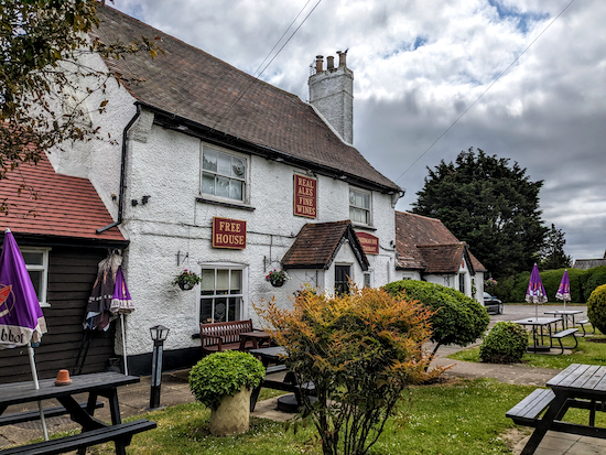 |
| The Woodman Inn on Warrengate Road, Water End |
Continue along Warrengate Road for 350m to Bradmore Lane on your left (location -
https://w3w.co/desks.jazzy.scuba).
27: Ignore Bradmore Lane and keep heading SSE along Warrengate Road for another 195m until you reach a footpath on the left (location -
https://w3w.co/stud.supporter.energetic), see image below.
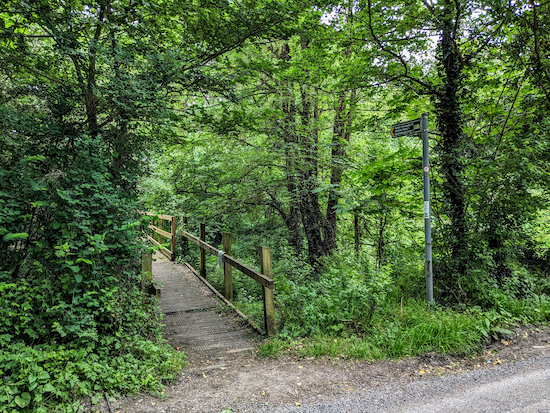 |
| Turn left on North Mymms footpath 11 then cross a footbridge |
28: Turn left on North Mymms footpath 11 then cross a footbridge (location -
https://w3w.co/pads.rather.eating) then a wooden walkway, see image below. This is a good spot for looking for kingfishers.
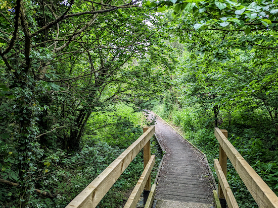 |
| Cross the footbridge then continue along the walkway |
 |
| North Mymms footpath 11 crosses Mimmshall Brook |
Head E along North Mymms footpath 11 for 550m ignoring a footpath on your right and continuing until you reach a metal gate (location -
https://w3w.co/broke.cans.family), see image below.
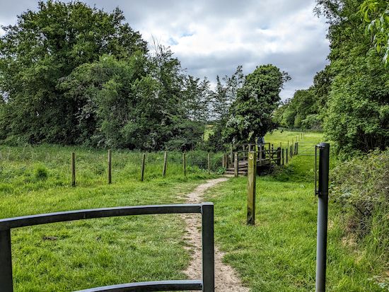 |
| After the metal gate turn right then cross a footbridge |
29: After going through the metal gate turn right, still on North Mymms footpath 11, then cross a footbridge (location -
https://w3w.co/fund.timing.jets). Once across the footbridge turn left, still on North Mymms footpath 11, then continue heading E, with the hedgerow on the left and field on the right, for 315m until you reach a footpath gate (location -
https://w3w.co/jets.swim.second), see image below.
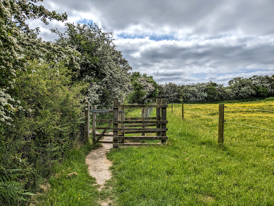 |
| Go through the gate then turn left on North Mymms footpath 9 |
30: Go through the gate then turn left on North Mymms footpath 9, cross the footbridge you crossed at point 3 in the walk then follow the footpath NNE then N for 570m back to Station Road (location -
https://w3w.co/shakes.festivity.will).
31: Turn right on Station Road then head S for 185m, cross the railway bridge then return to the starting point. Brookmans Park has a pub called
Brookmans, a couple of cafes, a selection of restaurants, and shops selling refreshments.
Interactive map


Thanks for taking the time to publish these. This was a lovely walk, with a lot of variety over the length.
ReplyDeleteA minor correction - the lsne in points 15 and 16 is Bell Lane rather than Bulls Lane
Thanks so much for pointing that out. Very helpful. Silly typo which I have now corrected. Thanks again. David
Delete