2.9 miles (4.8 km) with 61m total ascent
 |
| The footpath between points 6 and 7 |
This short walk takes you south along the old coaching road that once provided the main route between North Mymms and South Mimms. It crosses a quiet valley surrounded by rolling wooded hills, and follows footpaths edged by hedgerows rich in wild flowers.
Between points 3 and 6 you will cross meadows where sheep sometimes graze. There is an option of a detour near the end for refreshments at
The Woodman Inn at nearby Water End. The starting point for this walk is 1.3 miles SW from Welham Green station by road.
Fly through preview of walk
If you want to check what sort of landscape you will be crossing before you set off on this walk you can view a short 3D video of the route below. It's created using the free version of
Relive.
Directions
 |
Map for Walk 1: The North Mymms Loop
Click here or on the map above for a larger version
Created on Map Hub by Hertfordshire Walker
With elements © Thunderforest © OpenStreetMap contributors
We have an interactive map below the directions |
Those with GPS devices can download
GPX or
KML files for this walk. We've added
What3Words references for those who use that system. If you print these walks you might want to use the green
PrintFriendly icon at the bottom of these directions to delete elements such as photographs.
There are parking opportunities along St Mary’s Church Road between Tollgate Road (location -
https://w3w.co/test.gosh.king) and the turn off for St Mary's Church (location -
https://w3w.co/held.feel.units).
1: At the fork to St Mary's church, see image below, keep left then head SSW along St Mary’s Church Road for 500m.
 |
| Keep left at the fork then head SSW along St Mary's Church Road |
2: When the lane turns sharp right (location -
https://w3w.co/cook.erase.onions), see image below, your way is straight ahead, through a gate and heading SSW on North Mymms bridleway 2, see image below.
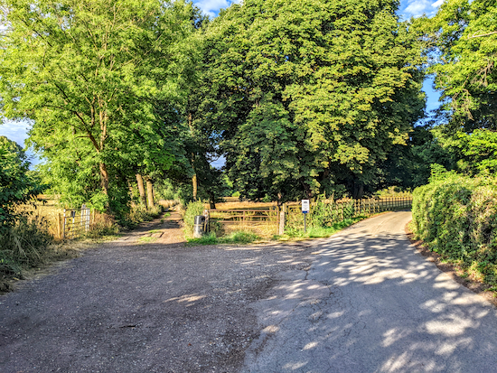 |
| Keep left at the fork then head SSW on North Mymms bridleway 2 |
Watch where you step along this short stretch. Sadly some dog owners don't clear up after their pets and this section can be a bit of a mess. After 290m ignore the footpath on your left (location -
https://w3w.co/tender.book.unable) and continue heading SW as the path begins a steady climb through Cangsley Grove, see image below.
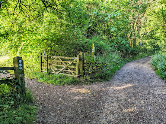 |
| Head SW and uphill through Cangsley Grove |
3: After 500m you will emerge from the woods (location -
https://w3w.co/jars.drive.washed) and reach a bridleway on your right, see image below.
 |
| Turn right on North Mymms bridleway 90 |
Turn right on North Mymms bridleway 90 then head SW for 230m with the hedgerow on the right and the field on your left. This is a lovely open section with many wildflowers and butterflies in the summer.
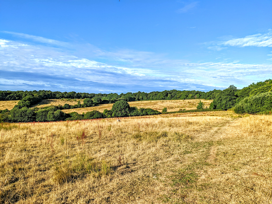 |
| North Mymms bridleway 90 |
Continue until the track goes through the hedgerow (location -
https://w3w.co/local.makes.trees), see image below.
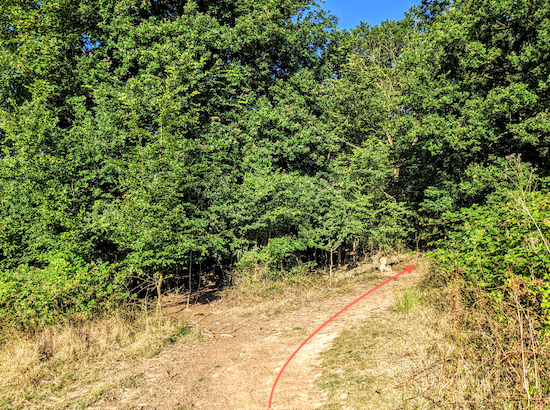 |
| Head SW then S, now on Ridge bridleway 44 |
Continue heading SW then S, now on Ridge bridleway 44, for 240m. Here you will have uninterrupted views across the Potwells Valley, see image below.
 |
| The view over Potwells Valley from Ridge bridleway 44 |
Continue until you reach a gate on the right (location -
https://w3w.co/owls.speeds.last), see image below.
 |
| Keep left at the gate then head SSE on Ridge bridleway 10 |
* At this point you could take a slight detour by going through the gate and taking Ridge bridleway 10 through the woods and continuing WSW with the woods on your left and fields on the right for 600m to a view point (https://w3w.co/still.entry.spends) where you can enjoy views to the W towards St Albans.
4: If you don’t take the detour, head SSE on Ridge bridleway 10 for 130m to a footbridge (location -
https://w3w.co/asking.voters.bumpy), see image below.
 |
| Cross the footbridge then continue heading SSE |
Cross the footbridge then continue heading SSE across a field for 230m to a gate (location -
https://w3w.co/rice.oils.refers), see image below.
 |
| Go through the gate to join North Mymms bridleway 2 |
Go through the gate to join North Mymms bridleway 2 where you turn left and head N for 50m until you reach a gate on the right (location -
https://w3w.co/mile.lakes.curve), see image below.
 |
| Turn right on North Mymms footpath 1 |
5: Take this path, North Mymms footpath 1, which cuts NE across the field for 310m. This field is full of wild flowers and butterflies in the summer. Follow the path as it drops down to a footbridge across a stream, see image below (location -
https://w3w.co/rising.habit.limit).
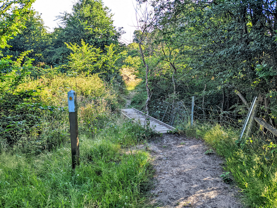 |
| Cross the footbridge then head NE across a field |
Climb the hill on the other side of the bridge, still heading NE, and continue for 160m until you reach a gate leading to a path running along the S edge of Cangsley Grove (location -
https://w3w.co/image.grabs.horn). This is North Mymms bridleway 1, see image below.
 |
| Go through the gate then turn right on North Mymms bridleway 1 |
6: Turn right on North Mymms bridleway 1 then follow it NE for 540m until you reach a crossing in the tracks (location -
https://w3w.co/policy.state.liability), see image below.
 |
| Continue heading NE, still on North Mymms bridleway 1 |
7: Continue heading NE, still on North Mymms bridleway 1, for 780m until you reach the side of the A1(M) (location -
https://w3w.co/backed.rocks.switch), see image below.
 |
| At the A1(M) turn left on North Mymms BOAT 5 |
8: Turn left on North Mymms BOAT 5 (byway open to all traffic) then head N alongside the W side of the A1(M) until you reach Tollgate Road (location -
https://w3w.co/turned.mouth.driven), see image below.
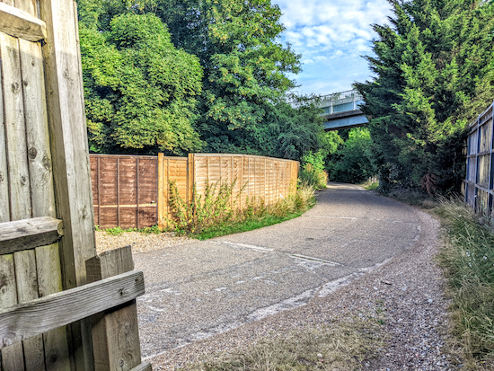 |
| Turn right on Tollgate Road then go under the footbridge |
Turn right then head NW for 90m. Go under the footbridge then take a footpath on the left (location -
https://w3w.co/rods.tones.other), see image below.
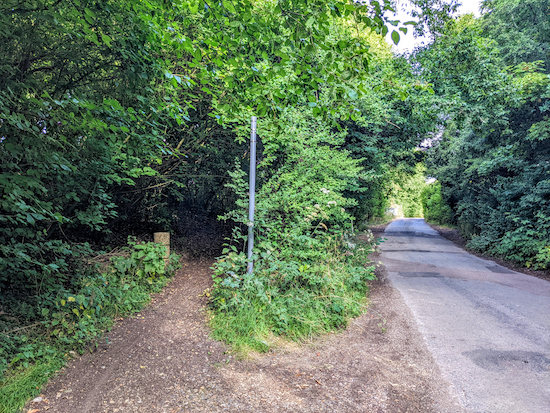 |
| Take the footpath on the left after going under the footbridge |
* Here you can take a 360m detour to The Woodman Inn at Water End by crossing the footbridge over the A1(M) and walking down Warrengate Road where you will find the pub on your left (location - https://w3w.co/remedy.echo.pizza).
9: Turn left on the footpath then follow it through the hedgerow and down some wooden steps to a gate leading to a field (location -
https://w3w.co/liked.hatch.food), see image below.
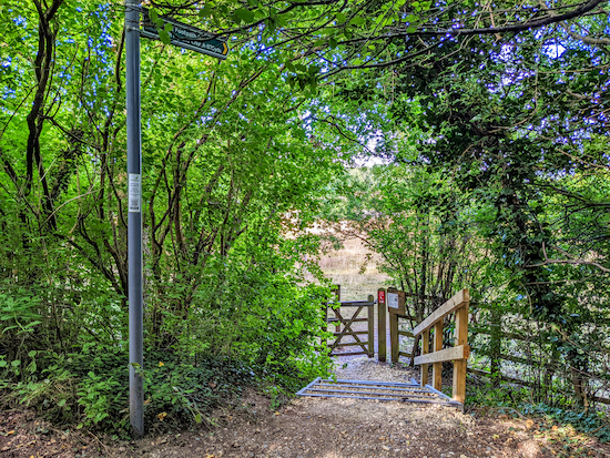 |
| Go down the steps then take North Mymms footpath 6 |
This is North Mymms footpath 6. Walk diagonally to your right heading W for 90m until you reach a gate (location -
https://w3w.co/angel.dock.sunk), see image below.
 |
| The short section after the gate is often overgrown, see detour |
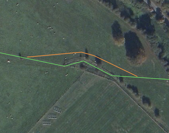
The short section beyond the gate is often overgrown and most walkers avoid this by keeping right around the hedge (see orange arrow on the image above) and then rejoin North Mymms footpath 6 (location -
https://w3w.co/wisely.lines.humans), see map below.
 |
| North Mymms footpath 6 in green, the detour in orange |
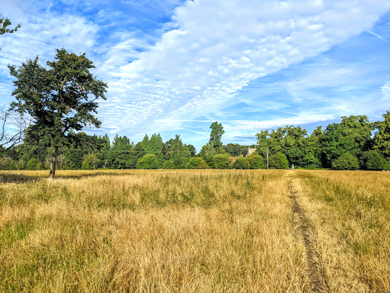
Continue heading NW for 330m back to St Mary's Church Road and the start point.
 |
| North Mymms footpath 6 at the end of the walk |
Interactive map
Note: There is an interesting variation of this walk which focuses on the fascinating geological features of this walk. It’s on the
North Mymms History Project and is titled
The natural history around Water End, Hertfordshire. You might want to read it before you set off on this walk. It includes maps and directions, too.


Really enjoyed this walk today. Got completely covered in mud but loved every minute. We have just moved to the area and will be working our way through every walk
ReplyDeleteHi Gemma, glad you enjoyed Walk 1. And welcome to the area.
ReplyDeleteGreat walk for dogs as they could be off lead most of the time. Lovely countryside and we enjoyed lunch at The Woodman Inn.
ReplyDeleteHi Orla, that is the first walk in the collection, first mapped out more than 25 years ago. It's one we do quite often because it's close to where we live. I hope you missed the rain. If you haven't already done so, please consider joining our members-only Facebook group where fellow walkers are sharing photographs and updates on their walks. https://www.facebook.com/groups/hertfordshirewalker
Delete